
Wood County is a county located in the U.S. state of Wisconsin. As of the 2020 census, the population was 74,207. Its county seat is Wisconsin Rapids. The county is named after Joseph Wood, a member of the Wisconsin State Assembly. Wood County comprises the Wisconsin Rapids-Marshfield, WI Micropolitan Statistical Area and is included in the Wausau-Stevens Point-Wisconsin Rapids, WI Combined Statistical Area.

Benson County is a county in the U.S. state of North Dakota. As of the 2020 census, the population was 5,964. Its county seat is Minnewaukan. The county was created on March 9, 1883 by the Dakota Territory legislature, and was named for Bertil W. Benson, a Dakota Territory legislator at the time. The county government was organized on June 4, 1884, and its boundary lines were altered by two legislative actions in 1885.

Dare County is the easternmost county in the U.S. state of North Carolina. As of the 2020 census, the population was 36,915. Its county seat is Manteo. Dare County is named after Virginia Dare, the first child born in the Americas to English parents, who was born within the county's current borders. Founded in 1870 from parts of Tyrrell, Currituck and Hyde counties, it consists of a large segment of the Outer Banks of North Carolina, along with Roanoke Island and a peninsula of land attached to the mainland. Most of the county consists of a string of resort communities along the Outer Banks. While lightly populated by year-round residents, the population swells during the summer with vacationers.

Yellow Medicine County is a county in the state of Minnesota. Its eastern border is formed by the Minnesota River. As of the 2020 census, the population was 9,528. Its county seat is Granite Falls.

Lake of the Woods County is a county in the northwestern part of the U.S. state of Minnesota. As of the 2020 census, the population was 3,763, making it the second-least populous county in Minnesota. Its county seat is Baudette.
Kanabec County is a county in the East Central part of U.S. state of Minnesota. As of the 2020 census, the population was 16,032. Its county seat is Mora.

Crow Wing County is a county in the East Central part of the U.S. state of Minnesota. As of the 2020 census, the population was 66,123. Its county seat is Brainerd. The county was formed in 1857, and was organized in 1870.

Bethel is a town in Sullivan County, New York, United States. The population was estimated at 3,959 in 2020. The town received worldwide attention after it served as the location of Woodstock in 1969, which was originally planned for Wallkill, New York, but was relocated to Bethel after Wallkill withdrew.

Oneida Lake is the largest lake entirely within New York state, with a surface area of 79.8 square miles (207 km2). The lake is located northeast of Syracuse and near the Great Lakes. It feeds the Oneida River, a tributary of the Oswego River, which flows into Lake Ontario. From the earliest times until the opening of the Erie Canal in 1825, the lake was part of an important waterway connecting the Atlantic seaboard of North America to the continental interior.

Northeast Texas is a cultural and geographic region in the northeast corner of the U.S. state of Texas. Geographically centered on two metropolitan areas strung along Interstate 20—Tyler in the west and Longview/Marshall to the east, the areas of Mount Pleasant, Sulphur Springs, Paris, and Texarkana in the north primarily along Interstate 30, and Jacksonville and Palestine to the south are also major cities within the region. Most of Northeast Texas is included in the interstate region of the Ark-La-Tex.
Wisconsin's 7th congressional district is a congressional district of the United States House of Representatives in northwestern and central Wisconsin; it is the largest congressional district in the state geographically, covering 20 counties, for a total of 18,787 sq mi. The district contains the following counties: Ashland, Barron, Bayfield, Burnett, St. Croix, Chippewa (partial), Clark, Douglas, Florence, Forest, Iron, Jackson (partial), Juneau (partial), Langlade, Lincoln, Marathon, Monroe (partial), Oneida, Polk, Price, Rusk, Sawyer, Taylor, Vilas, Washburn, and Wood (partial).

The 9th congressional district of Illinois covers parts of Cook, Lake, and McHenry counties as of the 2021 redistricting which followed the 2020 census. It includes all or parts of Chicago, Evanston, Glenview, Skokie, Morton Grove, Niles, Northfield, Prospect Heights, Wilmette, Buffalo Grove, Hawthorn Woods, Wauconda, Island Lake, Long Grove, Lake Barrington, Algonquin Township, Cary, Crystal Lake, Lake in the Hills, Lakewood, Oakwood Hills, Trout Valley, Algonquin, Port Barrington, Barrington Hills, and Fox River Grove. It is anchored in Chicago's North Side, along Lake Michigan, and covers many of Chicago's northern suburbs. Democrat Jan Schakowsky has represented the district since January 1999.

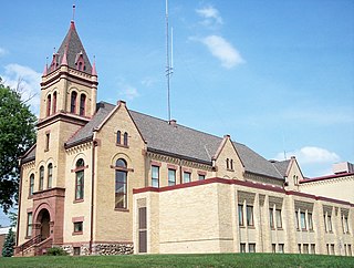
This is a list of the National Register of Historic Places listings in Wood County, Ohio.
The Lake of the Woods State Forest is a state forest located south of Lake of the Woods in Beltrami, Koochiching, Lake of the Woods and Roseau counties in Minnesota, USA. The forest borders the Pine Island State Forest to the east and the Beltrami Island State Forest to the west.

The Northwest Angle State Forest is a state forest located in Lake of the Woods County, Minnesota. The name of the forest is derived from its location near the Northwest Angle, the northernmost point of the contiguous United States. The forest borders the Canadian provinces of Manitoba and Ontario, and the Red Lake Indian Reservation. The forest is managed by the Minnesota Department of Natural Resources.
