Kanabec County is a county in the East Central part of U.S. state of Minnesota. As of the 2020 United States Census, the population was 16,032. Its county seat is Mora.
A state highway, state road, or state route is usually a road that is either numbered or maintained by a sub-national state or province. A road numbered by a state or province falls below numbered national highways in the hierarchy. Roads maintained by a state or province include both nationally numbered highways and un-numbered state highways. Depending on the state, "state highway" may be used for one meaning and "state road" or "state route" for the other.
Minnesota State Highway 65 is a highway in the east–central and northeast parts of the U.S. state of Minnesota, which starts at its split from I-35W, skipping past the downtown Minneapolis core, only to resume at the intersection with Washington Avenue at the north end of downtown Minneapolis to continue north to its northern terminus at its intersection with U.S. Highway 71 (US 71) in Littlefork near International Falls.
A routenumber, designation or abbreviation is an identifying numeric designation assigned by a highway authority to a particular stretch of roadway to distinguish it from other routes and, in many cases, also to indicate its classification, general geographical location and/or orientation. The numbers chosen may be used solely for internal administrative purposes; however, in most cases they are also displayed on roadside signage and indicated on maps.
Minnesota State Highway 5 is a 76.347-mile-long (122.869 km) highway in Minnesota, which runs from its intersection with MN 19 and MN 22 in Gaylord and continues east and northeast to its eastern terminus at its intersection with MN 120 in Maplewood. The route passes through downtown Saint Paul.

A county highway is a road in the United States and in the Canadian province of Ontario that is designated and/or maintained by the county highway department. Route numbering can be determined by each county alone, by mutual agreement among counties, or by a statewide pattern.
Minnesota State Highway 47 is a 126.872-mile-long (204.181 km) highway in east–central Minnesota, which runs from its intersection with Central Avenue in Minneapolis and continues north to its northern terminus at its intersection with U.S. Highway 169 in Aitkin.
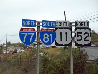
A highway shield or route marker is a sign denoting the route number of a highway, usually in the form of a symbolic shape with the route number enclosed. As the focus of the sign, the route number is usually the sign's largest element, with other items on the sign rendered in smaller sizes or contrasting colors. Highway shields are used by travellers, commuters, and all levels of government for identifying, navigating, and organising routes within a county, state, province, or country. Simplified highway shields often appear on maps.
Minnesota State Highway 66 (MN 66) was a highway in south-central Minnesota, which ran from its intersection with Blue Earth County Roads 1 and 10 near Good Thunder and continued north to its northern terminus at its interchange with U.S. Highway 169 / State Highway 60 in the city of Mankato. The highway is currently known as Blue Earth County Road 1.
Minnesota State Highway 152 was a highway in Minnesota, connecting the cities of St. Cloud and Minneapolis. It ran parallel to U.S. Route 52 and its route number derives from this. It originally began at U.S. 52 in St. Cloud and ran to U.S. 52 in Minneapolis, at the intersection of Washington Avenue and Broadway Street.
Minnesota State Highway 98 was a highway in Minnesota, which ran from to U.S. Route 61 in Wyoming to U.S. Route 8 in Chisago City. It was decommissioned in 1996 and became Chisago County Road 22.
Minnesota State Highway 62 (MN 62) is a highway in the Twin Cities region of Minnesota. The route was part of County Road 62 (CR 62) until 1988, when a portion of the route was inherited by the state. The western terminus of the highway is at Interstate 494 (I-494) in Eden Prairie, where the roadway continues west as CR 62 to CR 101. The eastern terminus of the route is at the junction with I-494 in Inver Grove Heights. Locally, the original portion of the route in Hennepin County is known as "the Crosstown," though signage with this name does not appear on the highway itself, but only on local streets adjacent to the road. It is also used as an alternate name, even by the Minnesota Department of Transportation (MnDOT). The route is 18.6 miles (29.9 km) in length.
Hennepin County Road 122 (CR 122) or County State-Aid Highway 122 (CSAH 122) is an unsigned county state-aid highway within the city of Minneapolis, Hennepin County, Minnesota, United States, crossing the Mississippi River on the Washington Avenue Bridge.
Hennepin County Road 61 or County State-Aid Highway 61 is a 24.853-mile-long (39.997 km) major route along the east side of Interstate 494 (I-494) in Hennepin County, Minnesota. The route travels through the west suburbs of the Twin Cities through Maple Grove, Plymouth, Minnetonka, Hopkins and Eden Prairie.


