List of county roads in Scott County, Minnesota

Last updated

Scott County Route 42 MN.svg
Standard county road marker
Highway names
Interstates Interstate X (I-X)
US Highways U.S. Highway X (US X)
State Trunk Highway X (MN X or TH X)
County State-Aid Highways:County State-Aid Highway X (CSAH X)
County Roads:County Road X (CR X)
System links

The following is a list of county-maintained roads in Scott County, Minnesota, United States. Many routes in this list are also county-state-aid-highways (CSAH.) [1]

Route list

NumberLength (mi) [2] Length (km)Southern or western terminusNorthern or eastern terminusFormedRemovedNotes
County 1 (MN).svgCSAH 12.7904.490Sibley County line (County 5) US 169 in Blakeley Township  
County 2 (MN).svgCSAH 2County 61 in Helena Township Dakota County line (County 9) Non-CSAH west of County Road 11.
County 3 (MN).svgCSAH 35.6699.123Le Sueur County line (County 11) MN 25 in Belle Plaine  
County 4 (MN).svgCSAH 4County 7 in Belle Plaine Township Saint Benedict Road in Helena Township Non-CSAH east of County Road 11.
County 5 (MN).svgCSAH 5Kittson Boulevard in Belle Plaine US 169 / MN 25 in Belle Plaine 
County 5 (MN).svgCSAH 56.38310.272Le Sueur County line (County 32) County 5A in Belle Plaine Township  
County 5A square.svgCR 5ACounty 5 in Belle Plaine Township County 7A in Belle Plaine  
County 6 (MN).svgCSAH 64.5507.323County 1 / County 60 in Blakeley Township MN 25 in Belle Plaine  
County 7 (MN).svgCSAH 7Le Sueur County line (County 31) County 5 / County 7A in Belle Plaine  
County 7A square.svgCR 7ACounty 5A in Belle Plaine County 5 / County 7 in Belle Plaine 
County 8 (MN).svgCSAH 8 MN 21 in Helena Township Dakota County line (County 60)  
County 9 (MN).svgCSAH 9 US 169 / MN 282 in Jordan Carver County line (County 11)  
County 10 (MN).svgCSAH 10 MN 282 in Sand Creek Township County 23 in Spring Lake Township  
County 11 (MN).svgCSAH 11Le Sueur County line (County 30) MN 21 in Helena Township  
County 12 (MN).svgCSAH 12County 17 in Spring Lake Township MN 13 in Prior Lake  
County 14 (MN).svgCSAH 14 US 169 in Louisville Township County 17 in Shakopee  
County 15 (MN).svgCSAH 15Le Sueur County line (County 60) 6th Avenue West in Shakopee  
County 16 (MN).svgCSAH 16County 15 in Shakopee Dakota County line 
County 17 (MN).svgCSAH 17 MN 282 in Spring Lake Township County 101 in Shakopee  
County 18 (MN).svgCSAH 18County 42 in Prior Lake County 21 in Shakopee  
County 21 (MN).svgCSAH 2111.72218.865Dakota County line (County 60) US 169 in Shakopee Part of the National Highway System from County Road 42 to US 169. [3]
County 23 (MN).svgCSAH 23 MN 19 / County 86 in Cedar Lake Township MN 13 in Prior Lake  
County 27 (MN).svgCSAH 27Rice County line (County 3) County 16 in Savage  
County 29 (MN).svgCR 29County 91 in New Market Township Dakota County line 
County 37 (MN).svgCSAH 37 MN 21 in Helena Township MN 19 / MN 13 in New Prague  
County 42 (MN).svg CSAH 42 8.44713.594County 17 in Shakopee Dakota County line (County 42) Part of the National Highway System from County Road 21 to the Dakota County line. [3]
County 44 (MN).svgCSAH 44 MN 13 in Prior Lake County 27 in Savage  
County 46 (MN).svgCSAH 46County 86 in New Market Township Dakota County line (County 5S)  
County 47 (MN).svgCSAH 47County 86 in New Market Township Dakota County line (County 5)  
County 51 (MN).svgCR 51Le Sueur County lineCounty 1 in Blakeley Township  
County 53 (MN).svgCR 53 MN 19 in Blakeley Township US 169 in Blakeley Township 
County 56 (MN).svgCR 56 MN 13 in Cedar Lake Township County 87 in Cedar Lake Township 
County 59 (MN).svgCSAH 59County 7 in Belle Plaine Township US 169 in Saint Lawrence Township  
County 60 (MN).svgCR 60County 1 in Blakeley Township US 169 in Blakeley Township  
County 61 (MN).svgCR 61 MN 19 in Helena Township , Belle Plaine Township County 66 in Jordan  
County 62 (MN).svgCR 62County 87 in Cedar Lake Township Dakota County line 
County 64 (MN).svgCR 64County 5 in Belle Plaine County 61 in Belle Plaine Township , Helena Township  
County 66 (MN).svgCR 66 US 169 in Saint Lawrence Township MN 21 in Jordan  
County 68 (MN).svgCSAH 68County 23 in Spring Lake Township Dakota County line (County 64)  
County 69 (MN).svgCSAH 69County 14 in Louisville Township County 101 in Shakopee Non-CSAH south of US 169.
County 70 (MN).svgCR 70County 15 in Sand Creek Township County 79 in Sand Creek Township, Spring Lake Township  
County 73 (MN).svgCR 73Zumbro Avenue in Jackson Township , Louisville Township County 78 in Jackson Township  
County 76 (MN).svgCR 76County 66 in Saint Lawrence Township County 59 in St. Lawrence Township 
County 77 (MN).svgCR 77County 78 in Jackson Township US 169 in Shakopee No access to US 169; overpass
County 78 (MN).svgCSAH 78 US 169 / MN 41 in Jackson Township County 17 in Shakopee  
County 79 (MN).svgCR 79County 10 in Spring Lake Township 10th Avenue East in Shakopee  
County 81 (MN).svgCR 81County 8 in Spring Lake Township , Cedar Lake Township MN 13 in Spring Lake Township, Prior Lake  
County 81 (MN).svgCR 81Spring Lake Regional Park in Prior LakeCounty 82 in Prior Lake  
County 82 (MN).svgCSAH 82County 17 in Prior Lake , Shakopee County 21 in Prior Lake 
County 83 (MN).svgCSAH 83County 82 in Prior Lake County 101 in Shakopee  
County 85 (MN).svgCR 85County 86 in Cedar Lake Township County 2 in Cedar Lake Township 
County 86 (MN).svgCSAH 86 MN 19 / County 23 in Cedar Lake Township Dakota County line (County 86) Runs concurrent with Rice County Road 86 along its entire length.
County 87 (MN).svgCR 87County 56 in Cedar Lake Township County 21 in Credit River  
County 89 (MN).svgCR 89 MN 19 / MN 13 in Helena Township County 8 in Helena Township, Sand Creek Township  
County 91 (MN).svgCSAH 91County 86 in New Market Township County 21 in Credit River  
County 101 (MN).svgCSAH 101Carver County line (County 101) US 169, MN 101 (unmarked MN 801B), MN 13 [4] in Shakopee 01988-01-011988currentOriginally part of MN 101 until 1988. [5]

Related Research Articles

<span class="mw-page-title-main">Interstate 90</span> Interstate Highway across northern United States

Interstate 90 (I-90) is an east–west transcontinental freeway and the longest Interstate Highway in the United States at 3,021 miles (4,862 km). It begins in Seattle, Washington, and travels through the Pacific Northwest, Mountain West, Great Plains, Midwest, and the Northeast, ending in Boston, Massachusetts. The highway serves 13 states and has 15 auxiliary routes, primarily in major cities such as Chicago, Cleveland, Buffalo, and Rochester.

The St. Joseph Valley Parkway is a freeway in the U.S. states of Indiana and Michigan, serving as a bypass route around Elkhart, Mishawaka, and South Bend in Indiana and Niles in Michigan. The freeway runs to the south and west of Elkhart and South Bend and Niles and consists of segments of U.S. Route 31 (US 31) and US 20; those two highway designations run concurrently at the southwestern rim of the South Bend metropolitan area. It continues north to run along the St. Joseph River valley.

<span class="mw-page-title-main">U.S. Route 8</span> U.S. Highway in Minnesota, Wisconsin, and Michigan

U.S. Highway 8 (US 8) is a United States Numbered Highway that runs primarily east–west for 280 miles (451 km), mostly within the state of Wisconsin. It connects Interstate 35 (I-35) in Forest Lake, Minnesota, to US 2 at Norway in the Upper Peninsula of Michigan near the border with Wisconsin. Except for the short freeway segment near Forest Lake, a section near the St. Croix River bridge, the interchange with US 51, and a three-mile (4.8 km) stretch west of Rhinelander, Wisconsin, it is mostly an undivided surface road. As a state highway in the three states, US 8 is maintained by the Minnesota, Wisconsin and Michigan departments of transportation.

<span class="mw-page-title-main">U.S. Route 53</span> U.S. Highway in Minnesota and Wisconsin

U.S. Route 53, or U.S. Highway 53 (U.S. 53), is a north–south U.S. highway that runs for 404 miles (650 km) from La Crosse, Wisconsin to International Falls, Minnesota. It is the primary north–south route in northwestern Wisconsin, serving as a vital link between I-94 at Eau Claire, Wisconsin and the Twin Ports of Superior, Wisconsin, and Duluth, Minnesota. The entire route from Eau Claire to the city limits of Superior is a four lane divided highway. The highway's northern terminus is at the Fort Frances–International Falls International Bridge in International Falls, Minnesota, at the Canada–US border. Its southern terminus is in La Crosse, Wisconsin, at U.S. Highway 14.

<span class="mw-page-title-main">Minnesota State Highway 7</span> Highway in Minnesota

Minnesota State Highway 7, or Trunk Highway 7, is a state highway in Minnesota, which runs from its intersection with MN 28 near Beardsley and continues east to its terminus with MN 100 and County Road 25 (CR 25) in St. Louis Park. The highway runs east–west for approximately 194.2 miles (312.5 km) through mostly rural farmland in the central part of the state. On its western end, it is part of the Minnesota River Valley Scenic Byway where it runs northwest–southeast along the Minnesota River and associated lakes near the border with the adjoining state of South Dakota. For roughly 24 miles (39 km) of its route, it runs concurrently with U.S. Highway 59 (US 59) between Appleton and Montevideo. In Montevideo, the highway turns to the east cutting across the state. It passes through several small towns before entering the Twin Cities metropolitan area. In the metro area, MN 7 follows an expressway through several suburbs before terminating in St. Louis Park. Two different segments have been listed on the National Highway System, system of roads considered important to the country.

<span class="mw-page-title-main">Interstate 675 (Georgia)</span> Highway in Georgia

Interstate 675 (I-675) is an 11.04-mile-long (17.77 km) auxiliary Interstate Highway in the southeast part of the Atlanta metropolitan area. It travels from I-75 in Stockbridge in the south to I-285 in the north. I-675 is also designated as the Terrell Starr Parkway and also has the unsigned internal state route designation of State Route 413 (SR 413).

<span class="mw-page-title-main">Minnesota State Highway 610</span> State highway in Minnesota, United States

Minnesota State Highway 610 (MN 610) is an east–west freeway in the Twin Cities region of Minnesota. The freeway connects Interstate 94 (I-94), County Road 81, and CR 130 in northern Hennepin County to U.S. Highway 10 (US 10) in southern Anoka County. MN 610 crosses the Mississippi River on the Richard P. Braun Bridge between suburban Brooklyn Park and Coon Rapids. The highway is 12.3 miles (19.8 km) long.

<span class="mw-page-title-main">Minnesota State Highway 280</span>

Minnesota State Highway 280 is a 3.710-mile-long (5.971 km) highway in the Twin Cities region of Minnesota that travels from its Interchange with Interstate 94/U.S.Route 12/US Route 52 (I-94/US 12/US 52) in Saint Paul to its interchange with I-35W in Roseville.

<span class="mw-page-title-main">Minnesota State Highway 24</span>

Minnesota State Highway 24 (MN 24) is a 47.832-mile-long (76.978 km) highway in central Minnesota, which travels from its intersection with U.S. Highway 12 (US 12) and MN 22 in Litchfield and continues northeast to its intersection with US 10 and Sherburne County Road 6 in Clear Lake.

<span class="mw-page-title-main">Minnesota State Highway 29</span>

Minnesota State Highway 29 (MN 29) is a 126.592-mile-long (203.730 km) highway in west-central Minnesota, which runs from its junction with U.S. Highways 59 and 212 in Montevideo and continues north to its terminus at U.S. Highway 71 in Wadena.

<span class="mw-page-title-main">State Highway 243 (Minnesota–Wisconsin)</span>

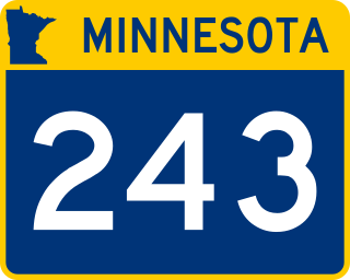
Trunk Highway 243 and State Trunk Highway 243 are two short state highways in the U.S. states of Minnesota and Wisconsin. They connect MN 95 in Franconia Township, Minnesota with WIS 35 in Osceola, Wisconsin. The two highways meet at the state line on a bridge across St. Croix River. The combined highway is 1.53 miles (2.46 km) in length, 1.23 miles (1.98 km) in Minnesota and 0.30 miles (0.48 km) in Wisconsin. The two highways were designated in 1949. The bridge across the St. Croix River dates to 1953.

<span class="mw-page-title-main">Minnesota State Highway 225</span>

Minnesota State Highway 225 (MN 225) was a 8.809-mile-long (14.177 km) highway in north-central Minnesota, which ran from its intersection with County State-Aid Highway 26 and County Road 129 in the town of Ponsford south and east to its intersection with State Highway 34 in Osage Township of Becker County.

<span class="mw-page-title-main">U.S. Route 10 in Minnesota</span> Section of U.S. Numbered Highway in Minnesota, United States

U.S. Highway 10 (US 10) is a major divided highway for almost all of its length in the U.S. state of Minnesota. The route runs through the central portion of the state, following generally the alignment of the former Northern Pacific Railway and connects the cities of Moorhead, Detroit Lakes, Wadena, Little Falls, St. Cloud, Anoka, Saint Paul, and Cottage Grove. US 10 within Minnesota is 275 miles (443 km) in length.

<span class="mw-page-title-main">U.S. Route 65 in Minnesota</span>

U.S. Highway 65 is a north-south United States Numbered Highway running from Clayton, Louisiana to Albert Lea, Minnesota. In the state of Minnesota, US 65 travels for 15 miles from the Iowa border to a partial interchange with Interstate 35 in Albert Lea. The length of US 65 in Minnesota is the shortest of the five states the route travels through.

<span class="mw-page-title-main">Minnesota State Highway 266</span>

Minnesota State Highway 266 was a 13.860-mile-long (22.306 km) highway in southwest Minnesota that had connected the communities of Wilmont and Reading to the city of Worthington. It was decommissioned in 2004, and was renumbered Nobles County State-Aid Highway 25.

<span class="mw-page-title-main">U.S. Route 75 in Iowa</span> Highway in Iowa

U.S. Highway 75 (US 75) is a United States Highway in northwestern Iowa. It begins at the Missouri River on a bridge with Interstate 129 (I-129) and US 20. Immediately upon landing in Iowa from Nebraska, I-129 ends at an interchange with I-29. US 20 and US 75 continue around Sioux City on a four-lane expressway until US 20 exits to the east. US 75 heads to the north-northeast, parallel to the Floyd River, until Le Mars. There, Iowa Highway 60 (Iowa 60) continues northeastward on the expressway while US 75 heads due north. Near Hull, it is briefly overlapped by US 18. It leaves the state and enters Minnesota north of Rock Rapids.

References

  1. Minnesota Department of Transportation. Scott County Road Map (PDF) (Map). St. Paul: Minnesota Department of Transportation. Retrieved May 29, 2016.
  2. Minnesota Department of Transportation. "Logpoint Listings". St. Paul: Minnesota Department of Transportation. Archived from the original on March 4, 2022. Retrieved May 29, 2016.
  3. 1 2 Federal Highway Administration. National Highway System, Minneapolis–St. Paul, MN–WI (PDF) (Map). Federal Highway Administration. Archived from the original (PDF) on October 17, 2016. Retrieved June 15, 2016.
  4. Riner, Steve. "Details of routes 288–694". The Unofficial Minnesota Highways Page. Retrieved June 16, 2016.[ self-published source ]
  5. Minnesota Department of Transportation (1987). Explore Minnesota: Official State Highway Map (Map) (1987–1988 ed.). 1:1,137,760. St. Paul: Minnesota Department of Transportation. OCLC   5673160, 80405240, 56293701, 35834362 . Retrieved June 15, 2016 via Minnesota Digital Library.