
Beaver is a town in Carroll County, Arkansas, United States. As of the 2020 census it had a population of 67. The community is located on the White River at the western limits of Table Rock Lake deep in the Ozark Mountains. Located north of Eureka Springs, the small town has been featured in movies for its picturesque scenery. The town is known for the Beaver Bridge, a two-panel suspension bridge over the White River listed on the National Register of Historic Places.

Fallston is a borough in Beaver County, Pennsylvania, United States, along the Beaver River. The population was 255 at the 2020 census. It is a part of the Pittsburgh metropolitan area.

The River Tay is the longest river in Scotland and the seventh-longest in Great Britain. The Tay originates in western Scotland on the slopes of Ben Lui, then flows easterly across the Highlands, through Loch Dochart, Loch Iubhair and Loch Tay, then continues east through Strathtay, in the centre of Scotland, then southeasterly through Perth, where it becomes tidal, to its mouth at the Firth of Tay, south of Dundee. It is the largest river in the United Kingdom by measured discharge. Its catchment is approximately 2,000 square miles, the Tweed's is 1,500 sq mi (3,900 km2) and the Spey's is 1,097 sq mi (2,840 km2).

The White River is a 722-mile (1,162 km) river that flows through the U.S. states of Arkansas and Missouri. Originating in the Boston Mountains of northwest Arkansas, it arcs northwards through southern Missouri before turning back into Arkansas, flowing southeast to its mouth at the Mississippi River.

Events from the BCs in Canada.

The Bronx River, approximately 24 miles (39 km) long, flows through southeast New York in the United States and drains an area of 38.4 square miles (99 km2). It is named after colonial settler Jonas Bronck. Besides the Hutchinson River, the Bronx River is the only fresh water river in New York City.

The Ashuelot River is a tributary of the Connecticut River, approximately 64 miles (103 km) long, in southwestern New Hampshire in the United States. It drains a mountainous area of 425 square miles (1,101 km2), including much of the area known as the Monadnock Region. It is the longest tributary of the Connecticut River within New Hampshire.

The Verde River is a major tributary of the Salt River in the U.S. state of Arizona. It is about 170 miles (270 km) long and carries a mean flow of 602 cubic feet per second (17.0 m3/s) at its mouth. It is one of the largest perennial streams in Arizona.
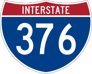
Interstate 376 (I-376) is a major auxiliary route of the Interstate Highway System in the US state of Pennsylvania, located within the Allegheny Plateau. It runs from I-80 near Sharon south and east to a junction with the Pennsylvania Turnpike in Monroeville, after having crossed the Pennsylvania Turnpike at an interchange in Big Beaver. The route serves Pittsburgh and its surrounding areas and is the main access road to Pittsburgh International Airport (PIT). Portions of the route are known as the Beaver Valley Expressway, Southern Expressway, and Airport Parkway. Within Allegheny County, the route runs along the majority of the Penn-Lincoln Parkway, known locally as Parkway West and Parkway East. It is currently the ninth-longest auxiliary Interstate route in the system and second only to I-476 within Pennsylvania.

The Allegheny County Belt System color codes various county roads to form a unique system of routes in Allegheny County, Pennsylvania, and around the city of Pittsburgh.

The Assabet River is a small, 34.4-mile (55.4 km) long river located about 20 miles (30 km) west of Boston, Massachusetts, United States. The Assabet rises from a swampy area known as the Assabet Reservoir in Westborough, Massachusetts, and flows northeast before merging with the Sudbury River at Egg Rock in Concord, Massachusetts, to become the Concord River. The Organization for the Assabet, Sudbury and Concord Rivers, headquartered in West Concord, Massachusetts, is a non-profit organization dedicated to the preservation, protection, and enhancement of the natural and recreational features of these three rivers and their watershed. As the Concord River is a tributary of the Merrimack River, it and the Assabet and Sudbury rivers are part of the larger Merrimack River watershed.

The Aliquippa and Ohio River Railroad is a six-mile short line railroad in Aliquippa, Pennsylvania, United States, controlled by Genesee & Wyoming Inc. through its ownership of the Ohio Central Railroad System. It lies between CSX Transportation's ex-Pittsburgh and Lake Erie Railroad line and the Ohio River, extending south from CSX's yard in northern Aliquippa to near the Ambridge-Aliquippa Bridge. Formerly known as the Aliquippa and Southern Railroad, its owner and primary customer was LTV Steel, which mostly closed its Aliquippa plant in 1985 and sold the line to the Ohio Central in 2002. The AOR now connects the Aliquippa Industrial Park, which occupies the LTV site, with CSX.
The Scott River is a 60-mile-long (97 km) river in Siskiyou County, California, United States. It is a tributary of the Klamath River, one of the largest rivers in California.

Pennsylvania Route 18 is a major north–south highway in Western Pennsylvania whose southern terminus is at West Virginia Route 69 at the state line in Greene County near the village of Garrison, while the northern terminus is at PA 5 in Lake City. At a length of 205 miles (330 km), PA 18 is the only state route in Pennsylvania — north–south or east–west — to traverse the entire state. It also has the distinction of being the longest state route in Pennsylvania.

The Lowville and Beaver River Railroad is a short-line railroad that was owned by Genesee Valley Transportation (GVT) of Batavia, New York from 1993 to Wednesday, January 24, 2007. Map

U.S. Route 231 in Kentucky runs 86.465 miles (139.152 km) from the Tennessee state line near Adolphus to the William H. Natcher Bridge on the Ohio River near Rockport, Indiana. It crosses the state mainly in the west-central region, traversing Allen, Warren, Butler, Ohio, and Daviess Counties.
The White River Bridge is a five span Warren deck truss bridge located near Beaver, Carroll County, Arkansas. It carries U.S. Route 62 over the White River for 786.90 feet (239.85 m). Each span is about 128 feet (39 m) in length, and is mounted on concrete piers or abutments. The bridge was built in 1950-52 by the Forcum-James Company of Dyersburg, Tennessee. It was the last of eleven deck-truss bridges built in the state, and is the only one of its type in the county.

Willamette Park is a city park of about 26 acres (11 ha) in south Portland, in the U.S. state of Oregon. Located at Southwest Macadam Avenue and Nebraska Street, the park includes a boat dock and ramp, paved and unpaved paths, picnic areas, restrooms, a dog off-leash area, playground, soccer field, and tennis courts.
The Beaver River Bridge is a bridge that carries the Pennsylvania Turnpike across the Beaver River in North Sewickley Township, Pennsylvania. Built in 1951 and opened in 1952, the 71-year-old bridge is being replaced with the construction of a new span to its north. The Beaver River Bridge has a total length of 1,546 ft (471 m) and a clearance below of 170 ft (52 m) making it higher than the Delaware River Bridge's 160 ft (49 m) clearance on the PA Turnpike's eastern terminus in Bucks County, but lower than the Hawk Falls Bridge's 190 ft (58 m) clearance on the Pennsylvania Turnpike's Northeast Extension in Carbon County. The Beaver River Bridge is an example of a mid-20th century cantilever deck truss with preservation groups making efforts to save it from demolition as its structural style is becoming rare. About 20,000 vehicles travel across the bridge each day.

The Beaver Bridge in Beaver, Arkansas, is a historic one-lane suspension bridge carrying Arkansas Highway 187 over the White River at Table Rock Lake. Built in 1949 by the Pioneer Construction Company, the structure is the only suspension bridge open to traffic in Arkansas. The Beaver Bridge was added to the National Register of Historic Places in 1990.