A biome is a distinct geographical region with specific climate, vegetation, and animal life. It consists of a biological community that has formed in response to its physical environment and regional climate. Biomes may span more than one continent. A biome encompasses multiple ecosystems within its boundaries. It can also comprise a variety of habitats.

The Nearctic realm is one of the eight biogeographic realms constituting the Earth's land surface.
The Global 200 is the list of ecoregions identified by the World Wide Fund for Nature (WWF), the global conservation organization, as priorities for conservation. According to WWF, an ecoregion is defined as a "relatively large unit of land or water containing a characteristic set of natural communities that share a large majority of their species dynamics, and environmental conditions". For example, based on their levels of endemism, Madagascar gets multiple listings, ancient Lake Baikal gets one, and the North American Great Lakes get none.

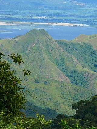
The Cordillera de la Costa montane forests is a montane ecoregion of the tropical and subtropical moist broadleaf forests biome, in the Venezuelan Coastal Range on the Caribbean Sea in northern Venezuela.
Ptychadena porosissima is a species of frog in the family Ptychadenidae. It is found in Angola, Democratic Republic of the Congo, Ethiopia, Kenya, Malawi, Rwanda, South Africa, Eswatini, Tanzania, Uganda, Zambia, Zimbabwe, possibly Burundi, possibly Lesotho, and possibly Mozambique. Its natural habitats are temperate forest, subtropical or tropical moist montane forest, moist savanna, subtropical or tropical moist shrubland, temperate grassland, subtropical or tropical seasonally wet or flooded lowland grassland, subtropical or tropical high-altitude grassland, swamps, intermittent freshwater marshes, pastureland, rural gardens, and heavily degraded former forest.
The Central America bioregion is a biogeographic region comprising southern Mexico and Central America.

Montane ecosystems are found on the slopes of mountains. The alpine climate in these regions strongly affects the ecosystem because temperatures fall as elevation increases, causing the ecosystem to stratify. This stratification is a crucial factor in shaping plant community, biodiversity, metabolic processes and ecosystem dynamics for montane ecosystems. Dense montane forests are common at moderate elevations, due to moderate temperatures and high rainfall. At higher elevations, the climate is harsher, with lower temperatures and higher winds, preventing the growth of trees and causing the plant community to transition to montane grasslands and shrublands or alpine tundra. Due to the unique climate conditions of montane ecosystems, they contain increased numbers of endemic species. Montane ecosystems also exhibit variation in ecosystem services, which include carbon storage and water supply.
The ecology of the Himalayas varies with climate, rainfall, altitude, and soils. The climate ranges from tropical at the base of the mountains to permanent ice and snow at the highest elevations. The amount of yearly rainfall increases from west to east along the southern front of the range. This diversity of climate, altitude, rainfall and soil conditions supports a variety of distinct plant and animal species, such as the Nepal gray langur

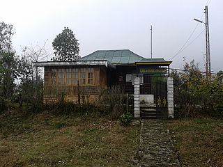
Fambong Lho Wildlife Sanctuary is a 51 km2 (20 sq mi) large wildlife sanctuary in Gangtok district of the state of Sikkim in India. It is contiguous with Khangchendzonga National Park and located around 30 km (19 mi) west of Gangtok. It hosts a few small hamlets inside, namely Dikchu, Pangthang, and Mangan and is managed by State Forest Department.
Vegetation classification is the process of classifying and mapping the vegetation over an area of the Earth's surface. Vegetation classification is often performed by state based agencies as part of land use, resource and environmental management. Many different methods of vegetation classification have been used. In general, there has been a shift from structural classification used by forestry for the mapping of timber resources, to floristic community mapping for biodiversity management. Whereas older forestry-based schemes considered factors such as height, species and density of the woody canopy, floristic community mapping shifts the emphasis onto ecological factors such as climate, soil type and floristic associations. Classification mapping is usually now done using geographic information systems (GIS) software.
Naina Devi Himalayan Bird Conservation Reserve is a wildlife reserve in the Nainital district of the state of Uttarakhand in India. This reserve forest is located in Kumaon region of Uttarakhand and placed inside Nainital forest division. Nainital forest division at present has several birding trails and forest patches consisting of temperate broad-leaf forests to alpine grasslands to rhododendron shrubberies. Wide altitudinal variation supports a very large segment of avian fauna to inhibit in this forest range.