Related Research Articles

Brisbane Water National Park is a national park on the Central Coast of New South Wales, Australia. The national park is situated 70 kilometres (43 mi) north of Sydney and 12 kilometres (7.5 mi) southwest of Gosford. It consists the Brisbane Water and Mooney Mooney Creek waterways.

The Nightcap National Park is a national park situated within the Nightcap Range in the Northern Rivers region of New South Wales, Australia. The 8,080-hectare (20,000-acre) park was created in April 1983 and is situated 35 kilometres (22 mi) north of Lismore. The park was established following campaigns and blockades against logging at Terania Creek, Grier's Scrub and Mount Nardi between 1979 and 1982. Sections of the Whian Whian state forest were added to it following blockading and campaigning in 1998. The national park is classed by the IUCN World Commission on Protected Areas as Category II and is part of the Shield Volcano Group of the World Heritage Site Gondwana Rainforests of Australia inscribed in 1986 and added to the Australian National Heritage List in 2007.
A threatened species is any species which is vulnerable to extinction in the near future. Species that are threatened are sometimes characterised by the population dynamics measure of critical depensation, a mathematical measure of biomass related to population growth rate. This quantitative metric is one method of evaluating the degree of endangerment without direct reference to human activity.

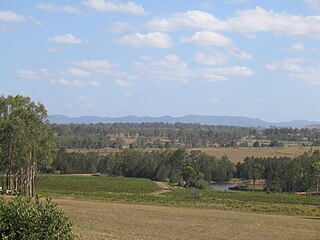
The Hunter Region, also commonly known as the Hunter Valley, Newcastle Region, or simply Hunter, is a region in northern New South Wales, Australia, extending from approximately 162 km (101 mi) to 310 km (193 mi) north of Sydney. It contains the Hunter River and its tributaries with highland areas to the north and south. Situated at the northern end of the Sydney Basin bioregion, the Hunter Valley is one of the largest river valleys on the NSW coast, and is most commonly known for its wineries and coal industry.

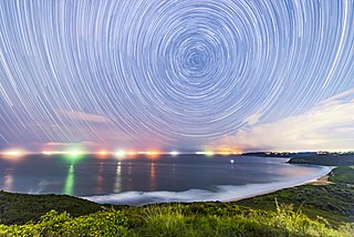
Barrenjoey is a locality in the suburb of Palm Beach, at the most northern tip of Pittwater. The headland is made up primarily of sandstones of the Newport Formation, the top third is a cap of Hawkesbury sandstone. Around 10,000 years ago the headland was cut off from the mainland due to the rising sea level; subsequent buildup of a sand spit or tombolo reconnected the island to the mainland. It is the location of the Barrenjoey Head Lighthouse, a lighthouse that was first lit in 1881. In 1995 Barrenjoey was gazetted into Ku-ring-gai Chase National Park.

The Environment Protection and Biodiversity Conservation Act 1999(Cth) is an Act of the Parliament of Australia that provides a framework for protection of the Australian environment, including its biodiversity and its natural and culturally significant places. Enacted on 17 July 2000, it established a range of processes to help protect and promote the recovery of threatened species and ecological communities, and preserve significant places from decline. The Act is as of September 2024 administered by the Department of Climate Change, Energy, the Environment and Water. Lists of threatened species are drawn up under the Act, and these lists, the primary reference to threatened species in Australia, are available online through the Species Profile and Threats Database (SPRAT).

The Sydney Turpentine-Ironbark Forest (STIF) is a wet sclerophyll forest community of Sydney, New South Wales, Australia, that is typically found in the Inner West and Northern region of Sydney. It is also among the three of these plant communities which have been classified as Endangered, under the New South Wales government's Threatened Species Conservation Act 1995, with only around 0.5% of its original pre-settlement range remaining.

The Paroo-Darling National Park is a protected national park that is located in the Far West region of New South Wales, in eastern Australia. The 178,053-hectare (439,980-acre) national park spans two distinct regions in the outback area. This region covers the arid catchments of the Paroo River and the Paroo-Darling confluence to the south.

The Yanga National Park is a newly formed national park, located near the township of Balranald in south- western New South Wales. It covers an area of 66,734 hectares which includes 1,932 hectares of Yanga Nature Reserve, and has a frontage of 170 kilometres (110 mi) on the Murrumbidgee River. It is largely located in the Lower Murrumbidgee Floodplain, which is included on A Directory of Important Wetlands in Australia because of its importance as a breeding site for waterbirds when flooded.

Euphorbia psammogeton, commonly known as sand spurge, is a flowering plant in the family Euphorbiaceae. The specific epithet derives from the Greek psammos (“sand”) and geiton (“neighbour”), alluding to the typical habitat.
The Queanbeyan Nature Reserve is a protected nature reserve that is located in the Southern Tablelands region of New South Wales, in eastern Australia. The 67-hectare (170-acre) reserve is situated approximately 4 kilometres (2.5 mi) west-south-west of the City of Queanbeyan.

The Charcoal Tank Nature Reserve is a protected nature reserve in the central western region of New South Wales, Australia. The 86.4-hectare (213-acre) reserve is situated 10 kilometres (6.2 mi) south of West Wyalong and may be accessed via the Newell Highway and The Charcoal Tank Road. The reserve is an important refuge for native flora and fauna in a highly fragmented landscape, one in which the majority of the original vegetation has been removed.
Glenrock State Conservation Area is a protected conservation area located eight kilometres south of the central business district of Newcastle in the state of New South Wales, on the east coast of Australia. The park borders the coast and encompasses 534 hectares stretching from the residential suburbs of Merewether to Dudley within the Newcastle and Lake Macquarie Local Government Areas.

The Cooks River/Castlereagh Ironbark Forest (CRCIF) is a scattered, dry sclerophyll, open-forest to low woodland and scrubland which occurs predominantly in the Cumberland subregion of the Sydney basin bioregion, between Castlereagh and Holsworthy, as well as around the headwaters of the Cooks River. The Cooks River Clay Plain Scrub Forest is a component of this ecological community, though both belong to a larger occurring community called the Temperate Eucalyptus fibrosa/Melaleuca decora woodland.

The Threatened Species Conservation Act 1995 (TSC Act) was enacted by the Parliament of New South Wales in 1995 to protect threatened species, populations and ecological communities in NSW. In 2016 it was replaced by the Biodiversity Conservation Act 2016. These acts form the basis and the mechanisms in NSW by which species, populations and ecological communities are declared endangered, vulnerable or critically endangered, and under which people and corporations are prosecuted for destruction of habitat sheltering such species, populations or communities.

McKay Reserve is a small tract of remnant urban bushland in Palm Beach, parts of which contain the endangered ecological community (EEC) Pittwater and Wagstaffe Spotted Gum Forest. The reserve lies on a ridge on the Barrenjoey Peninsula and overlooks western Pittwater.

Limeburners Creek National Park is a protected national park on the Mid North Coast of New South Wales, Australia. The 91.2 km national park is located 5 km (3.1 mi) to the north of Port Macquarie and exists across both the Kempsey Shire and Port Macquarie-Hastings Council local government areas, but is chiefly managed by National Parks and Wildlife Service. The area was originally erected as a nature reserve but this reservation was revoked when it became formally recognised as a national park in 2010 under the National Parks and Wildlife Act (1974). Many threatened ecological habitats and species of fauna and flora are found within this park, alongside several heritage sites of cultural significance, particularly to the local Birpai and Dunghutti people upon whose land the park exists. The protected status of this national park is largely owing to the ecological and cultural value of the area, in addition to the value of the ecosystems to further scientific research.
The Biodiversity Conservation Act 2016 is a state-based act of parliament in New South Wales (NSW). Its long title is An Act relating to the conservation of biodiversity; and to repeal the Threatened Species Conservation Act 1995, the Nature Conservation Trust Act 2001 and the animal and plant provisions of the National Parks and Wildlife Act 1974. It supersedes the Threatened Species Conservation Act 1995, and commenced on 25 August 2017.
The Weeping Myall Woodlands is an endangered ecological community, under the EPBC Act of the Commonwealth of Australia. It is found in inland Queensland and inland New South Wales, on alluvial plains west of the Great Dividing Range. It takes its name from Acacia pendula, the weeping myall.
The Central Hunter Valley eucalypt forest and woodland is a grassy woodland community situated in the Hunter Valley, New South Wales, Australia. It was listed in May 2015 as critically endangered under Australia's national environment law. The Warkworth Sands Woodland of the Hunter Valley, situated in the area, was gazetted as an endangered ecological community in New South Wales on 13 December 2002 under the NSW Threatened Species Conservation Act 1995 and now under the Biodiversity Act of 2016.
References
- ↑ "2000 - 2003 Final determinations". NSW Office of Environment and Heritage. Retrieved 2 September 2018.
- 1 2 "1996 - 1999 Final determinations". NSW Office of Environment and Heritage. Retrieved 2 September 2018.
- 1 2 "2004 - 2007 Final determinations". NSW Office of Environment and Heritage. Retrieved 2 September 2018.
- ↑ "2008 - 2010 Final determinations". NSW Office of Environment and Heritage. Retrieved 2 September 2018.
- ↑ "2011 - 2012 Final determinations". NSW Office of Environment and Heritage. Retrieved 2 September 2018.
- ↑ "2013 - 2015 Final determinations". NSW Office of Environment and Heritage. Retrieved 2 September 2018.