This article relies largely or entirely on a single source .(February 2008) |
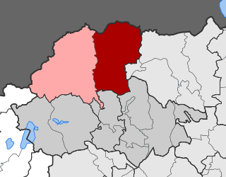
Many inhabited places in Pella Prefecture of Greece have both Slavic and Greek forms. Some of the forms are identifiably of Greek origin, others of Slavic, yet others of Turkish or more obscure origins. Following the First World War and the Graeco-Turkish War which followed, the Greek government undertook a renaming program to place Greek names first on places with Turkophonic, and later on those with Slavophonic names. [1]
Slavic language
Turkish language
| Slavic name(s) | Current official name other Greek names | Geographic Coordinates | Citation [2] | Population (2001) [3] | Other |
|---|---|---|---|---|---|
| Arsen | Arsenio (Αρσένιο) | 40°43′N22°10′E / 40.717°N 22.167°E | p. 43 | 1,409 | |
| Banya | Loutrochori (Λουτροχώρι) | 40°43′N22°07′E / 40.717°N 22.117°E | p. 43 | 466 | |
| Begna | Agios Spyridon (Άγιος Σπυρίδων) | 40°47′N21°46′E / 40.783°N 21.767°E | p. 43 | ||
| Vladovo | Agras (Άγρας) | 40°48′N22°00′E / 40.800°N 22.000°E | p. 44 | 883 | |
| V'lkojanevo | Lykoi (Λύκοι) | 40°50′N22°00′E / 40.833°N 22.000°E | p. 44 | 64 | |
| V'ngeni | Sevastiana (Σεβαστιανά) | 40°46′N22°07′E / 40.767°N 22.117°E | p. 44 | 1,501 | |
| Voden | Edessa (Έδεσσα) | 40°48′N22°03′E / 40.800°N 22.050°E | p. 45 | 18, 253 | Capital of the prefecture |
| Vrbeni | Nea Zoi (Νέα Ζωή) | 40°51′N22°06′E / 40.850°N 22.100°E | p. 46 | 201 | |
| Vrtikop, Vertikop, Vrtekop | Skydra (Σκύδρα) | 40°46′N22°10′E / 40.767°N 22.167°E | p. 46 | 5,081 | |
| Gorno Gramatikovo, Kolibi | Ano Grammatiko (Άνω Γραμματικό) | 40°42′N21°57′E / 40.700°N 21.950°E | p. 47 | 78 | |
| Gorno Lipoor | Ano Lipochori (Άνω Λιποχώρι) | 40°46′N22°10′E / 40.767°N 22.167°E | p. 47 | ||
| Gugovo | Vryta (Βρυτά) | 40°48′N21°55′E / 40.800°N 21.917°E | p. 47 | 506 | |
| Dolno Gramatikovo, Gramatikovo | Kato Grammatiko (Κάτω Γραμματικό) | 40°42′N21°54′E / 40.700°N 21.900°E | p. 48 | 230 | |
| Dolno Lipoor | Kato Lipochori, Lipochori (Κάτω Λιποχώρι, Λιποχώρι) | 40°45′N22°11′E / 40.750°N 22.183°E | p. 48 | 1,032 | |
| Drushka | Drosia (Δροσιά) | 40°48′N21°53′E / 40.800°N 21.883°E | p. 48 | 68 | |
| Zhervi | Zervi (Ζέρβη) | 40°51′N21°50′E / 40.850°N 21.833°E | p. 49 | 349 | |
| Jaborjani, Jaboreni | Platani (Πλατάνη) | 40°46′N22°03′E / 40.767°N 22.050°E | p. 49 | 465 | |
| Kamenik | Petraia (Πετραία) | 40°43′N22°09′E / 40.717°N 22.150°E | p. 49; GeoNames [ permanent dead link ] | 921 | both Greek & Slavic names mean "rocky" |
| K'drovo, K'drevo | Agios Dimitrios, Kedrona (Άγιος Δημήτριος, Κεδρώνα) | 40°45′N21°55′E / 40.750°N 21.917°E | p. 50 | 63 | |
| Kolibi na Janakula | Kalyvia, Kalyvia Giannakoula (Καλύβια, Καλύβια Γιαννακούλα) | 40°54′N21°52′E / 40.900°N 21.867°E | p. 50 | 1,186 | |
| Kolibi na Nana | Kalyvia Nanna (Καλύβια Νάννα) | 40°55′N21°48′E / 40.917°N 21.800°E | p. 50 | ||
| Kosten, Kostino | Kosteno (Κόστενο) | 40°55′N21°48′E / 40.917°N 21.800°E | p. 50 | ||
| Kotugeri, Kutugeri | Kaisariana (Καισαριανά) | 40°45′N22°04′E / 40.750°N 22.067°E | p. 50 | 116 | |
| Kochana | Peraia (Περαία) | 40°44′N21°49′E / 40.733°N 21.817°E | p. 51 | 352 | |
| Krontselevo, Krontselovo | Kerasies (Κερασιές, Κερασέαι) | 40°53′N21°58′E / 40.883°N 21.967°E | p. 51 | 455 | |
| Lukovets (Staro Lukovets) | Palaia Sotira, Sotira (Παλαιά Σωτήρα, Σωτήρα) | 40°51′N22°04′E / 40.850°N 22.067°E | p. 51 | 2 | |
| Mesimer | Mesimeri (Μεσημέρι) | 40°47′N22°02′E / 40.783°N 22.033°E | p. 52 | 930 | |
| Nisija | Nisi, Pella (Νησί) | 40°50′N21°56′E / 40.833°N 21.933°E | p. 52 | 415 | |
| Nov Chegan | Neos Agios Athanasios (Νέος Άγιος Αθανάσιος) | 40°50′N21°48′E / 40.833°N 21.800°E | p. 52 | 460 | |
| Novo Lukovets | Sotira, Nea Sotira (Σωτήρα, Νέα Σωτήρα) | 40°52′N22°03′E / 40.867°N 22.050°E | p. 52 | 226 | |
| Novo Rusilovo | Nea Xanthogeia (Νέα Ξανθόγεια) | 40°49′N21°52′E / 40.817°N 21.867°E | p. 53 | 114 | |
| Novo Selo, Eni Kjoj | Plevroma (Πλεύρωμα) | 40°43′N22°08′E / 40.717°N 22.133°E | p. 53 | 294 | Yeni Köy ("new village") in Turkish |
| Orizari | Rizarion (Ριζάριον) | 40°47′N22°06′E / 40.783°N 22.100°E | p. 53 | 1,129 | |
| Orman Chiflik | Dendri (Δενδρί) | 40°45′N22°08′E / 40.750°N 22.133°E | p. 53 | ||
| Oslovo | Panagitsa (Παναγίτσα) | 40°51′N21°51′E / 40.850°N 21.850°E | p. 54 | 730 | |
| Ostrovo | Arnissa (Άρνισσα) | 40°48′N21°50′E / 40.800°N 21.833°E | p. 54; GeoNames [ permanent dead link ] | 1,550 | |
| Oshljani | Agia Foteini (Αγία Φωτεινή) | 40°43′N22°00′E / 40.717°N 22.000°E | p. 54 | 299 | |
| Patechina | Patima (Πάτημα) | 40°51′N21°53′E / 40.850°N 21.883°E | p. 55 | ||
| Pachareshkjoj | Proastion Edessis (Προάστιον Έδεσσας) | 40°47′N22°04′E / 40.783°N 22.067°E | p. 55 | 48 | |
| Pod | Flamouria (Φλαμουριά) | 40°45′N22°01′E / 40.750°N 22.017°E | p. 55 | 675 | |
| Pochep | Margarita (Μαργαρίτα) | 40°53′N22°02′E / 40.883°N 22.033°E | p. 56 | 22,209 | |
| Prakhna, Prakhnjani | Aspro (Άσπρο) | 40°44′N22°13′E / 40.733°N 22.217°E | p. 56 | 794 | |
| Rizovo | Rizo (Ριζό) | 40°44′N22°08′E / 40.733°N 22.133°E | p. 57 | 1,081 | |
| Rusilovo | Xanthogeia (Ξανθόγεια) | 40°48′N21°52′E / 40.800°N 21.867°E | p. 57 | 2 | |
| Samar | Samari (Σαμάρι) | 40°49′N22°06′E / 40.817°N 22.100°E | p. 57 | 91 | |
| Sveti Ilija, Mechkili | Profitis Ilias (Προφήτης Ηλίας) | 40°49′N22°10′E / 40.817°N 22.167°E | p. 58 | 1,290 | both Greek & Slavic names mean "Prophet Elijah" |
| Teovo | Karydia (Καρυδιά) | 40°51′N21°56′E / 40.850°N 21.933°E | p. 58 | 438 | |
| Trebolets | Mavrovouni (Μαυροβούνιον) | 40°47′N22°10′E / 40.783°N 22.167°E | p. 58 | 1,029 | |
| Furka | Fourka (Φούρκα) | 40°48′N22°00′E / 40.800°N 22.000°E | p. 59 | ||
| Tsrkovjani | Ekklisiochori (Εκκλησιοχώρι) | 40°49′N22°04′E / 40.817°N 22.067°E | p. 59 | 415 | both Greek & Slavic names mean "church village" |
| Chegan | Agios Athanasios, Meteora (Άγιος Αθανάσιος, Μετέωρα) | 40°50′N21°46′E / 40.833°N 21.767°E | p. 59 | 184 | |
| Alar | Archontikon (Αρχοντικόν) | 40°47′N22°29′E / 40.783°N 22.483°E | p. 63 | 231 | |
| Asarbegovo, Asar Bey | Drosero (Δροσερό) | 40°49′N22°15′E / 40.817°N 22.250°E | p. 63 | 496 | |
| Babjani | Laka (Λάκκα) | 40°51′N22°15′E / 40.850°N 22.250°E | p. 63 | 401 | |
| Baldzha, Bal'dzha | Melissi (Μελίσσιον) | 40°46′N22°21′E / 40.767°N 22.350°E | p. 63 | 983 | |
| Bozets | Athyra (Άθυρα) | 40°50′N22°36′E / 40.833°N 22.600°E | p. 64; GeoNames [ permanent dead link ] | 1,693 | |
| V'drishta, Sari Kadi | Palaios Mylotopos (Παλαιός Μυλότοπος) | 40°48′N22°20′E / 40.800°N 22.333°E | p. 64 | 831 | |
| Veti Pazar, Eskidzhe | Pontochori, Palaion, Palaion Palaion (Ποντοχώρι, Παλαιόν, Παλαιόν Παλαιόν) | 40°48′N22°21′E / 40.800°N 22.350°E | p. 65 | 58 | |
| Vrezhot, Vres | Agios Loukas (Άγιος Λουκάς) | 40°43′N22°18′E / 40.717°N 22.300°E | p. 65 | 1,555 | |
| Golo Selo | Akrolimni, Gymna (Ακρολίμνη, Γυμνά) | 40°41′N22°16′E / 40.683°N 22.267°E | p. 66; GeoNames [ permanent dead link ] | 1,340 | |
| Gorno Vlasi | Esovalta (Εσώβαλτα) | 40°43′N22°16′E / 40.717°N 22.267°E | p. 66 | 989 | |
| Gorno Krushare | Eso Achladochori (Έσω Αχλαδοχώρι) | 40°43′N22°15′E / 40.717°N 22.250°E | p. 66 | both Greek & Slavic names mean "upper pear-village" | |
| Gradishte, Palikastro | Kyrros, Palaiokastron (Κύρρος, Παλαιόκαστρον) | 40°50′N22°19′E / 40.833°N 22.317°E | p. 66 | ||
| Gropino | Dafni, Valtolivadon (Δάφνη, Βαλτολίβαδον) | 40°46′N22°14′E / 40.767°N 22.233°E | p. 67 | 667 | |
| Grubevtsi, Gurbesh | Agrosykia, Agriosykia (Αγροσυκέα. Αγριοσυκέα) | 40°51′N22°30′E / 40.850°N 22.500°E | p. 67 | 384 | |
| Damjan, Sulukli | Damiano (Δαμιανόν) | 40°50′N22°27′E / 40.833°N 22.450°E | p. 67 | 381 | |
| Dolno Vlasi | Exovalta (Εξώβαλτα) | 40°44′N22°17′E / 40.733°N 22.283°E | p. 67 | ||
| Dolno Krushare | Exo Achladochori (Έξω Αχλαδοχώριον) | 40°44′N22°15′E / 40.733°N 22.250°E | p. 68 | ||
| Gjupchevo | Gypsochori (Γυψοχώρι) | 40°49′N22°16′E / 40.817°N 22.267°E | p. 68 | 470 | |
| Enidzhe Vardar, Pazar | Giannitsa (Γιαννιτσά) | 40°47′N22°25′E / 40.783°N 22.417°E | p. 69 | 26,296 | Yenice/Yenidje Vardar in Turkish |
| Kadinovo, Kasino Selo, Sujukli | Galatades (Γαλατάδες) | 40°45′N22°17′E / 40.750°N 22.283°E | p. 69 | 2,339 | |
| Kalinitsa, Jach Kjoj | Kali (Καλή) | 40°49′N22°11′E / 40.817°N 22.183°E | p. 70 | 1,684 | |
| Kara Khamza | Kallipoli (Καλλίπολις) | 40°47′N22°14′E / 40.783°N 22.233°E | p. 70 | 484 | |
| Kariotitsa, Stara Kariotitsa | Palaia Karyotissa (Παλαιά Καρυώτισσα) | 40°45′N22°20′E / 40.750°N 22.333°E | p. 70 | ||
| Kolibite, Kolibalar | Kalyvia (Καλύβια) | 40°45′N22°13′E / 40.750°N 22.217°E | p. 71 | ||
| Konikovo | Dytiko (Δυτικόν) | 40°51′N22°32′E / 40.850°N 22.533°E | p. 71 | 477 | |
| Kornishor | Kromni (Κρώμνη) | 40°54′N22°20′E / 40.900°N 22.333°E | p. 71 | 14 | |
| Krushari, Armuchi, Krushare | Ampeleies, Ampelia (Αμπελείες, Αμπελείαι) | 40°51′N22°24′E / 40.850°N 22.400°E | p. 72; GeoNames [ permanent dead link ] | 1,095 | |
| K'salar | Achladochori, Mandarai (Αχλαδοχώριον, Μανδαραί) | 40°50′N22°21′E / 40.833°N 22.350°E | p. 72 | 417 | |
| Liparinovo | Liparo (Λιπαρό) | 40°45′N22°15′E / 40.750°N 22.250°E | p. 73 | 478 | |
| Litovoj | Leptokarya, Litovoion (Λεπτοκαρυά, Λιτοβόϊον) | 40°51′N22°28′E / 40.850°N 22.467°E | p. 73 | 215 | |
| Lozanovo | Palaifyto (Παλαίφυτο) | 40°47′N22°17′E / 40.783°N 22.283°E | p. 73 | 1,468 | |
| Mavrejnovo | Mavron (Μαύρον) | 40°51′N22°13′E / 40.850°N 22.217°E | p. 74 | ||
| Mandalevo | Mandalon (Μάνδαλον) | 40°51′N22°13′E / 40.850°N 22.217°E | p. 74 | 1,153 | |
| Nedirchevo, Nad'r | Anydro (Άνυδρο) | p. 74 | 534 | ||
| Neon Paleon | Axos, Palaion, Neon Palaion (Αξός, Παλαιόν, Νέον Παλαιόν) | 40°48′N22°22′E / 40.800°N 22.367°E | p. 75 | 1,442 | |
| Neos Milotopos, Novo V'drishta | Neos Mylotopos (Νέος Μυλότοπος) | 40°49′N22°21′E / 40.817°N 22.350°E | p. 75 | 2,605 | |
| Nova Kariotitsa, Kariotitsa | Karyotissa, Nea Karyotissa (Καρυώτισσα, Νέα Καρυώτισσα) | 40°46′N22°19′E / 40.767°N 22.317°E | p. 75 | 1,999 | |
| Obor, Dermenchik, Ombar | Aravissos (Αραβησσός) | 40°50′N22°18′E / 40.833°N 22.300°E | p. 76 | 1,514 | |
| Pilorik | Pentaplatanos, Pilorygio (Πενταπλάτανον, Πιλορύγιον) | 40°49′N22°25′E / 40.817°N 22.417°E | p. 76; GeoNames [ permanent dead link ] | 956 | |
| Plasnichevo | Krya Vrysi (Κρύα Βρύση) | 40°41′N22°18′E / 40.683°N 22.300°E | p. 76 | 6,535 | |
| Plugar | Loudias (Λουδίας) | 40°44′N22°20′E / 40.733°N 22.333°E | p. 77 | ||
| Postol, Sveti Apostol | Pella, Agioi Apostoloi, Palaia Pella (Πέλλα, Άγιοι Απόστολοι, Παλαιά Πέλλα) | 40°45′N22°32′E / 40.750°N 22.533°E | p. 77 | 2,450 | |
| P'rgas | Pyrgari (Πυργάρι) | 40°45′N22°21′E / 40.750°N 22.350°E | p. 77 | ||
| Prizna | Vrasti (Βραστή) | 40°42′N22°20′E / 40.700°N 22.333°E | p. 78 | ||
| Radomir | Asvestareio (Ασβεσταρειό) | 40°52′N22°25′E / 40.867°N 22.417°E | p. 78; GeoNames [ permanent dead link ] | 35 | |
| Ramel | Rachona (Ραχώνα) | 40°49′N22°32′E / 40.817°N 22.533°E | p. 78 | 626 | |
| Sveti Gjorgji, Dort Armutlar | Agios Georgios (Άγιος Γεώργιος) | 40°46′N22°15′E / 40.767°N 22.250°E | p. 79 | 359 | |
| Sendelchevo | Sandali (Σανδάλι) | 40°48′N22°13′E / 40.800°N 22.217°E | p. 79 | 212 | |
| Spirlitovo, Ispirlik | Plagiari (Πλαγιάρι) | 40°51′N22°17′E / 40.850°N 22.283°E | p. 79 | 363 | |
| Tagarmish | Ydromyloi (Υδρόμυλοι) | 40°50′N22°34′E / 40.833°N 22.567°E | p. 79 | ||
| Trifulchevo, Kadi Kjoj | Trifyli (Τριφύλλι) | 40°47′N22°16′E / 40.783°N 22.267°E | p. 79 | 531 | |
| Chaushlievo, Chaushli | Mesiano (Μεσιανό) | 40°47′N22°29′E / 40.783°N 22.483°E | p. 80 | 341 | |
| Chekri, Kirkalovo | Paralimni (Παραλίμνη) | 40°45′N22°28′E / 40.750°N 22.467°E | p. 80 | 816 | |
| Chichig's, Cheshig's | Stavrodromi (Σταυροδρόμιον) | 40°43′N22°13′E / 40.717°N 22.217°E | p. 80 | 556 | |
| Baovo, Bakhovo | Promachoi (Πρόμαχοι) | 41°02′N22°00′E / 41.033°N 22.000°E | p. 83 | 1,825 | |
| Berislavtsi, Berislav, Borislav | Perikleia (Περίκλεια) | 41°06′N22°16′E / 41.100°N 22.267°E | p. 83 | 382 | |
| Bizovo (Bizova in Turkish) | Megaplatanos]] (Μεγαπλάτανος) | 40°56′N21°59′E / 40.933°N 21.983°E | p. 83 | 310 | |
| Bidzhova Mala, Bidzho Makhala | Piperies (Πιπεριές, Πιπεριαί) | 40°59′N22°01′E / 40.983°N 22.017°E | p. 84 | 589 | |
| Volchishta, V'lchishta | Ydraia (Υδραία) | 40°57′N22°05′E / 40.950°N 22.083°E | p. 84 | 462 | |
| Gabrishta | Dorothea (Δωροθέα) | 41°00′N22°03′E / 41.000°N 22.050°E | p. 85 | 633 | |
| Gorno Pozhar | Ano Loutraki (Άνω Λουτράκι) | 40°59′N21°55′E / 40.983°N 21.917°E | p. 85 | ||
| Gorno Rodivo | Ano Koryfi (Άνω Κορυφή) | 40°56′N21°54′E / 40.933°N 21.900°E | p. 85 | ||
| Gorno Turmanli | Ano Rodonia (Άνω Ροδωνιά) | 40°58′N22°01′E / 40.967°N 22.017°E | p. 86 | ||
| Gorno Tsrneshevo | Ano Garefeio, Garefeio (Άνω Γαρέφειο, Γαρέφειο) | 41°02′N22°03′E / 41.033°N 22.050°E | p. 86 | 736 | |
| Gostoljubi, Kostoljubi | Konstantia (Κωνσταντία) | 41°00′N22°10′E / 41.000°N 22.167°E | p. 86 | 759 | |
| Dolno Pozhar (Pojar in Turkish) | Loutraki, Kato Loutraki (Λουτράκι, Κάτω Λουτράκι) | 40°58′N21°57′E / 40.967°N 21.950°E | p. 87 | 1,163 | |
| Dolno Rodivo | Kato Koryfi (Κάτω Κορυφή) | 40°55′N21°56′E / 40.917°N 21.933°E | p. 87 | 96 | |
| Dolno Turmanli, Tormanli Makhala, Turmanli | Kato Rodonia (Κάτω Ροδωνιά) | 40°57′N22°02′E / 40.950°N 22.033°E | p. 88 | ||
| Dolno Tsrneshevo | Kato Garefeio (Κάτω Γαρέφειο) | 41°02′N22°03′E / 41.033°N 22.050°E | p. 88 | ||
| Dragomantsi | Apsalos (Άψαλος) | 40°53′N22°04′E / 40.883°N 22.067°E | p. 88 | 1,178 | |
| Drenovo | Krania (Κρανέα) | 40°54′N22°09′E / 40.900°N 22.150°E | p. 89 | 130 | |
| Eni Maala, Jeni Makhala | Mikrochori (Μικροχώρι) | 40°59′N22°01′E / 40.983°N 22.017°E | p. 89 | Turkish: Yeni Mahalla ("new quarter") | |
| Izvor | Anavra (Ανάβρα) | 41°03′N22°08′E / 41.050°N 22.133°E | p. 90 | ||
| Kapinjani | Exaplatanos (Εξαπλάτανος) | 40°58′N22°08′E / 40.967°N 22.133°E | p. 90 | 1,768 | |
| Kara Dere Vodenski | Mavrolakkon Vodenon (Μαυρόλακκον Βοδενών) | 40°54′N22°07′E / 40.900°N 22.117°E | p. 90 | "Kara Dere" (Turkish) and "Mavrolakkon" both mean "black hole" | |
| Kara Dere Pazarski | Mavrolakkon Genitson (Μαυρόλακκον Γενιτσών) | 40°55′N22°07′E / 40.917°N 22.117°E | p. 90 | "Kara Dere" (Turkish) and "Mavrolakkon" both mean "black hole" | |
| Karladovo (Karladova or Kırlat in Turkish) | Milea (Milia) (Μηλέα) | 41°00′N22°09′E / 41.000°N 22.150°E | p. 91 | 677 | |
| Kozhushani (Kuzuşen in Turkish) | Filoteia (Φιλώτεια) | 41°02′N22°10′E / 41.033°N 22.167°E | p. 91 | 639 | |
| Kosturino | Xifiani, Xyfonia (Ξιφιανή, Ξυφώνια) | 40°56′N22°05′E / 40.933°N 22.083°E | p. 92 | 850 | |
| Leskovo | Tria Elata (Τρία Έλατα) | 41°02′N22°15′E / 41.033°N 22.250°E | p. 92 | ||
| Luguntsi, Luntsi | Langadia (Λαγκαδιά) | 41°07′N22°17′E / 41.117°N 22.283°E | p. 92 | 89 | |
| Manastir, Monastir, Monastirdzhik | Monastiraki (Μοναστηράκιον) | 40°56′N21°59′E / 40.933°N 21.983°E | p. 93 | 169 | |
| Nevor, Nevokhor, Nivor, Malo Severnik | Neochori (Νεοχώριον) | 41°02′N22°06′E / 41.033°N 22.100°E | p. 94 | 469 | |
| Novo Selo, Eni Kjoj | Litharia (Λιθαριά) | 40°54′N22°11′E / 40.900°N 22.183°E | p. 94 | 6 | |
| Novoseltsi | Neromylos (Νερόμυλοι) | 41°02′N22°12′E / 41.033°N 22.200°E | p. 94; GeoNames [ permanent dead link ] | 123 | |
| Noti, N'ti | Notia (Νότια) | 41°06′N22°13′E / 41.100°N 22.217°E | p. 95 | 388 | |
| Oshin | Archangelos (Αρχάγγελος) | 41°05′N22°17′E / 41.083°N 22.283°E | p. 96 | 686 | |
| Pozharski Banji | Loutra Loutrakiou, Loutra Aridaias (Λουτρά Λουτρακίου, Λουτρά Αριδαίας) | 40°58′N21°55′E / 40.967°N 21.917°E | p. 96 | 24 | |
| Poljani | Polykarpi (Πολυκάρπι) | 40°56′N22°01′E / 40.933°N 22.017°E | p. 96 | 1,071 | |
| Preb'dishte (Prebiştine in Turkish) | Sosandra (Σωσάνδρα) | 41°00′N22°02′E / 41.000°N 22.033°E | p. 97 | 1,206 | |
| Prodrom | Prodromos (Πρόδρομος) | 41°02′N22°12′E / 41.033°N 22.200°E | p. 97 | 186 | |
| Ranislavtsi, Ranislav | Agathi (Αγάθη) | 41°00′N22°04′E / 41.000°N 22.067°E | p. 98 | 58 | |
| Rudino | Aloros (Άλωρος) | 40°56′N22°05′E / 40.933°N 22.083°E | p. 98 | 464 | |
| Ruzhjani (Rujiani in Turkish) | Rizochori (Ριζοχώρι) | 41°01′N22°08′E / 41.017°N 22.133°E | p. 98 | 537 | |
| Sarakinovo | Sarakinoi (Σαρακηνοί) | 40°55′N21°57′E / 40.917°N 21.950°E | p. 99 | 375 | |
| Sborsko, Zborsko | Pefkoto (Πευκωτό) | 41°04′N22°06′E / 41.067°N 22.100°E | p. 99 | ||
| S'botsko, Sabotsko, Subotsko (Sıbıska or Sabusko in Turkish) | Aridaia, Ardea (Αριδαία, Αρδέα) | 40°58′N22°04′E / 40.967°N 22.067°E | p. 99 | 5,600 | |
| Severjani, Severni, Sevreli (Sevirni in Turkish) | Voreino (Βορεινό) | 41°02′N22°05′E / 41.033°N 22.083°E | p. 100 | 871 | both Slavic & Greek names mean "northern" |
| Slatina, Slatino (Slatin in Turkish) | Chrysi (Χρυσή) | 40°57′N22°07′E / 40.950°N 22.117°E | p. 100 | 395 | both Slavic & Greek names mean "golden" |
| Straishta, Vitolishta | Ida (Ίδα) | 41°01′N22°11′E / 41.017°N 22.183°E | p. 101 | 735 | |
| Strupino (Şturupino in Turkish) | Lykostomo (Λυκόστομο) | 40°59′N21°59′E / 40.983°N 21.983°E | p. 101 | 395 | |
| Tresino | Orma (Όρμα) | 40°57′N21°56′E / 40.950°N 21.933°E | p. 101 | 649 | |
| Trstenik (Tresnik in Turkish) | Thiriopetra (Θηριόπετρα) | 41°03′N22°10′E / 41.050°N 22.167°E | p. 102 | 401 | |
| Tudortsi, Todortsi, Tudurtsi | Theodorakeio (Θεοδωράκειο) | 40°57′N22°12′E / 40.950°N 22.200°E | p. 102; GeoNames [ permanent dead link ] | 772 | |
| Tushim, Tushin | Aetochori (Αετοχώρι) | 41°06′N22°11′E / 41.100°N 22.183°E | p. 103 | 62 | |
| Fushtani | Foustani, Evropos (Φούστανη, Ευρωπός) | 41°03′N22°11′E / 41.050°N 22.183°E | p. 103; GeoNames [ permanent dead link ] | 542 | |
| Tsakon Maala, Juruk Makhala | Tsaki, Tsakones (Τσάκοι, Τσάκωνες) | 40°57′N22°02′E / 40.950°N 22.033°E | p. 104 | 1,020 | |
| Tsakoni, Tsakon Chiflik | Chrysa (Χρύσα) | 40°57′N22°03′E / 40.950°N 22.050°E | p. 104 | ||