Ackerman
| | This section is empty. You can help by adding to it. (January 2016) |
This is an incomplete list of ghost towns in Franklin County, Ohio.
| | This section is empty. You can help by adding to it. (January 2016) |
| | This section is empty. You can help by adding to it. (January 2016) |
| | This section is empty. You can help by adding to it. (January 2016) |
| | This section is empty. You can help by adding to it. (January 2016) |
| | This section is empty. You can help by adding to it. (January 2016) |
| | This section is empty. You can help by adding to it. (January 2016) |
| | This section is empty. You can help by adding to it. (January 2016) |
| | This section is empty. You can help by adding to it. (January 2016) |
Evanston was a town located at North Broadway and the railroad near Clintonville, Columbus, Ohio, hence its alternate name, North Broadway.
Five Mile Siding was a railroad stop and small town located near the Blendon Township/Mifflin Township line.
Hibernia was a town along Big Walnut Creek. Today, all that remains is the cemetery, and an apartment complex that bears its name.
| | This section is empty. You can help by adding to it. (January 2016) |
Olentangy Station was a town along the Hocking Valley Railroad in Clinton Township.
Park's Mill was a town in Mifflin Township, around where Sunbury Road and McCutcheon Road are today, with a post office having been there from 1851 to 1853.
Pinhook was a town at the intersection of Dublin-Granville Road and Columbus-Central College Pike, now known as Sunbury Road, in Blendon Township, next to Big Walnut Creek.
Seagrove is a historic ghost neighborhood of Columbus, Ohio. Existing prior to 1872, the neighborhood is situated in what was then southern Clinton Township, at Lisle Avenue (Kenny Road) and Lane Avenue. Today, it is mainly overrun by warehouses, with a few buildings older than 1962 still existing. [1] It was also known as Lanevue and Lane Avenue at one point. [2]

Shattucksburg was first created when Simon Shattuck sold some of his land off into some plots. [2] The town lasted for many years, and disappeared in the 1970s.
Shattucksburg was founded somewhere before 1856. [3] Shattucksburg was along what was then Henderson Road, now DeSantis Court and Old Henderson Road, where it met Kenny Road. The town was not meant to truly become a town; however, with the railroad being put through town in the mid-1800s, it did, and between 1910 [4] and 1927, [5] the town grew to have six streets, not including Henderson Road. The six streets were Mobile Drive, Midwest Drive, Inglewood Avenue, Winton Road, Lincoln Road, and Edgewood Drive. The town began to disappear from maps in the 1970s, one of the last maps showing the town as a whole was the 1960 Census Tract Map of Franklin County. [6] The town had disappeared from maps for the most part by 1974, with Winton Road and Mobile Drive as exceptions. [7] The last original roads remaining as of 2016 are Mobile Drive, Henderson Road (now Old Henderson Road), Midwest Drive, and a property line/grass strip between a Weight Watchers center and a Wolfe Sons Heating & Cooling warehouse, marking where Winton Road was. Currently, the former land of the town consists of mostly industrial buildings, including Evans Adhesive, Dale Cleaners, and a museum of trains, called The Depot. [8] A secondary name for the area currently is Midwest Boulevard, even though there is no Midwest Boulevard, only a Midwest Drive. This error of the nickname "Midwest Boulevard" is shown on the map in the infobox.
Sullivant was a town named after Lucas Sullivant.
This neighborhood was mainly inhabited by the Bacons, and followed a small road named Thomas Lane. It was platted between 1872 and 1910. [9] Thomas Lane exists today, but no longer crosses the railroad and is suburbanized.
Wonderland was a town at Hamilton Road and I-270. It was bought out by the airport.

Lincoln Village is a census-designated place (CDP) in Prairie Township, Franklin County, Ohio, United States. It is centered near the intersection of US 40 and I-270 on the west side of Columbus. As of the 2020 census, the population was 9,702.

State Route 59 is an east–west state highway in the U.S. state of Ohio, serving the Akron metropolitan area. The western terminus of State Route 59 is in downtown Akron at a partial interchange with the Interstate 76/Interstate 77 concurrency, and the eastern terminus is at State Route 5, 0.5 miles (0.80 km) east of Ravenna. The route is approximately 23 miles (37 km) long and was certified in 1969 over what had previously been part of SR 5. It serves as a major or as the primary east–west roadway for the cities of Cuyahoga Falls, Kent, Ravenna, and Stow, the village of Silver Lake, and Franklin and Ravenna Townships.

Blendon Township is one of the seventeen townships of Franklin County, Ohio, United States. The 2020 census found 10,152 people in the township.

Genoa Township is one of the eighteen townships of Delaware County, Ohio, United States. The 2020 census found 24,806 people in the township.

Hilltop is one of the largest neighborhoods in Columbus, Ohio, located west of Franklinton and Downtown. The Greater Hilltop area contains newer and historic neighborhoods, schools, various stores, industrial areas, and recreational facilities. The development pattern is considered a distinct suburb. The majority of the area is predominantly single family residential.

Franklinton is a neighborhood in Columbus, Ohio, just west of its downtown. Settled in 1797, Franklinton is the first American settlement in Franklin County, and was the county seat until 1824. As the city of Columbus grew, the city annexed and incorporated the existing settlement in 1859. Franklinton is bordered by the Scioto River on the north and east, Harmon Avenue on the east, Stimmel Road and Greenlawn Avenue on the south, and Interstate 70 on the west. Its main thoroughfare is West Broad Street, one of the city's two main roads.
Riverbend is a neighborhood in southwest Columbus, Ohio. Riverbend itself is a single subdivision that is located next to Big Run Park. Because Riverbend is at the southwest border of the city, it was not annexed into the city until the late 1960s. A major road that serves as the northern boundary of the neighborhood, Clime Road, has segments that have yet to be annexed into the city.

Galloway is an unincorporated community west of the city of Columbus in southern Prairie Township, Franklin County, Ohio, United States. The 43119 ZIP Code, however covers a significant portion of rural and suburban western Franklin County, as well as parts of western Columbus, and locals might use the name Galloway to refer to any location in the area roughly bounded by I-70, Galloway Rd, Alkire Rd, and Big Darby Creek; such a location is seldom in the community of Galloway proper. The Galloway Post Office is located within the city of Columbus about two miles north of the actual community of Galloway, which lies at the intersection of Galloway Road and Sullivant Avenue.

Olentangy West is a neighborhood approximately 5 miles (8 km) northwest of downtown Columbus, Ohio, United States. Also called West Olentangy, it is generally bordered by West Henderson Road on the north, the Olentangy River and Clintonville on the east, Kinnear Road on the south, and Upper Arlington on the west. The area is primarily residential, although the large Riverside Methodist Hospital and the headquarters for Chemical Abstracts Service are located within its boundaries. Additionally, the west campus of Ohio State University is located within the southern boundary of the area.
Murray Hill is a neighborhood on the west side of Columbus, Ohio in the United States. It is part of the Lincoln Village subdivision and is colloquially known as Lincoln Village. It is bounded by West Broad Street on the north, Sullivant Avenue on the south, South Grener Avenue on the east, and Redmond and Hiler Roads on the west. It is in Prairie Township, and the ZIP Code 43228.
Columbus, the state capital and Ohio's largest city, has numerous neighborhoods within its city limits. Neighborhood names and boundaries are not officially defined. They may vary or change from time to time due to demographic and economic variables.

The city of Columbus is located in central Ohio at the confluence of the Scioto and Olentangy rivers. The region is dominated by a humid continental climate, characterized by hot, muggy summers and cold, dry winters.
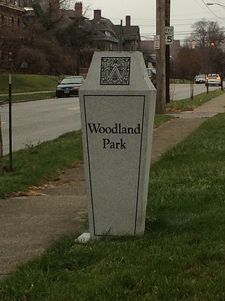
Woodland Park is a residential neighborhood located in the Near East Side of Columbus, Ohio that houses approximately 1,500 residents. The neighborhood was previously home to such figures as artist Emerson Burkhart, cartoonist Billy Ireland, and judge William Brooks. Established in the early 20th century, Woodland Park has grown from its planned neighborhood roots into a neighborhood that contains various faith communities, schools, sources of entertainment and recreation, and borders an extension of the Ohio State University medical center.
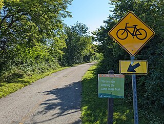
The Camp Chase Trail is a paved multi-use trail in Madison and Franklin counties in the U.S. state of Ohio. It serves as the Southwest Columbus segment of the 326-mile (525 km) Ohio to Erie Trail. The entire length of the Camp Chase Trail is part of the Great American Rail-Trail, U.S. Bicycle Route 21 and U.S. Bicycle Route 50.
Northwest Columbus is a region in Franklin County, Ohio. It has about 45,000 residents, according to the 2010 U.S. census.
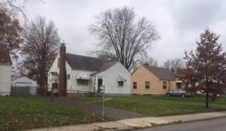
Briggsdale is a neighborhood of Franklin County in the city of Columbus, Ohio. The neighborhood is on the west/southwest side of the city within the Hilltop area. The area was first settled and founded by the family of Joseph M. Briggs, after whom the neighborhood was named. Joseph Briggs was an active figure in the early years of the township and county operations. The Briggsdale Methodist church was founded with his help, and it now exists as the New Horizons Methodist Church. The present-day Briggsdale neighborhood is located near the historical Green Lawn Cemetery to the north as well as Briggs High School to the west.

Franklin Park is a neighborhood located on the Near East Side of Columbus, Ohio. Both the historic neighborhood and landmark, the Franklin Park Conservatory and Botanical Gardens, are named after the 88-acre park.

The Discovery District is a special improvement district in downtown Columbus, Ohio, the home of Columbus State Community College, Columbus College of Art and Design, Columbus Museum of Art, and Columbus Metropolitan Library. It is considered a cultural district because of its close proximity to higher educational campuses and art destinations. It was named to imply that the area is full of possibility due to the number of learning and creative campuses in this small area. "Culture, art, and academia converge and present the Discovery District." While not typically viewed as the most prominent Columbus neighborhood, the density of academic and arts-based institutions in this area are what make this creative campus unique.

Shattucksburg, Ohio - is a former community in Perry Township, Franklin County, Ohio. It was first created when Simon Shattuck (1793-1875) from Massachusetts, sold some of his farm land off into some plots, in 1850. Simon Shattuck operated a general store on the southwest at the intersection of Henderson Road and Kenny Road.
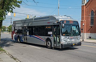
The 10 E Broad / W Broad is a Central Ohio Transit Authority (COTA) bus service in Columbus, Ohio. The line operates on Broad Street, the city's main east-west thoroughfare.