List of islands of Ponce, Puerto Rico

Last updated

Isla de Ratones, as seen from Barrio Canas, Ponce, PR Isla Ratones (vista desde el Hotel Ponce Holiday Inn), Ponce, PR (DSC05629).jpg
Isla de Ratones, as seen from Barrio Canas, Ponce, PR

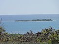
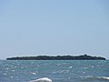
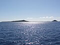
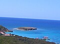
This list of islands in Ponce, Puerto Rico, is a summary of the seven islands that form part of the municipality of Ponce, Puerto Rico. It consists of islands, keys, and cays, and similarly named geographic features surrounded by large bodies of water, namely, the Caribbean Sea. [1] [2]

Contents

Island list summary table

No.NameAreaLocationTypeComment
1 Isla de Cardona 0.04 km2 (9.9 acres) Barrio Playa IslandAlso known as Isla Sor Isolina Ferré
2 Isla de Ratones 0.03 km2 (7.4 acres) Barrio Canas IslandNot to be confused with Isla de Ratones in Cabo Rojo
3 Isla del Frío 0.01 km2 (2.5 acres) Barrio Vayas IslandAdministered by the Puerto Rico Department of Natural and Environmental Resources
4 Caja de Muertos 1.54 km2 (380 acres) Barrio Playa IslandLargest of the islands
5 Isla Morrillito 0.04 km2 (9.9 acres) Barrio Playa IslandA protected nature reserve; Connected to Caja de Muertos by a bank of shallow waters about 5.49 meters deep
6 Isla de Gatas 0.05 km2 (12 acres) Barrio Playa IslandHas been artificially joined to the Ponce mainland and is now occupied by Club Nautico de Ponce
7 Isla de Jueyes 0.01 km2 (2.5 acres) Barrio Vayas IslandActually a group of three small islands

Related Research Articles

Anón River River of Puerto Rico

Anón River is a river in the municipality of Ponce, Puerto Rico. It is located in the northeastern area of the municipality. Río Anón is one of the 14 rivers in the municipality and, at 1,060 feet (320 m), it is also the third with the highest river mouth location, after Río Prieto and Río Blanco, both of which have their mouths at 1,381 feet (421 m). Río Anón is a tributary of Río Inabón. It has a length of approximately 4 kilometers (2.5 mi) and generally runs south. It has both its origin and its mouth in Barrio Anón.

Bayagán River River of Puerto Rico

Río Bayagán is a river in the municipality of Ponce, Puerto Rico. Bayagán is a tributary of Cerrillos River. It has a length of approximately six kilometers and runs in a southerly direction, mostly along PR-505. It originates in barrio Montes Llanos and runs south through barrio Machuelo Arriba for about nine kilometers until it meets Río Cerrillos. It is part of the Bucaná River watershed. This river is one of the 14 rivers in the municipality.

Río Blanco (Ponce, Puerto Rico) River of Puerto Rico

Río Blanco is a river in the municipality of Ponce, Puerto Rico. It is located in the northeastern area of the municipality. It empties into the Río Prieto. Together with the Río Prieto, the Río Blanco is one of the two rivers in Ponce with their mouth at the highest elevation. This river is one of the 14 rivers in the municipality.

Bucaná River River of Puerto Rico

Bucaná River is a river in the municipality of Ponce, Puerto Rico. Río Bucaná has its origin in barrio Machuelo Arriba where it forms at an altitude of 115 feet (35 m). It forms from the confluence of Río Cerrillos and Río Bayagán. It is also fed by Río Portugues during its southernly run. Río Bucaná used to run for some 29.5 kilometers (18.3 mi) prior to canalization and other diversion work by the U.S. Army Corps of Engineers. It now runs for 5.89 miles (9.48 km) to drain into the Caribbean Sea. This river is one of the 14 rivers in the municipality.

Chiquito River (Ponce, Puerto Rico) River of Puerto Rico

Chiquito River is a river in the municipality of Ponce, Puerto Rico. This river feeds into Río Portugués in the sector called Parras, about 0.5 km (0.3 mi) north of the intersection of PR-504 and PR-505. It has its origin in the mountains west of Montes Llanos. Río Chiquito is fed by Quebrada del Pastillo. This river is one of the 14 rivers in the municipality of Ponce.

San Patricio River River of Puerto Rico

San Patricio River is a river in the municipality of Ponce, Puerto Rico. It is part of the Bucaná River river system via Cerrillos River. San Patricio is one of the 14 rivers in the municipality.

Anón Barrio of Ponce, Puerto Rico

Anón is one of the 31 barrios in the municipality of Ponce, Puerto Rico. Along with Marueño, Coto Laurel, Guaraguao, Quebrada Limon, Real, and San Patricio, and the coastal barrios of Canas and Capitanejo, Anón is one of the municipality's nine bordering barrios. Anón borders the municipalities of Jayuya and Juana Diaz. The name of this barrio is of native Indian origin. It was founded in 1878. Barrio Anón is one of three Ponce barrios located on the Cordillera Central mountain range.

Tibes Barrio of Ponce, Puerto Rico

Tibes is one of the 31 barrios in the municipality of Ponce, Puerto Rico. Together with Magueyes, Portugués, Montes Llanos, Maragüez, Machuelo Arriba, Sabanetas, and Cerrillos, barrio Tibes is one of the municipality's eight rural interior barrios. Tibes attracted attention recently when, in 1975, what was to become the discovery of the oldest cemetery in the West Indies came about as a result of rainstorms. The name of this barrio is of native Indian origin. It was organized in 1831.

Canas, Ponce, Puerto Rico Barrio of Puerto Rico

Canas is one of the 31 barrios in the municipality of Ponce, Puerto Rico. Along with Anón, Coto Laurel, Guaraguao, Quebrada Limón, Real, San Patricio, and Marueño, and the coastal barrio of Capitanejo, Canas is one of the municipality's nine bordering barrios. It borders the municipality of Peñuelas. Along with Playa, Bucana, Vayas and Capitanejo, Canas is also one of Ponce's five coastal barrios. It was founded in 1831.

Magueyes, Ponce, Puerto Rico Barrio of Puerto Rico

Magueyes is one of the 31 barrios of the municipality of Ponce, Puerto Rico. Together with Cerrillos, Machuelo Arriba, Maragüez, Montes Llanos, Portugués, Sabanetas, and Tibes, Magueyes is one of the municipality's eight interior barrios. The name of this barrio is of native Indian origin. It was created in 1831.

Montes Llanos Barrio of Ponce, Puerto Rico

Montes Llanos, is one of the 31 barrios in the municipality of Ponce, Puerto Rico. Along with Magueyes, Tibes, Portugués, Maragüez, Machuelo Arriba, and Cerrillos, Montes Llanos is one of the municipality's seven rural interior barrios. It was created in 1898.

Marueño Barrio of Ponce, Puerto Rico

Marueño is one of the 31 barrios of the municipality of Ponce, Puerto Rico. Along with Anón, Coto Laurel, Guaraguao, Quebrada Limón, Real, and San Patricio, and the coastal barrios of Canas and Capitanejo, Marueño is one of the municipality's nine bordering barrios. Marueño borders the municipality of Peñuelas. The name of this barrio is of native Indian origin. It was created in 1831.

Quebrada Limón Barrio of Ponce, Puerto Rico

Quebrada Limón is one of the 31 barrios of the municipality of Ponce, Puerto Rico. Along with Anón, Coto Laurel, Guaraguao, Marueño, Real, and San Patricio, and the coastal barrios of Canas and Capitanejo, Quebrada Limón is one of the municipality's nine bordering barrios. It borders the municipality of Peñuelas. It was founded in 1878.

Cerrillos, Ponce, Puerto Rico Barrio of Puerto Rico

Cerrillos is one of the 31 barrios of the municipality of Ponce, Puerto Rico. Along with Magueyes, Tibes, Portugués, Montes Llanos, Maragüez, and Machuelo Arriba, Cerrillos is one of the municipality's seven interior rural barrios. It was founded in 1878.

Real, Ponce, Puerto Rico Barrio of Puerto Rico

Real is one of the 31 barrios of the municipality of Ponce, Puerto Rico. Along with Anón, Coto Laurel, Guaraguao, Quebrada Limón, Marueño, and San Patricio, and the coastal barrios of Canas and Capitanejo, Real is one of the municipality's nine bordering barrios. It borders the municipality of Juana Diaz. It was founded in 1878.

Machuelo Abajo Barrio of Ponce, Puerto Rico

Machuelo Abajo is one of the 31 barrios of the municipality of Ponce, Puerto Rico. Along with Canas Urbano, Magueyes Urbano, Portugués Urbano, and San Antón, Machuelo Abajo is one of the municipality's five originally rural barrios that are now also part of the urban zone of the city of Ponce. It was founded in 1818.

Machuelo Arriba Barrio of Ponce, Puerto Rico

Machuelo Arriba is one of the 31 barrios of the municipality of Ponce, Puerto Rico. Along with the barrios of Magueyes, Tibes, Portugués, Montes Llanos, Maragüez, and Cerrillos, Machuelo Arriba is one of the municipality's seven rural interior barrios. It was established in 1831.

Cerrillos River River of Puerto Rico

Cerrillos River is a river in the municipality of Ponce, Puerto Rico. Río Cerrillos has its origin in barrio Anón and runs south until it feeds into Bucaná River. Río Cerrillos is commonly known by the locals as Maragüez River, because most of its course runs through Barrio Maragüez. This river is one of the 14 rivers in the municipality. The river has a discharge of 24,000 cubic feet per second, making it the second most affluent river in the municipality after Río Jacaguas.

Isla de Jueyes Uninhabited islands of Puerto Rico

Isla de Jueyes are a group of three small uninhabited islands off the southern coast of Puerto Rico. Together with Caja de Muertos, Gatas, Morrillito, Ratones, Cardona, and Isla del Frío, Isla de Jueyes is one of seven islands ascribed to the municipality of Ponce. At an area of just 2.89 cuerdas, they are also the smallest of these seven islands. Like Isla del Frío, the islands are considered part of barrio Vayas.

References

  1. Maptest. Archived 2010-02-18 at the Wayback Machine Government of the Commonwealth of Puerto Rico. General Purpose Population Data, Census 2000. Unidad de Sistemas de Información Geográfica, Área de Tecnología de Información Gubernamental, Oficina de Gerencia y Presupuesto. Gobierno de Puerto Rico. Accessed 7 June 2016.
  2. Webcensus. Archived 2010-08-12 at the Wayback Machine Government of the Commonwealth of Puerto Rico. General Purpose Population Data, Census 2000. Unidad de Sistemas de Información Geográfica, Área de Tecnología de Información Gubernamental, Oficina de Gerencia y Presupuesto. Gobierno de Puerto Rico. Accessed 7 June 2016.