Cabo Rojo is a city and municipality situated on the southwest coast of Puerto Rico and forms part of the San Germán–Cabo Rojo metropolitan area as well as the larger Mayagüez–San Germán–Cabo Rojo Combined Statistical Area.
Caborrojeños Pro Salud y Ambiente, Inc. is a non-profit environmentalist organization based in Cabo Rojo, Puerto Rico.
Dr. Pedro Valle Carlo, is a retired college professor and noted environmentalist leader based in western Puerto Rico.
Efrén Pérez Rivera was a Puerto Rican environmentalist leader and college professor. He got married at the age of 28 with Pezinka Berenguer, till the day he died. He had three children with her, Efrén Pérez Berenguer, Manuel Pérez Berenguer, and José Luis Pérez Berenguer

Bahía de Jobos or Reserva Natural de Investigación Estuarina de Bahía de Jobos is a federally protected estuary in Aguirre, Salinas, Puerto Rico. The bay is an intertidal tropical ecosystem dominated by seagrass beds, coral reefs, and mangroves. In an area of 1,140 hectares, the reserve contains five distinct habitat types and provides sanctuary to several endangered species. Bahía de Jobos is one of 28 reserves that comprise the National Oceanic and Atmospheric Administration’s (NOAA) National Estuarine Research Reserve System. The reserve is operated in conjunction with the Puerto Rico Department of Natural and Environmental Resources (DRNA).

Cabo Rojo National Wildlife Refuge is an 1,836-acre National Wildlife Refuge located in southwestern Puerto Rico, in the municipality of Cabo Rojo. The refuge is a habitat for number of native bird species including the endangered yellow-shouldered blackbird, locally known as mariquita de Puerto Rico or capitán. Many birds find their way to the refuge while migrating between North and South America, and more than 118 bird species have been recorded near the area.

Porta del Sol, or simply West Region, is a tourism region in western Puerto Rico. Porta del Sol was the first tourism region to be established by the Puerto Rico Tourism Company. It consists of 17 municipalities in the western area: Quebradillas, Isabela, San Sebastián, Moca, Aguadilla, Aguada, Rincón, Añasco, Mayagüez, Las Marías, Maricao, Hormigueros, San Germán, Sabana Grande, Guánica, Lajas and Cabo Rojo.

Isla de Ratones is a small uninhabited island off the southern coast of Puerto Rico, off the coast of Ponce. The island is part of barrio Canas in the municipality of Ponce. The island gained attention in 2010 when the Puerto Rican Bird Society made it a target for the eradication of the black rat. While named as one single island, it is actually composed of two islands separated by a few feet of shallow water during high tide, which become a single island at low tide.

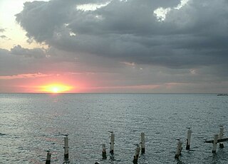
Joyuda is a quiet coastal fishing village in western Puerto Rico, located between the cities of Mayagüez and Cabo Rojo, known for its seafood and snorkeling and seafood restaurants.
Miradero is a barrio in the municipality of Cabo Rojo, Puerto Rico. Its population in 2010 was 15,521. Joyuda, a small fishing village on Cabo Rojos' gastronomic route, is in Miradero.

Boquerón State Forest is one of the 20 forestry units that make up the public forest system of Puerto Rico. Despite its name, the Boquerón State Forest is not only located in Boquerón, Cabo Rojo but also spans almost 5,000 acres across the municipalities of Cabo Rojo, Lajas and Mayagüez. The forest area is also known for its limestone cliffs, the lighthouse, and the salt flats which have been a source of salt since the pre-Hispanic era and, dating to 700 C.E., they are considered to be one of the oldest industries in the Americas.

Los Morrillos de los Cabos Rojos or more commonly known as Los Morrillos de Cabo Rojo, is a cape and tombolo landform located in southwestern Puerto Rico in the municipality of Cabo Rojo. Los Morrillos is an excellent example of a tombolo, or a tied island, with two sand pits. The cape resembles a letter Y with its two promontories or morrillos being connected through sand pits which enclose a saltwater lagoon. The landform was designated a National Natural Landmark in 1980, and the site includes mangroves, beaches, important bird nesting areas, limestone caves, cliffs and rock formations. The reddish-colored limestone cliffs give the name to the town and municipality of Cabo Rojo.

Caja de Muertos Nature Reserve is a nature reserve in southern Puerto Rico consisting of the islands of Caja de Muertos, Cayo Morrillito, Cayo Berbería, and their surrounding reefs and waters in the Caribbean Sea. This nature reserve was founded on January 2, 1980, by the Puerto Rico Planning Board as recommended by the Puerto Rico Department of Natural and Environmental Resources with the purpose of preserving the subtropical dry forest ecosystems found within these islands, some important sea turtle nesting sites, and the marine habitats found on their surrounding reefs and waters.

Mona and Monito Islands Nature Reserve consists of two islands, Mona and Monito, in the Mona Passage off western Puerto Rico in the Caribbean. Mona and Monito Islands Nature Reserve encompasses both land and marine area, and with an area of 38,893 acres it is the largest protected natural area in the Commonwealth of Puerto Rico. Much like the Galapagos Islands in the Pacific Ocean, the Mona and Monito Islands reserve represents a living laboratory for archaeological, biological, geological, oceanographical and wildlife management research.

Hacienda Belvedere, also known as Finca Belvedere, is a former 1,649-acre plantation located in Miradero, in the municipality of Cabo Rojo, Puerto Rico. It was the second largest plantation in the region. There are debating theories as to the foundation and development of Hacienda Belvedere: one proposed by writer Ferreras Pagán states that the plantation was founded by the Cabassa brothers in the late 19th century, while local sources claim that it was founded in the early 19th century by the Monagas family. There is however no conflicting history regarding the hacienda's development during the early 20th century, when the plantation was owned and operated by the Vidal family until 1922, when it was leased to Manuel de Santiago of Hacienda Borinquen.
Nature Reserve of Puerto Rico is a title and special designation given by the upper house of the Legislative Assembly of Puerto Rico to specific natural areas or features throughout the territory. All nature reserves in Puerto Rico are protected by Puerto Rico Law #150, first approved on August 8, 1988, better known as the Puerto Rico Natural Heritage Program Act that seeks to protect the natural resources of the island for the purpose of natural preservation and tourism. These are managed by different agencies within the Puerto Rico Department of Natural and Environmental Resources, public-private partnerships such as the Conservation Trust of Puerto Rico and its management unit Para la naturaleza, and other grassroots and community institutions and programs.

The La Cordillera Reef Nature Reserve, also known as the Reserva Natural Cayos de la Cordillera, is a nature reserve located 1.5 nautical miles off the coast of the barrio of Cabezas in the municipality of Fajardo in northeastern Puerto Rico. It consists of a small chain of cays, reefs, and islets, collectively known as La Cordillera or Cayos de la Cordillera. From west to east, the archipelago comprises Las Cucarachas islets, Los Farallones islets, Icacos cay, Ratones cay, Lobos cay, Palominos island, Palominitos island, La Blanquilla cay and islets, Diablo cay, Hermanos reefs, and Barriles reefs. The nature reserve covers about 18 nautical miles and almost 30,000 acres between cape Las Cabezas de San Juan in Cabezas, Fajardo and the Spanish virgin island of Culebra.

Punta Guaniquilla is a headland or small peninsula located immediately to the south of Buyé Beach and north of Boquerón Bay in the municipality of Cabo Rojo, Puerto Rico. The entirety of the headland is protected as the Punta Guaniquilla Nature Reserva by the Conservation Trust of Puerto Rico and the Puerto Rico Department of Natural and Environmental Resources since 1977, making it one of the oldest nature reserves officially protected by Puerto Rico Law #150.

La Parguera Nature Reserve is a protected area located in the southwestern Puerto Rico, primarily in the municipality of Lajas but also covering cays and islets under the municipal jurisdictions of Guánica and Cabo Rojo. The nature reserve is itself a unit of the Boquerón State Forest and it protects the Bahía Montalva mangrove forest in addition to mangrove bays, salt marshes and lagoons located along the coast of the Parguera barrio of Lajas, including its numerous cays and coral reefs. The reserve is mostly famous for its bioluminescent bay, locally called Bahía Fosforecente,, one of the three of its kind in Puerto Rico and one of the seven year-round places where bioluminescent can be seen in the Caribbean.