List of lakes in Custer County, Montana

Last updated
Map all coordinates using: OpenStreetMap  ·  Google Maps
Download coordinates as: KML  ·  GPX

There are at least 23 named lakes and reservoirs in Custer County, Montana .

Lake A body of relatively still water, in a basin surrounded by land

A lake is an area filled with water, localized in a basin, that is surrounded by land, apart from any river or other outlet that serves to feed or drain the lake. Lakes lie on land and are not part of the ocean, and therefore are distinct from lagoons, and are also larger and deeper than ponds, though there are no official or scientific definitions. Lakes can be contrasted with rivers or streams, which are usually flowing. Most lakes are fed and drained by rivers and streams.

Reservoir A storage space for fluids

A reservoir is, most commonly, an enlarged natural or artificial lake, pond or impoundment created using a dam or lock to store water.

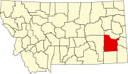
Custer County, Montana County in the United States

Custer County is a county located in the U.S. state of Montana. As of the 2010 United States Census, the population was 11,699. Its county seat is Miles City. The county was formed in 1877 and named for George Armstrong Custer.
Contents

Lakes

Reservoirs

See also

Notes

  1. "Cook Lake". Geographic Names Information System . United States Geological Survey.
  2. "Scanlan Lake". Geographic Names Information System . United States Geological Survey.
  3. "Branum Lake". Geographic Names Information System . United States Geological Survey.
  4. "Corny Coulee Reservoir". Geographic Names Information System . United States Geological Survey.
  5. "Corral Creek Reservoir". Geographic Names Information System . United States Geological Survey.
  6. "Dead Cow Reservoir". Geographic Names Information System . United States Geological Survey.
  7. "Hall Reservoir". Geographic Names Information System . United States Geological Survey.
  8. "Hamlick Reservoir". Geographic Names Information System . United States Geological Survey.
  9. "Hay Creek Reservoir". Geographic Names Information System . United States Geological Survey.
  10. "Jones Reservoir". Geographic Names Information System . United States Geological Survey.
  11. "Love Reservoir". Geographic Names Information System . United States Geological Survey.
  12. "McFarland Reservoir". Geographic Names Information System . United States Geological Survey.
  13. "Morgan Creek Reservoir". Geographic Names Information System . United States Geological Survey.
  14. "Noble Reservoir". Geographic Names Information System . United States Geological Survey.
  15. "Noble Reservoir". Geographic Names Information System . United States Geological Survey.
  16. "Physic Creek Reservoir". Geographic Names Information System . United States Geological Survey.
  17. "Pine Hill Reservoir". Geographic Names Information System . United States Geological Survey.
  18. "Pine Hills Reservoir". Geographic Names Information System . United States Geological Survey.
  19. "Shoemaker". Geographic Names Information System . United States Geological Survey.
  20. "Spotted Eagle Lake". Geographic Names Information System . United States Geological Survey.
  21. "Tepee Butte Reservoir". Geographic Names Information System . United States Geological Survey.
  22. "Willie Reservoir". Geographic Names Information System . United States Geological Survey.
  23. "Witcher Reservoir". Geographic Names Information System . United States Geological Survey.