Name Location Date Listed Grid Ref. [note 1] Geo-coordinates Notes LB Number [note 2] Image 2, 4, 6 Cadzow Street And 3, 5 Castle Street 55°46′35″N 4°02′01″W / 55.776254°N 4.033639°W / 55.776254; -4.033639 (2, 4, 6 Cadzow Street And 3, 5 Castle Street ) Category B 34551 Upload Photo 40, 42 Castle Street 55°46′37″N 4°02′00″W / 55.776961°N 4.033262°W / 55.776961; -4.033262 (40, 42 Castle Street ) Category B 34554 Upload Photo 371 Glasgow Road, Limetree, Including Boundary Wall 55°47′07″N 4°04′38″W / 55.785232°N 4.077121°W / 55.785232; -4.077121 (371 Glasgow Road, Limetree, Including Boundary Wall ) Category C(S) 34557 Upload Photo 4 And 6 Keith Street 55°46′33″N 4°01′59″W / 55.775939°N 4.033113°W / 55.775939; -4.033113 (4 And 6 Keith Street ) Category C(S) 34560 Upload Photo 85-89 (Odd Nos) Quarry Street 55°46′29″N 4°02′08″W / 55.774649°N 4.035549°W / 55.774649; -4.035549 (85-89 (Odd Nos) Quarry Street ) Category C(S) 34572 Upload Photo 117-121 (Odd Nos) Quarry Street And 2-8 (Even Nos) Duke Street, Royal Hotel 55°46′26″N 4°02′12″W / 55.773985°N 4.036598°W / 55.773985; -4.036598 (117-121 (Odd Nos) Quarry Street And 2-8 (Even Nos) Duke Street, Royal Hotel ) Category B 34574 Upload Photo 123-127 (Odd Nos) Quarry Street 55°46′26″N 4°02′13″W / 55.773766°N 4.03681°W / 55.773766; -4.03681 (123-127 (Odd Nos) Quarry Street ) Category C(S) 34575 Upload Photo 185 Quarry Street 55°46′19″N 4°02′18″W / 55.772076°N 4.038412°W / 55.772076; -4.038412 (185 Quarry Street ) Category C(S) 34583 Upload Photo 74-78 (Even Nos) Quarry Street 55°46′31″N 4°02′07″W / 55.775174°N 4.035353°W / 55.775174; -4.035353 (74-78 (Even Nos) Quarry Street ) Category C(S) 34589 Upload Photo 102-106 (Even Nos) Quarry Street 55°46′29″N 4°02′10″W / 55.774757°N 4.036112°W / 55.774757; -4.036112 (102-106 (Even Nos) Quarry Street ) Category C(S) 34592 Upload Photo 29-41 (Odd Nos) Townhead Street, Hamilton Town Hotel 55°46′32″N 4°01′58″W / 55.775577°N 4.032727°W / 55.775577; -4.032727 (29-41 (Odd Nos) Townhead Street, Hamilton Town Hotel ) Category C(S) 34603 Upload Photo Churchyard Ann Street [ de ] 55°46′35″N 4°02′12″W / 55.776417°N 4.036789°W / 55.776417; -4.036789 (Churchyard Ann Street [ de] ) Category A 34474 Upload another image
4-24 (Even Nos) Gateside Street And 175-177 (Odd Nos) Quarry Street 55°46′20″N 4°02′17″W / 55.772255°N 4.037959°W / 55.772255; -4.037959 (4-24 (Even Nos) Gateside Street And 175-177 (Odd Nos) Quarry Street ) Category B 34517 Upload Photo Union Street, Auchingramont Church 55°46′32″N 4°02′45″W / 55.775431°N 4.045842°W / 55.775431; -4.045842 (Union Street, Auchingramont Church ) Category B 34529 Upload another image
4 Auchingramont Road, Strathclyde Regional Council Education Resource Centre, Including Gatepiers 55°46′39″N 4°02′24″W / 55.777387°N 4.040077°W / 55.777387; -4.040077 (4 Auchingramont Road, Strathclyde Regional Council Education Resource Centre, Including Gatepiers ) Category B 34537 Upload Photo Chatelherault Hunting Lodge [ de ] 55°45′44″N 4°00′55″W / 55.762168°N 4.015293°W / 55.762168; -4.015293 (Chatelherault Hunting Lodge [ de] ) Category A 12485 Upload another image See more images
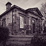
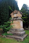
Toll House (No. 50 Carlisle Road) 55°46′09″N 4°01′03″W / 55.769213°N 4.017506°W / 55.769213; -4.017506 (Toll House (No. 50 Carlisle Road) ) Category B 12517 Upload Photo Hamilton Monument (1863) [ de ] 55°45′58″N 4°01′39″W / 55.766058°N 4.027385°W / 55.766058; -4.027385 (Hamilton Monument (1863) [ de] ) Category A 12520 Upload another image
21-31 (Odd Nos) Quarry Street, Victoria Buildings 55°46′32″N 4°02′02″W / 55.77553°N 4.033952°W / 55.77553; -4.033952 (21-31 (Odd Nos) Quarry Street, Victoria Buildings ) Category B 44550 Upload Photo 14-18 (Inclusive Nos) Kemp Street 55°46′22″N 4°02′23″W / 55.772685°N 4.03964°W / 55.772685; -4.03964 (14-18 (Inclusive Nos) Kemp Street ) Category C(S) 34565 Upload Photo 41-49 (Odd Nos) Quarry Street 55°46′31″N 4°02′05″W / 55.775151°N 4.034586°W / 55.775151; -4.034586 (41-49 (Odd Nos) Quarry Street ) Category C(S) 34569 Upload Photo 67-75 (Odd Nos) Quarry Street 55°46′29″N 4°02′07″W / 55.774853°N 4.035177°W / 55.774853; -4.035177 (67-75 (Odd Nos) Quarry Street ) Category C(S) 34571 Upload Photo 167 And 169 Quarry Street And 3 Avon Street 55°46′21″N 4°02′14″W / 55.772544°N 4.037304°W / 55.772544; -4.037304 (167 And 169 Quarry Street And 3 Avon Street ) Category C(S) 34580 Upload Photo 183 Quarry Street 55°46′20″N 4°02′17″W / 55.772179°N 4.038194°W / 55.772179; -4.038194 (183 Quarry Street ) Category C(S) 34582 Upload Photo 38-46 (Even Nos) Quarry Street 55°46′32″N 4°02′05″W / 55.775536°N 4.03467°W / 55.775536; -4.03467 (38-46 (Even Nos) Quarry Street ) Category B 34585 Upload Photo 58-64 (Even Nos) Quarry Street 55°46′31″N 4°02′06″W / 55.775321°N 4.035121°W / 55.775321; -4.035121 (58-64 (Even Nos) Quarry Street ) Category C(S) 34587 Upload Photo 172-176 (Even Nos) Quarry Street 55°46′21″N 4°02′16″W / 55.772633°N 4.037899°W / 55.772633; -4.037899 (172-176 (Even Nos) Quarry Street ) Category B 34596 Upload Photo 29 Wellhall Road, Flakedale, Including Boundary Wall 55°46′32″N 4°03′34″W / 55.775681°N 4.059392°W / 55.775681; -4.059392 (29 Wellhall Road, Flakedale, Including Boundary Wall ) Category C(S) 34608 Upload Photo Auchencampbell Road, Hamilton Grammar School 55°46′27″N 4°02′47″W / 55.774119°N 4.046395°W / 55.774119; -4.046395 (Auchencampbell Road, Hamilton Grammar School ) Category B 34475 Upload Photo Auchingramont Road, St. Mary's Episcopal Church 55°46′38″N 4°02′27″W / 55.777184°N 4.040927°W / 55.777184; -4.040927 (Auchingramont Road, St. Mary's Episcopal Church ) Category B 34482 Upload Photo Bothwell Road, 65 Lodge And Gatepiers At Hamilton Public Park 55°47′09″N 4°03′01″W / 55.785736°N 4.050354°W / 55.785736; -4.050354 (Bothwell Road, 65 Lodge And Gatepiers At Hamilton Public Park ) Category C(S) 34485 Upload another image
Bothwell Road, Railings At Hamilton College Of Education 55°46′58″N 4°02′48″W / 55.782651°N 4.046715°W / 55.782651; -4.046715 (Bothwell Road, Railings At Hamilton College Of Education ) Category B 34488 Upload Photo Cadzow Street, 78, 80, 82, 84 And Corner Of Church Street 55°46′37″N 4°02′12″W / 55.776995°N 4.03666°W / 55.776995; -4.03666 (Cadzow Street, 78, 80, 82, 84 And Corner Of Church Street ) Category B 34501 Upload Photo Cadzow Street, 114 55°46′41″N 4°02′24″W / 55.777972°N 4.040059°W / 55.777972; -4.040059 (Cadzow Street, 114 ) Category B 34508 Upload Photo Cadzow Street, St Mary's Roman Catholic Church 55°46′42″N 4°02′27″W / 55.778344°N 4.040924°W / 55.778344; -4.040924 (Cadzow Street, St Mary's Roman Catholic Church ) Category B 34511 Upload Photo 4, 6, 8, 10, 14, 16 Muir Street 55°46′45″N 4°02′38″W / 55.779137°N 4.044011°W / 55.779137; -4.044011 (4, 6, 8, 10, 14, 16 Muir Street ) Category B 34524 Upload Photo 26, 28, 30, 32 Muir Street 55°46′44″N 4°02′36″W / 55.778899°N 4.043233°W / 55.778899; -4.043233 (26, 28, 30, 32 Muir Street ) Category B 34525 Upload Photo Windmill Road, 12 55°46′41″N 4°02′39″W / 55.778075°N 4.044099°W / 55.778075; -4.044099 (Windmill Road, 12 ) Category C(S) 34535 Upload Photo 66 Brandon Street, Hamilton District Council Offices And Boundary Walls 55°46′27″N 4°02′23″W / 55.774169°N 4.039589°W / 55.774169; -4.039589 (66 Brandon Street, Hamilton District Council Offices And Boundary Walls ) Category B 34536 Upload Photo 14-18 (Even Nos) Brandon Street, Brandon Chambers 55°46′27″N 4°02′14″W / 55.774279°N 4.037315°W / 55.774279; -4.037315 (14-18 (Even Nos) Brandon Street, Brandon Chambers ) Category B 34541 Upload Photo Old Avon Bridge [ de ] 55°46′06″N 4°01′15″W / 55.768432°N 4.020749°W / 55.768432; -4.020749 (Old Avon Bridge [ de] ) Category A 12518 Upload another image
Barncluith House 55°46′02″N 4°01′34″W / 55.767158°N 4.026056°W / 55.767158; -4.026056 (Barncluith House ) Category B 12481 Upload Photo Keith Street, Salvation Army Citadel, Including Boundary Wall And Railings 55°46′34″N 4°01′56″W / 55.776098°N 4.032196°W / 55.776098; -4.032196 (Keith Street, Salvation Army Citadel, Including Boundary Wall And Railings ) Category C(S) 34558 Upload Photo Kemp Street, Former Caledonian Railway Booking Office 55°46′23″N 4°02′19″W / 55.77308°N 4.038592°W / 55.77308; -4.038592 (Kemp Street, Former Caledonian Railway Booking Office ) Category C(S) 34563 Upload Photo Mill Road, Hamilton South Church, Including Boundary Railings 55°45′37″N 4°02′48″W / 55.760185°N 4.046637°W / 55.760185; -4.046637 (Mill Road, Hamilton South Church, Including Boundary Railings ) Category C(S) 34566 Upload Photo 48-56 (Even Nos) Quarry Street 55°46′32″N 4°02′05″W / 55.775452°N 4.034809°W / 55.775452; -4.034809 (48-56 (Even Nos) Quarry Street ) Category B 34586 Upload Photo 57 Union Street, Including Coach House/Stable, Boundary And Terrace Walls 55°46′34″N 4°03′02″W / 55.776215°N 4.050555°W / 55.776215; -4.050555 (57 Union Street, Including Coach House/Stable, Boundary And Terrace Walls ) Category B 34606 Upload Photo Almada Street 63 Currie House 55°46′44″N 4°02′51″W / 55.778889°N 4.04757°W / 55.778889; -4.04757 (Almada Street 63 Currie House ) Category B 34471 Upload Photo Parish Church Ann Street [ de ] 55°46′34″N 4°02′13″W / 55.776225°N 4.037018°W / 55.776225; -4.037018 (Parish Church Ann Street [ de] ) Category A 34473 Upload another image
Auchingramont Road, 31 55°46′32″N 4°02′47″W / 55.775546°N 4.04647°W / 55.775546; -4.04647 (Auchingramont Road, 31 ) Category C(S) 34481 Upload Photo Burnbank Road, 57 55°46′43″N 4°03′31″W / 55.77864°N 4.058719°W / 55.77864; -4.058719 (Burnbank Road, 57 ) Category C(S) 34492 Upload Photo Cadzow Street, 111,113 And 1 Auchingramont Road, Bank Of Scotland 55°46′39″N 4°02′21″W / 55.777382°N 4.039295°W / 55.777382; -4.039295 (Cadzow Street, 111,113 And 1 Auchingramont Road, Bank Of Scotland ) Category B 34498 Upload Photo Cadzow Street 26-42 (Even Nos) And Corner Of Campbell Street 55°46′36″N 4°02′05″W / 55.776611°N 4.034854°W / 55.776611; -4.034854 (Cadzow Street 26-42 (Even Nos) And Corner Of Campbell Street ) Category B 34500 Upload Photo Cadzow Bridge [ de ] 55°46′37″N 4°02′15″W / 55.77708°N 4.037493°W / 55.77708; -4.037493 (Cadzow Bridge [ de] ) Category A 34504 Upload another image
Cadzow Street, 98-102 Municipal Buildings 55°46′40″N 4°02′19″W / 55.777681°N 4.038641°W / 55.777681; -4.038641 (Cadzow Street, 98-102 Municipal Buildings ) Category B 34505 Upload another image
Carlisle Road, 9 Angus Hotel 55°46′21″N 4°01′38″W / 55.772596°N 4.027119°W / 55.772596; -4.027119 (Carlisle Road, 9 Angus Hotel ) Category C(S) 34513 Upload Photo Church Street, 5 55°46′37″N 4°02′11″W / 55.77698°N 4.036468°W / 55.77698; -4.036468 (Church Street, 5 ) Category B 34515 Upload Photo 56 Muir Street 55°46′43″N 4°02′23″W / 55.7785°N 4.039656°W / 55.7785; -4.039656 (56 Muir Street ) Category B 34526 Upload Photo Union Street, Waugh's Premises, Corner Of Auchinampbell Road 55°46′27″N 4°02′40″W / 55.774142°N 4.044435°W / 55.774142; -4.044435 (Union Street, Waugh's Premises, Corner Of Auchinampbell Road ) Category B 34531 Upload Photo 76 Burnbank Centre, Burnbank Library, Including Rear Enclosing Wall 55°46′54″N 4°04′04″W / 55.78165°N 4.067872°W / 55.78165; -4.067872 (76 Burnbank Centre, Burnbank Library, Including Rear Enclosing Wall ) Category B 34545 Upload Photo Cadzow Castle 55°45′38″N 4°01′04″W / 55.760555°N 4.017744°W / 55.760555; -4.017744 (Cadzow Castle ) Category B 12483 Upload Photo 51 Neilsland Road, Burnhouse, With Boundary Wall 55°45′54″N 4°03′29″W / 55.765088°N 4.058164°W / 55.765088; -4.058164 (51 Neilsland Road, Burnhouse, With Boundary Wall ) Category C(S) 50117 Upload Photo 56 Woodfoot Road, Earnock Cottage 55°46′06″N 4°04′06″W / 55.768411°N 4.068463°W / 55.768411; -4.068463 (56 Woodfoot Road, Earnock Cottage ) Category B 50118 Upload Photo Ferniegair, Carlisle Road, Ferniegair Mission Church (Church Of Scotland) 55°45′57″N 4°00′28″W / 55.765884°N 4.007865°W / 55.765884; -4.007865 (Ferniegair, Carlisle Road, Ferniegair Mission Church (Church Of Scotland) ) Category C(S) 50166 Upload Photo 33 Quarry Street And 2 Regent Way 55°46′31″N 4°02′04″W / 55.775343°N 4.034357°W / 55.775343; -4.034357 (33 Quarry Street And 2 Regent Way ) Category C(S) 44551 Upload Photo 1, 3, 5 Gateside Street And 2, 4 Avon Street 55°46′20″N 4°02′14″W / 55.772184°N 4.037349°W / 55.772184; -4.037349 (1, 3, 5 Gateside Street And 2, 4 Avon Street ) Category C(S) 34555 Upload Photo Kemp Street And Graham Street, Hamilton Baptist Church, Including Adjoining Church Hall And Offices, Boundary Wall, Gatepiers And Railings 55°46′20″N 4°02′25″W / 55.772299°N 4.040193°W / 55.772299; -4.040193 (Kemp Street And Graham Street, Hamilton Baptist Church, Including Adjoining Church Hall And Offices, Boundary Wall, Gatepiers And Railings ) Category C(S) 34562 Upload Photo 3-10 (Inclusive Nos) Kemp Street 55°46′22″N 4°02′17″W / 55.772811°N 4.038004°W / 55.772811; -4.038004 (3-10 (Inclusive Nos) Kemp Street ) Category B 34564 Upload Photo Quarry Street, Former Entrance To Railway Station, Including Adjoining Wall 55°46′23″N 4°02′15″W / 55.773096°N 4.03762°W / 55.773096; -4.03762 (Quarry Street, Former Entrance To Railway Station, Including Adjoining Wall ) Category C(S) 34567 Upload Photo 35-39 (Odd Nos) Quarry Street 55°46′31″N 4°02′04″W / 55.775215°N 4.034478°W / 55.775215; -4.034478 (35-39 (Odd Nos) Quarry Street ) Category C(S) 34568 Upload Photo 57-65 (Odd Nos) Quarry Street 55°46′30″N 4°02′06″W / 55.774947°N 4.034958°W / 55.774947; -4.034958 (57-65 (Odd Nos) Quarry Street ) Category C(S) 34570 Upload Photo 129-135 (Odd Nos) Quarry Street 55°46′25″N 4°02′13″W / 55.773602°N 4.036897°W / 55.773602; -4.036897 (129-135 (Odd Nos) Quarry Street ) Category C(S) 34576 Upload Photo 30-36 (Even Nos) Quarry Street 55°46′32″N 4°02′04″W / 55.775619°N 4.034499°W / 55.775619; -4.034499 (30-36 (Even Nos) Quarry Street ) Category B 34584 Upload Photo 186 And 188 Quarry Street 55°46′21″N 4°02′18″W / 55.772466°N 4.038241°W / 55.772466; -4.038241 (186 And 188 Quarry Street ) Category C(S) 34598 Upload Photo Auchingramont Road, 19, The Orchard 55°46′34″N 4°02′39″W / 55.776044°N 4.044088°W / 55.776044; -4.044088 (Auchingramont Road, 19, The Orchard ) Category B 34478 Upload Photo Auchingramont Road, 4A Hall To St Mary's Church 55°46′39″N 4°02′28″W / 55.777399°N 4.040986°W / 55.777399; -4.040986 (Auchingramont Road, 4A Hall To St Mary's Church ) Category C(S) 34483 Upload Photo Bothwell Road, Bandstand At Hamilton Public Park 55°47′07″N 4°03′09″W / 55.78524°N 4.052624°W / 55.78524; -4.052624 (Bothwell Road, Bandstand At Hamilton Public Park ) Category C(S) 34486 Upload Photo Cadzow Street, 105 Royal Bank Of Scotland 55°46′38″N 4°02′19″W / 55.777151°N 4.038597°W / 55.777151; -4.038597 (Cadzow Street, 105 Royal Bank Of Scotland ) Category B 34497 Upload Photo Cadzow Street, 86, 88 55°46′37″N 4°02′12″W / 55.777028°N 4.036805°W / 55.777028; -4.036805 (Cadzow Street, 86, 88 ) Category B 34502 Upload Photo Cadzow Street, 108, 110, 112 55°46′41″N 4°02′24″W / 55.777939°N 4.039882°W / 55.777939; -4.039882 (Cadzow Street, 108, 110, 112 ) Category B 34507 Upload Photo St John's Church. Duke Street 55°46′25″N 4°02′10″W / 55.773723°N 4.036122°W / 55.773723; -4.036122 (St John's Church. Duke Street ) Category B 34516 Upload Photo Keith Street, Vogue Social Club 55°46′35″N 4°01′58″W / 55.776486°N 4.032647°W / 55.776486; -4.032647 (Keith Street, Vogue Social Club ) Category B 34520 Upload Photo Riding School Off Muir Street 55°46′47″N 4°02′07″W / 55.779751°N 4.035177°W / 55.779751; -4.035177 (Riding School Off Muir Street ) Category A 34522 Upload Photo 72 Muir Street 55°46′43″N 4°02′16″W / 55.778566°N 4.037826°W / 55.778566; -4.037826 (72 Muir Street ) Category B 34527 Upload Photo 24 Brandon Street, Post Office 55°46′27″N 4°02′16″W / 55.774253°N 4.037792°W / 55.774253; -4.037792 (24 Brandon Street, Post Office ) Category B 34543 Upload Photo Burnbank Centre, Gilmour Memorial Church, Including Gatepiers 55°46′55″N 4°04′07″W / 55.782078°N 4.068581°W / 55.782078; -4.068581 (Burnbank Centre, Gilmour Memorial Church, Including Gatepiers ) Category C(S) 34544 Upload Photo 17 Burnbank Road, Ulva Cottage 55°46′41″N 4°03′19″W / 55.777972°N 4.05516°W / 55.777972; -4.05516 (17 Burnbank Road, Ulva Cottage ) Category C(S) 34548 Upload Photo Quarter Church 55°44′13″N 4°02′13″W / 55.736882°N 4.036863°W / 55.736882; -4.036863 (Quarter Church ) Category B 13821 Upload Photo Ross House 55°46′44″N 4°00′41″W / 55.77876°N 4.011302°W / 55.77876; -4.011302 (Ross House ) Category B 12486 Upload Photo Fairholm 55°44′27″N 3°59′10″W / 55.74074°N 3.986214°W / 55.74074; -3.986214 (Fairholm ) Category B 12487 Upload Photo Barncluith 55°46′02″N 4°01′32″W / 55.767102°N 4.025638°W / 55.767102; -4.025638 (Barncluith ) Category B 12521 Upload Photo Bothwell Road, Gatepiers To Sewage Works 55°47′42″N 4°03′23″W / 55.794865°N 4.056385°W / 55.794865; -4.056385 (Bothwell Road, Gatepiers To Sewage Works ) Category B 50181 Upload another image
120 Cadzow Street, St Mary's Presbytery And Hall 55°46′43″N 4°02′27″W / 55.778532°N 4.04095°W / 55.778532; -4.04095 (120 Cadzow Street, St Mary's Presbytery And Hall ) Category C(S) 34553 Upload Photo 1-9 (Odd Nos) Keith Street, Douglas Chambers 55°46′35″N 4°01′59″W / 55.776263°N 4.033066°W / 55.776263; -4.033066 (1-9 (Odd Nos) Keith Street, Douglas Chambers ) Category B 34559 Upload Photo 179 And 181 Quarry Street 55°46′20″N 4°02′17″W / 55.772244°N 4.038038°W / 55.772244; -4.038038 (179 And 181 Quarry Street ) Category C(S) 34581 Upload Photo 66-72 (Even Nos) Quarry Street 55°46′31″N 4°02′07″W / 55.77523°N 4.035228°W / 55.77523; -4.035228 (66-72 (Even Nos) Quarry Street ) Category C(S) 34588 Upload Photo 118-122 (Even Nos) Quarry Street 55°46′28″N 4°02′11″W / 55.774491°N 4.036417°W / 55.774491; -4.036417 (118-122 (Even Nos) Quarry Street ) Category B 34593 Upload Photo 15-27 (Odd Nos) Townhead Street 55°46′33″N 4°01′59″W / 55.775762°N 4.032944°W / 55.775762; -4.032944 (15-27 (Odd Nos) Townhead Street ) Category B 34602 Upload Photo 51 Union Street, Linnburn, Including Gatepiers And Boundary Wall 55°46′32″N 4°02′53″W / 55.775494°N 4.047982°W / 55.775494; -4.047982 (51 Union Street, Linnburn, Including Gatepiers And Boundary Wall ) Category B 34605 Upload Photo Woodside Walk, Cadzow Parish Church, Including Gatepiers, Gates, Boundary Walls And Railings 55°46′18″N 4°02′13″W / 55.771796°N 4.036931°W / 55.771796; -4.036931 (Woodside Walk, Cadzow Parish Church, Including Gatepiers, Gates, Boundary Walls And Railings ) Category B 34610 Upload Photo Auchingramont Road 29 55°46′33″N 4°02′46″W / 55.77574°N 4.046161°W / 55.77574; -4.046161 (Auchingramont Road 29 ) Category B 34480 Upload Photo Bothwell Road, Lodge To Hamilton College Of Education 55°46′48″N 4°02′39″W / 55.780017°N 4.044041°W / 55.780017; -4.044041 (Bothwell Road, Lodge To Hamilton College Of Education ) Category B 34487 Upload another image
Burnbank Road, 53 55°46′43″N 4°03′29″W / 55.778515°N 4.058139°W / 55.778515; -4.058139 (Burnbank Road, 53 ) Category B 34490 Upload Photo Cadzow Street, 118A Old Chapel House 55°46′42″N 4°02′26″W / 55.778393°N 4.040655°W / 55.778393; -4.040655 (Cadzow Street, 118A Old Chapel House ) Category C(S) 34510 Upload Photo Townhead Street, 89 Staneacre House 55°46′28″N 4°01′52″W / 55.77449°N 4.031028°W / 55.77449; -4.031028 (Townhead Street, 89 Staneacre House ) Category B 34528 Upload Photo Chatelherault Country Park , Laigh Quarter, Laigh Quarter Bridge Over Burn 55°44′40″N 4°00′15″W / 55.744475°N 4.004136°W / 55.744475; -4.004136 (Chatelherault Country Park, Laigh Quarter, Laigh Quarter Bridge Over Burn ) Category C(S) 13623 Upload Photo Quarter Manse 55°44′12″N 4°02′16″W / 55.736722°N 4.037842°W / 55.736722; -4.037842 (Quarter Manse ) Category B 12489 Upload Photo 115 Cadzow Street, Hamilton District Council Computer Department (Formerly British Linen Bank) 55°46′39″N 4°02′23″W / 55.777572°N 4.039751°W / 55.777572; -4.039751 (115 Cadzow Street, Hamilton District Council Computer Department (Formerly British Linen Bank) ) Category C(S) 34549 Upload Photo 129 Cadzow Street 55°46′41″N 4°02′30″W / 55.777934°N 4.041764°W / 55.777934; -4.041764 (129 Cadzow Street ) Category C(S) 34550 Upload Photo 7-17 (Odd Nos) Gateside Street 55°46′20″N 4°02′14″W / 55.772274°N 4.037338°W / 55.772274; -4.037338 (7-17 (Odd Nos) Gateside Street ) Category C(S) 34556 Upload Photo 91-99 (Odd Nos) Quarry Street 55°46′28″N 4°02′09″W / 55.774528°N 4.035798°W / 55.774528; -4.035798 (91-99 (Odd Nos) Quarry Street ) Category C(S) 34573 Upload Photo 88-94 (Even Nos) Quarry Street 55°46′30″N 4°02′09″W / 55.774913°N 4.035897°W / 55.774913; -4.035897 (88-94 (Even Nos) Quarry Street ) Category C(S) 34590 Upload Photo 96-100 (Even Nos) Quarry Street 55°46′29″N 4°02′10″W / 55.774821°N 4.03602°W / 55.774821; -4.03602 (96-100 (Even Nos) Quarry Street ) Category C(S) 34591 Upload Photo 178-184 (Even Nos) Quarry Street 55°46′21″N 4°02′17″W / 55.77254°N 4.038085°W / 55.77254; -4.038085 (178-184 (Even Nos) Quarry Street ) Category C(S) 34597 Upload Photo Saffronhall Lane, Hamilton North Church, Including Gatepiers, Boundary Wall And Railings 55°46′42″N 4°02′37″W / 55.778253°N 4.043694°W / 55.778253; -4.043694 (Saffronhall Lane, Hamilton North Church, Including Gatepiers, Boundary Wall And Railings ) Category C(S) 34600 Upload Photo Udston Road, Burnbank Parish Church And Hall 55°46′52″N 4°04′28″W / 55.781007°N 4.074536°W / 55.781007; -4.074536 (Udston Road, Burnbank Parish Church And Hall ) Category C(S) 34604 Upload another image
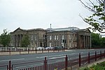
68 Wellhall Road, Cemetery Lodge, Including Gatepiers, Gates, Adjoining Walls And Waiting Room 55°46′19″N 4°03′12″W / 55.771974°N 4.053218°W / 55.771974; -4.053218 (68 Wellhall Road, Cemetery Lodge, Including Gatepiers, Gates, Adjoining Walls And Waiting Room ) Category C(S) 34609 Upload Photo Sheriff Court Buildings , Almada Street 55°46′46″N 4°02′56″W / 55.779381°N 4.048776°W / 55.779381; -4.048776 (Sheriff Court Buildings, Almada Street ) Category A 34470 Upload another image
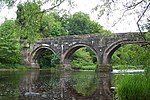
Auchingramont Road, 7 And Glen Cottage Adjoining 55°46′36″N 4°02′28″W / 55.776703°N 4.041205°W / 55.776703; -4.041205 (Auchingramont Road, 7 And Glen Cottage Adjoining ) Category C(S) 34477 Upload Photo Avon Street, St Andrews Parish Church 55°46′20″N 4°02′10″W / 55.772332°N 4.036034°W / 55.772332; -4.036034 (Avon Street, St Andrews Parish Church ) Category B 34484 Upload Photo Burnbank Road, 59, Herbertfield 55°46′43″N 4°03′33″W / 55.778731°N 4.059171°W / 55.778731; -4.059171 (Burnbank Road, 59, Herbertfield ) Category C(S) 34493 Upload Photo Burnbank Road 61 55°46′44″N 4°03′34″W / 55.778798°N 4.059509°W / 55.778798; -4.059509 (Burnbank Road 61 ) Category C(S) 34494 Upload Photo Burnbank Road, West Church Of Scotland, Including Church House, 40 Burnbank Road 55°46′43″N 4°03′20″W / 55.778637°N 4.055689°W / 55.778637; -4.055689 (Burnbank Road, West Church Of Scotland, Including Church House, 40 Burnbank Road ) Category B 34496 Upload Photo Cadzow Street, 104, 106 Masonic Buildings, And Corner Of Lower Auchingramont Road 55°46′41″N 4°02′23″W / 55.777934°N 4.039611°W / 55.777934; -4.039611 (Cadzow Street, 104, 106 Masonic Buildings, And Corner Of Lower Auchingramont Road ) Category B 34506 Upload Photo Cadzow Street, 116 55°46′41″N 4°02′25″W / 55.778047°N 4.040382°W / 55.778047; -4.040382 (Cadzow Street, 116 ) Category B 34509 Upload Photo Hamilton Mausoleum 55°47′00″N 4°01′54″W / 55.783342°N 4.0316°W / 55.783342; -4.0316 (Hamilton Mausoleum ) Category A 34518 Upload Photo 14 Beckford Street, Lanarkshire Health Board Offices, Including Gatepiers And Lampstandards 55°46′48″N 4°02′58″W / 55.780062°N 4.049465°W / 55.780062; -4.049465 (14 Beckford Street, Lanarkshire Health Board Offices, Including Gatepiers And Lampstandards ) Category B 34538 Upload Photo Bent Road, Bent Cemetery, Monument To Dukes Of Hamilton 55°46′22″N 4°03′14″W / 55.772663°N 4.053908°W / 55.772663; -4.053908 (Bent Road, Bent Cemetery, Monument To Dukes Of Hamilton ) Category C(S) 34539 Upload Photo 1, 3 Burnbank Road And 2, 4 Wellhall Road, Harveys Bar 55°46′40″N 4°03′14″W / 55.777802°N 4.054019°W / 55.777802; -4.054019 (1, 3 Burnbank Road And 2, 4 Wellhall Road, Harveys Bar ) Category C(S) 34546 Upload Photo 5, 7 Burnbank Road 55°46′40″N 4°03′16″W / 55.777815°N 4.054307°W / 55.777815; -4.054307 (5, 7 Burnbank Road ) Category C(S) 34547 Upload Photo Chatelherault Country Park , Bridge Over Burn, Darling Bridge 55°45′43″N 4°01′30″W / 55.762072°N 4.024915°W / 55.762072; -4.024915 (Chatelherault Country Park, Bridge Over Burn, Darling Bridge ) Category B 13622 Upload Photo Fairholm Bridge 55°44′41″N 3°59′22″W / 55.744805°N 3.989384°W / 55.744805; -3.989384 (Fairholm Bridge ) Category B 12488 Upload Photo Avon Bridge [ Avon Bridge ] 55°46′11″N 4°01′04″W / 55.769657°N 4.017816°W / 55.769657; -4.017816 (Avon Bridge [ Avon Bridge] ) Category A 12516 Upload another image
5 Blackswell Lane 55°46′30″N 4°01′53″W / 55.775034°N 4.031296°W / 55.775034; -4.031296 (5 Blackswell Lane ) Category B 47366 Upload Photo 8 Keith Street And 1 Bourne Street 55°46′34″N 4°01′58″W / 55.776023°N 4.032894°W / 55.776023; -4.032894 (8 Keith Street And 1 Bourne Street ) Category C(S) 34561 Upload Photo 143 And 145 Quarry Street And 2-6 (Even Nos) John Street 55°46′23″N 4°02′14″W / 55.772977°N 4.037199°W / 55.772977; -4.037199 (143 And 145 Quarry Street And 2-6 (Even Nos) John Street ) Category C(S) 34577 Upload Photo 147-155 (Odd Nos) Quarry Street 55°46′22″N 4°02′14″W / 55.772887°N 4.037211°W / 55.772887; -4.037211 (147-155 (Odd Nos) Quarry Street ) Category C(S) 34578 Upload Photo 157-165 (Odd Nos) Quarry Street 55°46′22″N 4°02′14″W / 55.772718°N 4.037138°W / 55.772718; -4.037138 (157-165 (Odd Nos) Quarry Street ) Category C(S) 34579 Upload Photo Almada Street, Lanark County Buildings 55°46′45″N 4°03′03″W / 55.779123°N 4.050819°W / 55.779123; -4.050819 (Almada Street, Lanark County Buildings ) Category A 34472 Upload another image
Auchingramont Road, 21 55°46′34″N 4°02′41″W / 55.776107°N 4.044666°W / 55.776107; -4.044666 (Auchingramont Road, 21 ) Category C(S) 34479 Upload Photo Burnbank Road, 63 Dunrod 55°46′44″N 4°03′37″W / 55.778912°N 4.060201°W / 55.778912; -4.060201 (Burnbank Road, 63 Dunrod ) Category B 34495 Upload Photo Cadzow Street, 8, 10, 12, 14, 16, 18, 20, 22, 24 55°46′35″N 4°02′02″W / 55.776365°N 4.033996°W / 55.776365; -4.033996 (Cadzow Street, 8, 10, 12, 14, 16, 18, 20, 22, 24 ) Category B 34499 Upload Photo Cadzow Street, 92, 94 [ de ] 55°46′38″N 4°02′13″W / 55.77716°N 4.036987°W / 55.77716; -4.036987 (Cadzow Street, 92, 94 [ de] ) Category A 34503 Upload another image
Carlisle Road, 4 The Priory 55°46′19″N 4°01′40″W / 55.772036°N 4.027839°W / 55.772036; -4.027839 (Carlisle Road, 4 The Priory ) Category C(S) 34514 Upload Photo Hamilton Mausoleum, Keeper's House/Lodge 55°47′03″N 4°01′55″W / 55.784164°N 4.03193°W / 55.784164; -4.03193 (Hamilton Mausoleum, Keeper's House/Lodge ) Category B 34519 Upload another image
Hamilton Burgh Museum Muir Street 55°46′46″N 4°02′07″W / 55.779533°N 4.035341°W / 55.779533; -4.035341 (Hamilton Burgh Museum Muir Street ) Category A 34521 Upload another image
Premises Of L.S. Smellie & Sons, Auction Mart. Muir Street 55°46′42″N 4°02′22″W / 55.778341°N 4.039441°W / 55.778341; -4.039441 (Premises Of L.S. Smellie & Sons, Auction Mart. Muir Street ) Category B 34523 Upload Photo Union Street, Auchingramont Church Manse 55°46′31″N 4°02′43″W / 55.775262°N 4.045195°W / 55.775262; -4.045195 (Union Street, Auchingramont Church Manse ) Category B 34530 Upload Photo Windmill Road, 19, 21 55°46′40″N 4°02′38″W / 55.77778°N 4.04402°W / 55.77778; -4.04402 (Windmill Road, 19, 21 ) Category C(S) 34533 Upload Photo Windmill Road, 10 55°46′41″N 4°02′38″W / 55.778141°N 4.043927°W / 55.778141; -4.043927 (Windmill Road, 10 ) Category C(S) 34534 Upload Photo 20-22 (Even Nos) Brandon Street, Post Office 55°46′27″N 4°02′15″W / 55.774247°N 4.037616°W / 55.774247; -4.037616 (20-22 (Even Nos) Brandon Street, Post Office ) Category B 34542 Upload Photo Cadzow Chapel 55°45′38″N 4°01′06″W / 55.760662°N 4.018323°W / 55.760662; -4.018323 (Cadzow Chapel ) Category B 12484 Upload Photo Terraces And Summerhouse, Barncluith [ de ] 55°46′01″N 4°01′33″W / 55.766936°N 4.025885°W / 55.766936; -4.025885 (Terraces And Summerhouse, Barncluith [ de] ) Category A 12522 Upload Photo 118 Cadzow Street, Muirbrow Chambers 55°46′41″N 4°02′26″W / 55.778125°N 4.040578°W / 55.778125; -4.040578 (118 Cadzow Street, Muirbrow Chambers ) Category C(S) 34552 Upload Photo 164 Quarry Street And 1 And 2 Kemp Street 55°46′22″N 4°02′16″W / 55.772825°N 4.037702°W / 55.772825; -4.037702 (164 Quarry Street And 1 And 2 Kemp Street ) Category B 34594 Upload Photo 166-170 (Even Nos) Quarry Street 55°46′22″N 4°02′16″W / 55.772716°N 4.037808°W / 55.772716; -4.037808 (166-170 (Even Nos) Quarry Street ) Category B 34595 Upload Photo 6 And 8 Saffronhall Crescent, Public Baths 55°46′43″N 4°02′48″W / 55.778538°N 4.046563°W / 55.778538; -4.046563 (6 And 8 Saffronhall Crescent, Public Baths ) Category B 34599 Upload Photo 20 Strathmore Road, Old Parish Church Halls, Including Gatepiers, Gates And Railings 55°46′33″N 4°02′16″W / 55.775871°N 4.037781°W / 55.775871; -4.037781 (20 Strathmore Road, Old Parish Church Halls, Including Gatepiers, Gates And Railings ) Category B 34601 Upload Photo 59 Union Street, Cadzowburn, Including Boundary Wall 55°46′34″N 4°03′04″W / 55.776208°N 4.051001°W / 55.776208; -4.051001 (59 Union Street, Cadzowburn, Including Boundary Wall ) Category C(S) 34607 Upload Photo Auchencampbell Road, House At Hamilton Grammar School (45 Union Street) 55°46′27″N 4°02′42″W / 55.774215°N 4.044901°W / 55.774215; -4.044901 (Auchencampbell Road, House At Hamilton Grammar School (45 Union Street) ) Category C(S) 34476 Upload Photo Brandon Street, Brandon Tower 55°46′27″N 4°02′13″W / 55.774268°N 4.036868°W / 55.774268; -4.036868 (Brandon Street, Brandon Tower ) Category B 34489 Upload Photo Burnbank Road, 55 55°46′43″N 4°03′30″W / 55.778573°N 4.058413°W / 55.778573; -4.058413 (Burnbank Road, 55 ) Category C(S) 34491 Upload Photo Cadzow Street/Muir Street Watson Fountain 55°46′44″N 4°02′32″W / 55.778834°N 4.042241°W / 55.778834; -4.042241 (Cadzow Street/Muir Street Watson Fountain ) Category C(S) 34512 Upload another image
Bent Road, Bent Cemetery, Monument To Robert Brown 55°46′22″N 4°03′14″W / 55.772663°N 4.053908°W / 55.772663; -4.053908 (Bent Road, Bent Cemetery, Monument To Robert Brown ) Category B 34540 Upload another image
Bridge, Chatelherault 55°45′40″N 4°01′01″W / 55.761037°N 4.016812°W / 55.761037; -4.016812 (Bridge, Chatelherault ) Category B 12482 Upload Photo Avon Railway Viaduct And Tunnel Approach 55°46′03″N 4°01′25″W / 55.767421°N 4.023742°W / 55.767421; -4.023742 (Avon Railway Viaduct And Tunnel Approach ) Category B 12519 Upload Photo