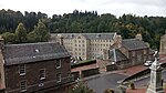
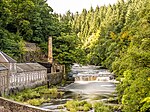
Name Location Date Listed Grid Ref. [note 1] Geo-coordinates Notes LB Number [note 2] Image Bankhead Farm, Including Farmhouse, Steading And Boundary Walls 55°39′56″N 3°46′33″W / 55.665436°N 3.77583°W / 55.665436; -3.77583 (Bankhead Farm, Including Farmhouse, Steading And Boundary Walls ) Category C(S) 43024 Upload Photo New Lanark, Mill No 1 55°39′49″N 3°46′58″W / 55.663547°N 3.782772°W / 55.663547; -3.782772 (New Lanark, Mill No 1 ) Category A 37051 Upload another image
New Lanark, Scottish Wildlife Trust Visitor Centre (Former Foundry, Later Dyeworks) 55°39′42″N 3°46′49″W / 55.661704°N 3.780367°W / 55.661704; -3.780367 (New Lanark, Scottish Wildlife Trust Visitor Centre (Former Foundry, Later Dyeworks) ) Category A 37055 Upload Photo Sisters Of Charity Convent, St Vincent Place 55°40′22″N 3°46′23″W / 55.672809°N 3.773095°W / 55.672809; -3.773095 (Sisters Of Charity Convent, St Vincent Place ) Category C(S) 37063 Upload Photo Gates To St Mary's Precinct, St Vincent Place 55°40′22″N 3°46′22″W / 55.672913°N 3.77275°W / 55.672913; -3.77275 (Gates To St Mary's Precinct, St Vincent Place ) Category C(S) 37064 Upload Photo 2 And 4 Wellgate, Clydesdale Bank 55°40′24″N 3°46′48″W / 55.673348°N 3.77991°W / 55.673348; -3.77991 (2 And 4 Wellgate, Clydesdale Bank ) Category C(S) 37071 Upload Photo 16 And 18 Wellgate 55°40′23″N 3°46′46″W / 55.673157°N 3.779488°W / 55.673157; -3.779488 (16 And 18 Wellgate ) Category C(S) 37075 Upload Photo 20-26 (Even Numbers Only) Wellgate 55°40′23″N 3°46′46″W / 55.673096°N 3.77931°W / 55.673096; -3.77931 (20-26 (Even Numbers Only) Wellgate ) Category C(S) 37076 Upload Photo 7 West Port 55°40′26″N 3°46′59″W / 55.674002°N 3.783168°W / 55.674002; -3.783168 (7 West Port ) Category C(S) 37086 Upload Photo 39 West Port 55°40′27″N 3°47′04″W / 55.674099°N 3.784556°W / 55.674099; -3.784556 (39 West Port ) Category C(S) 37090 Upload Photo 25, 27, 29 High Street 55°40′26″N 3°46′46″W / 55.673794°N 3.779517°W / 55.673794; -3.779517 (25, 27, 29 High Street ) Category C(S) 36987 Upload Photo 47 And 49 High Street 55°40′25″N 3°46′44″W / 55.67375°N 3.778831°W / 55.67375; -3.778831 (47 And 49 High Street ) Category C(S) 36993 Upload Photo 4, 6, 8 And 10 Hope Street 55°40′27″N 3°46′54″W / 55.674105°N 3.781662°W / 55.674105; -3.781662 (4, 6, 8 And 10 Hope Street ) Category C(S) 37012 Upload Photo 1 And 3 Hyndford Place 55°40′24″N 3°46′50″W / 55.673267°N 3.780542°W / 55.673267; -3.780542 (1 And 3 Hyndford Place ) Category C(S) 37019 Upload Photo Cemetery Chapel, Hyndford Road 55°40′10″N 3°46′06″W / 55.669481°N 3.768333°W / 55.669481; -3.768333 (Cemetery Chapel, Hyndford Road ) Category A 37029 Upload another image
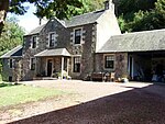
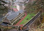
New Lanark Road, Braxfield House, Stables 55°40′08″N 3°47′15″W / 55.668772°N 3.787493°W / 55.668772; -3.787493 (New Lanark Road, Braxfield House, Stables ) Category B 37036 Upload Photo New Lanark 1-10 (Inclusive Nos) Braxfield Row 55°39′54″N 3°47′02″W / 55.665003°N 3.783983°W / 55.665003; -3.783983 (New Lanark 1-10 (Inclusive Nos) Braxfield Row ) Category A 37038 Upload Photo New Lanark, 9-16 (Inclusive Nos) Caithness Row With Garages (Former Abattoir) 55°39′45″N 3°46′46″W / 55.662501°N 3.779322°W / 55.662501; -3.779322 (New Lanark, 9-16 (Inclusive Nos) Caithness Row With Garages (Former Abattoir) ) Category A 37040 Upload Photo New Lanark, 1-14 (Inclusive Nos) Long Row 55°39′53″N 3°47′01″W / 55.664692°N 3.783746°W / 55.664692; -3.783746 (New Lanark, 1-14 (Inclusive Nos) Long Row ) Category A 37043 Upload Photo New Lanark, New Buildings 55°39′50″N 3°46′52″W / 55.663966°N 3.781153°W / 55.663966; -3.781153 (New Lanark, New Buildings ) Category A 37045 Upload another image
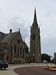
19 And 21 Bannatyne Street 55°40′26″N 3°46′29″W / 55.673782°N 3.774793°W / 55.673782; -3.774793 (19 And 21 Bannatyne Street ) Category C(S) 36927 Upload Photo 4 And 6 Bloomgate 55°40′26″N 3°46′50″W / 55.67378°N 3.780518°W / 55.67378; -3.780518 (4 And 6 Bloomgate ) Category B 36937 Upload Photo 4-16 (Even Nos Only) Broomgate 55°40′25″N 3°46′52″W / 55.673555°N 3.781175°W / 55.673555; -3.781175 (4-16 (Even Nos Only) Broomgate ) Category C(S) 36951 Upload Photo 13 & 15 Castlegate 55°40′24″N 3°46′49″W / 55.673199°N 3.780285°W / 55.673199; -3.780285 (13 & 15 Castlegate ) Category C(S) 36966 Upload Photo 56 And 58 Castlegate 55°40′19″N 3°46′57″W / 55.671855°N 3.782498°W / 55.671855; -3.782498 (56 And 58 Castlegate ) Category C(S) 36973 Upload Photo St Nicholas Parish Church High Street 55°40′25″N 3°46′50″W / 55.6735°N 3.780616°W / 55.6735; -3.780616 (St Nicholas Parish Church High Street ) Category B 36981 Upload another image See more images
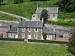
Baronald (Cartland Bridge Hotel), Stable Block And Walled Garden 55°40′51″N 3°47′38″W / 55.680738°N 3.793924°W / 55.680738; -3.793924 (Baronald (Cartland Bridge Hotel), Stable Block And Walled Garden ) Category C(S) 13344 Upload Photo Road To Bonnington Mains And Robbiesland, Cast-Iron Bridge, Over Former Lanark-Muirkirk Railway 55°39′47″N 3°45′06″W / 55.662961°N 3.751712°W / 55.662961; -3.751712 (Road To Bonnington Mains And Robbiesland, Cast-Iron Bridge, Over Former Lanark-Muirkirk Railway ) Category B 13069 Upload Photo New Lanark, Water Houses 55°39′48″N 3°46′59″W / 55.663311°N 3.782952°W / 55.663311; -3.782952 (New Lanark, Water Houses ) Category A 46471 Upload Photo Hyndford Road, Former Lady Hozier Convalescent Home And Boundary Walls 55°40′12″N 3°45′45″W / 55.670111°N 3.762606°W / 55.670111; -3.762606 (Hyndford Road, Former Lady Hozier Convalescent Home And Boundary Walls ) Category C(S) 47972 Upload Photo 46A, 48 And 48A Bannatyne Street, Lanark Bingo, Former Regal Cinema And Shops 55°40′23″N 3°46′26″W / 55.673129°N 3.773921°W / 55.673129; -3.773921 (46A, 48 And 48A Bannatyne Street, Lanark Bingo, Former Regal Cinema And Shops ) Category C(S) 51103 Upload Photo New Lanark, Education Centre (Formerly The School) 55°39′45″N 3°46′49″W / 55.662469°N 3.780274°W / 55.662469; -3.780274 (New Lanark, Education Centre (Formerly The School) ) Category A 37050 Upload another image
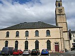
2 Park Place 55°40′32″N 3°47′10″W / 55.675503°N 3.786226°W / 55.675503; -3.786226 (2 Park Place ) Category B 37060 Upload Photo St Mary's Rc Church, St Vincent Place 55°40′20″N 3°46′24″W / 55.672258°N 3.773309°W / 55.672258; -3.773309 (St Mary's Rc Church, St Vincent Place ) Category A 37062 Upload another image
St Mary's Church Hall, St Vincent Place 55°40′21″N 3°46′25″W / 55.672606°N 3.773483°W / 55.672606; -3.773483 (St Mary's Church Hall, St Vincent Place ) Category A 37065 Upload Photo 6-8 Wellgate 55°40′24″N 3°46′47″W / 55.673323°N 3.779797°W / 55.673323; -3.779797 (6-8 Wellgate ) Category B 37072 Upload Photo 10 Wellgate 55°40′24″N 3°46′47″W / 55.673225°N 3.779761°W / 55.673225; -3.779761 (10 Wellgate ) Category C(S) 37073 Upload Photo 28 And 30 Wellgate 55°40′23″N 3°46′45″W / 55.673016°N 3.77929°W / 55.673016; -3.77929 (28 And 30 Wellgate ) Category C(S) 37077 Upload Photo 34 And 36 Wellgate 55°40′22″N 3°46′45″W / 55.672911°N 3.779063°W / 55.672911; -3.779063 (34 And 36 Wellgate ) Category B 37079 Upload Photo 42 Wellgate 55°40′22″N 3°46′44″W / 55.672832°N 3.778932°W / 55.672832; -3.778932 (42 Wellgate ) Category C(S) 37081 Upload Photo 44-48(Even Numbers Only) Wellgate 55°40′22″N 3°46′44″W / 55.672798°N 3.778835°W / 55.672798; -3.778835 (44-48(Even Numbers Only) Wellgate ) Category B 37082 Upload Photo 28 Wellgate Head 55°40′19″N 3°46′36″W / 55.671922°N 3.776665°W / 55.671922; -3.776665 (28 Wellgate Head ) Category C(S) 37085 Upload Photo 9, 11 And 13 West Port 55°40′26″N 3°47′00″W / 55.674001°N 3.783263°W / 55.674001; -3.783263 (9, 11 And 13 West Port ) Category B 37087 Upload Photo 20 West Port 55°40′28″N 3°47′01″W / 55.674434°N 3.783712°W / 55.674434; -3.783712 (20 West Port ) Category C(S) 37092 Upload Photo New Lanark, New Lanark Road, K6 Telephone Kiosk 55°39′50″N 3°46′53″W / 55.663829°N 3.781306°W / 55.663829; -3.781306 (New Lanark, New Lanark Road, K6 Telephone Kiosk ) Category B 37104 Upload another image
19, 21 And 23 High Street 55°40′25″N 3°46′47″W / 55.673738°N 3.779705°W / 55.673738; -3.779705 (19, 21 And 23 High Street ) Category C(S) 36986 Upload Photo 18 And 20 High Street 55°40′24″N 3°46′45″W / 55.673359°N 3.779195°W / 55.673359; -3.779195 (18 And 20 High Street ) Category C(S) 36999 Upload Photo 25 Hope Street 55°40′31″N 3°46′54″W / 55.675282°N 3.781652°W / 55.675282; -3.781652 (25 Hope Street ) Category B 37010 Upload Photo Hope Bank 18 Hope Street 55°40′29″N 3°46′53″W / 55.674613°N 3.781351°W / 55.674613; -3.781351 (Hope Bank 18 Hope Street ) Category C(S) 37014 Upload Photo Hyndford Road, Gates, Gatepiers And Railings At Auction Room And Cattle Market 55°40′14″N 3°46′05″W / 55.670564°N 3.767969°W / 55.670564; -3.767969 (Hyndford Road, Gates, Gatepiers And Railings At Auction Room And Cattle Market ) Category A 37024 Upload Photo 2Nd Auction Room And Hyndford Road Auction Market 55°40′16″N 3°46′14″W / 55.671057°N 3.770567°W / 55.671057; -3.770567 (2Nd Auction Room And Hyndford Road Auction Market ) Category C(S) 37025 Upload Photo Mousemill Road, Clydesholm Bridge 55°40′32″N 3°48′02″W / 55.675529°N 3.80046°W / 55.675529; -3.80046 (Mousemill Road, Clydesholm Bridge ) Category A 37032 Upload another image
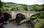
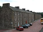
1A, Old Bridgend, Kirkfieldbank 55°40′34″N 3°47′59″W / 55.676016°N 3.799751°W / 55.676016; -3.799751 (1A, Old Bridgend, Kirkfieldbank ) Category C(S) 37033 Upload Photo New Lanark, 1-8 (Inclusive Nos) Caithness Row And The Counting House 55°39′47″N 3°46′47″W / 55.662936°N 3.779707°W / 55.662936; -3.779707 (New Lanark, 1-8 (Inclusive Nos) Caithness Row And The Counting House ) Category A 37039 Upload Photo New Lanark, Rosedale Street, 5-12 (Inclusive Nos) Double Row, Known As Water Row 55°39′52″N 3°47′00″W / 55.664382°N 3.78343°W / 55.664382; -3.78343 (New Lanark, Rosedale Street, 5-12 (Inclusive Nos) Double Row, Known As Water Row ) Category A 37042 Upload Photo New Lanark, 1-11 (Inclusive Nos) Nursery Buildings 55°39′48″N 3°46′48″W / 55.663424°N 3.780111°W / 55.663424; -3.780111 (New Lanark, 1-11 (Inclusive Nos) Nursery Buildings ) Category A 37046 Upload Photo 52 Bloomgate 55°40′27″N 3°46′56″W / 55.674104°N 3.782361°W / 55.674104; -3.782361 (52 Bloomgate ) Category B 36946 Upload Photo 28 And 30 Broomgate 55°40′24″N 3°46′53″W / 55.673209°N 3.781446°W / 55.673209; -3.781446 (28 And 30 Broomgate ) Category B 36952 Upload Photo 32 Broomgate 55°40′23″N 3°46′54″W / 55.673127°N 3.781538°W / 55.673127; -3.781538 (32 Broomgate ) Category B 36953 Upload Photo 38 Broomgate 55°40′23″N 3°46′54″W / 55.672999°N 3.781707°W / 55.672999; -3.781707 (38 Broomgate ) Category B 36955 Upload Photo 40 Broomgate 55°40′23″N 3°46′55″W / 55.672951°N 3.781895°W / 55.672951; -3.781895 (40 Broomgate ) Category C(S) 36956 Upload Photo 53 And 55 Castlegate 55°40′21″N 3°46′53″W / 55.672617°N 3.781387°W / 55.672617; -3.781387 (53 And 55 Castlegate ) Category C(S) 36970 Upload Photo 7, 9 And 13 High Street 55°40′25″N 3°46′48″W / 55.673744°N 3.779896°W / 55.673744; -3.779896 (7, 9 And 13 High Street ) Category C(S) 36984 Upload Photo Cartland Bridge 55°40′50″N 3°48′03″W / 55.680576°N 3.800708°W / 55.680576; -3.800708 (Cartland Bridge ) Category B 13054 Upload Photo Orchard Dell, Now Sorisdale 55°40′44″N 3°48′05″W / 55.678893°N 3.801474°W / 55.678893; -3.801474 (Orchard Dell, Now Sorisdale ) Category B 13063 Upload Photo 86 Mousebank Road, Ridge Park Home Including Walled Garden And Conservatory 55°40′51″N 3°47′12″W / 55.680746°N 3.786608°W / 55.680746; -3.786608 (86 Mousebank Road, Ridge Park Home Including Walled Garden And Conservatory ) Category B 13066 Upload Photo Bonnington Linn, Footbridge 55°38′47″N 3°46′31″W / 55.646453°N 3.775416°W / 55.646453; -3.775416 (Bonnington Linn, Footbridge ) Category B 46900 Upload Photo Falls Of Clyde, Stonebyres Power Station With Tank And Pipes 55°40′38″N 3°49′48″W / 55.677249°N 3.829994°W / 55.677249; -3.829994 (Falls Of Clyde, Stonebyres Power Station With Tank And Pipes ) Category A 51719 Upload Photo 7 North Vennel 55°40′28″N 3°46′57″W / 55.674371°N 3.782532°W / 55.674371; -3.782532 (7 North Vennel ) Category C(S) 37057 Upload Photo Lanark Memorial Hall, St Leonard Street 55°40′28″N 3°46′31″W / 55.674361°N 3.775169°W / 55.674361; -3.775169 (Lanark Memorial Hall, St Leonard Street ) Category B 37061 Upload Photo St Mary's Presbytery St Vincent Place 55°40′20″N 3°46′22″W / 55.672273°N 3.772848°W / 55.672273; -3.772848 (St Mary's Presbytery St Vincent Place ) Category A 37066 Upload Photo 13, 15 And 17 Wellgate Head 55°40′20″N 3°46′36″W / 55.672171°N 3.776803°W / 55.672171; -3.776803 (13, 15 And 17 Wellgate Head ) Category C(S) 37084 Upload Photo 35 And 37 West Port 55°40′27″N 3°47′02″W / 55.674287°N 3.783976°W / 55.674287; -3.783976 (35 And 37 West Port ) Category C(S) 37088 Upload Photo Eu Church West Port 55°40′27″N 3°47′04″W / 55.674209°N 3.784354°W / 55.674209; -3.784354 (Eu Church West Port ) Category C(S) 37089 Upload Photo 22 West Port 55°40′28″N 3°47′02″W / 55.674487°N 3.783778°W / 55.674487; -3.783778 (22 West Port ) Category C(S) 37093 Upload Photo Wheatpark Cottage, 5 Wheatpark Road 55°40′35″N 3°47′00″W / 55.676275°N 3.783239°W / 55.676275; -3.783239 (Wheatpark Cottage, 5 Wheatpark Road ) Category B 37098 Upload Photo Smyllum Park , Whitelees Road 55°40′24″N 3°45′40″W / 55.67345°N 3.761022°W / 55.67345; -3.761022 (Smyllum Park, Whitelees Road ) Category B 37101 Upload Photo 43 And 45 High Street D W Brown And Son 55°40′25″N 3°46′44″W / 55.673704°N 3.778908°W / 55.673704; -3.778908 (43 And 45 High Street D W Brown And Son ) Category C(S) 36992 Upload Photo 14 And 16 High Street 55°40′24″N 3°46′46″W / 55.673329°N 3.7794°W / 55.673329; -3.7794 (14 And 16 High Street ) Category B 36998 Upload Photo 13 Hope Street Mervyn 55°40′29″N 3°46′55″W / 55.674666°N 3.781989°W / 55.674666; -3.781989 (13 Hope Street Mervyn ) Category C(S) 37006 Upload Photo 6 Market End 55°40′23″N 3°46′52″W / 55.673087°N 3.78117°W / 55.673087; -3.78117 (6 Market End ) Category C(S) 37031 Upload Photo New Lanark Road, Braxfield House 55°40′08″N 3°47′20″W / 55.668832°N 3.788879°W / 55.668832; -3.788879 (New Lanark Road, Braxfield House ) Category B 37035 Upload Photo New Lanark, Community Hall (Former New Lanark Church) With Gatepiers, Railings And Boundary Walls 55°39′52″N 3°46′54″W / 55.664406°N 3.781793°W / 55.664406; -3.781793 (New Lanark, Community Hall (Former New Lanark Church) With Gatepiers, Railings And Boundary Walls ) Category A 37037 Upload another image
12, 14, 16 Bloomgate 55°40′26″N 3°46′51″W / 55.673802°N 3.780837°W / 55.673802; -3.780837 (12, 14, 16 Bloomgate ) Category C(S) 36939 Upload Photo 30 And 32 Bloomgate 55°40′26″N 3°46′53″W / 55.673886°N 3.781286°W / 55.673886; -3.781286 (30 And 32 Bloomgate ) Category B 36941 Upload Photo 42 Bloomgate 55°40′26″N 3°46′54″W / 55.673988°N 3.78164°W / 55.673988; -3.78164 (42 Bloomgate ) Category C(S) 36943 Upload Photo 48 Bloomgate 55°40′27″N 3°46′56″W / 55.674051°N 3.782248°W / 55.674051; -3.782248 (48 Bloomgate ) Category C(S) 36945 Upload Photo Castlepark Lodge Broomgate 55°40′18″N 3°47′00″W / 55.671548°N 3.783231°W / 55.671548; -3.783231 (Castlepark Lodge Broomgate ) Category B 36958 Upload Photo 9 & 11 Castlegate 55°40′24″N 3°46′49″W / 55.673236°N 3.780239°W / 55.673236; -3.780239 (9 & 11 Castlegate ) Category C(S) 36965 Upload Photo 38 Castlegate 55°40′21″N 3°46′55″W / 55.672402°N 3.781982°W / 55.672402; -3.781982 (38 Castlegate ) Category B 36969 Upload Photo 101 Castlegate 55°40′15″N 3°47′01″W / 55.670761°N 3.783577°W / 55.670761; -3.783577 (101 Castlegate ) Category B 36975 Upload Photo Former Tollhouse, 201 Hyndford Road 55°39′52″N 3°44′56″W / 55.664387°N 3.748755°W / 55.664387; -3.748755 (Former Tollhouse, 201 Hyndford Road ) Category B 13469 Upload Photo The Lee, South Lodge 55°40′50″N 3°48′20″W / 55.680477°N 3.805587°W / 55.680477; -3.805587 (The Lee, South Lodge ) Category B 13058 Upload Photo Mousemill House 55°40′40″N 3°47′59″W / 55.67775°N 3.799736°W / 55.67775; -3.799736 (Mousemill House ) Category C(S) 13062 Upload another image
64, 66 Hall Road, Nemphlar 55°40′47″N 3°49′19″W / 55.679788°N 3.821842°W / 55.679788; -3.821842 (64, 66 Hall Road, Nemphlar ) Category B 13068 Upload Photo New Lanark, Visitor Centre (Formerly New Institution For The Formation Of Character And Engine House) 55°39′48″N 3°46′51″W / 55.663214°N 3.780944°W / 55.663214; -3.780944 (New Lanark, Visitor Centre (Formerly New Institution For The Formation Of Character And Engine House) ) Category A 37049 Upload another image
New Lanark, Mill No 3 55°39′48″N 3°46′55″W / 55.663202°N 3.781818°W / 55.663202; -3.781818 (New Lanark, Mill No 3 ) Category A 37053 Upload Photo New Lanark, Former Mechanics' Workshop 55°39′42″N 3°46′48″W / 55.661762°N 3.780067°W / 55.661762; -3.780067 (New Lanark, Former Mechanics' Workshop ) Category A 37054 Upload another image
11 North Vennel 55°40′28″N 3°46′57″W / 55.674579°N 3.782415°W / 55.674579; -3.782415 (11 North Vennel ) Category C(S) 37059 Upload Photo 39 Wellgate 55°40′23″N 3°46′43″W / 55.672927°N 3.778603°W / 55.672927; -3.778603 (39 Wellgate ) Category B 37069 Upload Photo 32 Wellgate 55°40′23″N 3°46′45″W / 55.672927°N 3.779207°W / 55.672927; -3.779207 (32 Wellgate ) Category C(S) 37078 Upload Photo 50 Wellgate 55°40′22″N 3°46′43″W / 55.672683°N 3.778687°W / 55.672683; -3.778687 (50 Wellgate ) Category B 37083 Upload Photo 28 West Port 55°40′28″N 3°47′02″W / 55.674574°N 3.784005°W / 55.674574; -3.784005 (28 West Port ) Category C(S) 37095 Upload Photo Gatepiers, 52 Wheatpark Road 55°40′31″N 3°47′09″W / 55.675258°N 3.785754°W / 55.675258; -3.785754 (Gatepiers, 52 Wheatpark Road ) Category B 37100 Upload Photo Chapel, Smyllum Park, Whitelees Road 55°40′24″N 3°45′41″W / 55.673374°N 3.761321°W / 55.673374; -3.761321 (Chapel, Smyllum Park, Whitelees Road ) Category B 37102 Upload Photo Institute Smyllum Park, Whitelees Road 55°40′25″N 3°45′37″W / 55.673477°N 3.760387°W / 55.673477; -3.760387 (Institute Smyllum Park, Whitelees Road ) Category B 37103 Upload Photo 51 High Street 55°40′25″N 3°46′43″W / 55.673743°N 3.778735°W / 55.673743; -3.778735 (51 High Street ) Category C(S) 36994 Upload Photo The Portvaults Public House 116 High Street 55°40′25″N 3°46′33″W / 55.673679°N 3.775695°W / 55.673679; -3.775695 (The Portvaults Public House 116 High Street ) Category C(S) 37001 Upload Photo 20 Hope Street 55°40′29″N 3°46′53″W / 55.674721°N 3.781324°W / 55.674721; -3.781324 (20 Hope Street ) Category B 37015 Upload Photo Hyndford Road Auction Room Cattle Market 55°40′15″N 3°46′09″W / 55.67086°N 3.76927°W / 55.67086; -3.76927 (Hyndford Road Auction Room Cattle Market ) Category B 37023 Upload Photo New Lanark, 5 And 7 Rosedale Street, David Dale's House 55°39′51″N 3°46′56″W / 55.664051°N 3.782127°W / 55.664051; -3.782127 (New Lanark, 5 And 7 Rosedale Street, David Dale's House ) Category A 37048 Upload another image
Ymca Bloomgate 55°40′26″N 3°46′57″W / 55.673753°N 3.782377°W / 55.673753; -3.782377 (Ymca Bloomgate ) Category B 36935 Upload Photo 8 And 10 Bloomgate 55°40′26″N 3°46′50″W / 55.673796°N 3.780614°W / 55.673796; -3.780614 (8 And 10 Bloomgate ) Category B 36938 Upload Photo 5 Broomgate 55°40′25″N 3°46′51″W / 55.673498°N 3.780775°W / 55.673498; -3.780775 (5 Broomgate ) Category C(S) 36948 Upload Photo Wampherflatt Braxfield Road 55°40′15″N 3°46′38″W / 55.670702°N 3.777134°W / 55.670702; -3.777134 (Wampherflatt Braxfield Road ) Category B 36960 Upload Photo Hyndford Bridge 55°39′16″N 3°43′35″W / 55.654506°N 3.726268°W / 55.654506; -3.726268 (Hyndford Bridge ) Category A 13055 Upload another image
The Lee 55°41′55″N 3°49′29″W / 55.698538°N 3.824608°W / 55.698538; -3.824608 (The Lee ) Category B 13056 Upload Photo Baronald (Cartland Bridge Hotel) 55°40′55″N 3°47′35″W / 55.681899°N 3.793182°W / 55.681899; -3.793182 (Baronald (Cartland Bridge Hotel) ) Category A 12967 Upload Photo Bonnington Mains 55°39′31″N 3°45′47″W / 55.658736°N 3.763096°W / 55.658736; -3.763096 (Bonnington Mains ) Category B 51427 Upload Photo Mansefield House, West Port 55°40′30″N 3°47′02″W / 55.675025°N 3.783866°W / 55.675025; -3.783866 (Mansefield House, West Port ) Category B 37096 Upload Photo 7 Hope Street 55°40′27″N 3°46′55″W / 55.67428°N 3.78194°W / 55.67428; -3.78194 (7 Hope Street ) Category C(S) 37004 Upload Photo Hope Street Former Council Chambers Clerk's Office And Sheriff Court 55°40′30″N 3°46′52″W / 55.675002°N 3.781114°W / 55.675002; -3.781114 (Hope Street Former Council Chambers Clerk's Office And Sheriff Court ) Category B 37016 Upload another image
Hope Street Christ Church Episcopal Church 55°40′32″N 3°46′51″W / 55.675421°N 3.780767°W / 55.675421; -3.780767 (Hope Street Christ Church Episcopal Church ) Category B 37018 Upload Photo Hyndford House 5 Hyndford Place 55°40′24″N 3°46′51″W / 55.673308°N 3.780846°W / 55.673308; -3.780846 (Hyndford House 5 Hyndford Place ) Category B 37020 Upload Photo 5 And 7 Hyndford Road 55°40′19″N 3°46′30″W / 55.671876°N 3.774866°W / 55.671876; -3.774866 (5 And 7 Hyndford Road ) Category B 37022 Upload Photo 1 New Lanark Road 55°39′58″N 3°46′31″W / 55.665982°N 3.775378°W / 55.665982; -3.775378 (1 New Lanark Road ) Category B 37034 Upload Photo New Lanark, Rosedale Street, 1- 4 (Inclusive Nos) Double Row, Also Known As Wee Row 55°39′51″N 3°46′58″W / 55.664221°N 3.782771°W / 55.664221; -3.782771 (New Lanark, Rosedale Street, 1- 4 (Inclusive Nos) Double Row, Also Known As Wee Row ) Category A 37041 Upload another image
Clydesdale Hotel 13 & 15 Bloomgate 55°40′25″N 3°46′53″W / 55.673641°N 3.781434°W / 55.673641; -3.781434 (Clydesdale Hotel 13 & 15 Bloomgate ) Category B 36933 Upload Photo Castle Park 80 Broomgate 55°40′19″N 3°47′02″W / 55.671818°N 3.7838°W / 55.671818; -3.7838 (Castle Park 80 Broomgate ) Category B 36959 Upload Photo 54 Castlegate 55°40′19″N 3°46′57″W / 55.671946°N 3.782422°W / 55.671946; -3.782422 (54 Castlegate ) Category C(S) 36972 Upload Photo 13 Friars Lane, Friarsview, Including Boundary Walls 55°40′22″N 3°47′00″W / 55.672814°N 3.783289°W / 55.672814; -3.783289 (13 Friars Lane, Friarsview, Including Boundary Walls ) Category C(S) 36980 Upload Photo 15 And 17 High Street Wrights 55°40′26″N 3°46′47″W / 55.673754°N 3.779801°W / 55.673754; -3.779801 (15 And 17 High Street Wrights ) Category C(S) 36985 Upload Photo Hyndford Road, Lanark Racecourse, Tote Tower 55°39′53″N 3°44′47″W / 55.664789°N 3.746436°W / 55.664789; -3.746436 (Hyndford Road, Lanark Racecourse, Tote Tower ) Category B 46519 Upload Photo New Lanark Road, Braxfield House, Walled Garden 55°40′00″N 3°47′25″W / 55.666529°N 3.790332°W / 55.666529; -3.790332 (New Lanark Road, Braxfield House, Walled Garden ) Category C(S) 51429 Upload Photo Falls Of Clyde, Stonebyres Power Station Weir And Bridge 55°40′34″N 3°49′20″W / 55.67617°N 3.822198°W / 55.67617; -3.822198 (Falls Of Clyde, Stonebyres Power Station Weir And Bridge ) Category A 51720 Upload Photo Falls Of Clyde, Bonnington Power Station Weir And Bridge 55°40′34″N 3°49′20″W / 55.67617°N 3.822198°W / 55.67617; -3.822198 (Falls Of Clyde, Bonnington Power Station Weir And Bridge ) Category A 51728 Upload Photo New Lanark, Retort House Chimney 55°39′40″N 3°46′50″W / 55.661119°N 3.780436°W / 55.661119; -3.780436 (New Lanark, Retort House Chimney ) Category A 37056 Upload another image
1 Wellgate 55°40′24″N 3°46′47″W / 55.673451°N 3.779628°W / 55.673451; -3.779628 (1 Wellgate ) Category B 37067 Upload Photo 41, 43 And 45 Wellgate 55°40′22″N 3°46′43″W / 55.672892°N 3.778553°W / 55.672892; -3.778553 (41, 43 And 45 Wellgate ) Category C(S) 37070 Upload Photo 2 West Port 55°40′27″N 3°46′58″W / 55.674134°N 3.782713°W / 55.674134; -3.782713 (2 West Port ) Category B 37091 Upload Photo 31 High Street 55°40′25″N 3°46′46″W / 55.673734°N 3.779371°W / 55.673734; -3.779371 (31 High Street ) Category C(S) 36988 Upload Photo 37 And 39 High Street 55°40′25″N 3°46′45″W / 55.673719°N 3.779147°W / 55.673719; -3.779147 (37 And 39 High Street ) Category C(S) 36990 Upload Photo Hope Street St Kentigern's Church (Church Of Scotland) 55°40′29″N 3°46′55″W / 55.674845°N 3.782077°W / 55.674845; -3.782077 (Hope Street St Kentigern's Church (Church Of Scotland) ) Category B 37007 Upload Photo Crown Tavern 17 Hope Street 55°40′30″N 3°46′55″W / 55.674947°N 3.781811°W / 55.674947; -3.781811 (Crown Tavern 17 Hope Street ) Category C(S) 37008 Upload Photo Linsay Institute, Hope Street 55°40′28″N 3°46′54″W / 55.674322°N 3.78156°W / 55.674322; -3.78156 (Linsay Institute, Hope Street ) Category B 37013 Upload Photo 12-22 (Even Nos) Lockhart Drive, Former William Smellie Memorial Hospital 55°40′39″N 3°47′27″W / 55.677387°N 3.790765°W / 55.677387; -3.790765 (12-22 (Even Nos) Lockhart Drive, Former William Smellie Memorial Hospital ) Category B 37030 Upload Photo The Royal Oak Tree Bannatyne Street 55°40′25″N 3°46′26″W / 55.673669°N 3.773881°W / 55.673669; -3.773881 (The Royal Oak Tree Bannatyne Street ) Category C(S) 36928 Upload Photo 7 Bloomgate And 2 Broomgate 55°40′25″N 3°46′52″W / 55.673638°N 3.781036°W / 55.673638; -3.781036 (7 Bloomgate And 2 Broomgate ) Category C(S) 36932 Upload Photo Cairns Church Of Scotland Bloomgate 55°40′26″N 3°46′57″W / 55.673875°N 3.782605°W / 55.673875; -3.782605 (Cairns Church Of Scotland Bloomgate ) Category B 36936 Upload Photo 18 And 20 Bloomgate 55°40′26″N 3°46′52″W / 55.67388°N 3.781031°W / 55.67388; -3.781031 (18 And 20 Bloomgate ) Category C(S) 36940 Upload Photo 36 Bloomgate 55°40′26″N 3°46′54″W / 55.673971°N 3.78156°W / 55.673971; -3.78156 (36 Bloomgate ) Category C(S) 36942 Upload Photo 44 And 46 Bloomgate 55°40′27″N 3°46′56″W / 55.674036°N 3.782088°W / 55.674036; -3.782088 (44 And 46 Bloomgate ) Category B 36944 Upload Photo 7 Broomgate 55°40′24″N 3°46′51″W / 55.673244°N 3.780923°W / 55.673244; -3.780923 (7 Broomgate ) Category C(S) 36949 Upload Photo 34 And 36 Broomgate 55°40′23″N 3°46′54″W / 55.673072°N 3.781599°W / 55.673072; -3.781599 (34 And 36 Broomgate ) Category B 36954 Upload Photo Castlegate, Lodge To Castlebank Park Including Boundary Walls, Gatepiers And Gates 55°40′15″N 3°47′04″W / 55.6708°N 3.78458°W / 55.6708; -3.78458 (Castlegate, Lodge To Castlebank Park Including Boundary Walls, Gatepiers And Gates ) Category C(S) 36976 Upload Photo Ryber Lodge, Cleghorn Road 55°40′45″N 3°46′42″W / 55.679268°N 3.778207°W / 55.679268; -3.778207 (Ryber Lodge, Cleghorn Road ) Category C(S) 36979 Upload Photo The Lee, Dovecote 55°41′49″N 3°49′30″W / 55.697012°N 3.82511°W / 55.697012; -3.82511 (The Lee, Dovecote ) Category B 13057 Upload Photo Holmfoot 55°42′01″N 3°51′53″W / 55.700361°N 3.864763°W / 55.700361; -3.864763 (Holmfoot ) Category B 13059 Upload Photo The Roman Bridge 55°40′41″N 3°47′58″W / 55.678124°N 3.799403°W / 55.678124; -3.799403 (The Roman Bridge ) Category B 13061 Upload Photo Hyndford Road At A70, Winston Barracks, Officers' Mess 55°39′48″N 3°43′47″W / 55.663407°N 3.72976°W / 55.663407; -3.72976 (Hyndford Road At A70, Winston Barracks, Officers' Mess ) Category C(S) 46981 Upload Photo New Lanark Road, Braxfield House, Dairy 55°40′08″N 3°47′17″W / 55.668898°N 3.788103°W / 55.668898; -3.788103 (New Lanark Road, Braxfield House, Dairy ) Category C(S) 51428 Upload Photo Falls Of Clyde, Bonnington Power Station With Tank And Pipes 55°39′13″N 3°46′25″W / 55.653695°N 3.773645°W / 55.653695; -3.773645 (Falls Of Clyde, Bonnington Power Station With Tank And Pipes ) Category A 51727 Upload Photo New Lanark, Weir, Tunnel And Lade 55°39′33″N 3°46′48″W / 55.659284°N 3.779939°W / 55.659284; -3.779939 (New Lanark, Weir, Tunnel And Lade ) Category A 44552 Upload Photo 9 North Vennel 55°40′28″N 3°46′57″W / 55.674461°N 3.782521°W / 55.674461; -3.782521 (9 North Vennel ) Category C(S) 37058 Upload Photo 3 And 5 Wellgate 55°40′24″N 3°46′46″W / 55.673407°N 3.779579°W / 55.673407; -3.779579 (3 And 5 Wellgate ) Category B 37068 Upload Photo Wheatpark, Wheatpark Road 55°40′34″N 3°47′03″W / 55.676038°N 3.784056°W / 55.676038; -3.784056 (Wheatpark, Wheatpark Road ) Category B 37097 Upload Photo 41 High Street 55°40′25″N 3°46′45″W / 55.673738°N 3.779069°W / 55.673738; -3.779069 (41 High Street ) Category C(S) 36991 Upload Photo 61 High Street 55°40′25″N 3°46′42″W / 55.67375°N 3.778258°W / 55.67375; -3.778258 (61 High Street ) Category C(S) 36996 Upload Photo Royal Bank Of Scotland 88 High Street 55°40′24″N 3°46′37″W / 55.67342°N 3.776844°W / 55.67342; -3.776844 (Royal Bank Of Scotland 88 High Street ) Category C(S) 37000 Upload Photo Crosslaw House, Home Street 55°40′11″N 3°45′42″W / 55.669756°N 3.761651°W / 55.669756; -3.761651 (Crosslaw House, Home Street ) Category B 37002 Upload Photo 5 Hope Street 55°40′27″N 3°46′55″W / 55.674216°N 3.782017°W / 55.674216; -3.782017 (5 Hope Street ) Category C(S) 37003 Upload Photo 11 Hope Street 55°40′28″N 3°46′55″W / 55.674425°N 3.781899°W / 55.674425; -3.781899 (11 Hope Street ) Category B 37005 Upload Photo Hope Street Former County Police Station 55°40′31″N 3°46′51″W / 55.67524°N 3.780854°W / 55.67524; -3.780854 (Hope Street Former County Police Station ) Category B 37017 Upload Photo 7-13 Hyndford Place (Odd Numbers Only) 55°40′24″N 3°46′51″W / 55.673379°N 3.780865°W / 55.673379; -3.780865 (7-13 Hyndford Place (Odd Numbers Only) ) Category C(S) 37021 Upload Photo Lanark Grammar School, Hyndford Road 55°40′17″N 3°46′31″W / 55.671421°N 3.775258°W / 55.671421; -3.775258 (Lanark Grammar School, Hyndford Road ) Category B 37027 Upload Photo Railway Station, Bannatyne Street, Lanark, Including Platform Shelter 55°40′25″N 3°46′23″W / 55.673655°N 3.772974°W / 55.673655; -3.772974 (Railway Station, Bannatyne Street, Lanark, Including Platform Shelter ) Category B 36930 Upload Photo Bank Of Scotland 21 Bloomgate 55°40′26″N 3°46′55″W / 55.673776°N 3.782028°W / 55.673776; -3.782028 (Bank Of Scotland 21 Bloomgate ) Category C(S) 36934 Upload Photo 54 Bloomgate 55°40′27″N 3°46′57″W / 55.674129°N 3.782442°W / 55.674129; -3.782442 (54 Bloomgate ) Category B 36947 Upload Photo Castlebank House, Including Stable Court Range 55°40′16″N 3°47′17″W / 55.67111°N 3.788013°W / 55.67111; -3.788013 (Castlebank House, Including Stable Court Range ) Category B 36961 Upload Photo Castlebar 32 & 34 Castlegate 55°40′21″N 3°46′55″W / 55.672502°N 3.781843°W / 55.672502; -3.781843 (Castlebar 32 & 34 Castlegate ) Category C(S) 36967 Upload Photo 57 And 57A Castlegate 55°40′21″N 3°46′53″W / 55.672617°N 3.781387°W / 55.672617; -3.781387 (57 And 57A Castlegate ) Category C(S) 36971 Upload Photo Greenside, Cleghorn Road, Lanark 55°40′35″N 3°46′48″W / 55.676357°N 3.780015°W / 55.676357; -3.780015 (Greenside, Cleghorn Road, Lanark ) Category B 36978 Upload Photo Mousemill Bridge 55°40′41″N 3°48′00″W / 55.677951°N 3.800111°W / 55.677951; -3.800111 (Mousemill Bridge ) Category B 13060 Upload Photo Hyndford Road At A70, Winston Barracks, Accommodation Block 55°39′42″N 3°43′49″W / 55.661782°N 3.730277°W / 55.661782; -3.730277 (Hyndford Road At A70, Winston Barracks, Accommodation Block ) Category B 46978 Upload Photo Hyndford Road At A70, Winston Barracks, Sergeants' Mess 55°39′40″N 3°43′44″W / 55.661245°N 3.728886°W / 55.661245; -3.728886 (Hyndford Road At A70, Winston Barracks, Sergeants' Mess ) Category B 46982 Upload Photo 7 Wellgate 55°40′24″N 3°46′46″W / 55.673336°N 3.779496°W / 55.673336; -3.779496 (7 Wellgate ) Category C(S) 49589 Upload Photo 2 New Lanark Road 55°39′58″N 3°46′31″W / 55.665982°N 3.775378°W / 55.665982; -3.775378 (2 New Lanark Road ) Category B 51430 Upload Photo New Lanark, Mill No 2 55°39′48″N 3°46′56″W / 55.663339°N 3.782253°W / 55.663339; -3.782253 (New Lanark, Mill No 2 ) Category A 37052 Upload Photo 12 And 14 Wellgate, Maize's Bar 55°40′24″N 3°46′47″W / 55.673217°N 3.779665°W / 55.673217; -3.779665 (12 And 14 Wellgate, Maize's Bar ) Category C(S) 37074 Upload Photo 38 And 40 Wellgate 55°40′22″N 3°46′44″W / 55.672876°N 3.778998°W / 55.672876; -3.778998 (38 And 40 Wellgate ) Category C(S) 37080 Upload Photo 24 And 26 West Port 55°40′28″N 3°47′02″W / 55.67453°N 3.783907°W / 55.67453; -3.783907 (24 And 26 West Port ) Category C(S) 37094 Upload Photo Former Lodge To Wheatpark, 52 Wheatpark Road 55°40′32″N 3°47′08″W / 55.675475°N 3.785668°W / 55.675475; -3.785668 (Former Lodge To Wheatpark, 52 Wheatpark Road ) Category B 37099 Upload Photo 35 High Street 55°40′25″N 3°46′45″W / 55.673735°N 3.779244°W / 55.673735; -3.779244 (35 High Street ) Category C(S) 36989 Upload Photo 57 High Street 55°40′26″N 3°46′43″W / 55.673781°N 3.778578°W / 55.673781; -3.778578 (57 High Street ) Category B 36995 Upload Photo 2-8 High Street 55°40′25″N 3°46′46″W / 55.673489°N 3.779487°W / 55.673489; -3.779487 (2-8 High Street ) Category B 36997 Upload another image
21 Hope Street, Lanark, Including Boundary Walls And Railings 55°40′30″N 3°46′54″W / 55.675012°N 3.781671°W / 55.675012; -3.781671 (21 Hope Street, Lanark, Including Boundary Walls And Railings ) Category C(S) 37009 Upload Photo 35 Hope Street, Lanark, Including Outbuilding And Boundary Walls 55°40′33″N 3°46′53″W / 55.67579°N 3.781357°W / 55.67579; -3.781357 (35 Hope Street, Lanark, Including Outbuilding And Boundary Walls ) Category B 37011 Upload Photo Muirglen, Hyndford Road 55°40′13″N 3°45′50″W / 55.670181°N 3.763992°W / 55.670181; -3.763992 (Muirglen, Hyndford Road ) Category C(S) 37026 Upload Photo St Kentigern's Church, Hyndford Road 55°40′12″N 3°46′11″W / 55.669936°N 3.769753°W / 55.669936; -3.769753 (St Kentigern's Church, Hyndford Road ) Category B 37028 Upload Photo New Lanark, 1 And 3 Rosedale Street, Robert Owen's House 55°39′50″N 3°46′54″W / 55.663906°N 3.781596°W / 55.663906; -3.781596 (New Lanark, 1 And 3 Rosedale Street, Robert Owen's House ) Category A 37047 Upload another image
The Caledonian Hotel Banatyne Street 55°40′23″N 3°46′25″W / 55.673135°N 3.773539°W / 55.673135; -3.773539 (The Caledonian Hotel Banatyne Street ) Category C(S) 36929 Upload Photo 1, 3 And 5 Bloomgate 55°40′25″N 3°46′51″W / 55.673623°N 3.780781°W / 55.673623; -3.780781 (1, 3 And 5 Bloomgate ) Category C(S) 36931 Upload Photo 9 Broomgate 55°40′23″N 3°46′52″W / 55.673179°N 3.781063°W / 55.673179; -3.781063 (9 Broomgate ) Category C(S) 36950 Upload Photo Broomgate House, 42 And 44 Broomgate 55°40′22″N 3°46′55″W / 55.672825°N 3.78189°W / 55.672825; -3.78189 (Broomgate House, 42 And 44 Broomgate ) Category B 36957 Upload Photo Castlebank House, Garden Terraces 55°40′13″N 3°47′18″W / 55.670387°N 3.788298°W / 55.670387; -3.788298 (Castlebank House, Garden Terraces ) Category C(S) 36962 Upload Photo 5 & 7 Castlegate 55°40′24″N 3°46′49″W / 55.67329°N 3.780209°W / 55.67329; -3.780209 (5 & 7 Castlegate ) Category C(S) 36964 Upload Photo 36 Castlegate 55°40′21″N 3°46′55″W / 55.672475°N 3.78189°W / 55.672475; -3.78189 (36 Castlegate ) Category C(S) 36968 Upload Photo 68 And 72 Castlegate 55°40′18″N 3°46′58″W / 55.67158°N 3.782835°W / 55.67158; -3.782835 (68 And 72 Castlegate ) Category C(S) 36974 Upload Photo 1 High Street 55°40′25″N 3°46′49″W / 55.673739°N 3.780261°W / 55.673739; -3.780261 (1 High Street ) Category C(S) 36982 Upload Photo 3 High Street, The Cross Cafe 55°40′25″N 3°46′49″W / 55.673749°N 3.780151°W / 55.673749; -3.780151 (3 High Street, The Cross Cafe ) Category C(S) 36983 Upload Photo Jerviswood 55°41′25″N 3°46′38″W / 55.690211°N 3.777208°W / 55.690211; -3.777208 (Jerviswood ) Category A 13053 Upload Photo Mouse Mill 55°40′42″N 3°48′05″W / 55.678461°N 3.801486°W / 55.678461; -3.801486 (Mouse Mill ) Category B 13064 Upload Photo Corra Linn, Bonnington Pavilion 55°39′14″N 3°46′26″W / 55.653944°N 3.773816°W / 55.653944; -3.773816 (Corra Linn, Bonnington Pavilion ) Category A 13065 Upload Photo Mousebank Road, Ridge Park Lodge And Gatepiers 55°40′49″N 3°47′15″W / 55.680178°N 3.787377°W / 55.680178; -3.787377 (Mousebank Road, Ridge Park Lodge And Gatepiers ) Category C(S) 13067 Upload Photo Baronald Estate (Cartland Bridge Hotel), Lodge 55°40′49″N 3°47′43″W / 55.680343°N 3.795147°W / 55.680343; -3.795147 (Baronald Estate (Cartland Bridge Hotel), Lodge ) Category B 12968 Upload Photo Hyndford Road At A70, Winston Barracks, Guardhouse And Museum, Including Gates, Gatepiers And Railings 55°39′41″N 3°43′56″W / 55.661326°N 3.732085°W / 55.661326; -3.732085 (Hyndford Road At A70, Winston Barracks, Guardhouse And Museum, Including Gates, Gatepiers And Railings ) Category C(S) 46979 Upload Photo