
Midlothian is a historic county, registration county, lieutenancy area and one of 32 council areas of Scotland used for local government. Midlothian lies in the east-central Lowlands, bordering the City of Edinburgh, East Lothian and the Scottish Borders.
Bonnyrigg is a town in Midlothian, Scotland, eight miles southeast of Edinburgh city centre. The town had a population of 14,663 in the 2001 census which rose to 15,677 in the 2011 census, both figures based on the 2010 definition of the locality which, as well as Bonnyrigg and the adjacent settlement of Lasswade, includes Polton village, Poltonhall housing estate and modern development at Hopefield. The estimated population for 2018 is 18,120, the highest of any town in Midlothian. Along with Lasswade, Bonnyrigg is a twin town with Saint-Cyr-l'École, France.
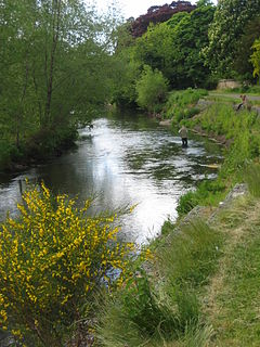
The River Esk, also called the Lothian Esk, is a river that flows through Midlothian and East Lothian, Scotland.
Edinburghshire was a Scottish county constituency of the House of Commons of the Parliament of Great Britain from 1708 to 1801 and of the Parliament of the United Kingdom from 1801 to 1918.

Gorebridge is a former mining village in Midlothian, Scotland.
Midlothian and Peebles Northern was a county constituency represented in the House of Commons of the Parliament of the United Kingdom from 1918 until 1950. Along with Peebles and Southern, it was formed by dividing the old Midlothian constituency.

Lasswade is a village and civil parish in Midlothian, Scotland, on the River North Esk, nine miles south of Edinburgh city centre, contiguous with Bonnyrigg and between Dalkeith to the east and Loanhead to the west. Melville Castle lies to the north east. The Gaelic form is Leas Bhaid, meaning the "clump at the fort."
Rosewell is a former mining village in Midlothian, Scotland, east of Roslin and south-west of Bonnyrigg. The village is in the civil parish of Lasswade and was previously a separate ecclesiastical parish, but has its own Community Council, namely Rosewell and District.

Lasswade High School is a non-denominational secondary state school in Bonnyrigg, Midlothian, Scotland.
Peebles and Southern Midlothian was a county constituency of the House of Commons of the Parliament of the United Kingdom (Westminster) from 1918 to 1950. It elected one Member of Parliament (MP) by the first past the post voting system.
David Johnstone Pryde was a Scottish Labour politician.
Lasswade Rugby Football Club is a rugby union club based in Bonnyrigg, Midlothian, Scotland. Established in 1921, the club plays at Hawthornden in Lasswade parish and competes in Scottish National League Division Three.
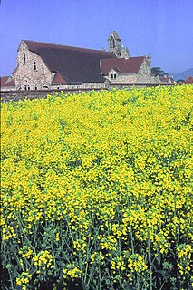
Lasswade and Rosewell Parish Church serves the communities of Lasswade, Poltonhall and Rosewell, Midlothian, Scotland. It is a congregation of the Church of Scotland.

Cockpen and Carrington Parish Church is located to the south of the town of Bonnyrigg in Midlothian, Scotland. It is a congregation of the Church of Scotland. The parish includes the south side of the town of Bonnyrigg, plus the rural area to the south of the town.
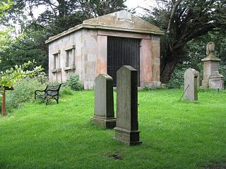
Old Pentland Cemetery is a cemetery in Old Pentland, near Loanhead in Midlothian, Scotland. A category B listed building, the cemetery dates back to the early 17th century.
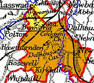
Cockpen is a parish in Midlothian, Scotland, containing at its north-west corner the town of Bonnyrigg, which lies two miles (3.2 km) south-west of Dalkeith. It is bounded on the west and north by the parish of Lasswade, on the east, by Newbattle and on the south by Carrington. It extends about three miles (4.8 km) from north to south and its greatest breadth is about 2+1⁄2 miles (4.0 km).
Glencorse is a parish of Midlothian, Scotland, lying 7 miles south of Edinburgh. It is bounded on the north-west by the former parish of Colinton now within the City of Edinburgh, to the north and west by Lasswade and to the south and west by Penicuik.
This page is based on this
Wikipedia article Text is available under the
CC BY-SA 4.0 license; additional terms may apply.
Images, videos and audio are available under their respective licenses.