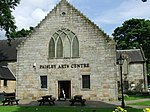
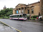
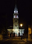
Name Location Date Listed Grid Ref. [note 1] Geo-coordinates Notes LB Number [note 2] Image Broomlands Street, Woodside Cemetery, Martyr's Monument (1 Of 2) 55°50′37″N 4°26′33″W / 55.843639°N 4.44255°W / 55.843639; -4.44255 (Broomlands Street, Woodside Cemetery, Martyr's Monument (1 Of 2) ) Category B 43485 Upload Photo New Street, Paisley Arts Centre (Former Low Church) 55°50′38″N 4°25′28″W / 55.843916°N 4.424452°W / 55.843916; -4.424452 (New Street, Paisley Arts Centre (Former Low Church) ) Category B 39059 Upload another image See more images
12 New Street 55°50′40″N 4°25′35″W / 55.844523°N 4.426455°W / 55.844523; -4.426455 (12 New Street ) Category B 39061 Upload another image
51-55 Oakshaw Street 55°50′44″N 4°25′52″W / 55.845634°N 4.431205°W / 55.845634; -4.431205 (51-55 Oakshaw Street ) Category C(S) 39073 Upload Photo 57 Oakshaw Street 55°50′44″N 4°25′54″W / 55.845538°N 4.431534°W / 55.845538; -4.431534 (57 Oakshaw Street ) Category B 39074 Upload Photo 6 Oakshaw Street Moran's Auction Rooms (Former Oakshaw East U.F. Church) 55°50′46″N 4°25′36″W / 55.846236°N 4.426642°W / 55.846236; -4.426642 (6 Oakshaw Street Moran's Auction Rooms (Former Oakshaw East U.F. Church) ) Category B 39075 Upload Photo 20 Oakshaw Street, Former Gaelic Church 55°50′47″N 4°25′44″W / 55.846518°N 4.428768°W / 55.846518; -4.428768 (20 Oakshaw Street, Former Gaelic Church ) Category B 39082 Upload Photo 62, 64 Oakshaw Street Former Cameronian Church 55°50′44″N 4°25′59″W / 55.845671°N 4.432965°W / 55.845671; -4.432965 (62, 64 Oakshaw Street Former Cameronian Church ) Category C(S) 39088 Upload Photo 66, 68 Oakshaw Street Former Manse 55°50′44″N 4°25′59″W / 55.845622°N 4.433169°W / 55.845622; -4.433169 (66, 68 Oakshaw Street Former Manse ) Category C(S) 39089 Upload Photo Orr Square Church Of Scotland 55°50′44″N 4°25′47″W / 55.84562°N 4.429654°W / 55.84562; -4.429654 (Orr Square Church Of Scotland ) Category B 39093 Upload Photo 86, 88 Renfrew Road 55°51′14″N 4°24′58″W / 55.853973°N 4.416227°W / 55.853973; -4.416227 (86, 88 Renfrew Road ) Category B 39096 Upload Photo 94 Renfrew Road 55°51′17″N 4°24′57″W / 55.854617°N 4.415947°W / 55.854617; -4.415947 (94 Renfrew Road ) Category B 39099 Upload Photo 6 St Mirren Street 55°50′42″N 4°25′25″W / 55.844938°N 4.423685°W / 55.844938; -4.423685 (6 St Mirren Street ) Category B 39107 Upload Photo 14 Shuttle Street 55°50′35″N 4°25′32″W / 55.843158°N 4.425523°W / 55.843158; -4.425523 (14 Shuttle Street ) Category C(S) 39113 Upload Photo Stanely Road, Moredun Lodge 55°49′51″N 4°26′13″W / 55.830806°N 4.436986°W / 55.830806; -4.436986 (Stanely Road, Moredun Lodge ) Category B 39120 Upload Photo Glasgow Road, Paisley Grammar School Including Boundary Walls And Gatepiers Including Janitor's Lodge 55°50′47″N 4°24′41″W / 55.846384°N 4.411394°W / 55.846384; -4.411394 (Glasgow Road, Paisley Grammar School Including Boundary Walls And Gatepiers Including Janitor's Lodge ) Category B 39129 Upload another image See more images
70-116 (Even Nos) And 55-101 (Odd Nos) Falside Road, Workmen's Cottages 55°49′46″N 4°25′48″W / 55.829473°N 4.429893°W / 55.829473; -4.429893 (70-116 (Even Nos) And 55-101 (Odd Nos) Falside Road, Workmen's Cottages ) Category B 39137 Upload Photo West End Cross, 2 Broomlands Street 55°50′39″N 4°26′15″W / 55.844242°N 4.437524°W / 55.844242; -4.437524 (West End Cross, 2 Broomlands Street ) Category B 39138 Upload Photo 11 Gauze Street Arnott's 55°50′45″N 4°25′15″W / 55.845883°N 4.420884°W / 55.845883; -4.420884 (11 Gauze Street Arnott's ) Category B 38981 Upload another image
10, 12 George Street 55°50′34″N 4°25′31″W / 55.842651°N 4.425252°W / 55.842651; -4.425252 (10, 12 George Street ) Category B 38990 Upload Photo 42 George Street, Paisley Technical College 55°50′35″N 4°25′50″W / 55.843078°N 4.430486°W / 55.843078; -4.430486 (42 George Street, Paisley Technical College ) Category B 38992 Upload Photo 7 Gilmour Street "Clydesdale Bank" 55°50′46″N 4°25′26″W / 55.846036°N 4.424025°W / 55.846036; -4.424025 (7 Gilmour Street "Clydesdale Bank" ) Category A 38994 Upload Photo 9 Gilmour Street 55°50′46″N 4°25′26″W / 55.846153°N 4.424017°W / 55.846153; -4.424017 (9 Gilmour Street ) Category B 38995 Upload Photo 3-19 (Odd) Glasgow Road, Garthland Place 55°50′50″N 4°24′54″W / 55.847301°N 4.415046°W / 55.847301; -4.415046 (3-19 (Odd) Glasgow Road, Garthland Place ) Category B 38998 Upload Photo Gordon Street, Former Fire Station 55°50′32″N 4°25′22″W / 55.842222°N 4.422829°W / 55.842222; -4.422829 (Gordon Street, Former Fire Station ) Category B 39006 Upload Photo Gordon Street / Johnston Street, St Matthew's Church Including Railings 55°50′33″N 4°25′19″W / 55.842449°N 4.421821°W / 55.842449; -4.421821 (Gordon Street / Johnston Street, St Matthew's Church Including Railings ) Category A 39007 Upload another image
Hawkhead Road, Hawkhead Hospital , Administration Block, Former Nurses Home, Wards 1-5, Boiler House And Mortuary, Laundry Block, Porter's Lodge, Waiting Room And Cottages 55°50′02″N 4°23′32″W / 55.834003°N 4.392278°W / 55.834003; -4.392278 (Hawkhead Road, Hawkhead Hospital, Administration Block, Former Nurses Home, Wards 1-5, Boiler House And Mortuary, Laundry Block, Porter's Lodge, Waiting Room And Cottages ) Category B 39010 Upload Photo 23 High Street, The Paisley Centre 55°50′43″N 4°25′31″W / 55.845167°N 4.425265°W / 55.845167; -4.425265 (23 High Street, The Paisley Centre ) Category B 39014 Upload another image
28 High Street 55°50′43″N 4°25′35″W / 55.845333°N 4.426426°W / 55.845333; -4.426426 (28 High Street ) Category B 39022 Upload another image
26 Hunterhill Road And Gate Piers 55°50′13″N 4°24′55″W / 55.836814°N 4.415385°W / 55.836814; -4.415385 (26 Hunterhill Road And Gate Piers ) Category B 39028 Upload Photo 46, 48 Love Street 55°51′02″N 4°25′34″W / 55.850436°N 4.426073°W / 55.850436; -4.426073 (46, 48 Love Street ) Category C(S) 39040 Upload Photo 53 Moss Street 55°50′52″N 4°25′35″W / 55.847911°N 4.42649°W / 55.847911; -4.42649 (53 Moss Street ) Category B 39053 Upload Photo Neilston Road St Luke's Church 55°50′15″N 4°25′30″W / 55.837625°N 4.424875°W / 55.837625; -4.424875 (Neilston Road St Luke's Church ) Category C(S) 39056 Upload Photo Abbey Close "Alexander Wilson" 55°50′44″N 4°25′17″W / 55.845587°N 4.421266°W / 55.845587; -4.421266 (Abbey Close "Alexander Wilson" ) Category B 38908 Upload another image See more images
Abbey Close, Paisley Abbey 55°50′42″N 4°25′13″W / 55.844951°N 4.420283°W / 55.844951; -4.420283 (Abbey Close, Paisley Abbey ) Category A 38910 Upload another image
Alice Street "Rosebank" 55°50′03″N 4°25′42″W / 55.83427°N 4.428196°W / 55.83427; -4.428196 (Alice Street "Rosebank" ) Category B 38913 Upload Photo Anchor Mills, Former Domestic Finishing Mill 55°50′31″N 4°25′06″W / 55.841904°N 4.418433°W / 55.841904; -4.418433 (Anchor Mills, Former Domestic Finishing Mill ) Category A 38915 Upload another image See more images
Anchor Mills, Mile End Mill 55°50′34″N 4°24′39″W / 55.842719°N 4.410784°W / 55.842719; -4.410784 (Anchor Mills, Mile End Mill ) Category A 38917 Upload another image See more images
5 Caledonia Street 55°50′56″N 4°25′50″W / 55.848782°N 4.430651°W / 55.848782; -4.430651 (5 Caledonia Street ) Category B 38931 Upload Photo Fountain At Angle Of Calside And Neilston Road 55°50′19″N 4°25′31″W / 55.838697°N 4.425197°W / 55.838697; -4.425197 (Fountain At Angle Of Calside And Neilston Road ) Category C(S) 38934 Upload Photo 43 Causeyside Street And 1 Johnston Street 55°50′33″N 4°25′26″W / 55.842608°N 4.423796°W / 55.842608; -4.423796 (43 Causeyside Street And 1 Johnston Street ) Category B 38940 Upload Photo 20 Donaldswood Road, Blacklands Lodge And Gatepiers 55°49′32″N 4°26′07″W / 55.825495°N 4.435153°W / 55.825495; -4.435153 (20 Donaldswood Road, Blacklands Lodge And Gatepiers ) Category B 38954 Upload Photo Dunn Square "Dunn Fountain" 55°50′43″N 4°25′23″W / 55.845183°N 4.423077°W / 55.845183; -4.423077 (Dunn Square "Dunn Fountain" ) Category B 38959 Upload Photo Ne Corner Of Falside Road And Braids Road, Brown And Polson Ltd 55°49′46″N 4°25′36″W / 55.829579°N 4.426801°W / 55.829579; -4.426801 (Ne Corner Of Falside Road And Braids Road, Brown And Polson Ltd ) Category B 38963 Upload another image See more images
Former Ferguslie Thread Works, Bridge Lane Gatehouse 55°50′21″N 4°26′43″W / 55.839217°N 4.445227°W / 55.839217; -4.445227 (Former Ferguslie Thread Works, Bridge Lane Gatehouse ) Category B 38964 Upload another image See more images
Former Ferguslie Thread Works, Tannahill's Bridge 55°50′20″N 4°26′34″W / 55.838842°N 4.44284°W / 55.838842; -4.44284 (Former Ferguslie Thread Works, Tannahill's Bridge ) Category C(S) 38968 Upload Photo 5-11 (Odd) Forbes Place 55°50′39″N 4°25′21″W / 55.844162°N 4.422471°W / 55.844162; -4.422471 (5-11 (Odd) Forbes Place ) Category B 38973 Upload Photo Nos 8, 10, 12 Forbes Place 55°50′38″N 4°25′21″W / 55.843926°N 4.422568°W / 55.843926; -4.422568 (Nos 8, 10, 12 Forbes Place ) Category B 38976 Upload Photo Gauze Street George A Clark Town Hall 55°50′42″N 4°25′19″W / 55.845125°N 4.42194°W / 55.845125; -4.42194 (Gauze Street George A Clark Town Hall ) Category A 38978 Upload another image
Leitchland Farm 55°49′32″N 4°28′53″W / 55.825629°N 4.481498°W / 55.825629; -4.481498 (Leitchland Farm ) Category C(S) 18829 Upload Photo Auchenlodment House 136 Auchenlodment Road Elderslie 55°49′36″N 4°29′40″W / 55.826562°N 4.494443°W / 55.826562; -4.494443 (Auchenlodment House 136 Auchenlodment Road Elderslie ) Category C(S) 18587 Upload Photo Incle Street, St Mirin's Roman Catholic Cathedral With Boundary Walls And Piers 55°50′51″N 4°25′00″W / 55.847441°N 4.416604°W / 55.847441; -4.416604 (Incle Street, St Mirin's Roman Catholic Cathedral With Boundary Walls And Piers ) Category B 46284 Upload another image See more images
Thornly Park, 17 South Avenue, Foxburn Including Boundary Walls And Gatepiers 55°49′32″N 4°24′58″W / 55.825446°N 4.416197°W / 55.825446; -4.416197 (Thornly Park, 17 South Avenue, Foxburn Including Boundary Walls And Gatepiers ) Category C(S) 48039 Upload Photo Thornly Park, 19 South Avenue, Arthurlie 55°49′32″N 4°24′56″W / 55.825605°N 4.415457°W / 55.825605; -4.415457 (Thornly Park, 19 South Avenue, Arthurlie ) Category C(S) 48040 Upload Photo Thornly Park, 10 Thornly Park Avenue, Glenarm Including Boundary Walls, Gatepiers And Gates 55°49′33″N 4°25′05″W / 55.825786°N 4.41815°W / 55.825786; -4.41815 (Thornly Park, 10 Thornly Park Avenue, Glenarm Including Boundary Walls, Gatepiers And Gates ) Category C(S) 48049 Upload Photo 215 Glasgow Road, Barshaw House 55°50′51″N 4°23′28″W / 55.847496°N 4.391238°W / 55.847496; -4.391238 (215 Glasgow Road, Barshaw House ) Category B 44766 Upload another image
22 New Street 55°50′38″N 4°25′32″W / 55.844018°N 4.425657°W / 55.844018; -4.425657 (22 New Street ) Category C(S) 39064 Upload Photo 10 Oakshaw Street 55°50′47″N 4°25′38″W / 55.846422°N 4.427244°W / 55.846422; -4.427244 (10 Oakshaw Street ) Category C(S) 39078 Upload Photo 12, 14 Oakshaw Street 55°50′47″N 4°25′39″W / 55.846514°N 4.427617°W / 55.846514; -4.427617 (12, 14 Oakshaw Street ) Category C(S) 39079 Upload Photo Underwood Road, Railway Viaduct 55°50′54″N 4°25′53″W / 55.848425°N 4.431427°W / 55.848425; -4.431427 (Underwood Road, Railway Viaduct ) Category B 39126 Upload Photo Park Road, Scotscraig 55°49′53″N 4°26′05″W / 55.831357°N 4.434609°W / 55.831357; -4.434609 (Park Road, Scotscraig ) Category B 39131 Upload Photo 4, 6 Gilmour Street 55°50′45″N 4°25′25″W / 55.845902°N 4.423538°W / 55.845902; -4.423538 (4, 6 Gilmour Street ) Category B 38996 Upload another image
1 Glasgow Road 55°50′50″N 4°24′58″W / 55.84711°N 4.41604°W / 55.84711; -4.41604 (1 Glasgow Road ) Category C(S) 38997 Upload Photo 83, Glasgow Road Arthur Allison Memorial Hall 55°50′49″N 4°24′18″W / 55.846921°N 4.405069°W / 55.846921; -4.405069 (83, Glasgow Road Arthur Allison Memorial Hall ) Category C(S) 39000 Upload another image
4 Glen Street 55°50′58″N 4°25′36″W / 55.849381°N 4.426678°W / 55.849381; -4.426678 (4 Glen Street ) Category C(S) 39004 Upload Photo 6, High Road, Castlehead 55°50′23″N 4°26′16″W / 55.839704°N 4.437895°W / 55.839704; -4.437895 (6, High Road, Castlehead ) Category B 39013 Upload Photo 39 High Street And 5 New Street, Ymca 55°50′42″N 4°25′35″W / 55.844894°N 4.426366°W / 55.844894; -4.426366 (39 High Street And 5 New Street, Ymca ) Category B 39015 Upload Photo 10, 10A And 12 High Street And 2 Moss Street 55°50′44″N 4°25′29″W / 55.845421°N 4.424706°W / 55.845421; -4.424706 (10, 10A And 12 High Street And 2 Moss Street ) Category B 39017 Upload Photo 18 High Street 55°50′43″N 4°25′32″W / 55.845379°N 4.425438°W / 55.845379; -4.425438 (18 High Street ) Category B 39018 Upload Photo 30 High Street 55°50′43″N 4°25′34″W / 55.845386°N 4.425998°W / 55.845386; -4.425998 (30 High Street ) Category B 39023 Upload another image
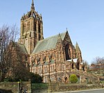
High Street, Coats Memorial Church 55°50′41″N 4°25′57″W / 55.844766°N 4.432381°W / 55.844766; -4.432381 (High Street, Coats Memorial Church ) Category A 39027 Upload another image
Inchinnan Road, Landmark Warehouse 55°51′18″N 4°25′37″W / 55.854939°N 4.426961°W / 55.854939; -4.426961 (Inchinnan Road, Landmark Warehouse ) Category B 39029 Upload Photo Nos 17-25 (Odd) Lady Lane 55°50′36″N 4°25′56″W / 55.843214°N 4.432236°W / 55.843214; -4.432236 (Nos 17-25 (Odd) Lady Lane ) Category B 39031 Upload another image See more images
Fountain Gardens Love Street Fountain 55°51′01″N 4°25′44″W / 55.850383°N 4.428769°W / 55.850383; -4.428769 (Fountain Gardens Love Street Fountain ) Category A 39035 Upload Photo 42, 44 Love Street 55°51′01″N 4°25′34″W / 55.85031°N 4.426097°W / 55.85031; -4.426097 (42, 44 Love Street ) Category C(S) 39039 Upload Photo 69-83 (Odd) Maxwellton Road 55°50′26″N 4°26′56″W / 55.840581°N 4.448939°W / 55.840581; -4.448939 (69-83 (Odd) Maxwellton Road ) Category B 39046 Upload Photo Moredun Road "Crosbie" 55°49′42″N 4°26′50″W / 55.828471°N 4.447299°W / 55.828471; -4.447299 (Moredun Road "Crosbie" ) Category A 39049 Upload Photo 1-5 (Odd) Moss Street 55°50′44″N 4°25′28″W / 55.845676°N 4.424546°W / 55.845676; -4.424546 (1-5 (Odd) Moss Street ) Category B 39050 Upload another image
6 Moss Street/1 The Cross 55°50′45″N 4°25′27″W / 55.845782°N 4.424169°W / 55.845782; -4.424169 (6 Moss Street/1 The Cross ) Category B 39054 Upload another image
Neilston Road, Royal Alexandra Infirmary 55°50′13″N 4°25′33″W / 55.836835°N 4.425736°W / 55.836835; -4.425736 (Neilston Road, Royal Alexandra Infirmary ) Category B 39057 Upload another image See more images
1-3 (Odd Nos) Causeyside Street And 21 Forbes Place 55°50′41″N 4°25′22″W / 55.844632°N 4.422756°W / 55.844632; -4.422756 (1-3 (Odd Nos) Causeyside Street And 21 Forbes Place ) 21 Forbes Place, Paisley.jpg 38937 Upload Photo Church Hill Former Middle Church Hall 55°50′44″N 4°25′38″W / 55.845552°N 4.427174°W / 55.845552; -4.427174 (Church Hill Former Middle Church Hall ) Category C(S) 38949 Upload Photo 1-5 (Odd) County Place, 15 Gilmour Street And 20 Moss Street 55°50′47″N 4°25′27″W / 55.846476°N 4.424069°W / 55.846476; -4.424069 (1-5 (Odd) County Place, 15 Gilmour Street And 20 Moss Street ) Category B 38951 Upload Photo Elderslie Kirk (West), 284 Main Road, Elderslie 55°50′09″N 4°29′29″W / 55.835963°N 4.491356°W / 55.835963; -4.491356 (Elderslie Kirk (West), 284 Main Road, Elderslie ) Category C(S) 19893 Upload Photo Ralston Golf Clubhouse, Strathmore Ave., Ralston, Paisley 55°50′40″N 4°22′59″W / 55.844492°N 4.383034°W / 55.844492; -4.383034 (Ralston Golf Clubhouse, Strathmore Ave., Ralston, Paisley ) Category C(S) 18585 Upload Photo Caplethill Road, Thorscrag Including Ancillary Structure 55°49′12″N 4°25′15″W / 55.819936°N 4.420789°W / 55.819936; -4.420789 (Caplethill Road, Thorscrag Including Ancillary Structure ) Category B 48036 Upload Photo Thornly Park, 43 Thornly Park Avenue, Airdoch Including Boundary Walls, Gatepiers And Gates 55°49′39″N 4°24′37″W / 55.827405°N 4.410283°W / 55.827405; -4.410283 (Thornly Park, 43 Thornly Park Avenue, Airdoch Including Boundary Walls, Gatepiers And Gates ) Category C(S) 48047 Upload Photo 19 Park Road, Makerston House, Including Outbuilding, Gatepiers And Walls To Street 55°49′51″N 4°25′56″W / 55.830705°N 4.432125°W / 55.830705; -4.432125 (19 Park Road, Makerston House, Including Outbuilding, Gatepiers And Walls To Street ) Category C(S) 49156 Upload Photo 15 And 17 Marshall's Lane And Cart Walk, Kelvin House 55°50′38″N 4°25′19″W / 55.84384°N 4.421892°W / 55.84384; -4.421892 (15 And 17 Marshall's Lane And Cart Walk, Kelvin House ) Category C(S) 50176 Upload Photo 21 Stonefield Avenue, Littlecroft 55°49′42″N 4°25′03″W / 55.828405°N 4.417499°W / 55.828405; -4.417499 (21 Stonefield Avenue, Littlecroft ) Category B 43891 Upload Photo 91, 93 New Sneddon Street "Adelphi House" 55°51′08″N 4°25′29″W / 55.852142°N 4.424789°W / 55.852142; -4.424789 (91, 93 New Sneddon Street "Adelphi House" ) Category B 39066 Upload Photo 19 Oakshaw Street, Paisley High Church Halls 55°50′47″N 4°25′44″W / 55.846261°N 4.429024°W / 55.846261; -4.429024 (19 Oakshaw Street, Paisley High Church Halls ) Category B 39070 Upload another image
35 Oakshaw Street 55°50′46″N 4°25′48″W / 55.846052°N 4.430049°W / 55.846052; -4.430049 (35 Oakshaw Street ) Category B 39071 Upload Photo 49 Oakshaw Street, Coats Observatory 55°50′44″N 4°25′52″W / 55.845692°N 4.430985°W / 55.845692; -4.430985 (49 Oakshaw Street, Coats Observatory ) Category A 39072 Upload Photo 6A Oakshaw Street (Former Church Hall) 55°50′46″N 4°25′36″W / 55.846236°N 4.426642°W / 55.846236; -4.426642 (6A Oakshaw Street (Former Church Hall) ) Category B 39076 Upload Photo 60 Oakshaw Street 55°50′45″N 4°25′57″W / 55.845733°N 4.432553°W / 55.845733; -4.432553 (60 Oakshaw Street ) Category B 39087 Upload Photo Queen Street Tannahill's Cottage 55°50′35″N 4°26′18″W / 55.843118°N 4.438412°W / 55.843118; -4.438412 (Queen Street Tannahill's Cottage ) Category B 39094 Upload another image
92 Renfrew Road 55°51′16″N 4°24′58″W / 55.854452°N 4.416097°W / 55.854452; -4.416097 (92 Renfrew Road ) Category B 39098 Upload Photo St James Street Procurator Fiscal's Office 55°50′55″N 4°25′37″W / 55.848641°N 4.426855°W / 55.848641; -4.426855 (St James Street Procurator Fiscal's Office ) Category B 39104 Upload Photo Stanely Road "Sanctuary House" 55°49′56″N 4°26′08″W / 55.8322°N 4.435604°W / 55.8322; -4.435604 (Stanely Road "Sanctuary House" ) Category B 39121 Upload Photo Abbeymill, Former Anchor Mills, Seedhill Footbridge And Gate 55°50′28″N 4°25′05″W / 55.841236°N 4.418136°W / 55.841236; -4.418136 (Abbeymill, Former Anchor Mills, Seedhill Footbridge And Gate ) Category B 39135 Upload Photo 11-17 (Odd Nos) George Place 55°50′35″N 4°25′34″W / 55.843068°N 4.425981°W / 55.843068; -4.425981 (11-17 (Odd Nos) George Place ) Category C(S) 38987 Upload Photo 6, 8 George Street 55°50′33″N 4°25′30″W / 55.842613°N 4.424882°W / 55.842613; -4.424882 (6, 8 George Street ) Category B 38989 Upload Photo 3 Gilmour Street "Bank Of Scotland" 55°50′45″N 4°25′26″W / 55.845822°N 4.42398°W / 55.845822; -4.42398 (3 Gilmour Street "Bank Of Scotland" ) Category B 38993 Upload another image
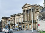
8 Glasgow Road 55°50′49″N 4°24′56″W / 55.846816°N 4.415463°W / 55.846816; -4.415463 (8 Glasgow Road ) Category C(S) 39002 Upload Photo High Street, Museum, Art Gallery And Library 55°50′43″N 4°25′49″W / 55.845274°N 4.430336°W / 55.845274; -4.430336 (High Street, Museum, Art Gallery And Library ) Category A 39025 Upload another image See more images
52 Love Street 55°51′02″N 4°25′33″W / 55.850672°N 4.42596°W / 55.850672; -4.42596 (52 Love Street ) Category B 39041 Upload Photo Broomlands Martyrs Church 55°50′39″N 4°26′19″W / 55.84405°N 4.438598°W / 55.84405; -4.438598 (Broomlands Martyrs Church ) Category B 38927 Upload Photo 18-22 (Evens) Causeyside 55°50′39″N 4°25′25″W / 55.844084°N 4.423648°W / 55.844084; -4.423648 (18-22 (Evens) Causeyside ) Category B 38945 Upload Photo Church Hill, Former Grammar School 55°50′45″N 4°25′39″W / 55.845938°N 4.42763°W / 55.845938; -4.42763 (Church Hill, Former Grammar School ) Category B 38947 Upload Photo Church Hill Christian Social Action Centre 55°50′45″N 4°25′38″W / 55.845746°N 4.427346°W / 55.845746; -4.427346 (Church Hill Christian Social Action Centre ) Category A 38948 Upload another image
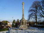
The Cross, War Memorial 55°50′44″N 4°25′27″W / 55.845613°N 4.424063°W / 55.845613; -4.424063 (The Cross, War Memorial ) Category A 38953 Upload another image
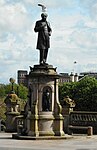
Dunn Square, Queen Victoria Monument 55°50′42″N 4°25′23″W / 55.844987°N 4.422985°W / 55.844987; -4.422985 (Dunn Square, Queen Victoria Monument ) Category B 38956 Upload Photo Dunn Square, "Sir Peter Coats" 55°50′43″N 4°25′24″W / 55.845296°N 4.42326°W / 55.845296; -4.42326 (Dunn Square, "Sir Peter Coats" ) Category B 38958 Upload another image
38 Ferguslie Former Stables And Gatepiers To Ferguslie Gardens 55°50′28″N 4°27′03″W / 55.841121°N 4.450714°W / 55.841121; -4.450714 (38 Ferguslie Former Stables And Gatepiers To Ferguslie Gardens ) Category B 38972 Upload Photo "West Lodge", (Of Former Ralston House,) 226 Glasgow Road, Ralston 55°50′45″N 4°23′11″W / 55.845836°N 4.386503°W / 55.845836; -4.386503 ("West Lodge", (Of Former Ralston House,) 226 Glasgow Road, Ralston ) Category B 18584 Upload Photo The Wallace Monument, At No. 243 Main Road, Elderslie 55°50′08″N 4°29′20″W / 55.835436°N 4.489006°W / 55.835436; -4.489006 (The Wallace Monument, At No. 243 Main Road, Elderslie ) Category B 18586 Upload another image
East Buchanan Street, Cathedral House And St Mirin's Old Academy 55°50′52″N 4°25′03″W / 55.84765°N 4.417368°W / 55.84765; -4.417368 (East Buchanan Street, Cathedral House And St Mirin's Old Academy ) Category C(S) 46283 Upload another image
50 High Street And 1 Orr Square 55°50′43″N 4°25′43″W / 55.845171°N 4.428716°W / 55.845171; -4.428716 (50 High Street And 1 Orr Square ) Category C(S) 50175 Upload Photo Penilee Road, Paisley Grammar School, Penilee Sports Pavilion 55°50′56″N 4°22′44″W / 55.848868°N 4.378877°W / 55.848868; -4.378877 (Penilee Road, Paisley Grammar School, Penilee Sports Pavilion ) Category A 43679 Upload Photo North Croft Street, Wallneuk Church 55°50′55″N 4°25′15″W / 55.848508°N 4.420808°W / 55.848508; -4.420808 (North Croft Street, Wallneuk Church ) Category B 39068 Upload Photo 16 Oakshaw Street 55°50′47″N 4°25′41″W / 55.846506°N 4.428°W / 55.846506; -4.428 (16 Oakshaw Street ) Category C(S) 39080 Upload Photo 6 Orr Square 55°50′43″N 4°25′43″W / 55.845354°N 4.42852°W / 55.845354; -4.42852 (6 Orr Square ) Category B 39091 Upload Photo 90 Renfrew Road 55°51′15″N 4°24′58″W / 55.854235°N 4.416195°W / 55.854235; -4.416195 (90 Renfrew Road ) Category B 39097 Upload Photo St James Street Sheriff Court House 55°50′55″N 4°25′37″W / 55.848641°N 4.426855°W / 55.848641; -4.426855 (St James Street Sheriff Court House ) Category A 39103 Upload another image
10 St Mirren Street 55°50′41″N 4°25′25″W / 55.844744°N 4.423497°W / 55.844744; -4.423497 (10 St Mirren Street ) Category C(S) 39109 Upload Photo School Wynd St John's Church (C Of S) 55°50′46″N 4°25′32″W / 55.846015°N 4.425542°W / 55.846015; -4.425542 (School Wynd St John's Church (C Of S) ) Category B 39112 Upload another image
6, 8 Smithhills Street 55°50′47″N 4°25′17″W / 55.846257°N 4.421515°W / 55.846257; -4.421515 (6, 8 Smithhills Street ) Category B 39114 Upload Photo Stevenson Street, "Spiersfield" (Excluding Modern Extensions) 55°50′20″N 4°25′45″W / 55.838869°N 4.429233°W / 55.838869; -4.429233 (Stevenson Street, "Spiersfield" (Excluding Modern Extensions) ) Category B 39115 Upload Photo Stanely Reservoir Stanely Castle 55°49′24″N 4°27′14″W / 55.823376°N 4.45402°W / 55.823376; -4.45402 (Stanely Reservoir Stanely Castle ) Category B 39116 Upload Photo Station Road Former Stable Block, And Gatepiers Ferguslie Mills 55°50′28″N 4°27′03″W / 55.841121°N 4.450714°W / 55.841121; -4.450714 (Station Road Former Stable Block, And Gatepiers Ferguslie Mills ) Category C(S) 39123 Upload Photo Glasgow Road Sherwood Church 55°50′50″N 4°24′36″W / 55.847184°N 4.409974°W / 55.847184; -4.409974 (Glasgow Road Sherwood Church ) Category B 38999 Upload Photo Hawkhead House Farm Steading Excluding Later Additions 55°49′49″N 4°23′08″W / 55.830259°N 4.385628°W / 55.830259; -4.385628 (Hawkhead House Farm Steading Excluding Later Additions ) Category B 39009 Upload Photo Hawkhead Road, Hawkhead Hospital , Wards 7 And 8 55°50′04″N 4°23′29″W / 55.834415°N 4.391441°W / 55.834415; -4.391441 (Hawkhead Road, Hawkhead Hospital, Wards 7 And 8 ) Category A 39011 Upload Photo Hawkhead Road, Ross House 55°50′00″N 4°23′38″W / 55.833265°N 4.39375°W / 55.833265; -4.39375 (Hawkhead Road, Ross House ) Category B 39012 Upload Photo 20 High Street Masonic Hall 55°50′44″N 4°25′32″W / 55.845438°N 4.425649°W / 55.845438; -4.425649 (20 High Street Masonic Hall ) Category B 39019 Upload Photo 24 High Street 55°50′43″N 4°25′34″W / 55.845386°N 4.425998°W / 55.845386; -4.425998 (24 High Street ) Category B 39020 Upload another image
76 High Street Territorial Army Centre 55°50′41″N 4°25′54″W / 55.844854°N 4.43154°W / 55.844854; -4.43154 (76 High Street Territorial Army Centre ) Category B 39026 Upload Photo Lonend, Watermill Hotel 55°50′33″N 4°25′10″W / 55.842586°N 4.419434°W / 55.842586; -4.419434 (Lonend, Watermill Hotel ) Category C(S) 39032 Upload Photo Fountain Gardens, Love Street: Burns Statue 55°51′02″N 4°25′43″W / 55.850512°N 4.428586°W / 55.850512; -4.428586 (Fountain Gardens, Love Street: Burns Statue ) Category B 39036 Upload another image See more images
Abbey Bridge 55°50′38″N 4°25′15″W / 55.843765°N 4.420705°W / 55.843765; -4.420705 (Abbey Bridge ) Category B 38907 Upload Photo Abbey Close "Robert Tannahill" 55°50′43″N 4°25′16″W / 55.845383°N 4.421141°W / 55.845383; -4.421141 (Abbey Close "Robert Tannahill" ) Category B 38909 Upload another image
Off Barrhead Road Blackhall Manor House 55°50′16″N 4°24′41″W / 55.837675°N 4.411366°W / 55.837675; -4.411366 (Off Barrhead Road Blackhall Manor House ) Category B 38922 Upload Photo Blackstoun Road Former Glencoats Hospital East Lodge Including Gatepiers And Railings 55°50′50″N 4°26′53″W / 55.847151°N 4.448074°W / 55.847151; -4.448074 (Blackstoun Road Former Glencoats Hospital East Lodge Including Gatepiers And Railings ) Category B 38925 Upload Photo Park Road, St Margaret's (Former Hospital) 55°50′02″N 4°25′53″W / 55.833891°N 4.431446°W / 55.833891; -4.431446 (Park Road, St Margaret's (Former Hospital) ) Category B 38933 Upload Photo 45-47 (Odd Nos) Causeyside Street And Johnston Street 55°50′32″N 4°25′26″W / 55.842219°N 4.423899°W / 55.842219; -4.423899 (45-47 (Odd Nos) Causeyside Street And Johnston Street ) Category B 38941 Upload Photo Causeyside Street, Russell Institute 55°50′37″N 4°25′26″W / 55.843476°N 4.423962°W / 55.843476; -4.423962 (Causeyside Street, Russell Institute ) Category A 38944 Upload another image See more images
Dunn Square, "Thomas Coats" 55°50′43″N 4°25′23″W / 55.845328°N 4.423023°W / 55.845328; -4.423023 (Dunn Square, "Thomas Coats" ) Category B 38957 Upload Photo 13-15 (Odd) Forbes Place 55°50′39″N 4°25′20″W / 55.844192°N 4.422281°W / 55.844192; -4.422281 (13-15 (Odd) Forbes Place ) Renfrewshire - 13-15 Forbes Place, Paisley - 20240825102553.jpg 38974 Upload Photo Thornly Park, 9 South Avenue, Holmhurst Including Terrace Wall 55°49′31″N 4°25′04″W / 55.825197°N 4.41789°W / 55.825197; -4.41789 (Thornly Park, 9 South Avenue, Holmhurst Including Terrace Wall ) Category B 48037 Upload Photo Thornly Park, 29 Thornly Park Avenue, Lismore Including Arch And Gatepeirs 55°49′37″N 4°24′50″W / 55.827076°N 4.413776°W / 55.827076; -4.413776 (Thornly Park, 29 Thornly Park Avenue, Lismore Including Arch And Gatepeirs ) Category C(S) 48044 Upload Photo Thornly Park, 33 Thornly Park Avenue Including Boundary Walls, Gatepiers And Gates 55°49′38″N 4°24′47″W / 55.827163°N 4.412983°W / 55.827163; -4.412983 (Thornly Park, 33 Thornly Park Avenue Including Boundary Walls, Gatepiers And Gates ) Category C(S) 48046 Upload Photo 6 And 8 High Street, Burton's 55°50′44″N 4°25′24″W / 55.84567°N 4.423459°W / 55.84567; -4.423459 (6 And 8 High Street, Burton's ) Category B 50162 Upload another image
Blackhall Lane, Blackhall House 55°50′26″N 4°24′56″W / 55.840578°N 4.415491°W / 55.840578; -4.415491 (Blackhall Lane, Blackhall House ) Category C(S) 50498 Upload Photo Renfrew Road, Abercorn School, Including Entrance Steps And Railings 55°51′14″N 4°25′07″W / 55.853845°N 4.418616°W / 55.853845; -4.418616 (Renfrew Road, Abercorn School, Including Entrance Steps And Railings ) Category C(S) 45579 Upload another image See more images
4 Sandholes Street 55°50′40″N 4°26′15″W / 55.844392°N 4.437629°W / 55.844392; -4.437629 (4 Sandholes Street ) Category C(S) 43486 Upload Photo 7 New Street The Bull Inn 55°50′41″N 4°25′34″W / 55.844701°N 4.426115°W / 55.844701; -4.426115 (7 New Street The Bull Inn ) Category A 39058 Upload Photo 38, 40 Oakshaw Street 55°50′46″N 4°25′51″W / 55.84618°N 4.43084°W / 55.84618; -4.43084 (38, 40 Oakshaw Street ) Category C(S) 39083 Upload Photo 7, 9 Orr Square 55°50′45″N 4°25′44″W / 55.845713°N 4.429005°W / 55.845713; -4.429005 (7, 9 Orr Square ) Category B 39092 Upload Photo 15 School Wynd 55°50′44″N 4°25′34″W / 55.845665°N 4.425999°W / 55.845665; -4.425999 (15 School Wynd ) Category B 39111 Upload Photo Storie Street Paisley College Of Technology, Hugh Smiley Annexe Formerly Hugh Smiley Day Nursery 55°50′39″N 4°25′42″W / 55.844064°N 4.428343°W / 55.844064; -4.428343 (Storie Street Paisley College Of Technology, Hugh Smiley Annexe Formerly Hugh Smiley Day Nursery ) Category B 39124 Upload Photo Underwood Road St James Church 55°50′55″N 4°26′01″W / 55.848742°N 4.433588°W / 55.848742; -4.433588 (Underwood Road St James Church ) Category B 39125 Upload Photo Walker Street Former Baptist Church 55°50′37″N 4°26′08″W / 55.843542°N 4.435659°W / 55.843542; -4.435659 (Walker Street Former Baptist Church ) Category C(S) 39127 Upload Photo Greenhill Road, Four Square Tobacco Factory 55°51′15″N 4°26′34″W / 55.854058°N 4.442868°W / 55.854058; -4.442868 (Greenhill Road, Four Square Tobacco Factory ) Category B 39130 Upload Photo Cyril Street, Violet Street, Ralston Uf Church 55°50′40″N 4°24′32″W / 55.844456°N 4.408831°W / 55.844456; -4.408831 (Cyril Street, Violet Street, Ralston Uf Church ) Category B 39139 Upload Photo 3-9 (Odd) Gauze Street Methodist Central Halls And Shops To Ground 55°50′46″N 4°25′17″W / 55.845973°N 4.421305°W / 55.845973; -4.421305 (3-9 (Odd) Gauze Street Methodist Central Halls And Shops To Ground ) Category B 38980 Upload another image
5 George Place 55°50′35″N 4°25′35″W / 55.842961°N 4.426374°W / 55.842961; -4.426374 (5 George Place ) Category B 38986 Upload Photo Glasgow Road Barshaw Park Gatepiers And Gates 55°50′48″N 4°23′44″W / 55.846611°N 4.395641°W / 55.846611; -4.395641 (Glasgow Road Barshaw Park Gatepiers And Gates ) Category C(S) 39001 Upload Photo 7-9 (Odd) King Street And Sandholes Street "Hayweighs" 55°50′39″N 4°26′21″W / 55.844135°N 4.439274°W / 55.844135; -4.439274 (7-9 (Odd) King Street And Sandholes Street "Hayweighs" ) Category B 39030 Upload Photo 30 Mansion House Road, Greenlaw House 55°50′57″N 4°24′40″W / 55.849223°N 4.410979°W / 55.849223; -4.410979 (30 Mansion House Road, Greenlaw House ) Category B 39044 Upload Photo Acer Crescent Balgonie 55°49′44″N 4°27′07″W / 55.828972°N 4.451962°W / 55.828972; -4.451962 (Acer Crescent Balgonie ) Category B 38912 Upload Photo Mile End Mill Chimney Stack 55°50′32″N 4°24′39″W / 55.842306°N 4.41079°W / 55.842306; -4.41079 (Mile End Mill Chimney Stack ) Category B 38918 Upload Photo Ardgowan Avenue Hunterhill House 55°50′16″N 4°25′05″W / 55.837716°N 4.417981°W / 55.837716; -4.417981 (Ardgowan Avenue Hunterhill House ) Category B 38919 Upload Photo 20, 22 Back Sneddon Street And 13 Maxwell Street 55°50′54″N 4°25′30″W / 55.848444°N 4.42499°W / 55.848444; -4.42499 (20, 22 Back Sneddon Street And 13 Maxwell Street ) Category B 38921 Upload Photo Broomlands Street, Woodside Cemetery, Martyrs Memorial 55°50′37″N 4°26′33″W / 55.843639°N 4.44255°W / 55.843639; -4.44255 (Broomlands Street, Woodside Cemetery, Martyrs Memorial ) Category C(S) 38928 Upload Photo 46 Broomlands Street, Woodside Crematorium 55°50′40″N 4°26′46″W / 55.844475°N 4.446133°W / 55.844475; -4.446133 (46 Broomlands Street, Woodside Crematorium ) Category B 38929 Upload Photo 7 Caledonia Street 55°50′56″N 4°25′50″W / 55.848908°N 4.430643°W / 55.848908; -4.430643 (7 Caledonia Street ) Category C(S) 38932 Upload Photo 25-29 (Odd) Causeyside And 2 Forbes Place Paisley Co-Op 55°50′38″N 4°25′23″W / 55.843807°N 4.42312°W / 55.843807; -4.42312 (25-29 (Odd) Causeyside And 2 Forbes Place Paisley Co-Op ) Category B 38938 Upload another image
4 Dyers Wynd, Good Templar Halls And Terrace Buildings 55°50′45″N 4°25′23″W / 55.845765°N 4.423178°W / 55.845765; -4.423178 (4 Dyers Wynd, Good Templar Halls And Terrace Buildings ) Category B 38960 Upload Photo Dykebar Hospital Excluding Modern Additions 55°49′26″N 4°23′52″W / 55.824003°N 4.397667°W / 55.824003; -4.397667 (Dykebar Hospital Excluding Modern Additions ) Category B 38961 Upload another image
Former Ferguslie Thread Works, Counting House 55°50′23″N 4°26′55″W / 55.83961°N 4.448542°W / 55.83961; -4.448542 (Former Ferguslie Thread Works, Counting House ) Category B 38965 Upload another image
Thornly Park, 23 South Avenue, The Gables 55°49′33″N 4°24′53″W / 55.825762°N 4.41478°W / 55.825762; -4.41478 (Thornly Park, 23 South Avenue, The Gables ) Category B 48041 Upload Photo Thornly Park, 12 And 12A Thornly Park Avenue, Thorncroft Including Boundary Walls And Gatepiers 55°49′33″N 4°25′03″W / 55.825869°N 4.417549°W / 55.825869; -4.417549 (Thornly Park, 12 And 12A Thornly Park Avenue, Thorncroft Including Boundary Walls And Gatepiers ) Category B 48050 Upload Photo Thornly Park 22 Thornly Park Avenue, Monimail Including Boundary Walls And Gatepiers 55°49′35″N 4°24′54″W / 55.826331°N 4.415071°W / 55.826331; -4.415071 (Thornly Park 22 Thornly Park Avenue, Monimail Including Boundary Walls And Gatepiers ) Category C(S) 48051 Upload Photo 5 And 7 West Paisley Brae, Paisley 55°50′41″N 4°26′06″W / 55.844815°N 4.434876°W / 55.844815; -4.434876 (5 And 7 West Paisley Brae, Paisley ) Category B 49026 Upload Photo Manor Park Avenue, Newark House 55°49′41″N 4°26′45″W / 55.828142°N 4.445778°W / 55.828142; -4.445778 (Manor Park Avenue, Newark House ) Category B 49300 Upload Photo 96 Causeyside Street 55°50′22″N 4°25′31″W / 55.83948°N 4.42515°W / 55.83948; -4.42515 (96 Causeyside Street ) Category B 43735 Upload Photo Glenpatrick Road, Elderslie, East Church 55°50′12″N 4°28′49″W / 55.836782°N 4.480228°W / 55.836782; -4.480228 (Glenpatrick Road, Elderslie, East Church ) Category C(S) 43480 Upload Photo 58 Stock Street And Espedair Street, Monty's Snooker Hall (Former Bath House) 55°50′06″N 4°25′19″W / 55.835088°N 4.421826°W / 55.835088; -4.421826 (58 Stock Street And Espedair Street, Monty's Snooker Hall (Former Bath House) ) Category B 43487 Upload Photo 26 New Street, Conservative Club 55°50′38″N 4°25′31″W / 55.843853°N 4.425343°W / 55.843853; -4.425343 (26 New Street, Conservative Club ) Category B 39065 Upload Photo 40 New Sneddon Street 55°51′00″N 4°25′24″W / 55.85003°N 4.423411°W / 55.85003; -4.423411 (40 New Sneddon Street ) Category B 39067 Upload Photo Oakshawhead Former John Neilson Institution And Entrance Lodge 55°50′43″N 4°26′03″W / 55.845353°N 4.434031°W / 55.845353; -4.434031 (Oakshawhead Former John Neilson Institution And Entrance Lodge ) Category A 39069 Upload another image See more images
18 Oakshaw Street 55°50′47″N 4°25′42″W / 55.846464°N 4.428333°W / 55.846464; -4.428333 (18 Oakshaw Street ) Category C(S) 39081 Upload Photo 42, 44 Oakshaw Street 55°50′46″N 4°25′52″W / 55.845979°N 4.431019°W / 55.845979; -4.431019 (42, 44 Oakshaw Street ) Category B 39084 Upload Photo 56 Oakshaw Street, Peter Brough District Nurses' Home 55°50′45″N 4°25′55″W / 55.845779°N 4.432045°W / 55.845779; -4.432045 (56 Oakshaw Street, Peter Brough District Nurses' Home ) Category B 39086 Upload Photo 72, 74 Oakshaw 55°50′45″N 4°26′02″W / 55.845789°N 4.433819°W / 55.845789; -4.433819 (72, 74 Oakshaw ) Category C(S) 39090 Upload Photo 121 Renfrew Road 55°51′26″N 4°24′57″W / 55.85718°N 4.415851°W / 55.85718; -4.415851 (121 Renfrew Road ) Category B 39095 Upload Photo 13 School Wynd, Oakshaw 55°50′44″N 4°25′33″W / 55.84567°N 4.42576°W / 55.84567; -4.42576 (13 School Wynd, Oakshaw ) Category C(S) 39110 Upload Photo Stanely Road "Middle Park" 55°49′55″N 4°26′03″W / 55.832013°N 4.434139°W / 55.832013; -4.434139 (Stanely Road "Middle Park" ) Category C(S) 39118 Upload Photo Stanely Road "Moredun" 55°49′50″N 4°26′26″W / 55.830655°N 4.440554°W / 55.830655; -4.440554 (Stanely Road "Moredun" ) Category B 39119 Upload Photo Anchor Buildings, Seedhill With Railings 55°50′33″N 4°25′02″W / 55.842402°N 4.417346°W / 55.842402; -4.417346 (Anchor Buildings, Seedhill With Railings ) Category B 39132 Upload Photo 25 Gauze Street 55°50′47″N 4°25′09″W / 55.846276°N 4.419184°W / 55.846276; -4.419184 (25 Gauze Street ) Category B 38983 Upload Photo 27 Gauze Street 55°50′47″N 4°25′08″W / 55.846253°N 4.418959°W / 55.846253; -4.418959 (27 Gauze Street ) Category C(S) 38984 Upload Photo 29-31 (Odd) Gauze Street 55°50′47″N 4°25′07″W / 55.84633°N 4.418692°W / 55.84633; -4.418692 (29-31 (Odd) Gauze Street ) Category B 38985 Upload Photo 14 George Street St George's Church Of Scotland 55°50′34″N 4°25′33″W / 55.842713°N 4.425735°W / 55.842713; -4.425735 (14 George Street St George's Church Of Scotland ) Category B 38991 Upload another image See more images
10, 12 Glasgow Road 55°50′48″N 4°24′54″W / 55.846798°N 4.41503°W / 55.846798; -4.41503 (10, 12 Glasgow Road ) Category B 39003 Upload Photo Gleniffer Road Macdonald's Fountain 55°48′55″N 4°27′49″W / 55.8154°N 4.463623°W / 55.8154; -4.463623 (Gleniffer Road Macdonald's Fountain ) Category B 39005 Upload Photo Lounsdale Road Ciba-Geigy Social Club 55°50′21″N 4°26′32″W / 55.839234°N 4.44213°W / 55.839234; -4.44213 (Lounsdale Road Ciba-Geigy Social Club ) Category B 39033 Upload Photo 7 Moss Street 55°50′45″N 4°25′29″W / 55.845844°N 4.424684°W / 55.845844; -4.424684 (7 Moss Street ) Category B 39051 Upload Photo 49, 51 Moss Street 55°50′52″N 4°25′35″W / 55.847732°N 4.426447°W / 55.847732; -4.426447 (49, 51 Moss Street ) Category B 39052 Upload Photo 28 Arkleston Road 55°50′55″N 4°24′01″W / 55.848622°N 4.400334°W / 55.848622; -4.400334 (28 Arkleston Road ) Category C(S) 38920 Upload Photo 51 Causeyside Street 55°50′31″N 4°25′26″W / 55.841939°N 4.423962°W / 55.841939; -4.423962 (51 Causeyside Street ) Category B 38943 Upload Photo Dunn Square 55°50′42″N 4°25′23″W / 55.845112°N 4.423041°W / 55.845112; -4.423041 (Dunn Square ) Category B 38955 Upload another image See more images
15-19 (Odd) Espedair Street 55°50′18″N 4°25′24″W / 55.838435°N 4.42344°W / 55.838435; -4.42344 (15-19 (Odd) Espedair Street ) Category B 38962 Upload Photo Ferguslie Threadworks, Stables And Store On Glasgow, Paisley And Johnstone Canal 55°50′24″N 4°26′59″W / 55.840043°N 4.449816°W / 55.840043; -4.449816 (Ferguslie Threadworks, Stables And Store On Glasgow, Paisley And Johnstone Canal ) Category C(S) 38970 Upload Photo Thornly Park, 17 Thornly Park Avenue, Dunard Including Boundary Walls And Gatepiers 55°49′36″N 4°25′01″W / 55.826571°N 4.41705°W / 55.826571; -4.41705 (Thornly Park, 17 Thornly Park Avenue, Dunard Including Boundary Walls And Gatepiers ) Category B 48043 Upload Photo Thornly Park, 2 Thornly Park Avenue, Thornly Park House 55°49′31″N 4°25′13″W / 55.825286°N 4.420259°W / 55.825286; -4.420259 (Thornly Park, 2 Thornly Park Avenue, Thornly Park House ) Category C(S) 48048 Upload Photo Thornly Park, 24 Thornly Park Avenue, Garail Including Ancillary Structure, Garden Wall And Gate 55°49′35″N 4°24′53″W / 55.826392°N 4.414707°W / 55.826392; -4.414707 (Thornly Park, 24 Thornly Park Avenue, Garail Including Ancillary Structure, Garden Wall And Gate ) Category C(S) 48052 Upload Photo 17 George Street, New Jerusalem Church (Swedenborgian Church) 55°50′33″N 4°25′39″W / 55.842381°N 4.427551°W / 55.842381; -4.427551 (17 George Street, New Jerusalem Church (Swedenborgian Church) ) Category C(S) 50177 Upload Photo Aqueduct, Blackhall 55°50′24″N 4°24′23″W / 55.839954°N 4.406492°W / 55.839954; -4.406492 (Aqueduct, Blackhall ) Category B 44021 Upload Photo 25-31 (Odd Nos) Weighhouse Close, New Street 55°50′39″N 4°25′36″W / 55.844071°N 4.426587°W / 55.844071; -4.426587 (25-31 (Odd Nos) Weighhouse Close, New Street ) Category B 39062 Upload Photo 20 New Street 55°50′39″N 4°25′33″W / 55.84404°N 4.425882°W / 55.84404; -4.425882 (20 New Street ) Category B 39063 Upload another image
8 Oakshaw Street 55°50′47″N 4°25′38″W / 55.846415°N 4.427148°W / 55.846415; -4.427148 (8 Oakshaw Street ) Category C(S) 39077 Upload Photo Gateway To No 46 Oakshaw Street 55°50′45″N 4°25′53″W / 55.845901°N 4.431317°W / 55.845901; -4.431317 (Gateway To No 46 Oakshaw Street ) Category C(S) 39085 Upload Photo 98-100 Renfrew Road 55°51′18″N 4°24′57″W / 55.854959°N 4.415936°W / 55.854959; -4.415936 (98-100 Renfrew Road ) Category B 39101 Upload Photo 4 St Mirren Street 55°50′42″N 4°25′26″W / 55.845089°N 4.423774°W / 55.845089; -4.423774 (4 St Mirren Street ) Category B 39106 Upload Photo 8 St Mirren Street 55°50′42″N 4°25′25″W / 55.844868°N 4.423585°W / 55.844868; -4.423585 (8 St Mirren Street ) Category B 39108 Upload Photo 82 Stanely Road "Whiteleigh" 55°49′44″N 4°26′31″W / 55.828774°N 4.442001°W / 55.828774; -4.442001 (82 Stanely Road "Whiteleigh" ) Category B 39122 Upload Photo 68 Falside Road, Formerly Brown And Polson Worker`S Institute 55°49′46″N 4°25′41″W / 55.829488°N 4.428185°W / 55.829488; -4.428185 (68 Falside Road, Formerly Brown And Polson Worker`S Institute ) Category B 39136 Upload Photo 23 Gauze Street 55°50′46″N 4°25′09″W / 55.846175°N 4.419273°W / 55.846175; -4.419273 (23 Gauze Street ) Category C(S) 38982 Upload Photo 26 High Street 55°50′43″N 4°25′34″W / 55.845364°N 4.426204°W / 55.845364; -4.426204 (26 High Street ) Category B 39021 Upload another image
Love Street, Lodges To Fountain Gardens 55°51′02″N 4°25′35″W / 55.850482°N 4.426475°W / 55.850482; -4.426475 (Love Street, Lodges To Fountain Gardens ) Category C(S) 39034 Upload Photo 32 Love Street 55°51′00″N 4°25′34″W / 55.849879°N 4.42607°W / 55.849879; -4.42607 (32 Love Street ) Category B 39037 Upload Photo 34, 36 (Evens) Love Street 55°51′00″N 4°25′34″W / 55.84996°N 4.426043°W / 55.84996; -4.426043 (34, 36 (Evens) Love Street ) Category C(S) 39038 Upload Photo 14 Main Road Castlehead "The Old House" 55°50′20″N 4°26′08″W / 55.838853°N 4.435509°W / 55.838853; -4.435509 (14 Main Road Castlehead "The Old House" ) Category B 39043 Upload another image
8-10 Moss Street 55°50′45″N 4°25′27″W / 55.845878°N 4.424287°W / 55.845878; -4.424287 (8-10 Moss Street ) Category C(S) 39055 Upload Photo Blackhall Railway Viaduct Over White Cart Water 55°50′24″N 4°24′23″W / 55.839954°N 4.406492°W / 55.839954; -4.406492 (Blackhall Railway Viaduct Over White Cart Water ) Category A 38923 Upload Photo Brediland Road Lounsdale House 55°49′38″N 4°27′31″W / 55.827335°N 4.458741°W / 55.827335; -4.458741 (Brediland Road Lounsdale House ) Category B 38926 Upload Photo 8-10 Broomlands Street 55°50′39″N 4°26′18″W / 55.844029°N 4.438261°W / 55.844029; -4.438261 (8-10 Broomlands Street ) Category B 38930 Upload Photo Castlehead, Main Road, Castlehead Church, Tannahill's Monument 55°50′30″N 4°26′12″W / 55.841724°N 4.436663°W / 55.841724; -4.436663 (Castlehead, Main Road, Castlehead Church, Tannahill's Monument ) Category B 38936 Upload another image See more images
Nos 14-20 (Even) Forbes Place 55°50′38″N 4°25′19″W / 55.843976°N 4.421852°W / 55.843976; -4.421852 (Nos 14-20 (Even) Forbes Place ) Category B 38977 Upload Photo Gauze Street George A Clark Statue 55°50′44″N 4°25′18″W / 55.845535°N 4.42163°W / 55.845535; -4.42163 (Gauze Street George A Clark Statue ) Category B 38979 Upload another image
"East Lodge", Darvel Crescent, Ralston, Paisley 55°50′46″N 4°22′37″W / 55.846092°N 4.376998°W / 55.846092; -4.376998 ("East Lodge", Darvel Crescent, Ralston, Paisley ) Category C(S) 18583 Upload Photo Leethland Glenpatrick Road 55°49′29″N 4°28′50″W / 55.824596°N 4.480554°W / 55.824596; -4.480554 (Leethland Glenpatrick Road ) Category C(S) 18588 Upload Photo Thornly Park, Stewart Road, Linton Including Terrace Wall 55°49′30″N 4°25′06″W / 55.825127°N 4.418285°W / 55.825127; -4.418285 (Thornly Park, Stewart Road, Linton Including Terrace Wall ) Category B 48042 Upload Photo 19 Lawn Street, Abbey Mission Hall 55°50′49″N 4°25′11″W / 55.846877°N 4.419652°W / 55.846877; -4.419652 (19 Lawn Street, Abbey Mission Hall ) Category C(S) 50161 Upload Photo 5 Mansionhouse Road 55°50′52″N 4°24′41″W / 55.847821°N 4.411435°W / 55.847821; -4.411435 (5 Mansionhouse Road ) Category C(S) 50163 Upload Photo 15 Abercorn Street, Former Oldfield's Machine Tools Warehouse 55°50′55″N 4°25′19″W / 55.848576°N 4.421963°W / 55.848576; -4.421963 (15 Abercorn Street, Former Oldfield's Machine Tools Warehouse ) Category C(S) 50168 Upload Photo Hawkhead House Farm, Farmhouse 55°49′47″N 4°23′06″W / 55.829757°N 4.385055°W / 55.829757; -4.385055 (Hawkhead House Farm, Farmhouse ) Category C(S) 43890 Upload Photo Cartside Mill Office Block, Milliken Park, Kilbarchan 55°49′48″N 4°31′54″W / 55.830071°N 4.531668°W / 55.830071; -4.531668 (Cartside Mill Office Block, Milliken Park, Kilbarchan ) Category B 43481 Upload Photo 4 New Street 55°50′42″N 4°25′37″W / 55.844901°N 4.42691°W / 55.844901; -4.42691 (4 New Street ) Category C(S) 39060 Upload Photo 96 Renfrew Road 55°51′17″N 4°24′58″W / 55.854805°N 4.415991°W / 55.854805; -4.415991 (96 Renfrew Road ) Category C(S) 39100 Upload Photo St James' Bridge 55°50′44″N 4°25′21″W / 55.845426°N 4.422629°W / 55.845426; -4.422629 (St James' Bridge ) Category B 39102 Upload Photo 2 St Mirren Street 55°50′43″N 4°25′26″W / 55.845205°N 4.423798°W / 55.845205; -4.423798 (2 St Mirren Street ) Category B 39105 Upload Photo Stanely Crescent, Stanely House 55°49′35″N 4°26′57″W / 55.826355°N 4.44929°W / 55.826355; -4.44929 (Stanely Crescent, Stanely House ) Category B 39117 Upload Photo 42 New Street 55°50′36″N 4°25′27″W / 55.843284°N 4.424141°W / 55.843284; -4.424141 (42 New Street ) Category C(S) 39128 Upload another image
Abbeymill, Former Anchor Mills, Seedhill Gate House Including Gatepiers And Railings 55°50′32″N 4°25′03″W / 55.842324°N 4.417628°W / 55.842324; -4.417628 (Abbeymill, Former Anchor Mills, Seedhill Gate House Including Gatepiers And Railings ) Category B 39133 Upload another image
167 George St St Mary's Church (Rc) 55°50′30″N 4°26′32″W / 55.841558°N 4.442308°W / 55.841558; -4.442308 (167 George St St Mary's Church (Rc) ) Category B 38988 Upload Photo Greenlaw Avenue Greenlaw Church 55°50′52″N 4°24′45″W / 55.847838°N 4.412411°W / 55.847838; -4.412411 (Greenlaw Avenue Greenlaw Church ) Category B 39008 Upload another image
41 High Street And 2 New Street 55°50′42″N 4°25′37″W / 55.845035°N 4.426966°W / 55.845035; -4.426966 (41 High Street And 2 New Street ) Category C(S) 39016 Upload Photo 32 High Street Liberal Club 55°50′43″N 4°25′37″W / 55.845288°N 4.426886°W / 55.845288; -4.426886 (32 High Street Liberal Club ) Category C(S) 39024 Upload another image
12 Main Road Castlehead The Mound 55°50′21″N 4°26′10″W / 55.839289°N 4.436176°W / 55.839289; -4.436176 (12 Main Road Castlehead The Mound ) Category B 39042 Upload Photo 38 Mansion House Road, Garage 55°50′59″N 4°24′39″W / 55.849809°N 4.410872°W / 55.849809; -4.410872 (38 Mansion House Road, Garage ) Category B 39045 Upload Photo 85 Maxwellton Road 55°50′26″N 4°26′58″W / 55.840527°N 4.449431°W / 55.840527; -4.449431 (85 Maxwellton Road ) Category B 39047 Upload Photo 68 Maxwellton Road 55°49′42″N 4°26′50″W / 55.828471°N 4.447299°W / 55.828471; -4.447299 (68 Maxwellton Road ) Category B 39048 Upload Photo Abbey Close Place Of Paisley 55°50′41″N 4°25′14″W / 55.844603°N 4.420613°W / 55.844603; -4.420613 (Abbey Close Place Of Paisley ) Category A 38911 Upload another image
Anchor Mills, Former No 1 Embroidery Mill 55°50′33″N 4°24′59″W / 55.842456°N 4.416406°W / 55.842456; -4.416406 (Anchor Mills, Former No 1 Embroidery Mill ) Category B 38916 Upload another image See more images
Blackhall Street Anchor Recreation Club 55°50′22″N 4°24′39″W / 55.839571°N 4.41094°W / 55.839571; -4.41094 (Blackhall Street Anchor Recreation Club ) Category B 38924 Upload Photo Castlehead, Main Road, Castlehead Church (Church Of Scotland) With Graveyard 55°50′29″N 4°26′11″W / 55.841435°N 4.436278°W / 55.841435; -4.436278 (Castlehead, Main Road, Castlehead Church (Church Of Scotland) With Graveyard ) Category C(S) 38935 Upload another image See more images
33 Causeyside Street And 1 Orchard Street 55°50′36″N 4°25′24″W / 55.843317°N 4.423393°W / 55.843317; -4.423393 (33 Causeyside Street And 1 Orchard Street ) Category B 38939 Upload Photo 49 Causeyside Street 55°50′31″N 4°25′26″W / 55.842056°N 4.423937°W / 55.842056; -4.423937 (49 Causeyside Street ) Category C(S) 38942 Upload Photo Church Hill And Oakshaw Street, High Church 55°50′46″N 4°25′41″W / 55.846198°N 4.428141°W / 55.846198; -4.428141 (Church Hill And Oakshaw Street, High Church ) Category A 38946 Upload another image See more images
County Square, Gilmour Street Railway Station 55°50′50″N 4°25′28″W / 55.84735°N 4.424411°W / 55.84735; -4.424411 (County Square, Gilmour Street Railway Station ) Category B 38950 Upload another image See more images
County Square, Head Post Office 55°50′49″N 4°25′29″W / 55.846841°N 4.424714°W / 55.846841; -4.424714 (County Square, Head Post Office ) Category B 38952 Upload Photo Former Ferguslie Thread Works, North Gatehouse And Gates 55°50′25″N 4°26′59″W / 55.840224°N 4.449747°W / 55.840224; -4.449747 (Former Ferguslie Thread Works, North Gatehouse And Gates ) Category B 38967 Upload Photo Former Ferguslie Thread Works, Tannahill's Hole 55°50′20″N 4°26′33″W / 55.83876°N 4.442436°W / 55.83876; -4.442436 (Former Ferguslie Thread Works, Tannahill's Hole ) Category C(S) 38969 Upload Photo 27 Ferguslie And 78 Maxwellton Road 55°50′28″N 4°26′56″W / 55.841059°N 4.448857°W / 55.841059; -4.448857 (27 Ferguslie And 78 Maxwellton Road ) Category B 38971 Upload Photo Nos 4 And 6 Forbes Place 55°50′38″N 4°25′23″W / 55.843928°N 4.422919°W / 55.843928; -4.422919 (Nos 4 And 6 Forbes Place ) Category C(S) 38975 Upload Photo Thornly Park,11 South Avenue, Wilmar Including Gates 55°49′31″N 4°25′02″W / 55.825272°N 4.417272°W / 55.825272; -4.417272 (Thornly Park,11 South Avenue, Wilmar Including Gates ) Category C(S) 48038 Upload Photo Thornly Park, 31 Thornly Park Avenue, Ardyne Including Gates 55°49′38″N 4°24′48″W / 55.827121°N 4.413315°W / 55.827121; -4.413315 (Thornly Park, 31 Thornly Park Avenue, Ardyne Including Gates ) Category B 48045 Upload Photo