List of monuments in Kalkara

Last updated

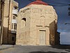
This is a list of monuments in Kalkara , Malta, which are listed on the National Inventory of the Cultural Property of the Maltese Islands. [1] [2]

List

Name of objectLocationCoordinatesIDPhotoUpload
Statue of St. Anthony of PaduaTriq Santa Liberata 35°53′09″N14°31′56″E / 35.885787°N 14.532111°E / 35.885787; 14.532111 (Statue of St. Anthony of Padua) 00648 Nicpmi-00648-2-kalkara statue st anthony.jpg Missing-monuments-image.svg
Statue of St. FrancisTriq Santa Liberata 35°53′08″N14°31′59″E / 35.885638°N 14.533006°E / 35.885638; 14.533006 (Statue of St. Francis) 00649 Nicpmi-00649-2-kalkara statue st francis.jpg Missing-monuments-image.svg
Statue of St. MichaelTriq Santa Liberata 35°54′25″N14°29′30″E / 35.906902°N 14.491629°E / 35.906902; 14.491629 (Statue of St. Michael) 00650 Nicpmi-00650-3-kalkara statue st michael.jpg Missing-monuments-image.svg
Church of St. Barbara and the Capuchin FriarsTriq Santu Rokku 35°53′08″N14°32′00″E / 35.885634°N 14.533224°E / 35.885634; 14.533224 (Church of St. Barbara and the Capuchin Friars) 00651 00651 Kalkara, Kunvent tal-Kapuccini (3).jpg Missing-monuments-image.svg
Niche of the Madonna of FatimaTriq Santu Rokku / Triq Kapuċċini 35°53′10″N14°32′01″E / 35.885982°N 14.533611°E / 35.885982; 14.533611 (Niche of the Madonna of Fatima) 00652 Nicpmi-00652-3-kalkara niche madonna fatima.jpg Missing-monuments-image.svg
Chapel of Christ the SaviourTriq is-Salvatur 35°53′30″N14°31′32″E / 35.891566°N 14.525463°E / 35.891566; 14.525463 (Chapel of Christ the Saviour) 00653 Our Saviour's Kalkara.jpg Missing-monuments-image.svg
Niche of the Madonna of Loreto83 Triq ir-Rinella / Triq Patist Borda 35°53′25″N14°31′37″E / 35.890317°N 14.526807°E / 35.890317; 14.526807 (Niche of the Madonna of Loreto) 00654 Nicpmi-00654-2-kalkara niche madonna loreto.jpg Missing-monuments-image.svg
Niche of St JosephTriq ir-Rinella / Triq is-Sienja 35°53′25″N14°31′37″E / 35.890344°N 14.526919°E / 35.890344; 14.526919 (Niche of St Joseph) 00655 Nicpmi-00655-6-kalkara niche st joseph.jpg Missing-monuments-image.svg
Niche of Saint Philomena4 Triq Santa Filumena 35°53′20″N14°31′44″E / 35.888887°N 14.528812°E / 35.888887; 14.528812 (Niche of Saint Philomena) 00656 Nicpmi-00656-3-kalkara niche st philomena.jpg Missing-monuments-image.svg
Parish Church of St. JosephMisraħ l-Arċisqof Gonzi 35°53′18″N14°31′44″E / 35.888415°N 14.528828°E / 35.888415; 14.528828 (Parish Church of St. Joseph) 00657 St. Joseph Church, Kalkara.jpg Missing-monuments-image.svg
Niche of St. Theresa of AvilaSqaq l-Ixprunara 35°53′17″N14°31′39″E / 35.888054°N 14.527457°E / 35.888054; 14.527457 (Niche of St. Theresa of Avila) 00658 Nicpmi-00658-2-kalkara niche st theresa avila.jpg Missing-monuments-image.svg
The CottageTriq Marina 35°53′25″N14°31′33″E / 35.890172°N 14.525757°E / 35.890172; 14.525757 (The Cottage) 01172 The Cottage, Triq Marina, Kalkara, 2017.jpg Missing-monuments-image.svg
Villa PortelliTriq Marina 35°53′26″N14°31′32″E / 35.890550°N 14.525634°E / 35.890550; 14.525634 (Villa Portelli) 01173 Villa Portelli (1).jpg Missing-monuments-image.svg
Kalkara Naval Cemetery Triq San Leonardu 5°53′14″N14°32′12″E / 5.887118°N 14.536686°E / 5.887118; 14.536686 (Kalkara Naval Cemetery) 01174 Kalkara Naval Cemetery.jpg
Missing-monuments-image.svg
Red HouseTriq Santu Rokku / Sqaq Tewma 35°53′25″N14°32′10″E / 35.890206°N 14.536047°E / 35.890206; 14.536047 (Red House) 01175 Red House side entrance.jpg Missing-monuments-image.svg
Fort Ricasoli Gallows’ Point 35°53′50″N14°31′36″E / 35.897174°N 14.526713°E / 35.897174; 14.526713 (Fort Ricasoli) 01655 Sudika Kalkara Fort Ricasoli.jpg
Missing-monuments-image.svg
Central BastionFort Ricasoli 35°53′45″N14°31′42″E / 35.895905°N 14.528470°E / 35.895905; 14.528470 (Central Bastion) 01656 Missing-monuments-image.svg
Right Demi-BastionFort Ricasoli 35°53′45″N14°31′38″E / 35.895697°N 14.527343°E / 35.895697; 14.527343 (Right Demi-Bastion) 01657 Malta - Kalkara - Triq Rinella + Rinella Bay + Fort Ricasoli 02 ies.jpg Missing-monuments-image.svg
Left Demi-BastionFort Ricasoli 35°53′49″N14°31′43″E / 35.896904°N 14.528550°E / 35.896904; 14.528550 (Left Demi-Bastion) 01658 Fort Ricasoli wall.jpg Missing-monuments-image.svg
FaussebaryeFort Ricasoli 35°53′44″N14°31′41″E / 35.895593°N 14.528001°E / 35.895593; 14.528001 (Faussebarye) 01659 Missing-monuments-image.svg
CounterguardFort Ricasoli 35°53′50″N14°31′48″E / 35.897223°N 14.529865°E / 35.897223; 14.529865 (Counterguard) 01660 Malta - Kalkara - Triq Santu Rokku - Fort Ricasoli 06 ies.jpg Missing-monuments-image.svg
Sally-portFort Ricasoli 35°53′47″N14°31′43″E / 35.896483°N 14.528666°E / 35.896483; 14.528666 (Sally-port) 01661 Missing-monuments-image.svg
Sally-portFort Ricasoli 35°53′44″N14°31′40″E / 35.895581°N 14.527741°E / 35.895581; 14.527741 (Sally-port) 01662 Missing-monuments-image.svg
Right CaponierFort Ricasoli 35°53′44″N14°31′40″E / 35.895418°N 14.527819°E / 35.895418; 14.527819 (Right Caponier) 01663 Missing-monuments-image.svg
Left CaponierFort Ricasoli 35°53′47″N14°31′44″E / 35.896461°N 14.528919°E / 35.896461; 14.528919 (Left Caponier) 01664 Missing-monuments-image.svg
Right RavelinFort Ricasoli 35°53′42″N14°31′41″E / 35.895016°N 14.528018°E / 35.895016; 14.528018 (Right Ravelin) 01665 Missing-monuments-image.svg
Left RavelinFort Ricasoli 35°53′47″N14°31′46″E / 35.896439°N 14.529438°E / 35.896439; 14.529438 (Left Ravelin) 01666 Malta - Kalkara - Triq Santu Rokku - Fort Ricasoli 03 ies.jpg Missing-monuments-image.svg
CovertwayFort Ricasoli 35°53′43″N14°31′46″E / 35.895344°N 14.529322°E / 35.895344; 14.529322 (Covertway) 01667 Fort Ricasoli Sea ruins.jpg Missing-monuments-image.svg
GlacisFort Ricasoli 35°53′42″N14°31′47″E / 35.895106°N 14.529752°E / 35.895106; 14.529752 (Glacis) 01668 Missing-monuments-image.svg
Land front ditchFort Ricasoli 35°53′44″N14°31′42″E / 35.895445°N 14.528456°E / 35.895445; 14.528456 (Land front ditch) 01669 Missing-monuments-image.svg
Sea front ditchFort Ricasoli 35°53′54″N14°31′33″E / 35.898278°N 14.525763°E / 35.898278; 14.525763 (Sea front ditch) 01670 Missing-monuments-image.svg
No 1 Bastion and TenailleFort Ricasoli 35°53′55″N14°31′27″E / 35.898479°N 14.524088°E / 35.898479; 14.524088 (No 1 Bastion and Tenaille) 01671 Missing-monuments-image.svg
No 1 CurtainFort Ricasoli 35°53′54″N14°31′29″E / 35.898414°N 14.524628°E / 35.898414; 14.524628 (No 1 Curtain) 01672 Missing-monuments-image.svg
No. 2 BastionFort Ricasoli 35°53′55″N14°31′31″E / 35.898640°N 14.525245°E / 35.898640; 14.525245 (No. 2 Bastion) 01673 Missing-monuments-image.svg
No.2 CurtainFort Ricasoli 35°53′53″N14°31′33″E / 35.898092°N 14.525846°E / 35.898092; 14.525846 (No.2 Curtain) 01674 Missing-monuments-image.svg
No. 3 BastionFort Ricasoli 35°53′53″N14°31′36″E / 35.898040°N 14.526538°E / 35.898040; 14.526538 (No. 3 Bastion) 01675 Missing-monuments-image.svg
Platform near No 3 BastionFort Ricasoli 35°53′52″N14°31′38″E / 35.897684°N 14.527178°E / 35.897684; 14.527178 (Platform near No 3 Bastion) 01676 Missing-monuments-image.svg
Curtain near No.4 BastionFort Ricasoli 35°53′51″N14°31′41″E / 35.897556°N 14.528146°E / 35.897556; 14.528146 (Curtain near No.4 Bastion) 01677 Missing-monuments-image.svg
No 4 BastionFort Ricasoli 35°53′52″N14°31′43″E / 35.897832°N 14.528568°E / 35.897832; 14.528568 (No 4 Bastion) 01678 Fort Ricasoli views.jpg Missing-monuments-image.svg
No 5 CurtainFort Ricasoli 35°53′50″N14°31′43″E / 35.897354°N 14.528595°E / 35.897354; 14.528595 (No 5 Curtain) 01679 Missing-monuments-image.svg
Harbour tenaille traceFort Ricasoli 35°53′49″N14°31′32″E / 35.896976°N 14.525575°E / 35.896976; 14.525575 (Harbour tenaille trace) 01680 Sudika Fort Ricasoli.jpg Missing-monuments-image.svg
Orsi Battery remainsFort Ricasoli 35°53′54″N14°31′25″E / 35.898258°N 14.523687°E / 35.898258; 14.523687 (Orsi Battery remains) 01681 Missing-monuments-image.svg
Main Gate and remains of Governor's HouseFort Ricasoli 35°53′46″N14°31′36″E / 35.896188°N 14.526615°E / 35.896188; 14.526615 (Main Gate and remains of Governor's House) 01682 Fort Ricasoli - polished version.jpg Missing-monuments-image.svg
Chapel of St Nicholas Fort Ricasoli 35°53′48″N14°31′36″E / 35.896557°N 14.526774°E / 35.896557; 14.526774 (Chapel of St Nicholas) 01683 Missing-monuments-image.svg
Gunpowder magazine 1Fort Ricasoli 35°53′50″N14°31′43″E / 35.897165°N 14.528624°E / 35.897165; 14.528624 (Gunpowder magazine 1) 01684 Missing-monuments-image.svg
Gunpowder magazine 2Fort Ricasoli 35°53′51″N14°31′37″E / 35.897598°N 14.527022°E / 35.897598; 14.527022 (Gunpowder magazine 2) 01685 Missing-monuments-image.svg

Related Research Articles

Fort Ricasoli Historic fort on Malta

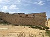
Fort Ricasoli is a bastioned fort in Kalkara, Malta, which was built by the Order of Saint John between 1670 and 1698. The fort occupies a promontory known as Gallows' Point and the north shore of Rinella Bay, commanding the entrance to the Grand Harbour along with Fort Saint Elmo. It is not only the largest fort in Malta but also the largest in Europe, and it has been on the tentative list of UNESCO World Heritage Sites since 1998, as part of the Knights' Fortifications around the Harbours of Malta.

Sacred Heart of Jesus Church, Fontana Church in Fontana, Malta

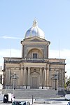
The Sacred Heart of Jesus Church is in Fontana, Gozo Island, part of the Maltese Archipelago. It is the parish church of Fontana, one of the smallest villages on the island.

Cottonera Lines

The Cottonera Lines, also known as the Valperga Lines, are a line of fortifications in Cospicua and Birgu, Malta. They were built in the 17th and 18th centuries to form the outer defences of the Three Cities of Birgu, Senglea and Cospicua. They surrounded an earlier line of fortifications, known as the Santa Margherita Lines.

Floriana Lines Line of fortifications in Floriana, Malta

The Floriana Lines are a line of fortifications in Floriana, Malta, which surround the fortifications of Valletta and form the capital city's outer defences. Construction of the lines began in 1636 and they were named after the military engineer who designed them, Pietro Paolo Floriani. The Floriana Lines were modified throughout the course of the 17th and 18th centuries, and they saw use during the French blockade of 1798–1800. Today, the fortifications are still largely intact but rather dilapidated and in need of restoration.

Cittadella (Gozo) Citadel in Victoria, Gozo, Malta

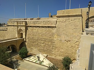
The Cittadella, also known as the Castello, is the citadel of Victoria on the island of Gozo, Malta. The area has been inhabited since the Bronze Age, and the site now occupied by the Cittadella is believed to have been the acropolis of the Punic-Roman city of Gaulos or Glauconis Civitas.

St Francis of Assisi Church, Valletta Church in Valletta, Malta

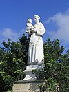
St Francis of Assisi Church, dedicated to St Francis of Assisi, in Valletta, was built in 1598 and was completed by 1607.

St Augustine Church, Valletta Church in Valletta, Malta

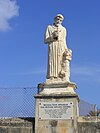
St Augustine Church is one of the churches built during the creation of the new city of Valletta, Malta.

Fort Chambray Fortress in Malta

Fort Chambray or Fort Chambrai is a bastioned fort located in the precincts of Għajnsielem, on the island of Gozo, Malta. It was built in the mid-18th century by the Order of Saint John, in an area known as Ras it-Tafal, between the port of Mġarr and Xatt l-Aħmar. The fort was meant to be the citadel of a new city which was to replace the Cittadella as the island's capital, but this plan never materialized.

Auberge dAllemagne, Birgu

The Auberge d'Allemagne was an auberge in Birgu, Malta. It was built in the 16th century to house knights of the Order of Saint John from the langue of Germany.

Auberge dItalie, Birgu

The Auberge d'Italie was an auberge in Birgu, Malta. It was built in the sixteenth century to house knights of the Order of Saint John from the langue of Italy.

Auberge dAragon, Birgu Auberge in Birgu, Malta

The Auberge d'Aragon is an auberge in Birgu, Malta. It was built in the 16th century to house knights of the Order of Saint John from the langue of Aragon, Navarre and Catalonia.

Auberge de Castille et Portugal

The Auberge de Castille et Portugal was an auberge in Birgu, Malta. It was built to house knights of the Order of Saint John from the langue of Castille, León and Portugal.

Church of Saint Barbara, Valletta Church in Valletta, Malta

The Church of St Barbara is a Roman Catholic church situated in Valletta, Malta. The church was built to service the spiritual needs of the knights of Provence.

Santa Margherita Lines Line of fortifications in Cospicua, Malta

The Santa Margherita Lines, also known as the Firenzuola Lines, are a line of fortifications in Cospicua, Malta. They were built in the 17th and 18th centuries to protect the land front defences of the cities of Birgu and Senglea. A second line of fortifications, known as the Cottonera Lines, was later built around the Santa Margherita Lines, while the city of Cospicua was founded in the 18th century within the Santa Margherita and Cottonera Lines.

Fortifications of Valletta Defensive walls in Valletta, Malta

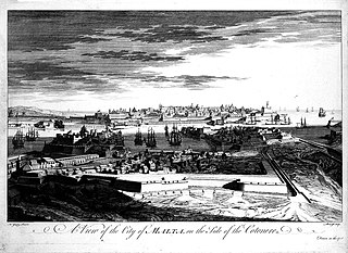
The fortifications of Valletta are a series of defensive walls and other fortifications which surround Valletta, the capital city of Malta. The first fortification to be built was Fort Saint Elmo in 1552, but the fortifications of the city proper began to be built in 1566 when it was founded by Grand Master Jean de Valette. Modifications were made throughout the following centuries, with the last major addition being Fort Lascaris which was completed in 1856. Most of the fortifications remain largely intact today.

Fortifications of Birgu

The fortifications of Birgu are a series of defensive walls and other fortifications which surround the city of Birgu, Malta. The first fortification to be built was Fort Saint Angelo in the Middle Ages, and the majority of the fortifications were built between the 16th and 18th centuries by the Order of Saint John. Most of the fortifications remain largely intact today.

Fortifications of Senglea

The fortifications of Senglea are a series of defensive walls and other fortifications which surround the city of Senglea, Malta. The first fortification to be built was Fort Saint Michael in 1552, and the majority of the fortifications were built over the next decade when it was founded by Grand Master Claude de la Sengle. Modifications continued until the 18th century, but large parts of the fortifications were demolished between the 19th and 20th centuries. Today, all that remain of Senglea's fortifications are the seaward bastions and part of the land front.

Saint George Redoubt

Saint George Redoubt is a redoubt in Birżebbuġa, Malta. It was built in 1714–1716 by the Order of Saint John as one of a series of coastal fortifications around the Maltese Islands, and it got its name from a chapel dedicated to St. George which was incorporated within the redoubt. Today, the redoubt and chapel still exist and they are in good condition.

National Inventory of the Cultural Property of the Maltese Islands

The National Inventory of the Cultural Property of the Maltese Islands (NICPMI) is a heritage register listing the cultural property of Malta. The inventory includes properties such as archaeological sites, fortifications, religious buildings, monuments and other buildings. The NICPMI is under the responsibility of the Superintendence of Cultural Heritage (SCH), which was founded in 2002 to replace the Antiquities Act. The NICPMI was established on 16 December 2011.

References

  1. "National Inventory Register". National Inventory of the Cultural Property of the Maltese Islands. 27 August 2012. Archived from the original on 12 September 2016.
  2. Terribile, Tony (2000). Niċeċ u Statwi fit-Toroq Maltin. Malta: Publikazzjoni Indipendenza (PIN). ISBN   9789990941784. OCLC   48920678.