Related Research Articles

Brazzaville is the capital and largest city of the Republic of the Congo. From an administrative perspective, it is a department and a commune. Constituting the financial and administrative centre of the country, it is located on the north side of the Congo River, opposite Kinshasa, the capital city of the Democratic Republic of the Congo.

The Democratic Republic of the Congo, also known as Congo-Kinshasa, DRC, DR Congo, or simply the Congo and known from 1971–1997 as Zaire, is a country in Central Africa. By land area, the DRC is the second-largest country in Africa and the 11th-largest in the world. With a population of around 112 million, the Democratic Republic of the Congo is the most populous officially Francophone country in the world. The national capital and largest city is Kinshasa, which is also the economic center. The country is bordered by the Republic of the Congo, Central African Republic, South Sudan, Uganda, Rwanda, Burundi, Tanzania, Zambia, Angola, the Cabinda exclave of Angola and the South Atlantic Ocean.

Virunga National Park is a national park in the Albertine Rift Valley in the eastern part of the Democratic Republic of the Congo. It was created in 1925. In elevation, it ranges from 680 m (2,230 ft) in the Semliki River valley to 5,109 m (16,762 ft) in the Rwenzori Mountains. From north to south it extends approximately 300 km (190 mi), largely along the international borders with Uganda and Rwanda in the east. It covers an area of 8,090 km2 (3,120 sq mi).

The United Nations Organization Stabilization Mission in the Democratic Republic of the Congo or MONUSCO, an acronym based on its French name Mission de l'Organisation des Nations Unies pour la stabilisation en République démocratique du Congo, is a United Nations peacekeeping force in the Democratic Republic of the Congo (DRC) which was established by the United Nations Security Council in resolutions 1279 (1999) and 1291 (2000) to monitor the peace process of the Second Congo War, though much of its focus subsequently turned to the Ituri conflict, the Kivu conflict and the Dongo conflict. The mission was known as the United Nations Mission in the Democratic Republic of Congo or MONUC, an acronym of its French name Mission de l'Organisation des Nations Unies en République démocratique du Congo, until 2010.

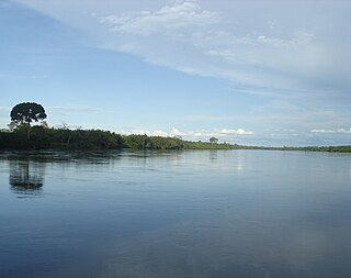
The Congo Basin is the sedimentary basin of the Congo River. The Congo Basin is located in Central Africa, in a region known as west equatorial Africa. The Congo Basin region is sometimes known simply as the Congo. It contains some of the largest tropical rainforests in the world and is an important source of water used in agriculture and energy generation.
The Western Congolian swamp forests are an ecoregion of the Republic of the Congo, Democratic Republic of the Congo and adjoining Central African Republic. Together with the adjacent Eastern Congolian swamp forests, it forms one of the largest continuous areas of freshwater swamp forest in the world. It is a flooded forest with a high canopy, dense undergrowth and has a muddy floor. It has not been disturbed very much by outside influences and so remains largely pristine as getting through this forest is called "almost impossible".
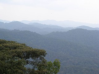
The Albertine Rift montane forests is a tropical moist broadleaf forest ecoregion in east-central Africa. The ecoregion covers the mountains of the northern Albertine Rift, and is home to distinct Afromontane forests with high biodiversity.

The wildlife of Cameroon is composed of its flora and fauna. Bordering Nigeria, it is considered one of the wettest parts of Africa and records Africa's second highest concentration of biodiversity. To preserve its wildlife, Cameroon has more than 20 protected reserves comprising national parks, zoos, forest reserves and sanctuaries. The protected areas were first created in the northern region under the colonial administration in 1932; the first two reserves established were Mozogo Gokoro Reserve and the Bénoué Reserve, which was followed by the Waza Reserve on 24 March 1934. The coverage of reserves was initially about 4 percent of the country's area, rising to 12 percent; the administration proposes to cover 30 percent of the land area.

The greater dwarf shrew is a species of mammal in the family Soricidae. It is found in Angola, Botswana, Democratic Republic of the Congo, Kenya, Malawi, Namibia, Tanzania, Zambia, and Zimbabwe. Its natural habitats are subtropical or tropical dry forests and dry savanna. It is present in several protected areas, including the Kruger National Park. The main threat to greater dwarf shrews is the loss or degradation of moist, productive areas such as wetlands and rank grasslands within suitable habitat.

The Atlantic Equatorial coastal forests, also known as the Congolian coastal forests, are a tropical moist broadleaf forest ecoregion of Central Africa, covering hills, plains, and mountains of the Atlantic coast of Cameroon, Equatorial Guinea, Gabon, Republic of the Congo, Angola, and Democratic Republic of the Congo.

The Republic of the Congo, also known as Congo-Brazzaville, the Congo Republic or simply either Congo or the Congo, is a country located on the western coast of Central Africa to the west of the Congo River. It is bordered to the west by Gabon, to its northwest by Cameroon and its northeast by the Central African Republic, to the southeast by the Democratic Republic of the Congo, to its south by the Angolan exclave of Cabinda and to its southwest by the Atlantic Ocean.

The Central Congolian lowland forests are an ecoregion within the Democratic Republic of the Congo. This is a remote, inaccessible area of low-lying dense wet forest, undergrowth and swamp in the Cuvette Centrale region of the Congo Basin south of the arc of the River Congo.

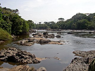
Nouabalé-Ndoki National Park is a national park in the Republic of the Congo. Established in 1993, in the northern provinces of Congo, it is home to forest elephants, great apes, including western lowland gorillas and the eastern sub-species of chimpanzees and bongo. It is 3,921.61 km2 (1,514.14 sq mi) of pristine tropical rainforest with no human habitation within it and with human population densities in its periphery that are comparatively low for the sub-region. The forests have a rich biodiversity of 300 bird species, plus 1,000 plant and tree species which include endangered mahoganies.

Lobéké National Park is a national park of southeastern Cameroon within the Moloundou Arrondissement of East Province. Located in the Congo Basin, it is bounded on the east by the Sangha River which serves as Cameroon's international border with Central African Republic and the Republic of the Congo. It is adjacent to two other reserves in the CAR and Congo. To the northwest is Boumba Bek National Park, another national park in Cameroon's East Province.

The Dzanga-Sangha Special Reserve is a protected reserve of southwestern Central African Republic. It was established in 1990 and covers 6,865.54 km2 (2,650.80 sq mi). It is one of several areas within the Dzanga-Sangha Complex of Protected Areas (DSCPA), each within its own protective status and along with Lobéké National Park in Cameroon and Nouabalé-Ndoki National Park in Republic of Congo, it is part of the Sangha Trinational Landscape. Other areas within the DSCPA include the Dzanga Ndoki National Park which has two sectors, the 495 km2 (191 sq mi) Dzanga park and the 725 km2 (280 sq mi) Ndoki park. A conference of the Ministers of Forests of Central African Forest Commission (COMIFAC) had resolved to establish within the Congo basin, the Sangha River Tri-national Protected area (STN) encompassing these three parks. The forest special reserve is operated by the Central African Forest Commission (COMIFAC).
The Dzanga-Ndoki National Park is located in the southwestern extremity of the Central African Republic. Established in 1990, the national park is 1,143.26 square kilometres (441.42 sq mi). The national park is split into two non-continuous sectors, the northern Dzanga sector 49,500 ha and the southern Ndoki sector 72,500 ha. Notable in the Dzanga sector is a gorilla density of 1.6/km2 (4.1/sq mi), one of the highest densities ever reported for the western lowland gorilla.
Mangroves National Park is a protected area and Ramsar wetland in the Democratic Republic of the Congo. It is the country's only marine park and is notable for its mangrove forests. It provides protection to the endangered manatee population situated at the mouth of the Congo River. These mangroves are distinct from the ones found in South Asia. They form a separate type of mangrove forests, which are typical to the Democratic Republic of Congo. The park was established in 1992.
The Northeastern Congolian lowland forests is a tropical moist broadleaf forest ecoregion that spans the Democratic Republic of the Congo and the Central African Republic.
The Northwestern Congolian lowland forests is a tropical moist broadleaf forest ecoregion that spans Cameroon, Gabon, the Republic of Congo, the Central African Republic and a minuscule part of the Democratic Republic of the Congo. It forms part of the larger Congolian rainforests region in Central Africa. The region is noteworthy for very high levels of species richness and endemism. It is home to a core population of the critically endangered Western lowland gorilla. There are also large populations of forest elephants.

The Western Congolian forest–savanna mosaic is an ecoregion of Angola, Democratic Republic of the Congo, Republic of the Congo, and Gabon.
References
- ↑ UNEP-WCMC (2021). Protected Area Profile for Congo, Republic from the World Database of Protected Areas. Accessed 25 September 2021.