Contents
Peninsulas of Japan include:
Peninsulas of Japan include:

Sagami Bay lies south of Kanagawa Prefecture in Honshu, central Japan, contained within the scope of the Miura Peninsula, in Kanagawa, to the east, the Izu Peninsula, in Shizuoka Prefecture, to the west, and the Shōnan coastline to the north, while the island of Izu Ōshima marks the southern extent of the bay. It lies approximately 40 kilometres (25 mi) southwest of the capital, Tokyo. Cities on the bay include Odawara, Chigasaki, Fujisawa, Hiratsuka, Itō, and Kamakura.

Oshima is a subprefecture of Hokkaido Prefecture, Japan. As of 2004 it had a population of 456,621 and an area of 3,715.38 km².

Hiyama Subprefecture is a subprefecture of Hokkaido Prefecture, Japan located on the Oshima Peninsula on the Sea of Japan side. It includes Okushiri Island. It was established in 1897.

Fuji-Hakone-Izu National Park is a national park in Yamanashi, Shizuoka, and Kanagawa Prefectures, and western Tokyo Metropolis, Japan. It consists of Mount Fuji, Fuji Five Lakes, Hakone, the Izu Peninsula, and the Izu Islands. Fuji-Hakone-Izu National Park covers 1,227 square kilometres (474 sq mi).

Matsumae is a town located in Oshima Subprefecture, Hokkaido, Japan. The former home of the Matsumae Han, it has an Edo period castle, Matsumae Castle, the only one in Hokkaido, and Ryūun-in.

Karakuwa was a town located in Motoyoshi District, in the extreme northeast of Miyagi Prefecture, bordering Kesennuma to the north-west and Rikuzentakata, part of Iwate Prefecture, to the north, and with Kesennuma Bay including Oshima island to the west, Hirota Bay to the north-east, and the Pacific Ocean to the south and east.
Ōshima, Oshima, Ooshima or Ohshima may refer to:

Amami Ōshima, also known as Amami, is the largest island in the Amami archipelago between Kyūshū and Okinawa. It is one of the Satsunan Islands.

The North Shore of Long Island is the area along the northern coast of New York's Long Island bordering Long Island Sound. Known for its extreme wealth and lavish estates, the North Shore exploded into affluence at the turn of the 20th century, earning it the nickname the Gold Coast. Historically, this term refers to the coastline communities in the towns of North Hempstead and Oyster Bay in Nassau County and the Town of Huntington in Suffolk County, although the town of Smithtown east of here is also known for its affluence. The easternmost Gold Coast mansion is the Geissler Estate, located just west of Indian Hills Country Club in Fort Salonga, within the Town of Huntington.

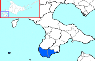
Matsumae is a district located in southwestern Oshima Subprefecture, Hokkaido, Japan.

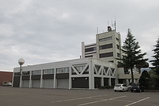
Shiriuchi is a town located in Oshima Subprefecture, Hokkaido, Japan.

Kikonai is a town located in Oshima Subprefecture, Hokkaido, Japan.

Otobe is a town located in Hiyama Subprefecture, Hokkaido, Japan.
The Oshima Peninsula is the southernmost part of Hokkaidō, the northernmost of the Japanese islands. Where the peninsula starts is open to interpretation. A more generous interpretation is to draw a line southeast from Ishikari Bay across the Ishikari Plain to Yūfutsu District, Hokkaido. A narrower interpretation is to draw a line connecting Suttsu on the Sea of Japan and Oshamambe on Uchiura Bay. This narrow interpretation encompasses the subprefectures of Oshima and Hiyama.

Hokuto is a city in the center of the Oshima Subprefecture in Japan's northern island of Hokkaido. It serves as a bedroom community for Hakodate, to the east of the city. Hokuto was formed on February 1, 2006 from merging the town of Kamiiso, from Kamiiso District, and the town of Ōno, from Kameda District. Hokuto is the third city to be established in Oshima.. Hokuto is the second largest city in Oshima by population after Hakodate.

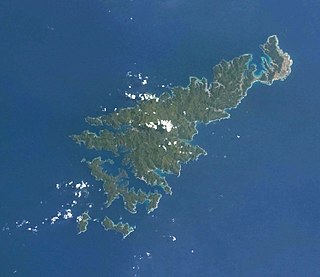
Izu Ōshima is an inhabited volcanic island in the Izu archipelago in the Philippine Sea, off the coast of Honshu, Japan, 22 km (14 mi) east of the Izu Peninsula and 36 km (22 mi) southwest of Bōsō Peninsula. As with the other islands in the Izu Island group, Izu Ōshima forms part of the Fuji-Hakone-Izu National Park. Izu Ōshima, at 91.06 km2 (35.16 sq mi) is the largest and closest of Tokyo's outlying islands, which also include the Ogasawara Islands.
National Route 58 is a Japanese national highway connecting the capital cities Kagoshima and Naha of Kagoshima Prefecture and Okinawa Prefecture, respectively. With a total length of 884.4 kilometers (549.5 mi), it is the longest national highway in Japan, though it measures only 245.2 kilometers (152.4 mi) on land. The highway begins at an intersection with National Routes 3 and 10 in Kagoshima. From Kagoshima, it travels southwest along the first island chain that divides the Pacific Ocean from the East China Sea. From the north to the south, it has sections on the islands of Tanegashima, Amami Ōshima, and finally, Okinawa. On Okinawa it ends at an intersection with National Routes 330, 331, and 390 in Naha.

Kii Ōshima (紀伊大島) is an inhabited island lying off the southern tip of the Kii Peninsula and the southernmost point of Honshū, Japan. It has an estimated population of around 2000, and is administratively part of the town of Kushimoto in Wakayama Prefecture. The island is approximately 8 kilometres (5.0 mi) in length from east-to-west by 2.5 kilometres (1.6 mi) north-to-south.

Ōshima is a rocky island off the northern coast of Natsudomari Peninsula in Mutsu Bay. The island is a part of Hiranai in Aomori Prefecture. The island has 3 km (1.9 mi) of coastline and an area of 0.16 km2 (0.062 sq mi). It is a part of the prefecture-maintained, Asamushi-Natsudomari Prefectural Natural Park.

The devastating eruption of Oshima–Ōshima began on the 18th of August, 1741 and ended on May 1 the next year. Eleven days into the eruption, the Kampo tsunami with estimated maximum heights of over 90 meters swept across neighboring islands in Japan and the Korean Peninsula.