Hurricane Floyd was a very powerful Cape Verde hurricane which struck the Bahamas and the East Coast of the United States. It was the sixth named storm, fourth hurricane, and third major hurricane in the 1999 Atlantic hurricane season. Floyd triggered the fourth largest evacuation in US history when 2.6 million coastal residents of five states were ordered from their homes as it approached. The hurricane formed off the coast of Africa and lasted from September 7 to 19, becoming extratropical after September 17, and peaked in strength as a very strong Category 4 hurricane. It was among the largest Atlantic hurricanes of its strength ever recorded, in terms of gale-force diameter.

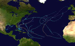
The 1999 Atlantic hurricane season had five Category 4 hurricanes – the highest number recorded in a single season in the Atlantic basin, previously tied in 1933 and 1961, and later tied in 2005 and 2020. The season officially began on June 1, and ended on November 30. These dates conventionally delimit the period of each year when most tropical cyclones form in the Atlantic basin. It was a fairly active season, mostly due to a persistent La Niña that developed in the latter half of 1998. The first storm, Arlene, formed on June 11 to the southeast of Bermuda. It meandered slowly for a week and caused no impact on land. Other tropical cyclones that did not affect land were Hurricane Cindy, Tropical Storm Emily, and Tropical Depression Twelve. Localized or otherwise minor damage occurred from Hurricanes Bret, Gert, and Jose, and tropical storms Harvey and Katrina.

The 1992 Atlantic hurricane season was a significantly below average season in which only ten tropical or subtropical cyclones formed. Six became named tropical storms, of which four became hurricanes. Among the four was Hurricane Andrew, a major hurricane, and the costliest Atlantic hurricane on record at the time, surpassing Hugo of 1989. The season officially started on June 1 and officially ended on November 30. However, tropical cyclogenesis is possible at any time of the year, as demonstrated by formation in April of an unnamed subtropical storm in the central Atlantic. A June tropical depression caused flooding in Cuba and in Florida, where two people were killed. In August, Andrew struck the Bahamas, Florida, and Louisiana. In all, it caused $27.3 billion in damage, mostly in Florida, as well as 65 fatalities. The greatest impact was in South Florida, where the storm made landfall with 1-minute sustained winds of 175 mph (280 km/h).

The 1981 Atlantic hurricane season featured direct or indirect impacts from nearly all of its 12 tropical or subtropical storms. Overall, the season was fairly active, with 22 tropical depressions, 12 of which became a namable storm, while 7 of those reached hurricane status and 3 intensified into major hurricanes. The season officially began on June 1, 1981, and lasted until November 30, 1981. These dates conventionally delimit the period of each year when most tropical cyclones form in the Atlantic basin. However, tropical cyclogenesis can occur before these dates, as demonstrated with the development of two tropical depressions in April and Tropical Storm Arlene in May. At least one tropical cyclone formed in each month between April and November, with the final system, Subtropical Storm Three, becoming extratropical on November 17, 1981.

The 2006 Atlantic hurricane season was the least active since 1997 as well as the first season since 2001 in which no hurricanes made landfall in the United States, and was the first since 1994 in which no tropical cyclones formed during October. Following the intense activity of 2003, 2004, and 2005, forecasters predicted that the 2006 season would be only slightly less active. Instead activity was slowed by a rapidly forming moderate El Niño event, the presence of the Saharan Air Layer over the tropical Atlantic, and the steady presence of a robust secondary high-pressure area to the Azores High centered on Bermuda. There were no tropical cyclones after October 2.

The 1987 Atlantic hurricane season was a below-average hurricane season that was limited by an ongoing El Niño. The season officially began on June 1, 1987, and lasted until November 30, 1987, although activity began on May 24 when a tropical depression developed 400 mi (640 km) east of the central Bahamas. The June through November dates conventionally delimit the period of each year when most tropical cyclones form in the Atlantic basin. The first cyclone to attain tropical storm status was an unnamed tropical storm which formed on August 9, nearly a month later than usual. The final storm of the year, Tropical Depression Fourteen, merged with a weak extratropical low on November 4. The season marked the first year tropical storm watches and warnings were issued; previously, gale watches and warnings were used for tropical storms, and this season was one of only a few seasons with no deaths in the United States; the last time this happened was in the 1981 season.

Hurricane Fox was the strongest and deadliest tropical cyclone of the below average 1952 Atlantic hurricane season. The seventh tropical storm, sixth Atlantic hurricane, and the third major hurricane of the season, Fox was a small and intense Caribbean storm that developed northwest of Cartagena, Colombia, in the southern Caribbean. It moved steadily northwest, intensifying to a tropical storm on October 21. The next day, it rapidly strengthened into a hurricane and turned north passing closely to Grand Cayman, Cayman Islands. The cyclone attained peak winds of 145 mph (233 km/h) as it struck Cayo Guano del Este off the coast of Cienfuegos. Fox made landfall on Cuba at maximum intensity, producing peak gusts of 170–180 mph (270–290 km/h). It weakened over land, but it re-strengthened as it turned east over the Bahamas. On October 26, it weakened and took an erratic path, dissipating west-southwest of Bermuda on October 28.

The 2019 Atlantic hurricane season was the fourth consecutive above-average and damaging season dating back to 2016. However, many were weak and short-lived, especially towards the end of the season. Six of those named storms achieved hurricane status, while three intensified into major hurricanes. Two storms became Category 5 hurricanes, marking the fourth consecutive season with at least one Category 5 hurricane, the third consecutive season to feature at least one storm making landfall at Category 5 intensity, and the seventh on record to have multiple tropical cyclones reaching Category 5 strength. The season officially began on June 1 and ended on November 30. These dates historically describe the period each year when most tropical cyclones form in the Atlantic basin and are adopted by convention. However, tropical cyclogenesis is possible at any time of the year, as demonstrated by the formation of Subtropical Storm Andrea on May 20, making this the fifth consecutive year in which a tropical or subtropical cyclone developed outside of the official season.

The Bahama Archipelago, also known as the Lucayan Archipelago, is an island group comprising the Commonwealth of The Bahamas and the British Overseas Territory of the Turks and Caicos Islands. The archipelago is in the western North Atlantic Ocean, north of Cuba along with the other Antilles, and east and southeast of Florida. The archipelago has experienced the effects of at least 22 Atlantic hurricanes, or storms that were once tropical or subtropical cyclones, including 17 since 2000. The storms collectively killed 101 people.

During 1999, tropical cyclones formed within seven different bodies of water called basins. To date, 142 tropical cyclones formed in bodies of water known as tropical cyclone basins, of which 72 were given names by various weather agencies. The strongest tropical cyclone of the year was Gwenda, attaining maximum sustained winds of 120 knots and a pressure of 900 hPa (26.58 inHg), later tied with Inigo in 2003. Floyd was the costliest tropical cyclone of the year, with around $6.5 billion worth of damages as it affected the Bahamas, the East Coast of the United States, and the Atlantic Canada. The deadliest cyclone of this year was the 1999 Odisha cyclone, which was blamed for over 9,667 deaths as it devastated India. It was also the strongest Northern Hemisphere cyclone of the year with the pressure of 912 hPa (26.93 inHg) and third most intense tropical cyclone worldwide next to Cyclone Gwenda and Cyclone Vance. Three Category 5 tropical cyclones were formed in 1999.


