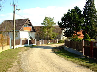
Banská Štiavnica District is a district in the Banská Bystrica Region of central Slovakia. Until 1918, most of the present-day district belonged to the county of Kingdom of Hungary of Hont, apart from Močiar and Podhorie in the north (Tekov) and Kozelník in the east.
Gąsówka-Somachy is a village in the administrative district of Gmina Łapy, within Białystok County, Podlaskie Voivodeship, in north-eastern Poland.

Łozowe is a village in the administrative district of Gmina Narewka, within Hajnówka County, Podlaskie Voivodeship, in north-eastern Poland, close to the border with Belarus. It lies approximately 7 kilometres (4 mi) north of Narewka, 22 km (14 mi) north-east of Hajnówka, and 47 km (29 mi) south-east of the regional capital Białystok.

Mehdibəyli is a village in the Khojali Rayon of Azerbaijan. Since the Nagorno-Karabakh war the village has been administered by the de facto Nagorno-Karabakh Republic as part of Askeran Province.
Wiśniów is a village in the administrative district of Gmina Sulmierzyce, within Pajęczno County, Łódź Voivodeship, in central Poland.

Wierzchy is a village in the administrative district of Gmina Zadzim, within Poddębice County, Łódź Voivodeship, in central Poland. It lies approximately 5 kilometres (3 mi) north-east of Zadzim, 11 km (7 mi) south-west of Poddębice, and 40 km (25 mi) west of the regional capital Łódź.
Folwark is a settlement in the administrative district of Gmina Żytno, within Radomsko County, Łódź Voivodeship, in central Poland.
Miłolas is a village in the administrative district of Gmina Kąkolewnica Wschodnia, within Radzyń Podlaski County, Lublin Voivodeship, in eastern Poland.
Grzybowo is a village in the administrative district of Gmina Raciąż, within Płońsk County, Masovian Voivodeship, in east-central Poland.

Michałówek is a village in the administrative district of Gmina Ożarów Mazowiecki, within Warsaw West County, Masovian Voivodeship, in east-central Poland. It lies approximately 6 kilometres (4 mi) west of Ożarów Mazowiecki and 19 km (12 mi) west of Warsaw.

Wygnanka is a village in the administrative district of Gmina Mszczonów, within Żyrardów County, Masovian Voivodeship, in east-central Poland. It lies approximately 12 kilometres (7 mi) south-east of Mszczonów, 23 km (14 mi) south-east of Żyrardów, and 44 km (27 mi) south-west of Warsaw.

Grodzisk is a village in the administrative district of Gmina Goworowo, within Ostrołęka County, Masovian Voivodeship, in east-central Poland. It lies approximately 1 kilometre (1 mi) south of Goworowo, 20 km (12 mi) south of Ostrołęka, and 84 km (52 mi) north-east of Warsaw.

Żołędnica is a village in the administrative district of Gmina Rawicz, within Rawicz County, Greater Poland Voivodeship, in west-central Poland. It lies approximately 6 kilometres (4 mi) north-east of Rawicz and 83 km (52 mi) south of the regional capital Poznań.
Nowa Wieś is a village in the administrative district of Gmina Przemęt, within Wolsztyn County, Greater Poland Voivodeship, in west-central Poland.
Złoty Potok is a village in the administrative district of Gmina Skąpe, within Świebodzin County, Lubusz Voivodeship, in western Poland.

Pieczyska is a village in the administrative district of Gmina Kartuzy, within Kartuzy County, Pomeranian Voivodeship, in northern Poland. It lies approximately 4 kilometres (2 mi) north of Kartuzy and 28 km (17 mi) west of the regional capital Gdańsk.

Dębno is a settlement in the administrative district of Gmina Gardeja, within Kwidzyn County, Pomeranian Voivodeship, in northern Poland. It lies approximately 4 kilometres (2 mi) west of Gardeja, 15 km (9 mi) south of Kwidzyn, and 86 km (53 mi) south of the regional capital Gdańsk.

Kuchnia is a village in the administrative district of Gmina Gniew, within Tczew County, Pomeranian Voivodeship, in northern Poland. It lies approximately 8 kilometres (5 mi) north of Gniew, 26 km (16 mi) south-east of Tczew, and 55 km (34 mi) south of the regional capital Gdańsk.

Gruda is a village in the administrative district of Gmina Bartoszyce, within Bartoszyce County, Warmian-Masurian Voivodeship, in northern Poland, close to the border with the Kaliningrad Oblast of Russia. It lies approximately 11 kilometres (7 mi) east of Bartoszyce and 57 km (35 mi) north-east of the regional capital Olsztyn.

Vinařice is a village and municipality in Beroun District in the Central Bohemian Region of the Czech Republic.


