
Roane County is a county of the U.S. state of Tennessee. As of the 2020 census, the population was 53,404. Its county seat is Kingston. Roane County is included in the Knoxville, TN Metropolitan Statistical Area.

Rhea County is a county located in the U.S. state of Tennessee. As of the 2020 census, its population was 32,870. Its county seat is Dayton. Rhea County comprises the Dayton, TN micropolitan statistical area, which is also included in the Chattanooga-Cleveland-Dalton, TN-GA-AL combined statistical area.

Monroe County is a county located on the eastern border of the U.S. state of Tennessee. As of the 2020 census, the population was 46,250. Its county seat is Madisonville, and its largest city is Sweetwater.

Meigs County is a county located in the U.S. state of Tennessee. As of the 2020 census, the population was 12,758. Its county seat is Decatur.
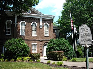
Loudon County is a county in the U.S. state of Tennessee. It is located in the central part of East Tennessee. As of the 2020 census, the population was 54,886. Its county seat is Loudon. Loudon County is included in the Knoxville, TN Metropolitan Statistical Area.

Spring City is a town in Rhea County, Tennessee, United States. The population was 1,949 at the 2020 census and 1,981 at the 2010 census. The town is located along Watts Bar Lake, and Watts Bar Dam and the Watts Bar Nuclear Generating Station are nearby.

The Tennessee River is a 652 mi (1,049 km) long river located in the southeastern United States in the Tennessee Valley. Flowing through the states of Tennessee, Alabama, Mississippi, Kentucky, it begins at the confluence of French Broad and Holston rivers at Knoxville, and drains into the Ohio River near Paducah, Kentucky. It is the largest tributary of the Ohio, and drains a basin of 40,876 sq mi (105,870 km2).
The Little Harpeth River is a 16.3-mile-long (26.2 km) tributary of the Harpeth River in Tennessee, just south of Nashville. Via the Harpeth, Cumberland, and Ohio rivers, it is part of the Mississippi River watershed.

The Emory River is a river draining a portion of Tennessee's Cumberland Plateau. It flows for just over 46 miles (74 km) from its source near Frozen Head State Park to its mouth along the Clinch River at Kingston, Tennessee.
The Little Obed River is a ten mile long stream in the Cumberland Plateau in Cumberland County, Tennessee.

The Piney River is a stream that drains a portion of Tennessee's Cumberland Plateau generally known as Walden Ridge. The Piney River rises near the Rhea County – Bledsoe County line and is referred to as Piney Creek in its upper reaches roughly until its confluence with Duskin Creek. Its major tributary, Little Piney Creek, flows over two spectacular waterfalls which are located in Piney Falls State Natural Area near the community of Grandview. A tributary of Little Piney Creek is Soak Creek, Tennessee's newest State Scenic River. The confluence of the two streams occurs below the falls of the smaller stream in an area referred to as "Shut-in Gap". The stream flows out of the gap and is bridged by State Route 68 just before that road begins its steep climb up the Cumberland Escarpment onto Waldens Ridge. The stream flows north of Spring City, Tennessee and becomes slack just east of the town at a headland of Watts Bar Lake, an impoundment of the Tennessee River formed by the Tennessee Valley Authority's Watts Bar Dam project. The mouth of the Piney is one of the larger bays of Watts Bar Lake and contains several small islands.
Ten Mile is an unincorporated community in northern Meigs and southeastern Roane counties in the U.S. state of Tennessee.
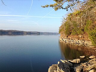
Watts Bar Lake is a reservoir on the Tennessee River created by Watts Bar Dam as part of the Tennessee Valley Authority system.

Watts Bar Dam is a hydroelectric dam on the Tennessee River in Meigs and Rhea counties in Tennessee, United States. The dam is one of nine dams on the main Tennessee River channel operated by the Tennessee Valley Authority, which built the dam in the early 1940s to provide flood control and electricity and to help create a continuous navigable channel along the entire length of the river. The dam is the technical boundary between the 39,090-acre (15,820 ha) Watts Bar Lake— which it impounds— and Chickamauga Lake, which stretches from the dam's tailwaters southward to Chattanooga.

Pistol Creek is a 13-mile-long (21 km) tributary of the Little River, located entirely within Blount County, Tennessee.

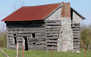
Overhill Cherokee was the term for the Cherokee people located in their historic settlements in what is now the U.S. state of Tennessee in the Southeastern United States, on the western side of the Appalachian Mountains. This name was used by 18th-century European traders and explorers from British colonies along the Atlantic coast, as they had to cross the mountains to reach these settlements.
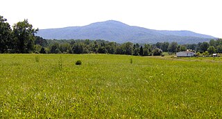
Lone Mountain State Forest is a state forest in Morgan County, Tennessee, located in the southeastern United States. The forest consists of 3,624 acres (14.67 km2) managed by the Tennessee Department of Agriculture.

Chilhowee was a prehistoric and historic Native American site in present-day Blount and Monroe counties in Tennessee, in what were the Southeastern Woodlands. Although now submerged by the Chilhowee Lake impoundment of the Little Tennessee River, the Chilhowee site was home to a substantial 18th-century Overhill Cherokee town. It may have been the site of the older Creek village "Chalahume" visited by Spanish explorer Juan Pardo in 1567. The Cherokee later pushed the Muscogee Creek out of this area.

Rhea Springs was a community once located along the Piney River in Rhea County, Tennessee, in the southeastern United States. Originally established in the 19th century as a health resort, the community was inundated when the completion of Watts Bar Dam by the Tennessee Valley Authority flooded the lower Piney Valley in 1942.
Euchee is an unincorporated community in Meigs County, in the U.S. state of Tennessee.

