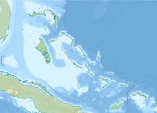
The Bahamas, known officially as the Commonwealth of The Bahamas, is a country within the Lucayan Archipelago of the West Indies in the Atlantic. It takes up 97% of the Lucayan Archipelago's land area and is home to 88% of the archipelago's population. The archipelagic state consists of more than 700 islands, cays, and islets in the Atlantic Ocean, and is located north of Cuba and Hispaniola Island, northwest of the Turks and Caicos Islands, southeast of the US state of Florida, and east of the Florida Keys. The capital is Nassau on the island of New Providence. The Royal Bahamas Defence Force describes The Bahamas' territory as encompassing 470,000 km2 (180,000 sq mi) of ocean space.

The Berry Islands are a chain of islands and a district of the Bahamas, covering about thirty square miles (78 km2) of the northwestern part of the Out Islands.

Andros Island is an archipelago within the Bahamas, the largest of the Bahamian Islands. Politically considered a single island, Andros in total has an area greater than all the other 700 Bahamian islands combined. The land area of Andros consists of hundreds of small islets and cays connected by mangrove estuaries and tidal swamplands, together with three major islands: North Andros, Mangrove Cay, and South Andros. The three main islands are separated by "bights", estuaries that trifurcate the island, connecting the island's east and west coasts. It is 167 kilometres (104 mi) long by 64 km (40 mi) wide at the widest point.

The Abaco Islands lie in the northern Bahamas, 180 miles off the South Florida coast. They comprise the main islands of Great Abaco and Little Abaco, along with smaller barrier cays. The northernmost are Walker's Cay, and its sister island Grand Cay. To the south, the next inhabited islands are Spanish Cay and Green Turtle Cay, with its settlement of New Plymouth, Great Guana Cay, private Scotland Cay, Man-O-War Cay, and Elbow Cay, with its settlement of Hope Town. Southernmost are Tilloo Cay and Lubbers Quarters. Another of note off Abaco's western shore is onetime Gorda Cay, now a Disney Island and cruise ship stop and renamed Castaway Cay. Also in the vicinity is Moore's Island. On the Big Island of Abaco is Marsh Harbour, the Abacos' commercial hub and the Bahamas' third largest city, plus the resort area of Treasure Cay. Both have airports. A few mainland settlements of significance are Coopers Town and Fox Town in the north and Cherokee and Sandy Point in the south. Administratively, the Abaco Islands constitute seven of the 31 Local Government Districts of the Bahamas: Grand Cay, North Abaco, Green Turtle Cay, Central Abaco, South Abaco, Moore's Island, and Hope Town.

Exuma is a district of the Bahamas, consisting of over 365 islands, also called cays.

Acklins is an island and district of the Bahamas.

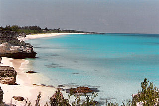
Rum Cay is an island and district of the Bahamas. It measures 30 square miles (78 km2) in area, it is located at Lat.: N23 42' 30" - Long.: W 74 50' 00". It has many rolling hills that rise to about 120 feet.

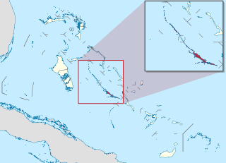
Mangrove Cay is one of the districts of the Bahamas, on Andros Island. Its capital is Moxey Town in the north east corner of the island.

CocoCay or Little Stirrup Cay, Bahamas, is one of the Berry Islands, a collection of cays and small islands, and is located approximately 55 miles north of Nassau. It is used for tourism by Royal Caribbean Cruises Ltd exclusively.

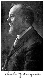
Charles Johnson Maynard was an American naturalist and ornithologist born in Newton, Massachusetts. He was a collector, a taxidermist, and an expert on the vocal organs of birds. In addition to birds, he also studied mollusks, moss, gravestones and insects. He lived in the house at 459 Crafts Street in Newton, Massachusetts, built in 1897 and included in the National Register of Historic Places in 1996 as the Charles Maynard House. The Charles Johnson Maynard Award is given out by the Newton Conservators, Inc.

Long Cay is an island in the Bahamas in an atoll that includes Acklins Island and Crooked Island. It is 8 square miles and is in the Acklins and Crooked Islands District. As of 2010, its population was 29.

The Cat Cays are two islands in the Bahamas, North Cat Cay and South Cat Cay, approximately 10 miles (16 km) south of Bimini. North Cat Cay is a privately owned island and is run as a private members club by the Cat Cay Yacht Club. South Cat Cay is currently under development.

Long Island is an island in the Bahamas that is split by the Tropic of Cancer. It is one of the Districts of the Bahamas and is known as the most scenic island in the Bahamas. Its capital is Clarence Town. The population of Long Island is 3,094 inhabitants.

Chub Cay is a small island located 150 miles (240 km) southeast of Fort Lauderdale, Florida, in the Berry Islands chain of the Bahamas. It has a population of 46.


