Little Lagoon

Last updated
Little Lagoon aerial photography. Little-lagoon-aerial.jpg
Little Lagoon aerial photography.

Little Lagoon is a shallow, brackish lagoon located in Gulf Shores, Alabama. The lagoon is approximately 10 miles long and 0.5 miles wide, with an average depth of 4-6 feet, and has a surface area of approximately 2,480 surface acres. [1] The western shore portion of the lagoon is part of the Bon Secour National Wildlife Refuge while the remainder is private property.

Contents

Geography

Little Lagoon Nautical Chart Nautical map little lagoon.png
Little Lagoon Nautical Chart

Little Lagoon is located on the western side of Gulf Shores, Alabama, and is situated between the Gulf of Mexico and Bon Secour Bay. The lagoon has four small fresh/brackish water lakes that drain into it, Lake Shelby (678 acres), Middle Lake (250 acres), Little Lake (45 acres), and Gator Lake (45 acres). [1] While the Little Lagoon Pass connects the lagoon to the Gulf of Mexico. The pass is located at the southern end of the lagoon and is a popular spot for fishing.

Little Lagoon Pass

View of the Little Lagoon Pass from the bridge, facing the Gulf of Mexico. Little Lagoon Pass View From Bridge towards Gulf of Mexico.jpg
View of the Little Lagoon Pass from the bridge, facing the Gulf of Mexico.
View of Little Lagoon Pass from the bridge towards Little Lagoon. Little Lagoon Pass View from Bridge towards Little Lagoon.jpg
View of Little Lagoon Pass from the bridge towards Little Lagoon.
Bridge height of the Little Lagoon Pass Little-Lagoon Pass Height.jpg
Bridge height of the Little Lagoon Pass

History

In 1847, the shoreline west of Perdido Pass was reported continuous to Fort Morgan, AL; however, by 1918, one small inlet had formed south of Lake Shelby and a slightly larger inlet formed south of the eastern end of Little Lagoon, which is known today as Little Lagoon Pass. Both features likely formed during the hurricane of 1916. [2]

Little Lagoon Pass Dredging

In 1991 a lawsuit was filed against the Alabama Department of Transportation which resulted in a court order requiring the Alabama Department of Transportation to dredge and maintain the channel into the lagoon and to place pass channel dredge spoils back into the coastal drift system west of the pass. [3] Little Lagoon pass dredging is a major and continuous project undertaken in Gulf Shores, Alabama, aimed at restoring the natural flow of water between Little Lagoon and the Gulf of Mexico. It involves the removal of sand from the Little Lagoon Pass, which had become an obstacle to water flow and was causing stagnation in the lagoon. [3] The state of Alabama spends approximately $400,000 a year to hire an engineering company to maintain the pass. [4]

Flora and fauna

Lightning whelk Lightning Whelk underside.jpg
Lightning whelk

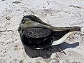
Little Lagoon is home to a variety of flora and fauna, including several species of fish (red drum, spotted seatrout, mangrove snapper), lightning whelk, crustaceans, and mollusks. The lagoon is also home to a variety of bird species, including herons, egrets, and pelicans. The surrounding areas of Little Lagoon are home to a variety of plant species, including sea oats, palmetto bushes, slash pine, longleaf pine, and live oak trees. [5] [6]

Recreation

Mo's Landing on the Little Lagoon Mo's Landing at Little Lagoon.jpg
Mo's Landing on the Little Lagoon
Mo's Landing Sign Info Mo's Landing Sign Info.jpg
Mo's Landing Sign Info
Recreational Fishing at the pass opening on Little Lagoon. Recreational Fishing at the Pass Opening in Little Lagoon.jpg
Recreational Fishing at the pass opening on Little Lagoon.

Little Lagoon is a popular spot for recreational activities, including boating, fishing, crabbing, and kayaking. The western part of the lagoon is also a popular spot for birdwatching and nature photography. There are four public access points to Little Lagoon, including a public boat launch, [7] hiking trails, [8] and a public beach. [9] One of the boat landings on Little Lagoon is Mo's Landing Park, a free public boat launch accessible 7 days a week. [10]

Conservation

Little Lagoon is an important ecosystem that provides habitat for a variety of plant and animal species. The lagoon has faced environmental threats over the years, including pollution and habitat loss. In response, a few organizations, including the Friends of the Lagoon, The Little Lagoon Preservation Society, LLPS, [3] and the Coastal Alabama Clean Water Partnership, have worked to protect and preserve Little Lagoon and its surrounding wetlands.

Related Research Articles

<span class="mw-page-title-main">Lagoon</span> Shallow body of water separated from a larger one by a narrow landform

A lagoon is a shallow body of water separated from a larger body of water by a narrow landform, such as reefs, barrier islands, barrier peninsulas, or isthmuses. Lagoons are commonly divided into coastal lagoons and atoll lagoons. They have also been identified as occurring on mixed-sand and gravel coastlines. There is an overlap between bodies of water classified as coastal lagoons and bodies of water classified as estuaries. Lagoons are common coastal features around many parts of the world.

<span class="mw-page-title-main">Shoal</span> Natural submerged sandbank that rises from a body of water to near the surface

In oceanography, geomorphology, and geoscience, a shoal is a natural submerged ridge, bank, or bar that consists of, or is covered by, sand or other unconsolidated material, and rises from the bed of a body of water close to the surface or above it, which poses a danger to navigation. Shoals are also known as sandbanks, sandbars, or gravelbars. Two or more shoals that are either separated by shared troughs or interconnected by past or present sedimentary and hydrographic processes are referred to as a shoal complex.

<span class="mw-page-title-main">Longshore drift</span> Sediment moved by the longshore current

Longshore drift from longshore current is a geological process that consists of the transportation of sediments along a coast parallel to the shoreline, which is dependent on the angle of incoming wave direction. Oblique incoming wind squeezes water along the coast, and so generates a water current which moves parallel to the coast. Longshore drift is simply the sediment moved by the longshore current. This current and sediment movement occur within the surf zone. The process is also known as littoral drift.

<span class="mw-page-title-main">Barrier island</span> Coastal dune landform that forms by wave and tidal action parallel to the mainland coast

Barrier islands are a coastal landform—a type of dune system and sand island—where an area of sand has been formed by wave and tidal action parallel to the mainland coast. They usually occur in chains, consisting of anything from a few islands to more than a dozen. They are subject to change during storms and other action, but absorb energy and protect the coastlines and create areas of protected waters where wetlands may flourish. A barrier chain may extend for hundreds of kilometers, with islands periodically separated by tidal inlets. The largest barrier island in the world is Padre Island of Texas, United States, at 113 miles (182 km) long. Sometimes an important inlet may close permanently, transforming an island into a peninsula, thus creating a barrier peninsula, often including a beach, barrier beach. Though many are long and narrow, the length and width of barriers and overall morphology of barrier coasts are related to parameters including tidal range, wave energy, sediment supply, sea-level trends, and basement controls. The amount of vegetation on the barrier has a large impact on the height and evolution of the island.

<span class="mw-page-title-main">Sabine Lake</span> Estuary on the Texas–Louisiana border

Sabine Lake is a bay on the Gulf coasts of Texas and Louisiana, located approximately 90 miles (140 km) east of Houston and 160 miles (260 km) west of Baton Rouge, adjoining the city of Port Arthur. The lake is formed by the confluence of the Neches and Sabine Rivers and connects to the Gulf of Mexico through Sabine Pass. It forms part of the Texas–Louisiana border, falling within Jefferson and Orange Counties in Texas and Cameron Parish, Louisiana.

<span class="mw-page-title-main">Biscayne Bay</span> Florida lagoon

Biscayne Bay is a lagoon with characteristics of an estuary located on the Atlantic coast of South Florida. The northern end of the lagoon is surrounded by the densely developed heart of the Miami metropolitan area while the southern end is largely undeveloped with a large portion of the lagoon included in Biscayne National Park.

<span class="mw-page-title-main">Pulicat Lake</span> Brackish water lagoon in India

Pulicat Lake is the second largest brackish water lagoon in India,, measuring 759 square kilometres (293 sq mi). A major part of the lagoon lies in the Tirupati district of Andhra Pradesh. The lagoon is one of three important wetlands that attracts northeast monsoon rain clouds during the October to December season. The lagoon comprises the following regions: Pulicat Lake, Marshy/Wetland Land Region (AP), Venadu Reserve Forest (AP), and Pernadu Reserve Forest (AP). The lagoon was cut across in the middle by the Sriharikota Link Road, which divided the water body into lagoon and marshy land. The lagoon encompasses the Pulicat Lake Bird Sanctuary. The barrier island of Sriharikota separates the lagoon from the Bay of Bengal and is home to the Satish Dhawan Space Centre.

<span class="mw-page-title-main">Perdido Key, Florida</span> Unincorporated community in Florida, United States

Perdido Key is an unincorporated community in Escambia County, Florida located between Pensacola, Florida and Orange Beach, Alabama. The community is located on and named for Perdido Key, a barrier island in northwest Florida and southeast Alabama. "Perdido" means "lost" in the Spanish and Portuguese languages. The Florida district of the Gulf Islands National Seashore includes the east end of the island, as well as other Florida islands. No more than a few hundred yards wide in most places, Perdido Key stretches some 16 miles (26 km) from near Pensacola to Perdido Pass Bridge near Orange Beach.

<span class="mw-page-title-main">Lake Worth Lagoon</span> Lagoon in Florida, US

The Lake Worth Lagoon is a lagoon located in Palm Beach County, Florida. It runs parallel to the coast, and is separated from the Atlantic Ocean by barrier beaches, including Palm Beach Island. The lagoon is connected to the Atlantic Ocean by two permanent, man-made inlets.

Bon Secour National Wildlife Refuge is a 7,157-acre (29 km2) National Wildlife Refuge located in five separate units in Baldwin and Mobile Counties, United States, directly west of Gulf Shores, Alabama on the Fort Morgan Peninsula. The refuge serves as a resting and feeding area for migratory birds and as a sanctuary for native flora and fauna. The refuge is one of the largest undeveloped parcels of land on the Alabama coast.

<span class="mw-page-title-main">Bon Secour, Alabama</span> Place in Alabama, United States

Bon Secour is an unincorporated community and census-designated place in Baldwin County, Alabama, United States. It lies along the eastern coastline of Bon Secour Bay. Bon Secour is over 35 miles (56 km) due east of the Alabama–Mississippi state line, near Gulf Shores, and over 45 miles (72 km) west of Pensacola, Florida. The name "Bon Secour" derives from the French phrase meaning "safe harbor" due to the secluded location on the inside coast of the Fort Morgan peninsula of southern Alabama.

<span class="mw-page-title-main">Perdido Bay</span>

Perdido Bay is a bay at the mouth of and draining the Perdido River, a designated Outstanding Florida Waters river, in Baldwin County, Alabama and Escambia County, Florida, United States. It is essentially a coastal lagoon enclosed by barrier islands, with an inlet, Perdido Pass.

<span class="mw-page-title-main">Kent Island (California)</span>

Kent Island is a small island in Marin County, California. In 1964, it was proposed for large-scale development including a hotel and marina, but the plan was defeated in 1967. The island is now included in the Greater Farallones National Marine Sanctuary.

<span class="mw-page-title-main">Agua Hedionda Lagoon</span> Lagoon in Carlsbad, California, US

The Agua Hedionda Lagoon is a lagoon in Carlsbad, California, that is fed by the Agua Hedionda Creek. Stewardship of much of the lagoon is held by the Encina Power Station and its owner NRG Energy. In November 2000 the Agua Hedionda Lagoon was designated as a critical habitat for the tidewater goby.

Lake Osborne, Florida, USA is a 378-acre lake that is part of a system of once natural freshwater lakes lying along the western slope of the coastal ridge in Palm Beach County just west of the Florida Intracoastal Waterway and Atlantic Ocean. It is located within the C-16 drainage basin which occupies approximately 40,031 acres of land. Five drainage canals discharge directly to Lake Osborne, and Lake Osborne discharges via the E-4 canal to the C16 and C51 canals to the Lake Worth Lagoon. The lake is bordered on the west by John Prince Memorial Park, and on the east be the City of Lake Worth.

<span class="mw-page-title-main">Laguna Madre (United States)</span> Hypersaline lagoon in Texas, US

The Laguna Madre is a long, shallow, hypersaline lagoon along the western coast of the Gulf of Mexico in Nueces, Kenedy, Kleberg, Willacy and Cameron Counties in Texas, United States. It is one of seven major estuaries along the Gulf Coast of Texas. The roughly 20-mile (32 km) long Saltillo Flats land bridge divides it into Upper and Lower lagoons joined by the Intracoastal Waterway, which has been dredged through the lagoon. Cumulatively, Laguna Madre is approximately 130 miles (210 km) long, the length of Padre Island in the US. The main extensions include Baffin Bay in Upper Laguna Madre, Red Fish Bay just below the Saltillo Flats, and South Bay near the Mexican border. As a natural ecological unit, the Laguna Madre of the United States is the northern half of the ecosystem as a whole, which extends into Tamaulipas, Mexico approximately 144 miles (232 km) south of the US border, to the vicinity of the Rio Soto La Marina and the town of La Pesca, extending approximately 275 miles (443 km) through USA and Mexico in total.

The South Lake Worth Inlet, also known as the Boynton Inlet, is an artificial cut through a barrier beach connecting the south end of the Lake Worth Lagoon in Palm Beach County, Florida with the Atlantic Ocean. The inlet is 130 feet (40 m) wide and 6 to 12 feet deep.

<span class="mw-page-title-main">Estuaries of Texas</span> Estuaries on the Gulf coast of Texas

The U.S. state of Texas has a series of estuaries along its coast on the Gulf of Mexico, most of them bounded by the Texas barrier islands. Estuaries are coastal bodies of water in which freshwater from rivers mixes with saltwater from the sea. Twenty-one drainage basins terminate along the Texas coastline, forming a chain of seven major and five minor estuaries: listed from southwest to northeast, these are the Rio Grande Estuary, Laguna Madre, the Nueces Estuary, the Mission–Aransas Estuary, the Guadalupe Estuary, the Colorado–Lavaca Estuary, East Matagorda Bay, the San Bernard River and Cedar Lakes Estuary, the Brazos River Estuary, Christmas Bay, the Trinity–San Jacinto Estuary, and the Sabine–Neches Estuary. Each estuary is named for its one or two chief contributing rivers, excepting Laguna Madre, East Matagorda Bay, and Christmas Bay, which have no major river sources. The estuaries are also sometimes referred to by the names of their respective primary or central water bodies, though each also includes smaller secondary bays, inlets, or other marginal water bodies.

<span class="mw-page-title-main">Mississippi–Alabama barrier islands</span> Islands in the Gulf of Mexico

The Mississippi–Alabama barrier islands are a chain of barrier islands in the Gulf of Mexico along the coasts of Mississippi and Alabama enclosing the Mississippi Sound. The major islands are Cat Island, Ship Island, Horn Island, Petit Bois Island, and Dauphin Island; in the early 20th century the chain also included the Isle of Caprice, which has since been submerged. The islands are separated by wide inlets, several of which have been channelized to form the shipping channels for Gulf coast ports. The shapes and sizes of the islands have changed significantly since the 1800s, with the islands generally shrinking and shifting westward, especially after major tropical cyclones. Most of the islands are uninhabited. Much of the Mississippi portion of the chain is included in the Gulf Islands National Seashore.

Perdido Key is a 24 kilometres (15 mi) long barrier island on the north coast of the Gulf of Mexico. The island extends from Pensacola Pass on the east to Perdido Pass on the west. Most of the island is in Florida, with the western end of the island in Alabama. Santa Rosa Island is to the east of the island, and Alabama Point is to the west. Perdido Key was attached to the mainland until the 1940s when a canal separated it from the mainland. The eastern part of the island forms part of the Gulf Islands National Seashore, which includes the Perdido Key Historic District, the site of three shore batteries that once defended Pensacola Bay. The rest of the island, with the exception of the Perdido Key State Park, has been developed as a resort and residential community. As a barrier island, Perdidio Key is subject to changes due to wave action and longshore currents, particularly from hurricanes. The endangered Perdido Key beach mouse is endemic to the island.

References

  1. 1 2 "Coastal Watershed of the Little Lagoon" (PDF).
  2. "Evaluation of Channel Dredging on Shoreline Response at Adjacent to Mobile Pass, Alabama" (PDF). Applied Coastal Research and Engineering.
  3. 1 2 3 "About Us – Little Lagoon Preservation Society". littlelagoon.org. Retrieved 2023-03-29.
  4. Gordon, James (2022-02-28). "Gulf Shores working to prevent flooding, plan to dredge Little Lagoon Pass". WPMI. Retrieved 2023-03-30.
  5. "Bon Secour Planning" (PDF).
  6. "Gulf Frontal Complex Watershed Management Plan" (PDF). Mobile Bay NEP.
  7. Tourism, Gulf Shores & Orange Beach. "Mo's Landing Park & Boat Launch". Gulf Shores & Orange Beach. Retrieved 2023-03-30.
  8. "Bon Secour National Wildlife Refuge".
  9. Tourism, Gulf Shores & Orange Beach. "Lagoon Pass Park". Gulf Shores & Orange Beach. Retrieved 2023-03-30.
  10. "Mo's Landing | Gulf Shores, AL - Official Website". www.gulfshoresal.gov. Retrieved 2023-06-10.