Little Lake City is an unincorporated community in Gilchrist County, Florida, United States. It is located on the Suwannee River, approximately 5 miles (8.0 km) northwest of Bell.
In law, an unincorporated area is a region of land that is not governed by a local municipal corporation; similarly an unincorporated community is a settlement that is not governed by its own local municipal corporation, but rather is administered as part of larger administrative divisions, such as a township, parish, borough, county, city, canton, state, province or country. Occasionally, municipalities dissolve or disincorporate, which may happen if they become fiscally insolvent, and services become the responsibility of a higher administration. Widespread unincorporated communities and areas are a distinguishing feature of the United States and Canada. In most other countries of the world, there are either no unincorporated areas at all, or these are very rare; typically remote, outlying, sparsely populated or uninhabited areas.
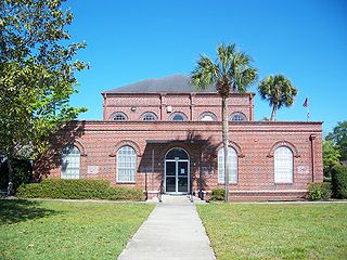
Gilchrist County is a rural county located in the U.S. state of Florida. Organized in 1925 from the western part of Alachua, it is the last county to be formed in the state. As of the 2010 census, the population was 16,939. The county seat is Trenton.
Florida is the southernmost contiguous state in the United States. The state is bordered to the west by the Gulf of Mexico, to the northwest by Alabama, to the north by Georgia, to the east by the Atlantic Ocean, and to the south by the Straits of Florida. Florida is the 22nd-most extensive, the 3rd-most populous, and the 8th-most densely populated of the U.S. states. Jacksonville is the most populous municipality in the state and the largest city by area in the contiguous United States. The Miami metropolitan area is Florida's most populous urban area. Tallahassee is the state's capital.
Little Lake City is located at 29°49′34″N82°53′31″W / 29.826°N 82.892°W at an elevation of 46 feet (14 m). [1]
Hidden Valley is a private residential community in Dearborn County, Indiana, United States. For statistical purposes it is a census-designated place (CDP), with a population of 5,387 at the 2010 census, up from 4,417 at the 2000 census.
Murray Hill is a home rule-class city in Jefferson County, Kentucky, United States, and a part of the Louisville Metro government. The population was 582 during the 2010 census.
Lake Charter Township is a charter township of Berrien County in the U.S. state of Michigan. The population was 2,972 at the 2010 census.
Red River is a town in Kewaunee County, Wisconsin, United States. The population was 1,476 at the 2000 census. The unincorporated communities of Bay View, Duvall, Frog Station, Thiry Daems, and Tonet are located in the town. The census-designated place of Dyckesville is also located partially in the town.
Beecher is a town in Marinette County, Wisconsin, United States. The population was 783 at the 2000 census. The unincorporated communities of Beecher, Beecher Lake, and White Pine Haven are located in the town.
Northern Manitoba is the most northerly region of the Canadian province of Manitoba, added to the province during the last major expansion of its boundaries in 1912. Forestry, mining and hydro-electric development are significant economic drivers with long-term consequences to the environment in the region.
Gull Island is the name of a dozen small islands in the U.S. state of Michigan.
Masterson may refer to:
Garden Hill is the second largest of 3 reserves of the Island Lake region. The First Nation community is located in the northeast section of the Canadian province of Manitoba on the shore of Island Lake. Garden Hill had a population of 2,776 in the Canada Census of 2011. The residents of Garden Hill speak Oji-Cree, the traditional First Nations language, and English.
Route 217 is a collector road in the Canadian province of Nova Scotia.
Evinston is an unincorporated community in Alachua and Marion counties, Florida, United States.
Orange Lake is an unincorporated community in Marion County, Florida, United States. It is located on US 441, on Orange Lake south of McIntosh.
A seagull intersection or continuous green T-intersection is a type of three-way road intersection, usually used on high traffic volume roads and dual carriageways. This form of intersection is popular in Australia and New Zealand, and sometimes used in the United States and other countries.
Black River First Nation is an Ojibwa First Nation located around O'Hanley, Manitoba, along the O'Hanley and Black Rivers, on the eastern shore of Lake Winnipeg. It is 32 kilometers north of Pine Falls, and around 150 kilometers north of Winnipeg. In January 2008, the total registered population was 977, of which the on-reserve population was 701. The 2011 Census reported 521 inhabitants at the reserve.
Mountain Lake (Ontario) may refer to one of a number of lakes in Ontario, Canada with this precise name or to others with similar names.
Lake Johnston No. 102 is a rural municipality in the Canadian province of Saskatchewan, located in the Census Division 3, just north of the Town of Assiniboia, and south of the City of Moose Jaw, in the southwestern corner of the Province. The seat of the municipality is located in the village of Mossbank.
Bear Lake may refer to one of 29 lakes of that name in Ontario, Canada:
Coordinates: 29°49′34″N82°53′31″W / 29.826°N 82.892°W
A geographic coordinate system is a coordinate system that enables every location on Earth to be specified by a set of numbers, letters or symbols. The coordinates are often chosen such that one of the numbers represents a vertical position and two or three of the numbers represent a horizontal position; alternatively, a geographic position may be expressed in a combined three-dimensional Cartesian vector. A common choice of coordinates is latitude, longitude and elevation. To specify a location on a plane requires a map projection.
This article about a location in Gilchrist County, Florida is a stub. You can help Wikipedia by expanding it. |