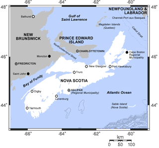
The Gulf of Saint Lawrence is the outlet of the North American Great Lakes via the Saint Lawrence River into the Atlantic Ocean. The gulf is a semi-enclosed sea, covering an area of about 226,000 square kilometres (87,000 sq mi) and containing about 34,500 cubic kilometres (8,300 cu mi) of water, which results in an average depth of 152 metres (499 ft).

Grand Narrows is a community in the Cape Breton Regional Municipality in Nova Scotia, Canada. The community is the birthplace of the longest serving Premier of Nova Scotia, George Henry Murray. The Barra Strait Marina is here, operated by the Grand Narrows Waterfront Development Society.
Third Lake, Nova Scotia may refer to:
Little Harbour, Nova Scotia could mean the following places:
Iona is a small community in the Canadian province of Nova Scotia, located in Victoria County on Cape Breton Island. It is named after Iona in Scotland. Perched above the Barra Strait between the Great Bras d'Or and Piper's Cove portions of Bras d'Or Lake, Iona is the western terminus of the Barra Strait Bridge carrying Nova Scotia Route 223 across to Grand Narrows village. The Cape Breton and Central Nova Scotia Railway passes through the village, crossing the Barra Strait over the Grand Narrows Bridge on its way east to North Sydney and Sydney.
Gabarus Lake is a community in the Canadian province of Nova Scotia, located in the Cape Breton Regional Municipality.
Little Harbour is a community in the Canadian province of Nova Scotia, in Richmond County on Cape Breton Island.
Big Beach is a community located on the north side of the Boisdale Hills on the east side of the Great Bras D'Or Lake on Provincial Route 223, which runs from Leitches Creek to Little Narrows, through Central Cape Breton Island in the Canadian province of Nova Scotia. Located on the "Bras D'Or Lakes Scenic Drive" it is part of the Cape Breton Regional Municipality in Central Cape Breton Island.
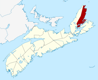
Northside East Bay is a community in the Canadian province of Nova Scotia, located in the Cape Breton Regional Municipality on Cape Breton Island. The location of Northside East Bay is flawed on the current map. Northside East Bay is actually located on the most Easterly end of the Bras d'or Lakes; about 15 miles west of the city of Sydney.
Malagawatch is a small community in the Canadian province of Nova Scotia, located in Inverness County on Cape Breton Island.
Thibeauville is a small community in the Canadian province of Nova Scotia, located in Richmond County.
Little Anse is a small community in the Canadian province of Nova Scotia, located in Richmond County.
Sporting Mountain is a small community in the Canadian province of Nova Scotia, located in Richmond County.
Pondville is a small community in the Canadian province of Nova Scotia, located in Richmond County on Isle Madame.
Pondville South is a small community in Isle Madame, in the province of Nova Scotia, located in Richmond County on Isle Madame.
There are various Black Lakes in Nova Scotia, Canada. They vary widely in size, depth and usability. Many counties, such as Cumberland, Halifax, Inverness, and Pictou Counties have more than one Black Lake so named, while other counties mentioned in this article have only one named Black Lake.

Rankin School of the Narrows is a Primary through Grade 12 school located in Iona, Nova Scotia, Canada, on Cape Breton Island in Victoria County. It is governed by the Cape Breton – Victoria Regional School Board.

The Barra Strait is a 1.22 km (0.76 mi) wide channel located the Canadian province of Nova Scotia. It connects the northern and southern basins of Bras d'Or Lake, an inland saltwater body that dominates the centre of Cape Breton Island. The border between two of Cape Breton Island's counties runs through the strait; the community of Grand Narrows, in Cape Breton County, is situated on the eastern shore while the community of Iona, in Victoria County is situated on the western shore.
Little Dummy Lake is a lake in Barron County, Wisconsin, in the United States.