Related Research Articles

Cornwall is a ceremonial county in South West England, bordered to the north and west by the Celtic Sea, to the south by the English Channel, and to the east by Devon, the River Tamar forming the border between them. Cornwall is the westernmost part of the South West Peninsula of the island of Great Britain. The southwesternmost point is Land's End and the southernmost Lizard Point. Cornwall has a population of 568,210 and an area of 3,563 km2 (1,376 sq mi). The county has been administered since 2009 by the unitary authority, Cornwall Council. The ceremonial county of Cornwall also includes the Isles of Scilly, which are administered separately. The administrative centre of Cornwall is Truro, its only city.

Newquay is a town on the north coast in Cornwall, in the south west of England. It is a civil parish, seaside resort, regional centre for aerospace industries, future spaceport and a fishing port on the North Atlantic coast of Cornwall, approximately 12 miles (19 km) north of Truro and 20 miles (32 km) west of Bodmin.

St Austell is a town in Cornwall, England, UK, 10 miles (16 km) south of Bodmin and 30 miles (48 km) west of the border with Devon.

Charlestown is a village and port on the south coast of Cornwall, United Kingdom, and in the civil parish of St Austell Bay. It is situated approximately 2 miles (3 km) south east of St Austell town centre.

Grampound is a village in Cornwall, England. It is at an ancient crossing point of the River Fal and today is on the A390 road six miles west of St Austell and eight miles east of Truro.

Trewoon is a village in south Cornwall, England, United Kingdom. It is on the western outskirts of St Austell, on the A3058 road and is a linear settlement, with housing estates, a village hall, park and playing fields. The village has many amenities and local businesses: a garage, a post office, a busy local convenience store, hairdressers, "The White Pyramid" pub, a social club and a Methodist church.
Dick Cole is a Cornish politician, currently serving as an elected member of Cornwall Council and the leader of the Cornish devolutionist political party, Mebyon Kernow, a role he has held since 1997. He is currently one of the longest serving political leaders in Britain. Dick Cole was first elected MK leader in 1997. He lives in Fraddon, a village in Mid-Cornwall.

St Austell and Newquay is a constituency represented in the House of Commons of the UK Parliament since 2015 by Steve Double, a Conservative.

Mining in Cornwall and Devon, in the southwest of England, began in the early Bronze Age, around 2150 BC, and ended with the closure of South Crofty tin mine in Cornwall in 1998. Tin, and later copper, were the most commonly extracted metals. Some tin mining continued long after the mining of other metals had become unprofitable.

St Stephen-in-Brannel is a civil parish and village in mid Cornwall, England, United Kingdom. St Stephen village is four miles (6.5 km) west of St Austell on the southern edge of Cornwall's china clay district. Other settlements in the parish include Whitemoor, Currian Vale and Nanpean. The population of the civil ward at the 2011 census was 7,119. An electoral ward also exists simply bearing the name St. Stephen. The population at the same census was 4,772 only. It follows therefore that the ward is not as big as the parish.

Treverbyn is a civil parish and village in mid-Cornwall, England, United Kingdom.

Roche is a civil parish and village in mid-Cornwall, United Kingdom. The village gets its name from a granite outcrop east of the village. Roche is the Norman-French word for Rock. On the southern flank of the village is the 20-metre (66-foot) high Roche Rock, a large granite outcrop. The parish population at the 2011 census including Belowda, Bilberry, Carbis, Coldvreath and Criggan is 3,381, and the ward population at the same census was 3,867.

Cornwall is administered as a county of South West England whose politics are influenced by a number of issues that make it distinct from the general political scene in the wider United Kingdom, and the political trends of neighbouring counties. Its position on the geographical periphery of the island of Great Britain is also a factor.

The economy of Cornwall in South West England, is largely dependent upon agriculture followed by tourism. Cornwall is one of the poorest areas in the United Kingdom with a GVA of 70.9% of the national average in 2015. and is one of four UK areas that qualifies for poverty-related grants from the EU. Farming and food processing contributed £366 million to the county, equal to 5.3% of Cornwall’s total GVA. The agricultural/food industry in Cornwall employs 9,500 people, 23,700 are employed in the food industry in Cornwall The Cornish economy also depends heavily on its successful tourist industry which contributes 24% of Cornwall's GDP and supports about 1 in 5 jobs. Tourism contributed £1.85 billion to the Cornish economy in 2011.

St Austell Brewery is a brewery founded in 1851 by Walter Hicks in St Austell, Cornwall, England. The brewery's flagship beer is Tribute Ale, which accounts for around 80% of sales. Other popular ales include Proper Job, Tinner's Ale and Duchy Bitter.

Pentewan is a coastal village and former port in south Cornwall, England, United Kingdom. It is situated at grid reference SX 019 472 3 miles (4.8 km) south of St Austell at the mouth of the St Austell River.

Gribbin Head is a promontory on the south coast of Cornwall, England, UK, owned and managed by the National Trust. It separates St Austell Bay from the estuary of the River Fowey and is marked by a large tower used to aid navigation of ships approaching the local harbours. The nearest town is Fowey. The western point of the headland is called Little Gribbin.

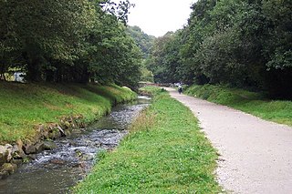
The St Austell River properly known as the River Vinnick, but historically called The White River, is a 12 kilometres (7.5 mi) long river located in south Cornwall, England, United Kingdom. 50.337°N 4.793°W. The river has also been known as the "red river" due to tin streaming and mining activity upstream.

Hensbarrow is a natural region in the county of Cornwall, England, UK, that has been recognized as National Character Area 154 by Natural England.

Menacuddle is a historic place, holy well and wooded area in St Austell, Cornwall. It has a reputation for being haunted.
References
- ↑ "Doogal" . Retrieved 8 October 2017.
- ↑ "Google Street View Little Treviscoe, England.Google Maps UK". streetviewmaps.co.uk. Retrieved 8 October 2017.
- ↑ "Interesting Information for Little Treviscoe, St. Austell, PL26 7QN Postcode". StreetCheck. Retrieved 8 October 2017.
- ↑ "House Prices in Little Treviscoe, St. Austell, Cornwall". www.rightmove.co.uk. Retrieved 8 October 2017.
- ↑ "Little Treviscoe - Cornish Mine Images - History in Black and White". Cornish Mine Images - History in Black and White. Retrieved 8 October 2017.
- ↑ "'Devil cat' Shiny wreaks havoc in Cornish village". Metro. 28 November 2013. Retrieved 8 October 2017.
- ↑ "BBC Weather - Little Treviscoe". BBC Weather. 2 July 2014. Retrieved 8 October 2017.
Coordinates: 50°21′54″N4°53′31″W / 50.365°N 4.892°W
| This Cornwall location article is a stub. You can help Wikipedia by expanding it. |