
Peso da Régua, commonly known as Régua, is a municipality in northern Portugal, in the district of Vila Real. The population in 2011 was 17,131, in an area of 94.86 km2 (36.63 sq mi) km².

The Terceira Divisão Portuguesa was a football league in Portugal, situated at the fourth level of the Portuguese football league system. The Third Division was initially the third level of the Portuguese pyramid but with the creation of the Segunda Liga in 1990–91, it became the fourth level. The competition merged with the Portuguese Second Division at the end of the 2012–13 to form a new enlarged third-level league, the Campeonato Nacional de Seniores.
Vale de Cambra is a city and a municipality in Portugal. The population in 2011 was 22,864, in an area of 147.33 km². It had 21,440 electors in 2006. The city itself has about 4,100 inhabitants and is located in the Vila Chã, Codal e Vila Cova de Perrinho parish.

The Viana do Castelo District is a district located in the northwest of Portugal, bordered by Spain (Galicia) from the north and Braga District from the south. It has an area of 2,255 km2 and a population of 252,011 (2006), for a density of 111.8 inhabitants/km2. The district capital is the city of Viana do Castelo.

Tâmega Subregion is a former NUTS3 subregion, part of the NUTS2 region of Norte Region, Portugal. It was abolished at the January 2015 NUTS 3 revision. Its name derives from the Tâmega River that crosses through the subregion. With 558,000 inhabitants (2005) it is the fourth most populated subregion in Portugal. It has several important urban centers - Paços de Ferreira, Lousada, Penafiel (24,000), Paredes and Felgueiras - being one of the most decentralized of the Portuguese subregions. The chief city is Penafiel. Other important cities are: Amarante, Felgueiras, Freamunde, Gandra, Lixa, Marco de Canaveses, Paços de Ferreira, Paredes, Rebordosa and São Salvador de Lordelo. Important towns: Baião, Cabeceiras de Basto, Castelo de Paiva (Sobrado), Cinfães, Lousada, Resende, Ribeira de Pena and Vila Meã.

Fafe is a municipality in the northern Portuguese district of Braga.

Vila Cova e Feitos is a civil parish in the municipality of Barcelos, Portugal. It was formed in 2013 by the merger of the former parishes Vila Cova and Feitos. The population in 2011 was 2,564, in an area of 15.73 km².

Laura Cardoso, artistic name of Laurinda de Jesus Cardoso BaleroniOMC is a Brazilian actress.

Barcelos is a city and a municipality in Braga District in the Minho Province, in the north of Portugal. The population in 2011 was 120,391, in an area of 378.90 km2. With 60 parishes, it is the municipality with the highest number of parishes in the country. It is one of the growing municipalities in the country, and is well known by its textile and adobe industries.
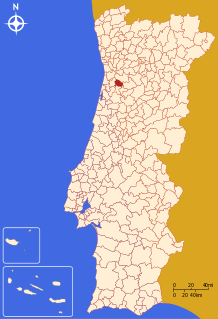
Freitas is a village and a former civil parish in the municipality of Fafe, Portugal. In 2013, the parish merged into the new parish Freitas e Vila Cova.

Felgueiras is a municipality in Porto District, Portugal. The current mayor is Inácio Ribeiro. There are two cities located in the municipality: Felgueiras and Lixa. The population in 2011 was 58,065, in an area of 115.74 km².

Fânzeres is a town and a former civil parish in the municipality of Gondomar, Portugal. In 2013, the parish merged into the new parish Fânzeres e São Pedro da Cova. Its population is around 20,000.

The District of Porto, is located on the north-west coast of Portugal. The district capital is the city of Porto, the second largest city in the country. It is bordered by the Aveiro and Viseu districts to the south, Braga district to the north and Vila Real district to the east.
W52–FC Porto is a professional road bicycle racing team, which participates in UCI Continental Circuits races. Run by the União Ciclista de Sobrado based in Sobrado, Valongo, Portugal, its title sponsors are clothing brand W52, and sports club FC Porto.


