This page is based on this
Wikipedia article Text is available under the
CC BY-SA 4.0 license; additional terms may apply.
Images, videos and audio are available under their respective licenses.

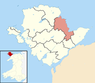
Moelfre is a village, community and electoral ward on the north-east coast of the Isle of Anglesey in Wales. The community area covers the village and harbour, and several smaller, dispersed settlements. It includes six scheduled Iron Age hut groups and many other sites of archaeological interest. The harbour was formerly a local fishing port; a lifeboat station has been based here since 1854. Among many shipwrecks off the coast was that of the Royal Charter in 1859. Near the modernised lifeboat station is the RNLI Seawatch Centre. The coastline includes a rocky headland north of the village and a large sandy beach at Lligwy Bay, both traversed by the Anglesey Coastal Path.

A fishing weir, fish weir, fishgarth or kiddle is an obstruction placed in tidal waters, or wholly or partially across a river, to direct the passage of, or trap fish. A weir may be used to trap marine fish in the intertidal zone as the tide recedes, fish such as salmon as they attempt to swim upstream to breed in a river, or eels as they migrate downstream. Alternatively, fish weirs can be used to channel fish to a particular location, such as to a fish ladder. Weirs were traditionally built from wood or stones. The use of fishing weirs as fish traps probably dates back prior to the emergence of modern humans, and have since been used by many societies across the world.
Llugwy may refer to a number of places and archaeological sites in Wales:
Dulas Bay is a small bay on the north east coast of Anglesey, north Wales, forming the boundary between Llaneilian and Moelfre communities. The bay is bordered by three beaches.
Ynys Dulas is a small island located off the north-east coast of Anglesey, Wales. It marks the most eastern part of the parish of Llaneilian.

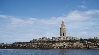
Ynys Moelfre is a small island off the coast of Anglesey, Wales. At low tide it has a maximum length of 261 metres and a maximum width of 121 metres with a maximum area of 6.6 acres (27,000 m2). The nearest settlement to the island is the village of Moelfre, and the two are separated by a shallow channel called Y Swnt, which is never more than 194 metres wide and can at low tide only be waist-deep all the way across. At extreme low Spring tides, it is possible to walk across to the island on dry ground all the way. Due to its proximity to the mainland there are grasses found on the island and a few wild flowers. Species of birds that can be found on the island include gulls, terns, gannets, fulmars, and Great/Arctic skuas. A colony of seals live there and porpoises are occasionally seen also. There are, however, no man-made structures. It is referred to by some locals as Rat Island.
Brynrefail is a small village in north-east Anglesey, Wales.

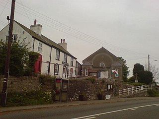
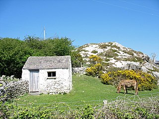
Lligwy Burial Chamber is a Neolithic burial chamber in Lligwy, near the east coast of Anglesey, Wales, United Kingdom. It consists of a circle of upright stones, made into a low chamber by a very large roof slab estimated at 25 tonnes. Excavation in 1909 found the remains of some 15 to 30 people, and pottery suggesting a late Neolithic date. Close to the village of Moelfre, the site is within a few metres of the road, where there is room to leave a single car for short periods.

Brynteg is a crossroads village and post town on the Isle of Anglesey, North Wales. It is part of the community of Llanfair-Mathafarn-Eithaf.
John Griffith (V) was a Welsh politician who sat in the House of Commons from 1715 to 1740.

Llanbedrgoch is a hamlet and post town, a mile south of the town of Benllech and west of Red Wharf Bay, on the island of Anglesey, north Wales. The parish church is St Peter's Church, Llanbedrgoch, a Grade II* listed building that dates back to the 15th century.
Llanddyfnan is a village and community in the Welsh county of Anglesey, located 3.5 miles (5.6 km) north east of Llangefni, 6.6 miles (10.6 km) north west of Menai Bridge and 7.1 miles (11.4 km) west of Beaumaris.

Llaneuddog is a hamlet in the community of Llaneilian, Ynys Môn, Wales. It lies along the A5025 road, between Brynrefail and Penysarn, near Dulas. It belonged to the historical parish of Llanwenllwyfo, now part of Llaneilian. The hamlet takes its name from an ancient chapel to St Euddog which was in the vicinity of the A5025. It was recorded in 1920 as having the stones re-used in farm buildings, and the water stoup used as a pig trough at nearby Lligwy. The presumed site is a small enclosure with a crescent-shaped bank thought to be the churchyard boundary.

St Michael's Church is the parish church of Penrhoslligwy, a village near Moelfre in the north-east of the island of Anglesey, in Gwynedd, Wales. With datable components from around 1400, the building is listed at Grade II* and was restored in 1865.