Related Research Articles

The National Oceanic and Atmospheric Administration is an American scientific and regulatory agency within the United States Department of Commerce that forecasts weather, monitors oceanic and atmospheric conditions, charts the seas, conducts deep sea exploration, and manages fishing and protection of marine mammals and endangered species in the U.S. exclusive economic zone.

A weather station is a facility, either on land or sea, with instruments and equipment for measuring atmospheric conditions to provide information for weather forecasts and to study the weather and climate. The measurements taken include temperature, atmospheric pressure, humidity, wind speed, wind direction, and precipitation amounts. Wind measurements are taken with as few other obstructions as possible, while temperature and humidity measurements are kept free from direct solar radiation, or insolation. Manual observations are taken at least once daily, while automated measurements are taken at least once an hour. Weather conditions out at sea are taken by ships and buoys, which measure slightly different meteorological quantities such as sea surface temperature (SST), wave height, and wave period. Drifting weather buoys outnumber their moored versions by a significant amount.

The National Hurricane Center (NHC) is the division of the United States' NOAA/National Weather Service responsible for tracking and predicting tropical weather systems between the Prime Meridian and the 140th meridian west poleward to the 30th parallel north in the northeast Pacific Ocean and the 31st parallel north in the northern Atlantic Ocean. The agency, which is co-located with the Miami branch of the National Weather Service, is situated on the campus of Florida International University in Westchester, Florida.

The National Weather Service (NWS) is an agency of the United States federal government that is tasked with providing weather forecasts, warnings of hazardous weather, and other weather-related products to organizations and the public for the purposes of protection, safety, and general information. It is a part of the National Oceanic and Atmospheric Administration (NOAA) branch of the Department of Commerce, and is headquartered in Silver Spring, Maryland, within the Washington metropolitan area. The agency was known as the United States Weather Bureau from 1890 until it adopted its current name in 1970.

NEXRAD or Nexrad is a network of 160 high-resolution S-band Doppler weather radars operated by the National Weather Service (NWS), an agency of the National Oceanic and Atmospheric Administration (NOAA) within the United States Department of Commerce, the Federal Aviation Administration (FAA) within the Department of Transportation, and the U.S. Air Force within the Department of Defense. Its technical name is WSR-88D.
The University Corporation for Atmospheric Research (UCAR) is a US nonprofit consortium of more than 100 colleges and universities providing research and training in the atmospheric and related sciences. UCAR manages the National Center for Atmospheric Research (NCAR) and provides additional services to strengthen and support research and education through its community programs. Its headquarters, in Boulder, Colorado, include NCAR's Mesa Laboratory, designed by I.M. Pei.

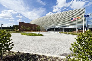
The Weather Prediction Center (WPC), located in College Park, Maryland, is one of nine service centers under the umbrella of the National Centers for Environmental Prediction (NCEP), a part of the National Weather Service (NWS), which in turn is part of the National Oceanic and Atmospheric Administration (NOAA) of the U.S. Government. Until March 5, 2013 the Weather Prediction Center was known as the Hydrometeorological Prediction Center (HPC). The Weather Prediction Center serves as a center for quantitative precipitation forecasting, medium range forecasting, and the interpretation of numerical weather prediction computer models.

The Finnish Meteorological Institute is the government agency responsible for gathering and reporting weather data and forecasts in Finland. It is a part of the Ministry of Transport and Communications but it operates semi-autonomously.
The Earth Observing System Data and Information System (EOSDIS) is a key core capability in NASA’s Earth Science Data Systems Program. It is a comprehensive data and information system designed to perform a wide variety of functions in support of a heterogeneous national and international user community. EOSDIS provides a spectrum of services; some services are intended for a diverse group of casual users while others are intended only for a select cadre of research scientists chosen by NASA's peer-reviewed competitions, and then many fall somewhere in between. The primary services provided by EOSDIS are User Support, Data Archive, Management and Distribution, Information Management, and Product Generation, all of which are managed by the Earth Science Data and Information System (ESDIS) Project.

The US National Center for Atmospheric Research is a US federally funded research and development center (FFRDC) managed by the nonprofit University Corporation for Atmospheric Research (UCAR) and funded by the National Science Foundation (NSF). NCAR has multiple facilities, including the I. M. Pei-designed Mesa Laboratory headquarters in Boulder, Colorado. Studies include meteorology, climate science, atmospheric chemistry, solar-terrestrial interactions, environmental and societal impacts.
The Integrated Data Viewer (IDV) from Unidata/UCAR is a Java based software framework for analyzing and visualizing geoscience data. The IDV release includes a software library and a reference application made from that software. It uses the VisAD library and other Java-based utility packages.
The Cooperative Institute for Meteorological Satellite Studies (CIMSS) is a research institute where scientists study the use of data from geostationary and polar orbit weather satellites to improve forecasts of weather (including tropical cyclones and severe storms. CIMSS was formed through a Memorandum of Understanding between the University of Wisconsin–Madison, the National Oceanic and Atmospheric Administration and the National Aeronautics and Space Administration. CIMSS parent organization, the Space Science and Engineering Center is a primary developer and operator of environmental satellite technologies.
MesoWest is an ongoing cooperative project, started in 1996, to provide access to current and archive weather observations across the United States. Weather observations include but are not limited to: temperature, humidity, wind speed, wind direction, and precipitation. Data are collected from a variety of organizations. Some stations participate in voluntary weather observing networks such as the Citizen Weather Observer Program. Others are part of mesonets that are managed by private firms or federal/state/local agencies. These data are available for a multitude of uses. Over 20,000 weather stations actively report to the MesoWest database.
UNAVCO is a non-profit university-governed consortium that facilitates geoscience research and education using Geodesy. UNAVCO is funded by the National Science Foundation (NSF) and the National Aeronautics and Space Administration (NASA) to support geoscience research around the world. UNAVCO operates the GAGE Facility on behalf of the NSF and NASA. As a university-governed consortium, UNAVCO supports the goals of the academic scientific community. UNAVCO has 120 US academic members and supports over 110 organizations globally as associate members.

The Antarctic Meteorological Research Center (AMRC) is an Antarctic research program funded by the National Science Foundation (NSF) that is based out of the Space Science and Engineering Center (SSEC) at the University of Wisconsin. The AMRC was founded as a link between the UW-Madison automatic weather station (AWS) project and the Man computer Interactive Data Access System (McIDAS) project, also at UW-Madison.
The NOAA National Operational Model Archive and Distribution System (NOMADS) is a Web-services based project providing both real-time and retrospective format independent access to climate and weather model data.
Meteocentre is a website displaying real-time weather information for North America and Europe organized in three different portals, each adapted for a given area and named after a town part of the region of interest: 1) Montréal, for Québec, 2) Toulouse, for France and 3) Reading, for the United Kingdom. The website created in 1994 is maintained by its founder Christian Pagé, actually a research engineer at CERFACS, in collaboration since 2009 with Jean-François Caron, a research scientist at the Met Office, and hosted by the Atmospheric Sciences Group at the Université du Québec à Montréal (UQAM).

Yellowstone was the inaugural supercomputer at the NCAR-Wyoming Supercomputing Center (NWSC) in Cheyenne, Wyoming. It was installed, tested, and readied for production in the summer of 2012. The Yellowstone supercomputing cluster was decommissioned on December 31, 2017, being replaced by its successor Cheyenne.

GOES-16, formerly known as GOES-R before reaching geostationary orbit, is the first of the GOES-R series of Geostationary Operational Environmental Satellites (GOES) operated by NASA and the National Oceanic and Atmospheric Administration (NOAA). GOES-16 serves as the operational geostationary weather satellite in the GOES East position at 75.2°W, providing a view centered on the Americas. GOES-16 provides high spatial and temporal resolution imagery of the Earth through 16 spectral bands at visible and infrared wavelengths using its Advanced Baseline Imager (ABI). GOES-16's Geostationary Lightning Mapper (GLM) is the first operational lightning mapper flown in geostationary orbit. The spacecraft also includes four other scientific instruments for monitoring space weather and the Sun.
The THORPEX Interactive Grand Global Ensemble (TIGGE) is an implementation of ensemble forecasting for global weather forecasting and is part of THORPEX, an international research programme established in 2003 by the World Meteorological Organization to accelerate improvements in the utility and accuracy of weather forecasts up to two weeks ahead.
References
- ↑ "Local Data Manager (LDM)" . Retrieved 7 April 2013.
- ↑ "Data Fact Sheet" (PDF). UCAR. Retrieved 7 April 2013.