Related Research Articles

A compass is a device that shows the cardinal directions used for navigation and geographic orientation. It commonly consists of a magnetized needle or other element, such as a compass card or compass rose, which can pivot to align itself with magnetic north. Other methods may be used, including gyroscopes, magnetometers, and GPS receivers.

Surveying or land surveying is the technique, profession, art, and science of determining the terrestrial two-dimensional or three-dimensional positions of points and the distances and angles between them. A land surveying professional is called a land surveyor. These points are usually on the surface of the Earth, and they are often used to establish maps and boundaries for ownership, locations, such as the designed positions of structural components for construction or the surface location of subsurface features, or other purposes required by government or civil law, such as property sales.

Flight instruments are the instruments in the cockpit of an aircraft that provide the pilot with data about the flight situation of that aircraft, such as altitude, airspeed, vertical speed, heading and much more other crucial information in flight. They improve safety by allowing the pilot to fly the aircraft in level flight, and make turns, without a reference outside the aircraft such as the horizon. Visual flight rules (VFR) require an airspeed indicator, an altimeter, and a compass or other suitable magnetic direction indicator. Instrument flight rules (IFR) additionally require a gyroscopic pitch-bank, direction and rate of turn indicator, plus a slip-skid indicator, adjustable altimeter, and a clock. Flight into instrument meteorological conditions (IMC) require radio navigation instruments for precise takeoffs and landings.

A magnetometer is a device that measures magnetic field or magnetic dipole moment. Different types of magnetometers measure the direction, strength, or relative change of a magnetic field at a particular location. A compass is one such device, one that measures the direction of an ambient magnetic field, in this case, the Earth's magnetic field. Other magnetometers measure the magnetic dipole moment of a magnetic material such as a ferromagnet, for example by recording the effect of this magnetic dipole on the induced current in a coil.

In navigation, bearing is the horizontal angle between the direction of an object and another object, or between it and that of true north.

Magnetic declination, or magnetic variation, is the angle on the horizontal plane between magnetic north and true north. This angle varies depending on position on the Earth's surface and changes over time.

A non-directional (radio) beacon (NDB) is a radio transmitter at a known location, used as an aviation or marine navigational aid. As the name implies, the signal transmitted does not include inherent directional information, in contrast to other navigational aids such as low-frequency radio range, VHF omnidirectional range (VOR) and tactical air navigation system (TACAN). NDB signals follow the curvature of the Earth, so they can be received at much greater distances at lower altitudes, a major advantage over VOR. However, NDB signals are also affected more by atmospheric conditions, mountainous terrain, coastal refraction and electrical storms, particularly at long range. The system, developed by United States Air Force (USAF) Captain Albert Francis Hegenberger, was used to fly the world's first instrument approach on May 9, 1932.

In geography and geodesy, a meridian is the locus connecting points of equal longitude, which is the angle east or west of a given prime meridian. In other words, it is a line of longitude. The position of a point along the meridian is given by that longitude and its latitude, measured in angular degrees north or south of the Equator. On a Mercator projection or on a Gall-Peters projection, each meridian is perpendicular to all circles of latitude. A meridian is half of a great circle on Earth's surface. The length of a meridian on a modern ellipsoid model of Earth has been estimated as 20,003.93 km (12,429.87 mi).
In aviation, aircraft compass turns are turns made in an aircraft using only a magnetic compass for guidance.

In marine navigation, a pelorus is a reference tool for maintaining bearing of a vessel at sea. It is a "simplified compass" without a directive element, suitably mounted and provided with vanes to permit observation of relative bearings.

Magnetic deviation is the error induced in a compass by local magnetic fields, which must be allowed for, along with magnetic declination, if accurate bearings are to be calculated.
Suunto Oy is a Finnish company that manufactures and markets sports watches, dive computers, compasses and precision instruments. Headquartered in Vantaa, Finland, Suunto employs more than 300 people worldwide, and its products are sold in over 100 countries. Although globally active, the headquarters is placed next to the factory, in which most of the work stages are still handcrafted. Suunto is a subsidiary of Amer Sports, owned since 2019 by the Chinese group Anta Sports, with sister brands Wilson, Atomic, Sports Tracker, Salomon, Precor, Arc'teryx.

Diver navigation, termed "underwater navigation" by scuba divers, is a set of techniques—including observing natural features, the use of a compass, and surface observations—that divers use to navigate underwater. Free-divers do not spend enough time underwater for navigation to be important, and surface supplied divers are limited in the distance they can travel by the length of their umbilicals and are usually directed from the surface control point. On those occasions when they need to navigate they can use the same methods used by scuba divers.

A circumferentor, or surveyor's compass, is an instrument used in surveying to measure horizontal angles. It was superseded by the theodolite in the early 19th century.
A Flinders bar is a vertical soft iron bar placed in a tube on the fore side of a compass binnacle. The Flinders bar is used to counteract the vertical magnetism inherent within a ship and is usually calibrated as part of the process known as swinging the compass, where deviations caused by this inherent magnetism are negated by the use of horizontal correctors.
Position resection and intersection are methods for determining an unknown geographic position by measuring angles with respect to known positions. In resection, the one point with unknown coordinates is occupied and sightings are taken to the known points; in intersection, the two points with known coordinates are occupied and sightings are taken to the unknown point.

The history of geomagnetism is concerned with the history of the study of Earth's magnetic field. It encompasses the history of navigation using compasses, studies of the prehistoric magnetic field, and applications to plate tectonics.

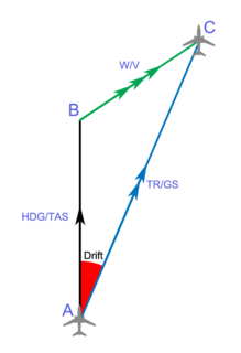
In navigation, the heading of a vessel or aircraft is the compass direction in which the craft's bow or nose is pointed. Note that the heading may not necessarily be the direction that the vehicle actually travels, which is known as its course or track. Any difference between the heading and course is due to the motion of the underlying medium, the air or water, or other effects like skidding or slipping. The difference is known as the drift, and can be determined by the wind triangle. At least seven ways to measure the heading of a vehicle have been described.

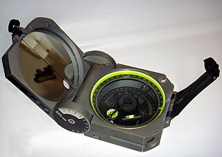
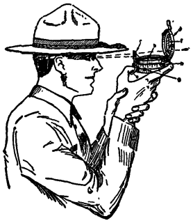
A prismatic compass is a navigation and surveying instrument which is extensively used to find out the bearing of the traversing and included angles between them, waypoints and direction. Compass surveying is a type of surveying in which the directions of surveying lines are determined with a magnetic compass, and the length of the surveying lines are measured with a tape or chain or laser range finder. The compass is generally used to run a traverse line. The compass calculates bearings of lines with respect to magnetic needle. The included angles can then be calculated using suitable formulas in case of clockwise and anti-clockwise traverse respectively. For each survey line in the traverse, surveyors take two bearings that is fore bearing and back bearing which should exactly differ by 180° if local attraction is negligible. The name Prismatic compass is given to it because it essentially consists of a prism which is used for taking observations more accurately.

Burt's solar compass or astronomical compass is a surveying instrument that makes use of the sun's direction instead of magnetism. William Austin Burt invented his solar compass in 1835. The solar compass works on the principle that the direction to the sun at a specified time can be calculated if the position of the observer on the surface of the Earth is known, to a similar precision. The direction can be described in terms of the angle of the sun relative to the axis of rotation of the planet.
References
- ↑ Surveying, Volume 1 by B.C. Punmia and Ashok Kumar Jain. Chapter: Compass Surveying
- ↑ "Surveying" by S. K. Duggal available on Google books
- 1 2 3 "Compass Surveying" by C. L. Kocher, Principal of Mehar Chand Polytechnic College, Jalandhar City, Punjab
- ↑ Surveying by B.C. Punmia "Compass Surveying"