Related Research Articles

Bracknell Forest is one of six unitary authority areas within Berkshire in southern England. It covers the two towns of Bracknell and Sandhurst and the village of Crowthorne and also includes the areas of North Ascot, Warfield and Winkfield. Parts of the borough border neighbouring boroughs such as Wokingham Borough Council and the Royal Borough of Windsor & Maidenhead. The south of the borough also borders parts of Surrey and Hampshire.
The Office for National Statistics is the executive office of the UK Statistics Authority, a non-ministerial department which reports directly to the UK Parliament.

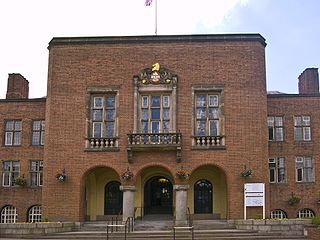
The Metropolitan Borough of Dudley is a metropolitan borough of West Midlands in England. It was created in 1974 following the Local Government Act 1972, through a merger of the existing Dudley County Borough with the municipal boroughs of Stourbridge and Halesowen. The borough borders Sandwell to the east, the city of Birmingham to the south east, Bromsgrove to the south in Worcestershire, South Staffordshire District to the west, and the city of Wolverhampton to the north.

Geomatics is defined in the ISO/TC 211 series of standards as the "discipline concerned with the collection, distribution, storage, analysis, processing, presentation of geographic data or geographic information". Under another definition, it "consists of products, services and tools involved in the collection, integration and management of geographic data". It includes geomatics engineering and is related to geospatial science.

The City of Bradford is a local government district of West Yorkshire, England, with the status of a city and metropolitan borough. It is named after its largest settlement, Bradford, but covers a far larger area which includes the towns and villages of Keighley, Shipley, Bingley, Ilkley, Haworth, Silsden, Queensbury, Thornton and Denholme. Bradford has a population of 528,155, making it the fourth-most populous metropolitan district and the sixth-most populous local authority district in England. It forms part of the West Yorkshire Urban Area conurbation which in 2011 had a population of 1,777,934, and the city is part of the Leeds-Bradford Larger Urban Zone (LUZ), which, with a population of 2,393,300, is the fourth largest in the United Kingdom after London, Birmingham and Manchester.
ONS codes are geocodes maintained by the United Kingdom's Office for National Statistics to represent a wide range of geographical areas of the UK, for use in tabulating census and other statistical data. These codes are also known as GSS codes, where GSS refers to the Government Statistical Service of which ONS is part.
Geodemography includes the application of geodemographic classifications for business, social research and public policy but has a parallel history in academic research seeking to understand the processes by which settlements evolve and neighborhoods are formed. It links the sciences of demography, the study of human population dynamics, geography, the study of the locational and spatial variation of both physical and human phenomena on Earth, and also sociology. In short, geodemography is the study of people based on where they live. Geodemographic systems estimate the most probable characteristics of people based on the pooled profile of all people living in a small area near a particular address.

Coincident full censuses have taken place in the different jurisdictions of the United Kingdom every ten years since 1801, with the exceptions of 1941 and Ireland in 1921. Simultaneous censuses were taken in the Channel Islands and the Isle of Man: returns were archived with those of England. In addition to providing detailed information about national demographics, the results of the census play an important part in the calculation of resource allocation to regional and local service providers by the UK government. The most recent UK census took place in 2011.

The fire services in the United Kingdom operate under separate legislative and administrative arrangements in England and Wales, Northern Ireland, and Scotland.
The Neighbourhood Statistics Service (NeSS) was established in 2001 by the UK's Office for National Statistics (ONS) and the Neighbourhood Renewal Unit (NRU) - then part of the Office of the Deputy Prime Minister (ODPM), now Communities and Local Government (CLG) - to provide good quality small area data to support the Government's Neighbourhood Renewal agenda. This cross-Government initiative also involved the co-operation and partnership of data suppliers across departments, agencies and other organisations. The ONS closed the Neighbourhood Statistics website for England and Wales on the 12 May 2017. To offset this, the ONS is aiming to meet the needs of users via the ONS website, although direct postcode searches are no longer available to users.

A census of the population of the United Kingdom is taken every ten years. The 2011 census was held in all countries of the UK on 27 March 2011. It was the first UK census which could be completed online via the Internet. The Office for National Statistics (ONS) is responsible for the census in England and Wales, the General Register Office for Scotland (GROS) is responsible for the census in Scotland, and the Northern Ireland Statistics and Research Agency (NISRA) is responsible for the census in Northern Ireland.
Community-based monitoring (CBM) is a form of public oversight, ideally driven by local information needs and community values, to increase the accountability and quality of social services such as health, development aid, or to contribute to the management of natural resources. Within the CBM framework, members of a community affected by a social program or environmental change track this change and its local impacts, and generate demands, suggestions, critiques and data that they then act on, including by feeding back to the organization implementing the program or managing the environmental change. For a Toolkit on Community-Based Monitoring methodology with a focus on community oversight of infrastructure projects, see www.communitymonitoring.org. For a library of resources relating to community-based monitoring of tropical forests, see forestcompass.org/how/resources.
The South West Observatory (SWO) was a regional resource for the South West of England, originally established by the former South West Regional Development Agency, Government Office for the South West, and the South West Regional Assembly as a partnership for use by policy-makers to aid and improve evidence-based decision-making. It operated from 2002 - 2013.

The regions, formerly known as the government office regions, are the highest tier of sub-national division in England. Between 1994 and 2011, nine regions had officially devolved functions within government. While they no longer fulfill this role, they continue to be used for statistical and some administrative purposes. While the UK was a member of the European Union, they defined areas (constituencies) for the purposes of elections to the European Parliament. Eurostat also used them to demarcate first level Nomenclature of Territorial Units for Statistics (NUTS) regions within the European Union. The regions generally follow the boundaries of the former standard regions, established in the 1940s for statistical purposes.

The World Database on Protected Areas (WDPA) is the largest assembly of data on the world's terrestrial and marine protected areas, containing more than 260,000 protected areas as of August 2020, with records covering 245 countries and territories throughout the world. The WDPA is a joint venture between the United Nations Environment Programme World Conservation Monitoring Centre and the International Union for Conservation of Nature World Commission on Protected Areas.
The UNESCO Institute for Statistics (UIS) is the statistical office of UNESCO and is the UN depository for cross-nationally comparable statistics on education, science and technology, culture, and communication.
Natural capital accounting is the process of calculating the total stocks and flows of natural resources and services in a given ecosystem or region. Accounting for such goods may occur in physical or monetary terms. This process can subsequently inform government, corporate and consumer decision making as each relates to the use or consumption of natural resources and land, and sustainable behaviour.
Beyond 2011 also known as The Beyond 2011 Programme is a project initiated by the UK Statistics Authority to look at the alternatives to running a Census in 2021. In 2008 UK Government Treasury Select Committee had expressed concerns about the increasing cost of running the census and inaccuracies in data gathered only every ten years. In 2010 the newly elected coalition government reiterated such concerns responding to a report by the UK Statistics Authority.
The ONS Postcode Directory (ONSPD) relates both current and terminated postcodes in the United Kingdom to a range of current statutory administrative, electoral, health and other area geographies. It also links postcodes to pre-2002 health areas, 1991 Census enumeration districts for England and Wales, 2001 Census Output Areas (OA) and Super Output Areas (SOA) for England and Wales, 2001 Census OAs and SOAs for Northern Ireland and 2001 Census OAs and Data Zones (DZ) for Scotland. It helps support the production of area based statistics from postcoded data.
References
- ↑ "Association of Public Health Observatories". Archived from the original on 2010-05-23. Retrieved 2009-09-03.
- ↑ Cabinet Office PAT 18 Report Archived 2009-07-03 at the Wayback Machine
- ↑ Local Information Systems: A review of their role, characteristics and benefits Archived 2009-08-15 at the Wayback Machine
- ↑ CLG LIS Resources Home page Archived 2009-06-25 at the Wayback Machine
- ↑ Improvement Service LIS Toolkit Archived 2009-09-14 at the Wayback Machine
- ↑ CLG LIS Toolkit Archived 2008-12-08 at the Wayback Machine