
HVDC Vancouver Island is a de-energized high-voltage direct current interconnection owned by BC Hydro that runs between Arnott Substation (ARN) in Delta, British Columbia at 49°5′31″N123°2′31″W on the Canadian mainland, and the Vancouver Island Terminal (VIT) in Duncan, British Columbia on Vancouver Island at 48°49′39″N123°42′55″W. It went into operation in 1968 and was extended in 1977. HVDC Vancouver Island consists of three overhead line sections with a total length of 42 kilometres and two submarine cable sections with a length of 33 kilometres. Pole 1 ceased operation in 2014, and Pole 2 ceased operation in 2016. The infrastructure remains in place and portions may be re-used in the future.
Dionisio Point Provincial Park is a provincial park campground in the southern Gulf Islands of British Columbia, Canada. It is located at the northwestern tip of Galiano Island, across Porlier Pass from Valdes Island.
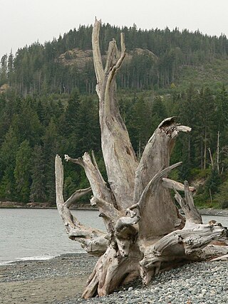
French Beach Provincial Park is a provincial park on Vancouver Island, between Sooke and Jordan River, British Columbia. The area has a day use parking lot and B.C. provincial campground. It was created in 1980 as the first family-oriented park on the southwest coast of Vancouver Island. Situated on the scenic Strait of Juan de Fuca on the west coast of southern Vancouver Island, French Beach Provincial Park offers views of the Strait and the Olympic Mountains. The beach spreads on 1,600-meters and is a location for whale watching as well as spotting Bald eagles, Ospreys and a variety of seabirds.
Sandwell Provincial Park is a provincial park in British Columbia, Canada. It is a small oceanfront site on Lock Bay, on the northeast shore of Gabriola Island. Hiking, swimming and beach-walking are popular activities here, though it is only accessible at low tide and park facilities are limited. There are also petroglyphs carved into the sandstone boulders on Lock Bay's foreshore.

Riley Park, sometimes also known as Riley Park–Little Mountain, is a neighbourhood in Vancouver, British Columbia. Its boundaries are 41st Avenue to the south, 16th Avenue to the north, Cambie Street to the west, and Fraser Street to the east. The main commercial thoroughfare of the neighbourhood is Main Street.
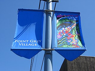
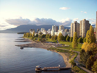
West Point Grey is a neighbourhood in the northwest of the city of Vancouver, British Columbia, Canada. It is on Point Grey and bordered by 16th Avenue to the south, Alma Street to the east, English Bay to the north, and Blanca Street to the west. Notable beaches within West Point Grey include Spanish Banks, Locarno and Jericho. Immediately to the south is Pacific Spirit Regional Park and to the east is Kitsilano.

Iona Island in Richmond, British Columbia, Canada was formerly an island, but is now a peninsula physically connected to Sea Island via a causeway and Ferguson Road. Iona is home to a primary sewage treatment plant, an animal refuge and a park. The Iona Sewage Plant is located near the centre of the island and has tours for the public. Iona Beach Regional Park also features a beach adjacent to wildlife from the nearby animal refuge. The park is managed by Metro Vancouver. Iona Island is located almost adjacent to the Vancouver International Airport. The park is mostly visited by birders, as the sewage ponds have attracted many rare shorebirds such as Spoon-billed Sandpiper, Great Knot, and Red-necked Stint.
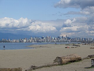
Spanish Banks are a series of beaches in the city of Vancouver, British Columbia, Canada, located along the shores of English Bay in the West Point Grey neighbourhood. Spanish Banks is located between Locarno Beach to the east and the grounds of the University of British Columbia to the west.
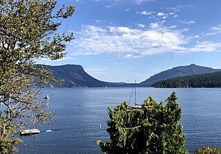
Maple Bay is a seaside community located in the Cowichan Valley of southern Vancouver Island, British Columbia, Canada. A narrow inlet and surrounded by smooth, pebbled beaches, Maple Bay is home to marine activity all year round. Maple Bay is a small town with a population of 2,640.
Little Mountain, elevation 125 m (410 ft), is a mountain in the central part of the city of Vancouver, British Columbia, Canada. The mountain is home to Queen Elizabeth Park, which sits at the top of the mountain, and Nat Bailey Stadium, which is located near the base. The mountain lends its name to the Riley Park–Little Mountain neighbourhood and to the Vancouver-Little Mountain electoral district.

Jericho Beach, known originally as iy'a'l'mexw in Squamish, a Vancouver beach, is located west of the seaside neighbourhood of Kitsilano. It is surrounded by Jericho Beach Park, a grassy area with a pond, which is a picnic destination. Jericho Beach is the home of the Jericho Sailing Centre Association.
The seawall in Vancouver, British Columbia, Canada, is a stone wall that was constructed around the perimeter of Stanley Park to prevent erosion of the park's foreshore and is the world's longest uninterrupted waterfront path. Colloquially, the term also denotes the pedestrian, bicycle, and rollerblading pathway on the seawall, one which has been extended far outside the boundaries of Stanley Park and which has become one of the most-used features of the park by both locals and tourists.
X̱wemelch'stn, usually anglicized as Homulchesan, is a large community within the Squamish Nation of the Squamish people, who are a part of the Coast Salish ethnic and linguistic group. The name X̱wemelch'stn, translates to "Fast Moving Water of Fish", relating to the Capilano River. The village is one of the oldest and major villages of the Squamish and continues to be so, being the Squamish Nation's most populated reserve. The community is also known as the Capilano Indian Reserve, formally Capilano Indian Reserve No. 5, and is named like the adjacent Capilano River after the Capilano chieftaincy, the best-known Joe Capilano. The name Kiapila'noq means "people of Kiap", and was the title of the supreme chief of the Sḵwx̱wú7mesh in the area of English Bay. Chief George Capilano was the chief who met Captain Vancouver at X̱wemelch'stn in 1792, and had met Captain Cook in 1782.
Point Grey is a headland marking the southern entrance to English Bay and Burrard Inlet in British Columbia, Canada. The headland is the site of Wreck Beach, Tower Beach, Point Grey Beach and most notably, since 1925, on its top is the Point Grey Campus of the University of British Columbia.

Vanier Park is a municipal park located in the Kitsilano neighbourhood of Vancouver, British Columbia, Canada, created in 1967. It is home to the Museum of Vancouver, the Vancouver Maritime Museum, the City of Vancouver Archives, and the H.R. MacMillan Space Centre. It is also the site of the ancestral Squamish settlement of Sen̓áḵw
Stanley Park is a neighbourhood of the West End in Vancouver, British Columbia, Canada. It is designated as the area lying between Denman Street and the boundary of Stanley Park proper. It is high density, like most of the West End, and is known for being a more affluent area of the West End and, once away from Denman Street, also one of the quietest on the downtown peninsula. Condominium properties facing the park are some of the most expensive in the city. The extreme southwest of the area overlaps with the English Bay neighbourhood.
English Bay is a neighbourhood in the West End of Vancouver, British Columbia, Canada. Though not formally defined, it is a commonly used local appellation that refers to the shopping and residential areas focused on the intersection of Denman and Davie Streets near at English Bay Beach. Generally, the term refers to the first few blocks of residential areas flanking the beach from Stanley Park to Sunset Beach, and to the commercial areas along Davie Street, and along Denman Street south of Nelson Street.

Prospect Point is a point at the northern tip of Stanley Park in Vancouver, British Columbia, Canada, located on the south side of the First Narrows of Burrard Inlet. The point, which as its name suggests, is a viewpoint, landmark and tourist attraction in Stanley Park and has a restaurant and other facilities, is just west of the Lions Gate Bridge.
Deering Island is a small island in Vancouver, British Columbia, in the North Arm of the Fraser River. It is mostly residential and connected to the rest of Vancouver by the Deering Island Bridge. Residential development, consisting mostly of luxury homes, began there in 1988 and continued into the 1990s. The island was previously a shipyard owned by B.C. Packers. It has a city park, Deering Island Park.
Nelson Park is a park in Vancouver, British Columbia. It was funded by the city charging development fees. Nelson Park is located in Vancouver's West End, and is bounded by Nelson St., Bute St., Comox St. and Thurlow Street. Nelson Park hosts one of Vancouver´s community gardens.
