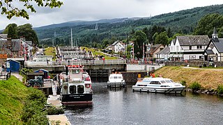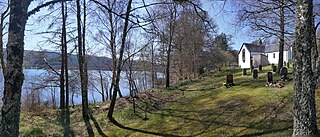
Fort Augustus is a settlement in the parish of Boleskine and Abertarff, at the south-west end of Loch Ness, Scottish Highlands. The village has a population of around 646 (2001). Its economy is heavily reliant on tourism.

Highland is a council area in the Scottish Highlands and is the largest local government area in the United Kingdom. It was the 7th most populous council area in Scotland at the 2011 census. It has land borders with the council areas of Aberdeenshire, Argyll and Bute, Moray and Perth and Kinross. The wider upland area of the Scottish Highlands after which the council area is named extends beyond the Highland council area into all the neighbouring council areas plus Angus and Stirling.

Loch Leven is a sea loch located onto the west coast of Scotland. It is spelled Loch Lyon in Timothy Pont's map of the area and is pronounced Li' un. However, the local Gaelic pronunciation is Lee' oon

Balloch is a village in West Dunbartonshire, Scotland, at the foot of Loch Lomond.

Appin is a coastal district of the Scottish West Highlands bounded to the west by Loch Linnhe, to the south by Loch Creran, to the east by the districts of Benderloch and Lorne, and to the north by Loch Leven. It lies northeast to southwest, and measures 23 by 11 kilometres. The name, meaning "abbey land", in reference to Lismore Abbey, is derived from the Middle Irish apdaine.
EDINA is a centre for digital expertise, based at the University of Edinburgh as a division of the Information Services Group.

Digimap is a web mapping and online data delivery service developed by the EDINA national data centre for UK academia. It offers a range of on-line mapping and data download facilities which provide maps and spatial data from Ordnance Survey, British Geological Survey, Landmark Information Group and OceanWise Ltd Ltd.,, Getmapping Ltd, the Environment Agency, OpenStreetMap, CollinsBartholomew Ltd, and various other sources.

Loch Meiklie is a freshwater loch in Inverness-shire, Scotland, 6.4 kilometres (4.0 mi) west of Drumnadrochit.

Loch Aisir Mòr is a lochan in Scotland's Flow Country. It is situated about one mile from the western coast of Sutherland, at the northeast edge of Oldshoremore, a scattered crofting settlement, and about two miles north of the larger settlement of Kinlochbervie. The lochan is surrounded by heathland. A claybed lines its north shore. Its outflow to the sea is Abhainn Aisir Mhòr, a river about one mile long.
The River Creran is a river in Argyllshire, Scotland. Its headwaters are on the slopes of Sgùrr na h-Ulaidh. It flows initially generally west through a narrow valley, with several waterfalls, and then generally west then south-west through a broader and flatter valley. Its major tributary, the River Ure, joins it on the left, then it flows through a small loch, Loch Baile Mhic Chalein, and it then reaches a sea loch, Loch Creran. The river's course passes no significant settlements.

Achridigill Loch, sometimes listed as Achridig Loch, is a remote lochan in Scotland's Flow Country, roughly 2.5 miles southeast of Strathy, a crofting settlement on Scotland's north coast.
Loch Airigh an Eilein is a lochan in Wester Ross, Scotland roughly 4 km northwest of the scattered crofting settlement of Inverasdale.

Loch Sealbhanach is a freshwater loch in Glen Cannich, Scotland.

Loch Neaty is a remote mountain loch in Inverness-shire, Scotland, just 900m west of the much larger Loch Bruicheach.

Loch na Bairness is a loch in Moidart, Scotland, roughly 1.8 km southwest of the village of Glenuig.

Ashgrove Loch, also known as Stevenston Loch, is a mesotrophic lochan in North Ayrshire, Scotland, approximately 2 km northeast of the town of Stevenston.

Loch Arail is a remote loch in Argyll, Scotland, situated on the side of the B8024 road roughly 2.8km northwest of the settlement of Achahoish.

Akermoor Loch is a remote upland lochan in Selkirkshire, Scotland, approximately 6.5 kilometres (4.0 mi) west of the village of Ashkirk.

Loch a' Chairn Mòr is a remote mountain loch in Wester Ross, Scotland, roughly 2km west of its main outflow, Loch Broom.


