
Wick River, known also as River Wick, is a river in Caithness in Highland, Scotland. It has its source at the confluence of Scouthal Burn and Strath Burn near Achingale Mill at the northern end of Bardarclay Moss in the Flow Country. The river estuary, is in the North Sea bay of Wick and is straddled by the town of Wick. The source is at a height of about 25 metres, about 11 kilometres west and 2 kilometres north of the estuary.
Achairn Burn, known also as Haster Burn, is one of the major tributaries of Wick River, in Caithness, in the Highland area of Scotland. The burn's source is in headwaters flowing from the northern slope of the Hill of Toftgunn, which rises to over 170 metres, and in Camster Loch, which is at nearly 120 metres, between the Hill of Toftgunn and Ballharn Hill. The same area feeds also another major tributary of Wick River, the Camster/Rowans-Strath Burn. Achairn Burn enters Wick River at Mary Ford, about 10 kilometres to the northeast of the burn's source. Its entire course is within Caithness, as is the whole of the catchment basin of Wick River.
Scouthal Burn, a continuation of Burn of Acharole has its source in the Flow Country of Caithness, in the Highland area of Scotland, at a height of around 50 metres, at the confluence of the Burn of Achorole and Alt Feithe Buidhe and about three kilometres south/southwest of the village of Watten.
Strath Burn is a stream which has its source in the Flow Country of Caithness, Scotland, at a height above sea level of around 70 metres, at the confluence of Kensary Burn, and Rowens Burn, and about five kilometres south of the village of Watten.

The River Thurso has Loch Rumsdale in Caithness as its source, about 26 kilometres south and 14 kilometres west of the burgh of Thurso, Caithness, and about 2 kilometres south of the railway line linking the burghs of Thurso and Wick with Inverness. At its source and until it reaches Loch More the river is known also as Strathmore Water. Caithness is in the Highland area of Scotland.

The A882 road is entirely within Caithness in the Highland area of Scotland. It has a length of about 23 kilometres (14 mi) and runs generally west/northwest from the A99 in the county town of Wick to the A9 in the Georgemas area.

Watten is a small village in Caithness, in the Highland area of Scotland, on the main road (A882-A9) between the burgh of Wick and the town of Thurso, about twelve kilometres west of Wick and close to Wick River and to Loch Watten. The village is on The Far North railway line but trains stopped calling at the village in 1960. The railway station is now a private house.
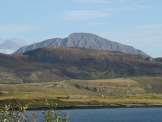
Ben Hope is a mountain in northern Scotland. It is the most northerly Munro, standing alone in the Flow Country south-east of Loch Hope in Sutherland. The mountain is a roughly triangular wedge, with a great crag on the west, with two lower shoulders to the south and northeast. Alpine flowers are abundant in season, although the ground is very rocky.
Crown is an area situated beside the city centre of Inverness, the capital city of the Scottish Highlands. In general, the area's housing dates back to the Victorian or Edwardian era.
Goddo is a small village in Suriname. The village sits on the Suriname River, 1.81 kilometres north of the Pikin River. Goddo can be reached via the Djoemoe Airstrip, or by boat from Pokigron. The village is home to Maroons of the Saramaka tribe.

The Endrick Water or River Endrick is a river which flows into the eastern end of Loch Lomond, Scotland.

The River Helmsdale is one of the major east-flowing rivers of Sutherland in the Highlands of Scotland. It flows broadly southeastwards from Loch Badanloch down the Strath of Kildonan, gathering the waters of the Bannock Burn on its left and the Abhainn na Frithe on its right before discharging into the Moray Firth on the North Sea at the town of Helmsdale. Other significant tributaries of the Helmsdale include the left-bank Suisgill Burn and the right-bank Craggie Water. Loch Achnamoine which is just over 1 km in length, lies on the line of the river 1 mi / 1.5 km downstream of Loch Badanloch. Loch Badanloch is one of a complex of three interconnecting lochs - the other two being Loch nan Clàr and Loch Rimsdale which gather waters from the moors on the southern edge of the Flow Country via the Allt an Lòin Tharsuinn, Allt Lòn a' Chùil and Rimsdale Burn.

The River Brora is an east-flowing river in Sutherland in the Highlands of Scotland. It is formed where its headwater streams, Allt Gobhlach and Allt nan Con-uisge meet. As a part of the Loch Shin Hydro Scheme, some of its flow is now diverted at Dalnessie into the Féith Osdail, a tributary of the River Tirry. It then flows southeastwards down Strath Brora to Dalreavoch. The river then briefly turns northeast and then east, before turning southeastwards once again to pass through the three distinct basins of Loch Brora to enter the Moray Firth on the North Sea at the town of Brora. Its one principal tributary is the Black Water which enters on its left bank at Balnacoil. The Black Water is itself fed by the River Skinsdale and the Coirefrois Burn.

The River Garry is a major tributary of the River Tummel, itself a tributary of the River Tay, in the traditional county of Perthshire in the Scottish Highlands. It emerges from the northeastern end of Loch Garry (56.8193°N 4.2311°W), just to the southeast of the Pass of Drumochter, and flows southeastwards and eastwards down Glen Garry to the narrow Pass of Killiecrankie beyond which it joins the Tummel (56.7182°N 3.7790°W).

Hoy Sound is a body of salt water subject to tidal currents situated south of the town of Stromness in the Orkney archipelago of Scotland.

The Grey Cairns of Camster are two large Neolithic chambered cairns located about 8+1⁄2 miles south of Watten and 5 miles (8 km) north of Lybster in Caithness, in the Highland region of Scotland. They are among the oldest structures in Scotland, dating to about 5,000 years ago. The cairns demonstrate the complexity of Neolithic architecture, with central burial chambers accessed through narrow passages from the outside. They were excavated and restored by Historic Environment Scotland in the late 20th century and are open to the public.
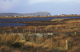
Loch of Mey is a loch near the north coast of Caithness, Scotland, and one of the most northern water features of mainland Britain. It lies just to the south of Skarfskerry, and southwest of Harrow. Described as a "shallow ephemeral loch fringed by fen", due to its importance in facilitating wintering populations of whooper swan and greylag goose from Greenland and Iceland, it has formed part of the Caithness Lochs Ramsar Site since February 1998. Ornithologists of the Scottish Ornithologists Club have established a footpath and memorial hide dedicated to James MacIntyre, which was renovated in August 2005. The Burn of Horsegrow flows into the loch on its southeastern side.
Hubble Creek is a stream in Wayne County in the U.S. state of Missouri. It is a tributary of the St. Francis River.
Dunbeath Water is a short river in Caithness in northern Scotland. It rises at Loch Braigh na h-Aibhne in the Flow Country and initially flows northeast before turning generally south-southeastward to flow through Dunbeath and into the Moray Firth at Dunbeath Bay. Its main tributaries in its upper catchment are the left-bank ones of Allt a' Bhuic which drains Loch Dubh and the Raffin Burn which drains Loch Breac. On the western edge of Dunbeath, the Burn of Houstry, fortified by the Allt an Learanaich also enter on the north bank. The river is crossed by the old bridge and a new bridge carrying the modern A9 road northwards. A small harbour has been developed at the river mouth.