
The Cuillin is a range of mostly jagged rocky mountains on the Isle of Skye in Scotland. The main Cuillin ridge is also called the Black Cuillin to distinguish it from the Red Cuillin, which lie to the east of Glen Sligachan.

The River Forth is a major river in central Scotland, 47 km (29 mi) long, which drains into the North Sea on the east coast of the country. Its drainage basin covers much of Stirlingshire in Scotland's Central Belt. The Gaelic name for the upper reach of the river, above Stirling, is Abhainn Dubh, meaning "black river". The name for the river below the tidal reach is Uisge For.

Summerston is a residential area of Glasgow, Scotland. With most of the housing constructed in the 1970s, it is situated in the far north of the city and is considered to be part of the larger Maryhill district, but has a different postcode; other nearby neighbourhoods are Gilshochill to the south and Cadder to the south-east. With open farmland to the north-east, Summerston is separated from the southern parts of the town of Bearsden to the north-west by the River Kelvin and a golf course.
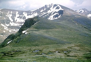
Carn Eighe is a mountain in the Northwest Highlands of Scotland. Rising to 1,183 metres (3,881 ft) above sea level, it is the highest mountain in Scotland north of the Great Glen, the twelfth-highest in the British Isles, and, in terms of relative height, it is the second-tallest mountain in the British Isles after Ben Nevis. Carn Eighe lies between Glen Affric and Loch Mullardoch, and is at the heart of a massif along with its twin peak, the 1,181-metre (3,875 ft) Mam Sodhail.

Wiay, pronounced "waya" is an uninhabited island in Loch Bracadale, off the coast of the Isle of Skye

Tweedbank is a large village south-east of Galashiels in the Scottish Borders. It is part of the county of Roxburghshire. It is an outer suburb or satellite development of Galashiels, on the other (eastern) side of the River Tweed. The population of Tweedbank at the latest census is 2,101.

Loch Scaven is a small freshwater loch at the head of Glen Carron near the source of the River Carron, Wester Ross, Scotland. It is about 6.4 km (4.0 mi) southwest of Achnasheen and 3.2 km (2.0 mi) upstream from Loch Gowan.

Kintail is a mountainous area sitting at the head of Loch Duich in the Northwest Highlands of Scotland, located in the Highland Council area.
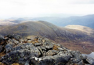
Càrn nan Gobhar is a mountain rising to 993 metres (3,258 ft) in the Northwest Highlands of Scotland. It stands on the northern side of Loch Mullardoch in the upper part of Glen Cannich, in a remote group of four Munros informally known as "The Mullardochs" which form the high ground between Loch Mullardoch and Loch Monar.
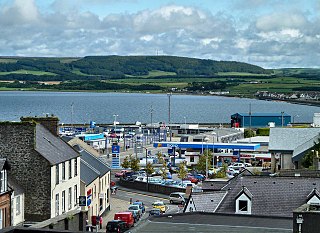
Inch is a civil parish in Dumfries and Galloway, southwest Scotland. It lies on the shore of Loch Ryan, in the traditional county of Wigtownshire.
Old Luce is a civil parish in Dumfries and Galloway, Scotland. It lies in the Machars peninsula, in the traditional county of Wigtownshire. The parish is around 10 miles (16 km) long and 8 miles (13 km) broad, and contains 40,350 acres (16,330 ha).
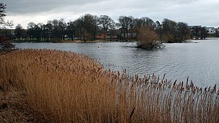
Carlingwark Loch is a small freshwater loch in the historical county of Kirkcudbrightshire, Dumfries and Galloway, Scotland lying just south of Castle Douglas and is roughly rectangular in shape, trending nearly north and south. The name of the loch comes from the Scots Gaelic word Caer meaning fort and wark the old Scots language word for work. There are four artificial islets in the loch showing evidence of fortification and settlement, Ash Island is thought to be a crannog. Several archaeological finds have been retrieved from the loch including a bronze cauldron, sword and pan and two dugout canoes.

Loch Dochart is a small freshwater loch on the Lochdochart Estate in Stirling, Scottish Highlands. It lies approximately 1.7 km (1.1 mi) to the east of the town of Crianlarich at the foot of Ben More. There is a small wooded island in the middle of the loch on which stands the ruins of a castle originally built by Sir Duncan Campbell between 1583 and 1631.
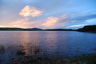
Lochrutton Loch is a large, lowland freshwater loch that lies to the west of Dumfries, Scotland. The loch trends from north to south and is 0.75 mi (1.21 km) long and 0.5 mi (0.80 km) at its widest point. It has an average depth of 13 ft (4.0 m) and is 58 ft (18 m) at its deepest. The loch was surveyed on 1 May 1905 by James Murray and L. W. Collett as part of Sir John Murray's Bathymetrical Survey of Fresh-Water Lochs of Scotland 1897-1909.
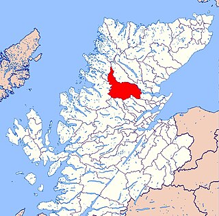
Kincardine is an extensive civil parish and Community council area on the south side of the Kyle of Sutherland, within the Highland unitary authority area of Scotland, the largest settlement being Ardgay.

St. John's Loch is a loch in the civil parish of Dunnet, in Caithness, Highland, Scotland. Loch Heilen and St. John's Loch are the two largest lochs in the parish. It is about two-thirds mile inland in a north-easterly direction from Dunnet Bay on the north coast of Scotland.

Achridigill Loch, sometimes listed as Achridig Loch, is a remote lochan in Scotland's Flow Country, roughly 2.5 miles southeast of Strathy, a crofting settlement on Scotland's north coast.

Loch Beinn a' Mheadhoin is a freshwater loch in Inverness-shire, Scotland. It is one of several lochs in Glen Affric, a National Nature Reserve within Scotland's Caledonian Forest.

Loch Neaty is a remote mountain loch in Inverness-shire, Scotland, just 900m west of the much larger Loch Bruicheach.

Loch na Bairness is a loch in Moidart, Scotland, roughly 1.8 km southwest of the village of Glenuig.


