
Argyll and Bute is one of 32 unitary council areas in Scotland and a lieutenancy area. The current lord-lieutenant for Argyll and Bute is Jane Margaret MacLeod. The administrative centre for the council area is in Lochgilphead at Kilmory Castle, a 19th-century Gothic Revival building and estate. The current council leader is Robin Currie, a councillor for Kintyre and the Islands.

The Caledonian Canal connects the Scottish east coast at Inverness with the west coast at Corpach near Fort William in Scotland. The canal was constructed in the early nineteenth century by Scottish engineer Thomas Telford.

The Crinan Canal between Crinan and Ardrishaig in Argyll and Bute in the west of Scotland is operated by Scottish Canals. The canal, which opened in 1801, takes its name from the village of Crinan at its western end. Approximately nine miles (14 km) long, the canal connects the village of Ardrishaig on Loch Gilp with the Sound of Jura, providing a navigable route between the Clyde and the Inner Hebrides, without the need for a long diversion around the Kintyre peninsula, and in particular the exposed Mull of Kintyre.

Lochgilphead is a town and former burgh in Argyll and Bute, Scotland, with a population of around 2,300 people. It is the administrative centre of Argyll and Bute Council. The village lies at the end of Loch Gilp and lies on the banks of the Crinan Canal. Lochgilphead sits on the A83, with Ardrishaig 2 miles (3 km) to the south and Inveraray 24 miles (39 km) to the north-east; Oban lies 37 miles (60 km) north on the A816.

Argyll, sometimes called Argyllshire, is a historic county and registration county of western Scotland.
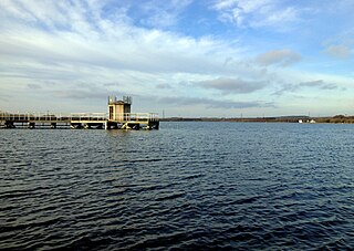
Chasewater is a reservoir located in the parish of Burntwood and the district of Lichfield in Staffordshire, England. Originally known as Norton Pool and Cannock Chase Reservoir, it was created as a canal feeder reservoir in 1797. The reservoir was created to directly supply the Wyrley and Essington Canal and maintain levels in the 160-mile (260 km) Birmingham Canal Network. During a period of great industrial growth in the Black Country region the maintenance of water levels in canal infrastructure was essential and Chasewater was in great demand. As canals became less essential for transport of goods during the mid-20th century, the reservoir diversified and became a popular public amenity with activities such as water-skiing, sailing, wakeboarding and cycling. Chasewater is the third largest reservoir by volume in the county of Staffordshire and the largest canal feeder reservoir in the West Midlands.
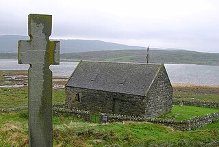
Knapdale forms a rural district of Argyll and Bute in the Scottish Highlands, adjoining Kintyre to the south, and divided from the rest of Argyll to the north by the Crinan Canal. It includes two parishes, North Knapdale and South Knapdale. The area is bounded by sea to the east and west, whilst the sea loch of West Loch Tarbert almost completely cuts off the area from Kintyre to the south. The name is derived from two Gaelic elements: Cnap meaning hill and Dall meaning field.

The Holy Loch is a sea loch, a part of the Cowal peninsula coast of the Firth of Clyde, in Argyll and Bute, Scotland.
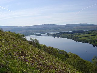
Loch Awe is a large body of freshwater in Argyll and Bute, Scottish Highlands. It has also given its name to a village on its banks, variously known as Loch Awe or Lochawe. There are islands within the loch such as Innis Chonnell and Inishail.

Loch Fyne, is a sea loch off the Firth of Clyde and forms part of the coast of the Cowal peninsula. Located on the west coast of Argyll and Bute, Scotland. It extends 65 kilometres (40 mi) inland from the Sound of Bute, making it the longest of the sea lochs in Scotland. It is connected to the Sound of Jura by the Crinan Canal. Although there is no evidence that grapes have grown there, the title is probably honorific, indicating that the river, Abhainn Fìne, was a well-respected river.

Ardrishaig is a coastal village on Loch Gilp, at the southern (eastern) entrance to the Crinan Canal in Argyll and Bute in the west of Scotland. It lies immediately to the south of Lochgilphead, with the nearest larger town being Oban.

Crinan is a small village located on the west coast of Scotland in the region known as Knapdale, which is part of Argyll and Bute. Before the Crinan Canal was built, Crinan was named Port Righ which meant the king's port. The canal was named from the small settlement of Crinan Ferry on the edge of Loch Crinan where a small ferry landed. The name Crinan probably derives from the Creones tribe who lived in the area in 140 AD. The canal starts at Ardrishaig sea loch on Loch Gilp, and ends nine miles away at Crinan sea loch on the Sound of Jura. The canal was designed to provide a short cut between the west coast and islands at one end and the Clyde estuary at the other, and so avoid the long voyage around the south end of the Kintyre Peninsula.
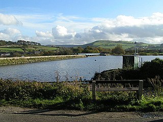
Toddbrook Reservoir, a feeder for the Peak Forest Canal, opened in 1838. It is above the town of Whaley Bridge in the High Peak area of Derbyshire, England. The reservoir is a Site of Special Scientific Interest (SSSI) providing habitats for herons, ducks and other animals and fish, while rare mosses and liverworts grow on its shores, particularly short-lived species that grow on seasonally exposed mud. The reservoir is used for sailing and angling. The Peak District Boundary Walk runs around the eastern end of the reservoir. The reservoir is owned by the Canal & River Trust and, like the nearby Combs Reservoir, is a feeder reservoir for the Peak Forest Canal. The feeder runs through Whaley Bridge, and with the Combs feed enters the canal system in a pool close to the transhipment shed at the Whaley Bridge canal basin.
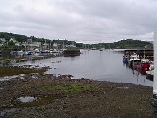
East Loch Tarbert, Argyll is a small sea loch on the eastern side of the Kintyre peninsula in Scotland. It is a part of the much larger Loch Fyne. The village of Tarbert lies along the shores of the loch, which is separated from West Loch Tarbert by an isthmus only 1.5 kilometres (0.93 mi) long.

The River Add is a river which runs through Argyll and Bute on the west coast of Scotland. Historically, it was known as the river Airigh but to avoid confusion with the Aray, it was renamed the River Add.

Cam Loch is one of a number of water supply sources for the Crinan Canal. The impounding reservoir lies to the south of the canal and about 3 kilometres west of Lochgilphead. It has an earthwork dam 8.5 metres high, with records showing that construction was before 1860.

Daill Loch is an impounding reservoir located 5 kilometres (3.1 mi) west north west of Lochgilphead and 1.5 kilometres (0.93 mi) south of the Crinan Canal. It is one of a number of lochs supplying water to the canal. The earthen dam is 8.1 metres (27 ft) high and was completed in 1930.
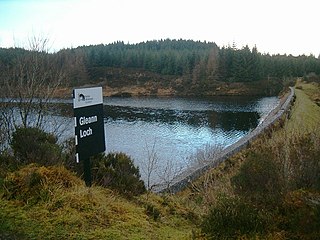
The loch runs south west to north east and is an impounding reservoir located to the west of Lochgilphead, Scotland. It is one of a number of lochs supplying water to the Crinan Canal. The earthen dam is 15 metres high. Records show the dam was constructed before 1860.

Banton Loch, also known as Kilsyth Loch, Townhead Reservoir and once nicknamed Bakers' Loch, is an artificial freshwater lake located to the east of Kilsyth, North Lanarkshire, Scotland, UK, and which supplies water to the highest stretch of the Forth and Clyde Canal.


