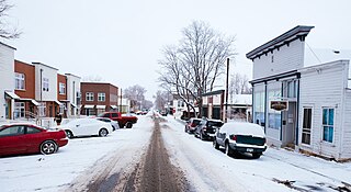
The City of Lafayette is a home rule municipality located in southeastern Boulder County, Colorado, United States. The city population was 30,411 at the 2020 United States Census.
Edgeworth is a suburb of Greater Newcastle, City of Lake Macquarie local government area in New South Wales, Australia, located 18 kilometres (11 mi) west of Newcastle's central business district.
Speers Point is a suburb of Greater Newcastle, and the location of the council seat of the City of Lake Macquarie local government area in New South Wales, Australia. It is 17 kilometres (10.6 mi) west-southwest of the city of Newcastle on the northern shore of Lake Macquarie, in Cockle and Warners Bays, between the suburbs of Cardiff and Warners Bay.
James Brunton Simpson was a Scottish-Australian trade unionist, coal miner and politician, elected as a member of the New South Wales Legislative Assembly for Lake Macquarie for the NSW Branch of the Labor Party.

Coalcliff is a town on the coast of New South Wales, Australia, between Sydney and Wollongong.

Clifton is a village on the coast of New South Wales, Australia, between Sydney and Wollongong. Along with nearby Coalcliff, the village began life as a coal-mining centre. It is situated on a narrow area between the sea and the Illawarra escarpment. The electrified South Coast railway line passes through, but the station at Clifton was closed in 1915. It reopened on 1934-07-04 and closed for the last time on 1983-11-27, at the time of double tracking and electrification.

Austinmer is a northern village of Wollongong on the south coast of New South Wales, Australia. It sits in the northern Illawarra region, south of Stanwell Park and immediately north of Thirroul.

Bellambi is a suburb of Wollongong in the Illawarra region of New South Wales, Australia. It has a railway station on the NSW TrainLink South Coast Line.
Coal Point is a suburb of the City of Lake Macquarie in New South Wales, Australia on a peninsula south-east of the towns of Toronto and Carey Bay, on the western side of Lake Macquarie.
Valentine is a suburb of the City of Lake Macquarie in New South Wales, Australia, and is regarded as a part of the Greater Newcastle district. The suburb is 20 kilometres (12 mi) from Newcastle's central business district situated along the eastern shoreline of Lake Macquarie.
Teralba is a town and suburb of Greater Newcastle, City of Lake Macquarie in New South Wales, Australia, between the towns of Speers Point and Booragul on the northern shoreline of Lake Macquarie. The town first came into being with the construction of the Homebush to Waratah Railway in the early 1880s.
Hillsborough is a suburb of the City of Lake Macquarie, New South Wales, Australia 13 kilometres (8 mi) from Newcastle's central business district on the eastern side of Lake Macquarie. It is part of the City of Lake Macquarie north ward.
Ebenezer Colliery was a coal mine located at Coal Point, New South Wales, Australia.

North Coogee is a coastal, western suburb of Perth, Western Australia, located within the City of Cockburn. The suburb is immediately to the north of Coogee, which takes its name from the lake, Lake Coogee, in the area, which translates to "Body of water" in the native Aboriginal Nyoongar language. Originally this lake was named Lake Munster after Prince William, the Earl of Munster, and later King William IV. The Aboriginal name Kou-gee was recorded in 1841 by Thomas Watson and has been variously spelt Koojee, Coojee and Coogee.

The Goonyella railway system is located in Central Queensland, Australia. It services the coal mining area of the Bowen Basin, carrying coal to the Hay Point and Dalrymple Bay Coal Terminals 20 km southeast of Mackay, as well as products to other destinations by way of connections to the North Coast Line at Yukan and the Central Line at Burngrove via the Gregory coal mine branch. It is also connected to the coal loading terminal at Abbot Point by the GAP line. The line opened on 5 November 1971 and runs for 477 kilometres. The Goonyella system is narrow gauge 1,067 mm and electrified using 25 kV 50 Hz. The line has been duplicated from Hay Point to Wotonga (174 km) and features CTC signalling over the entire system.

Wallarah Colliery was a coal mine located near Crangan Bay, Nords Wharf, New South Wales, Australia, and originally above ground utilities were at Mine Camp, very near Catherine Hill Bay. Originally coal was moved by above ground railway from Mine Camp area to the Catherine Hill Bay jetty, but after the move to Crangan Bay, it was moved underground to surface very near the jetty.

Port Kembla is a man-made cargo port or artificial harbour, with an outer harbour protected by breakwaters and an inner harbour constructed by dredging, located in the Illawarra region of New South Wales, Australia.

Bulli Jetty at Sandon Point, was first built in 1863 and was abandoned in 1943. During that time it was used by the Bulli Coal Company in the transportation of coal from the Bulli mine to the ships for export to other destinations.
The coastal coal-carrying trade of New South Wales involved the shipping of coal—mainly for local consumption but also for export or coal bunkering—by sea to Sydney from the northern and southern coal fields of New South Wales. It took place in the 19th and 20th centuries. It should not be confused with the export coal trade, which still exists today. There was also an interstate trade, carrying coal and coke to other Australian states that did not have local sources of black coal.

Sixty-miler (60-miler) is the colloquial name for the ships that were used in the coastal coal trade of New South Wales, Australia. The sixty-milers delivered coal to Sydney from ports and ocean jetties to the north and south. The name refers to the approximate distance by sea; the distance, from the Hunter River mouth at Nobbys Head to the North Head of Sydney Harbour, is 64 nautical miles.


