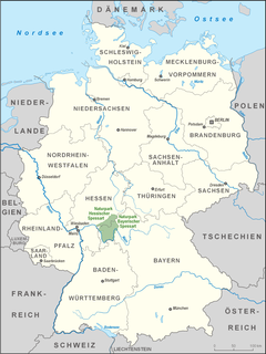
Main-Spessart is a Landkreis (district) in the northwest of Bavaria, Germany. It is located in Lower Franconia and derives its name from the river Main and the wooded hills of the Spessart.

Lohr am Main is a town in the Main-Spessart district in the Regierungsbezirk of Lower Franconia (Unterfranken) in Bavaria, Germany and the seat of the Verwaltungsgemeinschaft of Lohr am Main. It has a population of around 15,000.

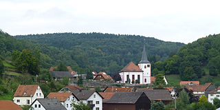
Neuhütten is a community in the Main-Spessart district in the Regierungsbezirk of Lower Franconia (Unterfranken) in Bavaria, Germany and a member of the Verwaltungsgemeinschaft of Partenstein. It has a population of around 1,100.

Neustadt am Main is a community in the Main-Spessart district in the Regierungsbezirk of Lower Franconia (Unterfranken) in Bavaria, Germany and a member of the Verwaltungsgemeinschaft Lohr am Main.
Flörsbachtal is a municipality in the Main-Kinzig district, in Hesse, Germany. It has a population close to 2,400. Flösbachtal contains both the oldest parish and the youngest settlement established in the Spessart hills. Located within the municipal territory is the Hermannskoppe, the highest elevation in the Hessian part of the Spessart and the Wiesbüttmoor, a rare hanging bog.

Sinntal is a municipality in the Main-Kinzig district, in Hesse, Germany. It has a population of around 8,900.

The Ludwig Western Railway is a German railway line that was originally funded by the Kingdom of Bavaria. It runs from Bamberg via Würzburg to Aschaffenburg and on into the former "Kurhessian" Hanau.
The East Hesse Highlands describes a heavily wooded range of hills lying mainly in the German state of Hesse, but also extending a little way into Lower Saxony to the north, Thuringia to the east and Bavaria to the southeast. The region is sandwiched between the West Hesse Depression to the west, the Weser Uplands to the north, the Thuringian Basin to the northeast, the northwestern edge of the Thuringian Forest to the east, the Spessart to the south and the Wetterau to the southwest.

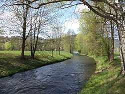
The Kahl is a river in the northern Spessart in Bavaria and Hesse, Germany. It is a right tributary of the Main and is 35.6 km (22.1 mi) long. The name Kahl comes from the Old High German word kaldaha, which means cool and clear. The Kahl rises from two sources left and right of the road at the foot of the Spessart hills, near Kleinkahl. These springs produce 50–60 litres per second. The Kahl flows into the river Main in Kahl am Main. The mouth is near the old Kahl Nuclear Power Plant. The largest tributaries are Westerbach, Sommerkahl, Reichenbach and Geiselbach.

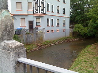
The Geiselbach is a right tributary of the Kahl in the northern Spessart in Bavaria and Hesse, Germany. It is 5,2 km (3,2 mi) long and begins at the confluence of multiple headstreams in Geiselbach. The largest tributary is the Omersbach. It discharges near the Teufelsmühle. The Geiselbach flows through the Teufelsgrund to Hüttelngesäß and forms the border between Hesse and Bavaria. Near the village Brücken it empties into the Kahl.
The Aschaff is a river in the northern Spessart in Bavaria, Germany.
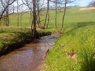
The Reichenbach is a left tributary of the Kahl in the northern Spessart in Lower Franconia, Bavaria, Germany. It is 5 km (3.1 mi) long and begins at the confluence of Schützbach and Kirchengrundbach in Reichenbach. Near Mömbris the Reichenbach empties in the Kahl.
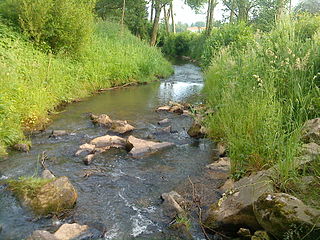
The Westerbach is a right tributary of the Kahl in the northern Spessart in Lower Franconia, Bavaria, Germany.
The Spessart Nature Park covers an area of 2,440 km² within the German hill range known as the Spessart. The geological foundation of the nature park is formed by a Bunter sandstone plate, up to about 400 metres thick, which tilts towards the southeast. The nature park includes the largest contiguous area of mixed forest in Germany. Deep valleys, gentle hillsides and heights characterise the landscape of the Spessart.
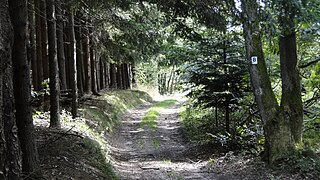
The Birkenhainer Straße is a long-distance hiking trail that follows an ancient trade route through the Mittelgebirge Spessart, in the states of Hesse and Bavaria, Germany. It is 71 km long and leads from Hanau to Gemünden am Main, cutting across the so-called Mainviereck, a large loop of the river Main. The trail follows an ancient trade route which in the Middle Ages was an important road for moving troops and for long-distance trade. The Birkenhainer Straße was a part of the link between Nuremberg and Antwerp. Its origins may lie back as far as the Neolithic period. The name likely derives from a prominent copse of birch trees that used to exist near the road at Geiselbach (Hesse).