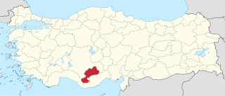
Karaman Province is a province of south-central Turkey. It has an area of 9,163 km2. It has a population of 232,633. According to the 2000 census the population was 243,210. Population density is 27.54 people/km2. The traffic code is 70. The capital is the city of Karaman. Karaman was the location of the Karamanid emirate, which came to an end in 1486.

Kameda was a town located in Nakakanbara District, Niigata Prefecture, Japan.
Dilawarpur is a village in Nirmal district of the India state of Telangana.

Kuntala is a village in Nirmal district in the Indian state of Telangana. Kuntala Mandal headquarters is Kuntala town.
Laxmanchanda is a Mandal in Adilabad district in the state of Telangana in India. It is one of the 5 mandals in Nirmal assembly segment. Laxmanchanda mandal is agriculturally well developed due to good irrigation facilities as its presence nearer to river Godavari and Sriramsagar dam. Establishing own intermediate and degree colleges by co-operative and village development societies has made the village to emerge in education field. Mandal headquarters is about 15 km from Nirmal town.

St. Mary's Church in Katowice is one of the oldest churches in Katowice, Poland, dating back to 19th century. This neo-Gothic church is located in the Śródmieście district.
Rembiocha is a village in the administrative district of Gmina Zbójno, within Golub-Dobrzyń County, Kuyavian-Pomeranian Voivodeship, in north-central Poland.

Majdany is a settlement in the administrative district of Gmina Dąbrowice, within Kutno County, Łódź Voivodeship, in central Poland. It lies approximately 2 kilometres (1 mi) north-east of Dąbrowice, 22 km (14 mi) north-west of Kutno, and 66 km (41 mi) north-west of the regional capital Łódź.
Kruplin-Piaski is a village in the administrative district of Gmina Nowa Brzeźnica, within Pajęczno County, Łódź Voivodeship, in central Poland.
Tarnówka is a village in the administrative district of Gmina Szadek, within Zduńska Wola County, Łódź Voivodeship, in central Poland. It lies approximately 4 kilometres (2 mi) east of Szadek, 13 km (8 mi) north of Zduńska Wola, and 32 km (20 mi) west of the regional capital Łódź.
Tchórzew is a village in the administrative district of Gmina Zbuczyn, within Siedlce County, Masovian Voivodeship, in east-central Poland. It lies approximately 6 kilometres (4 mi) east of Zbuczyn, 18 km (11 mi) south-east of Siedlce, and 104 km (65 mi) east of Warsaw.
Bukowo is a village in the administrative district of Gmina Murów, within Opole County, Opole Voivodeship, in south-western Poland.
Piękna Góra is a village in the administrative district of Gmina Giżycko, within Giżycko County, Warmian-Masurian Voivodeship, in northern Poland. It lies approximately 3 kilometres (2 mi) south-west of Giżycko and 85 km (53 mi) east of the regional capital Olsztyn.
Gnatowo is a village in the administrative district of Gmina Kętrzyn, within Kętrzyn County, Warmian-Masurian Voivodeship, in northern Poland.
Echrarda is a town and commune in the Kairouan Governorate, Tunisia. As of 2004 it had a population of 1,387.

Kuntala Waterfall is waterfall located in Kuntala, Adilabad district, Telangana. It is located on Kadem river in Neredigonda mandal. It is the highest waterfall in the state of Telangana, with a height of 147 feet.
Khanapur is a Mandal Headquarters in Nirmal district of Telangana, India.

Narsapur(G) is a Mandal in Nirmal district in Indian state of Telangana. It was previously famous for its bangles. Thus, it was commonly called as Gajula Narsapur. It was approximately 20 km far away from its nearest Municipality Nirmal city and 21 km from Bhainsa town. It is famous for its Mallikarjuna temple near Devuni cheruvu. There is a big mosque in the middle of the town which attracts the Muslim population even by neighboring villages.
Stallings Crossroads is an unincorporated community in eastern Franklin County, North Carolina, United States. It is located east of Louisburg, at an elevation of 384 feet. The primary cross roads where the community is located are N.C. Highway 56, Fire Tower Road and Edward Best Road.


