Loma del Capiro

Last updated
Lomacapiro3.JPG
View from the Hill; historic Santa Clara at far center of the panoramic, new developments South (left) and countryside with sugarcane crops and Cuban Royal Palm Roystonea regia forest by Northeast (right)
Loma del Capiro and the rooftops of Santa Clara Lomacapiro1.JPG
Loma del Capiro and the rooftops of Santa Clara

Loma del Capiro (English: Capiro's Hill) is a group of three small peaks located in the city of Santa Clara, Cuba.

Contents

The elevation gained local and worldwide historic significance after Che Guevara used it as hideout and command center to invade the city in a battle known as Battle of Santa Clara during the Cuban Revolution. With an altitude of 176.6 m (579 ft), the smallest peak holds the name of Capiro and next to it, with 185.9 and 188.4 meters tall are twin peaks known as Dos Hermanas (Two sisters). A monument commemorating the battle was placed at the top of the smallest peak. A lookout is located close to it, providing a view of the city, the savanna filled with royal palms and farms. The natural surroundings provide shelter to endemic vegetation and a plantation of Santa Clara's tree, the tamarind sits on the South side of it.

History

Hill top with Dellara's monument and the trenches used by rebels in the Battle of Santa Clara Capirotop.jpg
Hill top with Dellara's monument and the trenches used by rebels in the Battle of Santa Clara

With a strategic location overlooking the city, the hill was decisive for the rebels in their quest to take down the Batista regime in 1958. Boasting an army airport, Santa Clara city had several garrisons, numerous troops, mortars tanks and air support. Che Guevara initially estimated that taking over the city would take around two months of fighting. A key action in the very beginning of the battle made it happen in just a few days. Che intercepted an armored train filled with weapons passing the skirts of Capiro hill. The train was derailed and using Molotov cocktails against its metal walls, the soldiers inside did not stand a chance against the heat and surrendered. A museum and monument of the armored train action stands near the hill today. With all the new armaments the rebels began gaining positions inside the city. Once Santa Clara was in the hands of the rebel force, Batista fled Cuba from Havana, never to return again.

Nature

Capiro's Hill with Che's Battle of Santa Clara Monument at the top Lomacapiro2.JPG
Capiro's Hill with Che's Battle of Santa Clara Monument at the top

Aside from the great historic importance of Capiro hill, there is also a great natural, scientific and tourist interest attached to these hills, unfortunately these others features are completely unknown to locals and visitors.

A witness of the Chicxulub impact

In an article released in GeoScienceWorld in September 2005 by Laia Alegret is described how the author researched the sediments at Loma Capiro in Central Cuba and provided new evidence about the Chicxulub impact. The Chicxulub impact refers to the huge meteor that hit the Yucatán Peninsula in the Cretaceous/Paleogene era and is believed to have played a major role in the mass extinction of the dinosaurs. During impact, mega tsunamis, earthquakes and continental destabilization were generated. It affected Cuba in particular, due to the proximity and elongated shape of the island.

A natural shelter

Many endemic species of the Cuban savanna and forests can be found on the north slope of the site, while in the south, a plantation of Tamarind trees was started decades ago. This is the symbolic tree of Santa Clara city, representing its foundation. This plantation helps prevent slope erosion and provides fruit for the nearby community.

Tourism

Declared National Historic Site of Cuba in 1990, [1] along with the museum-monument of the armored train a staircase was built in order to reach the top of the hill where a metal sculpture by Jose Delarra is resting in a green marble base. It symbolizes the will to unify the Cuban nation. The trenches dug by the rebel forces surround the monument. The place serves as lookout post for the outstanding beauty of Santa Clara valley savanna, interrupted here and there by royal palms and farmlands. The city lies down the hill facing South West. Locals used to gather around at night in the site with guitars to serenade friends. In 2002 "Trabajos Comunales" (Community Works), a government enterprise in charge of every city public works, considered the possibility of turning the three hills and surrounding areas into a city natural recreation park and zoo; but without any funds for the idea, they had to keep improving the small city zoo instead.

Related Research Articles

<span class="mw-page-title-main">Cuban Revolution</span> 1955–58 armed rebellion against the Cuban government led by Fidel Castro

The Cuban Revolution was the military and political overthrow of Fulgencio Batista's dictatorship, which had reigned as the government of Cuba between 1952 and 1959. The revolution began after the 1952 Cuban coup d'état, which saw Batista topple the nascent Cuban democracy and consolidate power. Among those opposing the coup was Fidel Castro, then a novice attorney who attempted to contest the coup through Cuba's judiciary. Once these efforts proved fruitless, Fidel Castro and his brother Raúl led an armed attack on the Cuban military's Moncada Barracks on 26 July 1953.
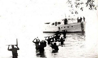
Landing of the <i>Granma</i> Invasion of Cuba done by a single yacht in the Cuban revolution

Granma is a yacht that was used to transport 82 fighters of the Cuban Revolution from Mexico to Cuba in November 1956 to overthrow the regime of Fulgencio Batista. The 60-foot diesel-powered vessel was built in 1943 by Wheeler Shipbuilding of Brooklyn, New York, as a light armored target practice boat, US Navy C-1994, and modified postwar to accommodate 12 people. "Granma", in English, is an affectionate term for a grandmother; the yacht is said to have been named for the previous owner's grandmother.

<span class="mw-page-title-main">Santa Clara, Cuba</span> City in Villa Clara, Cuba

Santa Clara is the capital city of the Cuban province of Villa Clara. It is centrally located in the province and Cuba. Santa Clara is the fifth-most populous Cuban city, with a population of nearly 245,959.

<span class="mw-page-title-main">Sierra Maestra</span> Mountain range of Cuba

The Sierra Maestra is a mountain range that runs westward across the south of the old Oriente Province in southeast Cuba, rising abruptly from the coast. The range falls mainly within the Santiago de Cuba and in Granma Provinces. Some view it as a series of connecting ranges, which join with others to the west. At 1,974 m (6,476 ft), Pico Turquino is the range's – and the country's – highest point. The area is rich in minerals, especially copper, manganese, chromium, and iron.
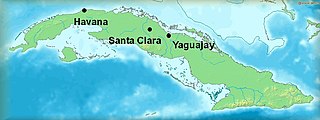
<span class="mw-page-title-main">Battle of Yaguajay</span>

The Battle of Yaguajay was a decisive victory for the Cuban Revolutionaries over the soldiers of the Batista government near the city of Santa Clara in Cuba during the Cuban Revolution.

<span class="mw-page-title-main">Plaza de la Revolución</span> Public square in Havana, Cuba

Plaza de la Revolución, "Revolution Square", is a municipality and a square in Havana, Cuba.

Radio Rebelde is a Cuban Spanish-language radio station. It broadcasts 24 hours a day with a varied program of national and international music hits of the moment, news reports and live sport events. The station was set up in 1958 by Che Guevara in the Sierra Maestra region of eastern Cuba, and was designed to broadcast the aims of the 26th of July Movement led by Fidel Castro.

<span class="mw-page-title-main">Battle of Santa Clara</span> Climax of the Cuban Revolution

The Battle of Santa Clara was a series of events in late December 1958 that led to the capture of the Cuban city of Santa Clara by revolutionaries under the command of Che Guevara.

The Cuban Revolution was the overthrow of Fulgencio Batista's regime by the 26th of July Movement and the establishment of a new Cuban government led by Fidel Castro in 1959.

Parque del Carmen is a park in Santa Clara, Cuba, which honors the city's founding. It is located in the ward (reparto) El Carmen, not too far from Martyr's Park and the railway station.

<span class="mw-page-title-main">Che Guevara Mausoleum</span> National site in Santa Clara, Cuba

The Che Guevara Mausoleum is a memorial in Santa Clara, Cuba, located in "Plaza Che Guevara". It houses the remains of the revolutionary Ernesto "Che" Guevara and 29 fellow combatants killed in 1967 during Guevara's attempt to spur an armed uprising in Bolivia. The full area, which contains a bronze 22-foot statue of Guevara, is referred to as the Ernesto Guevara Sculptural Complex.

The military history of Cuba is an aspect of the history of Cuba that spans several hundred years and encompasses the armed actions of Spanish Cuba while it was part of the Spanish Empire and the succeeding Cuban republics.

Topes de Collantes is a nature reserve park in the Escambray Mountains range in Cuba. It also refers to the third highest peak in the reserve, where a small settlement and tourist center is located, all sharing the same name.

<span class="mw-page-title-main">Yaguajay, Cuba</span> Municipality in Sancti Spíritus, Cuba

Yaguajay is a municipality and town in the Sancti Spíritus Province of Cuba. It is located in the northern part of the province, and borders the Bay of Buena Vista to the north. The Caguanes National Park is located in Yaguajay.

<span class="mw-page-title-main">Che Guevara</span> Argentine revolutionary (1928–1967)

Ernesto "Che" Guevara was an Argentine Marxist revolutionary, physician, author, guerrilla leader, diplomat, and military theorist. A major figure of the Cuban Revolution, his stylized visage has become a ubiquitous countercultural symbol of rebellion and global insignia in popular culture.

<span class="mw-page-title-main">Triumph of the Revolution</span>

The Triumph of the Revolution is the historical term for the flight of Fulgencio Batista on January 1, 1959, and the capture of Havana by the 26th of July Movement on January 8.

<span class="mw-page-title-main">Tren Blindado</span> National monument, memorial and museum in Santa Clara, Cuba

The Tren Blindado is a national monument, memorial park, and museum of the Cuban Revolution, located in the city of Santa Clara, Cuba. It was created by the Cuban sculptor José Delarra on the site of and in memory of the capture of an armoured train on 29 December 1958, during the Battle of Santa Clara.

<span class="mw-page-title-main">Villa Clara Provincial Museum</span>

The Villa Clara Provincial Museum, also known as Abel Santamaría Provincial Museum, is a museum located in the Cuban city of Santa Clara, capital of Villa Clara Province.
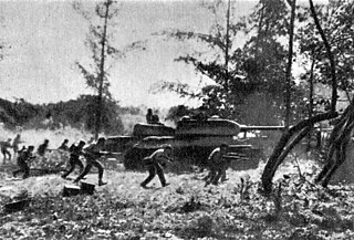
<span class="mw-page-title-main">Tanks of Cuba</span>

Tanks have been utilized on the island of Cuba both within the military and within several conflicts, with their usage and origin after World War II; the Cold War; and the modern era. This includes imported Soviet tanks in the Cuban Revolutionary Armed Forces today as well as American and British designs imported prior to the Cuban Revolution.
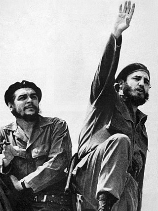
<span class="mw-page-title-main">Consolidation of the Cuban Revolution</span> Period of Cuban history (1959–1970)

The consolidation of the Cuban Revolution is a period in Cuban history typically defined as starting in the aftermath of the revolution in 1959 and ending in 1962, after the total political consolidation of Fidel Castro as the maximum leader of Cuba. The period encompasses early domestic reforms, human rights violations, and the ousting of various political groups. This period of political consolidation climaxed with the resolution of the Cuban missile crisis in 1962, which then cooled much of the international contestation that arose alongside Castro's bolstering of power.

References

  1. National Council for Cultural Heritage. "National Monuments in Cuba" (in Spanish). Archived from the original on 2007-12-11. Retrieved 2007-10-09.

Commons-logo.svg Media related to Loma del Capiro at Wikimedia Commons

22°24′30″N79°56′57″W / 22.40831°N 79.94929°W / 22.40831; -79.94929