Cosmoledo Atoll is an atoll of the Aldabra Group and belongs to the Outer Islands of the Seychelles, and is located 1,029 km (639 mi) southwest of the capital, Victoria, on Mahé Island.

Mahé is the largest island (157.3 km²) of Seychelles, lying in the northeast of the Seychellean nation in the Somali Sea part of the Indian Ocean. The population of Mahé was 77,000, as of the 2010 census. It contains the capital city of Victoria and accommodates 86% of the country's total population. The island was named after Bertrand-François Mahé de La Bourdonnais, a French governor of Isle de France.
Platte Island or Île Platte is an island in the Southern Coral Group that is part of the Outer Islands of the Seychelles.
The Providence Atoll is part of the Farquhar Group of islands in the Seychelles that are part of the Outer Islands, with a distance of 705 km (438 mi) southwest of the capital, Victoria, on Mahé Island.
Praslin is the second largest island (38.5 km2) of the Seychelles, lying 44 km (27 mi) northeast of Mahé in the Somali Sea. Praslin has a population of around 7,533 people and comprises two administrative districts: Baie Sainte Anne and Grand' Anse. The main settlements are the Baie Ste Anne, Anse Volbert and Grand' Anse.
La Digue is the third most populated island of the Seychelles, and fourth largest by land area, lying east of Praslin and west of Felicite Island. In terms of size it is the fourth largest granitic island of Seychelles after Mahé, Praslin and Silhouette Island. It has a population of 2,800 people, who mostly live in the west coast villages of La Passe and La Réunion. There is no airport on La Digue, so to get there from a foreign country, one has to fly to Victoria and continue by ferry, usually via Praslin. It has an area of 10.08 km2, which makes it relatively easy to travel around by bike or on foot.

Moyenne Island is a small island in the Ste Anne Marine National Park off the north coast of Mahé, Seychelles. Since the 1970s it has been a flora and fauna reserve. From 1915 until the 1960s, the island was abandoned until its purchase by Brendon Grimshaw, a former newspaper editor, originally from Dewsbury in Yorkshire, England.
Cerf Island (1.31 km2) lies 4 km off the northeast coast of Mahé in the Seychelles.
Desroches Island or Île Desroches is the main island of the Amirante Islands, part of the Outer Islands of the Seychelles.
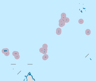
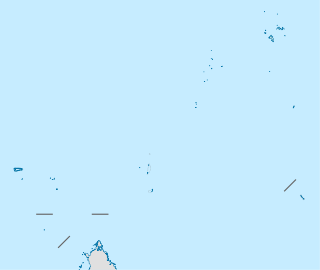
The Outer Islands or Coralline Seychelles (archipelago) is a collective term for those islands of the Seychelles that are not on the shallow Seychelles Bank which defines the location of the granitic Inner Islands archipelago to the east. The local Seychellois Creole name for the outer islands is Zil Elwannyen Sesel, while the French name is Îles Eloignées. They are all of coral formation, and in the western Indian Ocean.

Coëtivy Island is a small coral island in the Seychelles 290 km (180 mi) south of Mahé, at 07°08′S56°16′E.
Fregate Island Private is an island in Seychelles. The island is the easternmost of the granitic Inner Islands of the Seychelles. It is 2.07 square kilometres and is primarily known for the Oetker Collection's secluded private luxury resort which funds an environmental programme to restore habitat and protect rare species. The beach on the island, Anse Victorin, was voted "The World's Best Beach" by The Times. It was named by explorer Lazare Picault after the abundance of frigate birds on the island. A modernisation programme in 2014 improved its sustainability infrastructure with a water bottling plant and state of the art energy generators, and also the renovation of 16 villas.

North Island is a small granitic island (2.01 km²) in the Seychelles.
Sainte Anne Island is the largest (2.27 km²) of eight islands in Ste Anne Marine National Park of the Seychelles. These islands are part of the Mont Fleuri District of the Seychelles. It is 4 km off the east coast of Mahé and has abundant tropical vegetation. The highest peak on Sainte Anne is 246 meters.
Anonyme Island is a small granitic island (0.1 km²) in the Seychelles, lying 700 m off the east coast of Mahé, near the runway of the Seychelles International Airport.
Thérèse Island is a small island off the western coast of Mahé in the Seychelles. It has 700 m long white sand beaches, with numerous coconut palms. It has two rocky peaks which resemble a giant's staircase, the tallest, Thérèse Peak, being 164 metres above sea level. There is a reef protecting the south shore of the island. Thérèse Island, along with its sister island Conception Island, is part of Port Glaud district of Mahé, the main island of the Seychelles.
Sainte Anne Marine National Park lies about 5 km from Victoria, the capital city of the Seychelles, and encompasses eight small islands.
Marie Louise Island is a low-lying coral island in the Amirantes group of the Outer Islands of the Republic of Seychelles, in the western Indian Ocean, with a distance of 308 km south-west of Victoria, Seychelles.
Desnœufs Island is an island in Seychelles, lying at the southern edge of the Amirantes group, in the Outer Islands, with a distance of 321 km south of Victoria, Seychelles.
Round Island is an island in Seychelles, lying in the northeast shores of Mahe.


