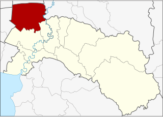
Long Khot โหล่งขอด | |
---|---|
Tambon | |
Coordinates: 19°6′37″N99°10′51″E / 19.11028°N 99.18083°E | |
Country | ![]() |
Province | Chiang Mai |
Amphoe | Phrao |
Population (2014) | |
• Total | 4,640 |
Time zone | TST (UTC+7) |
Postal code | 50190 |
TIS 1099 | 501111 |
Long Khot (Thai : โหล่งขอด) is a tambon (subdistrict) of Phrao District, in Chiang Mai Province, Thailand. In 2014 it had a total population of 4,640 people. [1]
Thai, Central Thai, is the sole official and national language of Thailand and the first language of the Central Thai people and vast majority of Thai Chinese. It is a member of the Tai group of the Kra–Dai language family. Over half of Thai vocabulary is derived from or borrowed from Pali, Sanskrit, Mon and Old Khmer. It is a tonal and analytic language, similar to Chinese and Vietnamese.
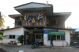
Tambon is a local governmental unit in Thailand. Below district (amphoe) and province (changwat), they form the third administrative subdivision level. As of 2016 there were 7,255 tambons, not including the 180 khwaeng of Bangkok, which are set at the same administrative level, thus every district contains eight to ten tambon. Tambon is usually translated as "township" or "subdistrict" in English — the latter is the recommended translation, though also often used for king amphoe, the designation for a subdistrict acting as a branch of the parent district. Tambon are further subdivided into 69,307 villages (muban), about ten per tambon. Tambon within cities or towns are not subdivided into villages, but may have less formal communities called chumchon (ชุมชน) that may be formed into community associations.
Phrao is a district (amphoe) in the north-eastern part of Chiang Mai Province in northern Thailand. Its major town, Phrao, lies 107 km north-northeast of Chiang Mai.
The tambon is subdivided into 9 administrative villages ( muban ).
Muban is the lowest administrative sub-division of Thailand. Usually translated as village and sometimes as hamlet, they are a subdivision of a tambon. As of 2008, there were 74,944 administrative muban in Thailand. As of the 1990 census, the average village consisted of 144 households or 746 persons.
No. | Name | Thai |
---|---|---|
1. | Ban Thung Daeng | บ้านทุ่งแดง |
2. | Ban Oa Daeng | บ้านป่าแต้ง |
3. | Ban Na Meng | บ้านนาเม็ง |
4. | Ban Mae Bon | บ้านแม่บอน |
5. | Ban Pa Ha | บ้านป่าห้า |
6. | Ban Luang | บ้านหลวง |
7. | Ban Mae Sai | บ้านแม่สาย |
8. | Ban Hang Tam | บ้านฮ่างต่ำ |
9. | Ban Mae Sai Na Lao | บำานแม่สายนาเลา |
The whole area of the subdistrict is covered by the subdistrict administrative organization (SAO) Long Khot (องค์การบริหารส่วนตำบลโหล่งขอด)
Sai Mai is one of the 50 districts (khet) of Bangkok, Thailand. It is bounded by : Lam Luk Ka District of Pathum Thani Province; Khlong Sam Wa, Bang Khen and Don Mueang of Bangkok. As of 2014, it had the highest population of all districts in Bangkok.
Sirindhorn is a district (amphoe) of Ubon Ratchathani Province, Thailand, established by the Royal Decree Establishing Amphoe Sirindhorn, BE 2534 (1991), coming into force on January 4, 1992. It was named in the honour of HRH Princess Sirindhorn on the occasion of her 36th birthday.
Lam Luk Ka is a district (amphoe) of Pathum Thani Province, central Thailand.
Khon San is the northernmost district (amphoe) of Chaiyaphum Province, northeastern Thailand.
Mae Ai is a tambon (subdistrict) of Mae Ai District, in Chiang Mai Province, Thailand. In 2014 it had a total population of 9,699 people.
Bang Nam Priao is the northwesternmost district (Amphoe) of Chachoengsao Province, central Thailand.
Mueang Chachoengsao is the capital district of Chachoengsao Province, central Thailand.
Bang Khla is a district (Amphoe) of Chachoengsao Province, central Thailand.
Huai Khot is a district (amphoe) in the central part of Uthai Thani Province, northern Thailand.
Pueai Noi is a district (Amphoe) in the southwestern part of Khon Kaen Province, northeastern Thailand.
Khilek is a tambon (subdistrict) of Mae Rim District, in Chiang Mai Province, Thailand. In 2014 it had a total population of 7,476 people.
Ban Klang is a tambon (subdistrict) of San Pa Tong District, in Chiang Mai Province, Thailand. In 2014 it had a total population of 9,676 people.
Mae Daet is a tambon (subdistrict) of Galyani Vadhana District, in Chiang Mai Province, Thailand. In 2012 it had a total population of 3,601 people.
Yang Hom is a tambon (subdistrict) of Khun Tan District, in Chiang Rai Province, Thailand. In 2014 it had a total population of 11,316 people.
Doi Ngam is a tambon (subdistrict) of Phan District, in Chiang Rai Province, Thailand. In 2014 it had a total population of 6,263 people.
Wang Phang is a tambon (subdistrict) of Wiang Nong Long District, in Lamphun Province, Thailand. In 2015 it had a total population of 8,051 people.
Pho Mak Khaeng is a tambon (sub-district) of Bueng Khong Long District, in Bueng Kan Province, Thailand. In 2015 it had a population of 12,783 people.
Bang Rachan is a tambon (subdistrict) of Khai Bang Rachan District, in Sing Buri Province, Thailand. In 2014 it had a total population of 7,382 people. The subdistrict is named after the historical village Bang Rachan.
Si Thoi is a tambon (subdistrict) of Mae Chai District, in Phayao Province, Thailand. In 2014 it had a total population of 7,038 people.
![]() | This Chiang Mai Province location article is a stub. You can help Wikipedia by expanding it. |