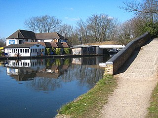
Cowley is a village contiguous with the town of Uxbridge in the London Borough of Hillingdon. A largely suburban village with 16 listed buildings, Cowley is 15.4 miles (24.8 km) west of Charing Cross, bordered to the west by Uxbridge Moor in the Green Belt and the River Colne, forming the border with Buckinghamshire. Cowley was an ancient parish in the historic county of Middlesex.

Commercial Street is an arterial road in Tower Hamlets, east London that runs north to south from Shoreditch High Street to Whitechapel High Street through the East End district of Spitalfields. The road is a section of the A1202 London Inner Ring Road and as such forms part of the boundary of the London congestion charge zone.

Eastcheap is a street in central London that is a western continuation of Great Tower Street towards Monument junction. Its name derives from cheap, the Old English word for market, with the prefix 'East' distinguishing it from Westcheap, another former market street that today is called Cheapside.

The A24 is a major road in England that runs for 53.2 miles (85.6 km) from Clapham in south-west London to Worthing on the English Channel in West Sussex via the suburbs of south-west London, as well as through the counties of Surrey and West Sussex.

Llantwit Major is a town and community in Wales on the Bristol Channel coast. It is one of four towns in the Vale of Glamorgan, with the third largest population after Barry and Penarth, and ahead of Cowbridge. It is 4+1⁄2 miles (7.2 km) from Cowbridge, 9 miles (14 km) from Bridgend, 10 miles (16 km) from Barry, and 15 miles (24 km) from Cardiff. It had a population of 9,486 in 2011.

The Northern Outfall Sewer (NOS) is a major gravity sewer which runs from Wick Lane in Hackney to Beckton sewage treatment works in east London; most of it was designed by Joseph Bazalgette after an outbreak of cholera in 1853 and the "Great Stink" of 1858.
Broadwick Street is a street in Soho, City of Westminster, London. It runs for 0.18 miles (0.29 km) approximately west–east between Marshall Street and Wardour Street, crossing Berwick Street.
The EC postcode area, also known as the London EC postal area, is a group of postcode districts in central London, England. It includes almost all of the City of London and parts of the London Boroughs of Islington, Camden, Hackney, Tower Hamlets and Westminster. The area covered is of very high density development. Deliveries for the EC postcode area are made from Mount Pleasant Mail Centre.

The Highway, formerly known as the Ratcliffe Highway, is a road in the East End of London. The route dates back to Roman times. In the 19th century it had a reputation for vice and crime and was the location of the Ratcliff Highway murders. The name "Ratcliffe" literally means "red cliff", referring to the red sandstone cliffs which descended from the plateau on which the road was situated down to the Wapping Marshes to the south.

Richmond Green is a recreation area located near the centre of Richmond, a town of about 20,000 inhabitants situated in south-west London. Owned by the Crown Estate, it is leased to the London Borough of Richmond upon Thames. The Green, which has been described as "one of the most beautiful urban greens surviving anywhere in England", is essentially square in shape and its open grassland, framed with broadleaf trees, extends to roughly twelve acres. On the north-east side there is also a smaller open space called Little Green. Richmond Green and Little Green are overlooked by a mixture of period townhouses, historic buildings and municipal and commercial establishments including the Richmond Lending Library and Richmond Theatre.

The A316, known in parts as the Great Chertsey Road, is a major road in England, which runs from the A315 Chiswick High Road, Turnham Green, Chiswick to join head-on the M3 motorway at Sunbury-on-Thames. Its initial London section Chiswick Lane heads south — following this it is a mostly straight dual carriageway aligned WSW.
Craven Hill Gardens is a classical, Victorian, residential garden estate which has two small garden squares, the green subset of squares in London. It is in Bayswater, in its Lancaster Gate neighbourhood, south-west of contemporary Paddington of which those districts were once part. It is made up of four rows of residential buildings lining its three streets, and eastern returns, between 160 and 250 metres north of Hyde Park. The western return of this street configuration is partly Leinster Gardens and partly named Leinster Terrace.

Cavendish Square is a public garden square in Marylebone in the West End of London. It has a double-helix underground commercial car park. Its northern road forms ends of four streets: of Wigmore Street that runs to Portman Square in the much larger Portman Estate to the west; of Harley Street which runs an alike distance; of Chandos Street which runs for one block and; of Cavendish Place which runs the same. The south side itself is modern: the rear façade and accesses to a flagship department store and office block. On the ground floors facing are Comptoir Libanais, Royal Bank of Scotland and Pret a Manger premises.

Hanger Hill or Haymills Estate is a local area and ward of the London Borough of Ealing around Hanger Lane. It was developed in the interwar period when affluent Londoners began to move out of Central London for more green spaces. The estate features spacious houses and flats designed by architects Douglas Smith and Barley.

Long Lane is a main east–west road in Southwark, south London, England.

Copthall Railway Walk and Copthall Old Common is a 9-hectare (22-acre) Site of Borough Importance for Nature Conservation, Grade II, in Mill Hill in the London Borough of Barnet.

Homer Street is a quiet one-way street in the Marylebone neighbourhood of the City of Westminster, London. It runs from Old Marylebone Road in the north to Crawford Street in the south. The street is part of the Bryanston and Dorset Square Ward of Westminster City Council. Its postcode is W1H.

Upper Grosvenor Street is a one-way Georgian street in Mayfair, London, United Kingdom. It runs from the north side of the Grosvenor House Hotel to the south side of the London Chancery Building ; both have the longest frontage of their respective streets.

Duchess Street is a street in the City of Westminster, London, that runs west to east from Mansfield Street in the west to Hallam Street in the east, and crosses Portland Place about halfway.
The Grove, Highgate, N6 is a short tree-lined street in north London, running north from Highgate West Hill to Hampstead Lane, known for the notable residents who have lived there over several centuries.

