
Ontonagon County is a county in the Upper Peninsula of the U.S. state of Michigan. As of the 2020 census, the population was 5,816, making it Michigan's third-least populous county. The county seat is Ontonagon. The county was set off in 1843, and organized in 1848. Its territory had been organized as part of Chippewa and Mackinac counties. With increasing population in the area, more counties were organized. After Ontonagon was organized, it was split to create Gogebic County. It is also the westernmost county in United States that lies within the Eastern Time Zone.

Gogebic County is a county in the Upper Peninsula of the U.S. state of Michigan. As of the 2020 census, the population was 14,380. The county seat is Bessemer. Gogebic County is the westernmost county in Michigan, and is one of four Michigan counties within the Central Time Zone. Gogebic County borders Wisconsin to the south, and has a shoreline on Lake Superior to the north.

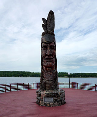
Bessemer is a city in the U.S. state of Michigan. As of the 2020 census, the city population was 1,805. It is the county seat of Gogebic County.
Wakefield is a city in Gogebic County in the U.S. state of Michigan. The population was 1,702 at the 2020 census.

Bergland Township is a civil township of Ontonagon County in the U.S. state of Michigan. As of the 2020 census, the township population was 438.
The protected areas of Michigan come in an array of different types and levels of protection. Michigan has five units of the National Park Service system. There are 14 federal wilderness areas; the majority of these are also tribal-designated wildernesses. It has one of the largest state forest systems as well having four national forests. The state maintains a large state park system and there are also regional parks, and county, township and city parks. Still other parks on land and in the Great Lakes are maintained by other governmental bodies. Private protected areas also exist in the state, mainly lands owned by land conservancies.

The Porcupine Mountains, or Porkies, are a group of small mountains spanning the northwestern Upper Peninsula of Michigan in Ontonagon and Gogebic counties, near the shore of Lake Superior. The Porcupine Mountains were named by the native Ojibwa people, supposedly because their silhouette had the shape of a crouching porcupine. They are home to the most extensive stand of old growth northern hardwood forest in North America west of the Adirondack Mountains, spanning at least 31,000 acres (13,000 ha). The area is popular among tourists, especially Lake of the Clouds in the heart of the mountains, and is part of Porcupine Mountains Wilderness State Park.
Lac Vieux Desert is a lake in the United States divided between Gogebic County, Michigan, and Vilas County, Wisconsin. Fed primarily by springs in the surrounding swamps, it is the source of the Wisconsin River, which flows out of its southwest corner. The lake contains a number of small islands, especially in its northeastern lobe, including Draper Island, in Michigan, and Duck Island, in Wisconsin.

The Ottawa National Forest is a national forest that covers 993,010 acres (401,860 ha) in the Upper Peninsula of the U.S. state of Michigan. It includes much of Gogebic and Ontonagon counties, as well as slices of Iron, Houghton, Baraga, and Marquette counties. The forest is under the jurisdiction of the U.S. Forest Service.

Lake Gogebic State Park is a public recreation area covering 360 acres (150 ha) in the Upper Peninsula of Michigan. The state park sits on the western shore of Lake Gogebic, the largest inland lake in the Upper Peninsula. The land around the park is sparsely populated, and relatively flat.

Clark Lake is a lake located in Gogebic County in the U.S. state of Michigan. Clark Lake is one of about two dozen clear, clean lakes located in the Sylvania Wilderness of Ottawa National Forest a few miles to the west of the town of Watersmeet. The shoreline is undeveloped except for a picnic area and boat launch at the northern end. The lake has several islands and numerous bays and coves. Large boulders strewn about the shoreline and lake bed add to the scenic setting of this lake. It is not uncommon to see nesting loons and eagles around the lake's islands, and black bear and wolves inhabit the old-growth forest around the lake. The total surface area of the lake is 820 acres (3.3 km2), with maximum depths of 74 ft (23 m).

Deer Island Lake is a lake located in Gogebic County in the U.S. state of Michigan. The Lake is one of about 24 clear, clean lakes located in a special wilderness area known as the Sylvania Wilderness, which in turn is located within the Ottawa National Forest a few miles to the west of the town of Watersmeet. The shoreline is completely undeveloped, and surrounded by virgin forest consisting mainly of hemlock and pine. This crystal-clear spring-fed lake is one of the most remote in the Sylvania Tract, but is well worth the journey for those intrepid enough to make it. The total surface area of the lake is 346 acres (1.4 km2), with maximum depths of 55 ft. The lake is named for the very large island in the center of the lake, which deer inhabit by crossing back and forth on the ice in winter. Several smaller islands and numerous rocky shoals add to the overall beauty of this fine body of water.
Sylvania Wilderness is an 18,327 acres (7,417 ha) protected area located a few miles west of Watersmeet Township, Michigan. Sylvania is located entirely within the bounds of the Ottawa National Forest, and is currently being managed as a wilderness area as part of the National Wilderness Preservation System by the U.S. Forest Service.

The Ontonagon River is a river flowing into Lake Superior at the village of Ontonagon, on the western Upper Peninsula of Michigan in the United States. The main stem of the river is 25 miles (40 km) long and is formed by a confluence of several longer branches, portions of which have been collectively designated as a National Wild and Scenic River. Several waterfalls occur on the river including Agate Falls and Bond Falls.

Lake Gogebic is the largest natural inland lake of the Upper Peninsula of Michigan. It is located within the one million acre (4,000 km2) Ottawa National Forest. Lake Gogebic State Park is located along its western shore.

The Gogebic Range is an elongated area of iron ore deposits located within a range of hills in northern Michigan and Wisconsin just south of Lake Superior. It extends from Lake Namakagon in Wisconsin eastward to Lake Gogebic in Michigan, or almost 80 miles. Though long, it is only about a half mile wide and forms a crescent concave to the southeast. The Gogebic Range includes the communities of Ironwood in Michigan, plus Mellen and Hurley in Wisconsin.
Delirium Wilderness is a 11,870-acre (48.0 km2) wilderness area in Chippewa County, within the Hiawatha National Forest in the U.S. state of Michigan.

Fisher Lake is a small, isolated lake located in Gogebic County in the U.S. state of Michigan. Fisher Lake is one of about two dozen clear, clean lakes located in a special wilderness area known as the Sylvania Wilderness, which in turn is located within the Ottawa National Forest a few miles to the west of the town of Watersmeet. This is one of the most remote and least visited lakes of the Sylvania Wilderness and a visit here is sure to provide a measure solitude along with a true wilderness experience. The shoreline is completely undeveloped, and surrounded by virgin timber consisting mainly of hemlock, pine and maple. This remote lake is bordered by abundant bog habitat and is home to pitcher plants and other bog flora. The total surface area of the lake is 31 acres (0.1 km2), with maximum depths of 39 feet (12 m).

Lake of the Clouds is a lake located in Ontonagon County in the Upper Peninsula of the U.S. state of Michigan within the Porcupine Mountains Wilderness State Park. The lake is situated in a valley between two ridges in the Porcupine Mountains. Surrounded by virgin wilderness and stunning vistas, the lake is a popular destination for hikers, campers, and fishermen.
The Porcupine Lake Wilderness is a 4,446 acres (1,799 ha) tract of protected land located in Bayfield County, Wisconsin, managed by the United States Forest Service. The Wilderness is located within the boundaries of the Chequamegon–Nicolet National Forest.

