| Lopatnik | |
|---|---|
 Lopatnik Location in Slovenia | |
| Coordinates: 46°21′14.72″N15°10′33.4″E / 46.3540889°N 15.175944°E Coordinates: 46°21′14.72″N15°10′33.4″E / 46.3540889°N 15.175944°E | |
| Country | |
| Traditional region | Styria |
| Statistical region | Savinja |
| Municipality | Velenje |
| Area | |
| • Total | 2.71 km2 (1.05 sq mi) |
| Elevation | 688.4 m (2,258.5 ft) |
| Population (2002) | |
| • Total | 36 |
| [1] | |
Lopatnik (pronounced [lɔˈpaːtnik] ) is a small settlement in the hills east of Velenje in northern Slovenia. The area was traditionally part of Styria. The entire Municipality of Velenje is now included in the Savinja Statistical Region. [2]

Velenje is Slovenia's fifth-largest city, and the seat of the Municipality of Velenje. The city is located in northeastern Slovenia, among the rolling green hills of the Šalek Valley, with the Kamnik–Savinja Alps to the west and the Pohorje Mountains to the east.

Slovenia, officially the Republic of Slovenia, is a sovereign state located in southern Central Europe at a crossroads of important European cultural and trade routes. It is bordered by Italy to the west, Austria to the north, Hungary to the northeast, Croatia to the southeast, and the Adriatic Sea to the southwest. It covers 20,273 square kilometers (7,827 sq mi) and has a population of 2.07 million. One of the successor states of the former Yugoslavia, Slovenia is a parliamentary republic and a member of the United Nations, of the European Union, and of NATO. The capital and largest city is Ljubljana.
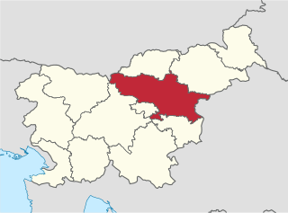
The Savinja Statistical Region is a statistical region in Slovenia. The largest town in the region is Celje. It is named after the Savinja River. The region is very diverse in natural geography; it mainly comprises the wooded mountainous terrain attractive to tourists, the fertile Lower Savinja Valley with good conditions for growing hops, the Kozje Hills, and the Velenje Basin with lignite deposits, used for electricity production. In 2013 the region invested more than EUR 127 million in environmental protection. In 2013, the region accounted for 14% of enterprises created and 8% of enterprises shut down. The region has good natural conditions for agriculture. In 2013 this region had more than 11,000 farms, which is 15% of all farms in Slovenia, ranking the region right behind the Drava Statistical Region. In agricultural area utilised and livestock, the region was also in second place. The region is a well-known and popular tourist destination. In 2012, tourist arrivals and overnight stays in the region represented 11.1% of all tourist arrivals in Slovenia and 15.0% of all overnight stays. On average, tourists spent four nights there.


