Bevče is a settlement in the Municipality of Velenje in northern Slovenia. The area was traditionally part of Styria. The entire municipality is now included in the Savinja Statistical Region.
Janškovo Selo is a settlement in the Municipality of Velenje in northern Slovenia. The area was traditionally part of Styria. The entire municipality is now included in the Savinja Statistical Region.
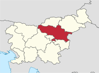
Lopatnik is a small settlement in the hills east of Velenje in northern Slovenia. The area was traditionally part of Styria. The entire Municipality of Velenje is now included in the Savinja Statistical Region.
Paka pri Velenju is a settlement in the Municipality of Velenje in northern Slovenia. The area was traditionally part of Styria. The entire municipality is now included in the Savinja Statistical Region.
Podkraj pri Velenju is a settlement in the Municipality of Velenje in northern Slovenia. It lies in the Ložnica Hills southwest of the town of Velenje. The area was traditionally part of Styria. The entire municipality is now included in the Savinja Statistical Region.

Brezje pri Lipoglavu is a small settlement in the hills southeast of Ljubljana in central Slovenia. It is part of the Ljubljana Urban Municipality. It lies in the traditional region of Lower Carniola and is now included with the rest of the municipality in the Central Slovenia Statistical Region.

Mali Vrh pri Prežganju is a small settlement in the hills east of Ljubljana, the capital of Slovenia. It belongs to the City Municipality of Ljubljana. The area was part of the traditional region of Lower Carniola and is now included with the rest of the municipality in the Central Slovenia Statistical Region.
Brezje pri Kumpolju is a small remote settlement in the Municipality of Litija in central Slovenia. Traditionally the area was part of Lower Carniola and is now included with the rest of the municipality in the Central Sava Statistical Region; until January 2014 the municipality was part of the Central Slovenia Statistical Region.
Kal pri Dolah is a small settlement immediately north of Dole in the Municipality of Litija in central Slovenia. The area was traditionally part of the Lower Carniola region and is now included with the rest of the municipality in the Central Sava Statistical Region; until January 2014 the municipality was part of the Central Slovenia Statistical Region.

Nova Cerkev is a settlement in the Municipality of Vojnik in eastern Slovenia. It lies on the left bank of the Hudinja River northwest of Vojnik off the main road to Velenje. The area was traditionally part of the Styria region. It is now included with the rest of the municipality in the Savinja Statistical Region.
Petelinjek pri Ločah is a dispersed settlement in the Municipality of Slovenske Konjice in eastern Slovenia. It lies in the hills north of Loče on the left bank of the Dravinja River. The area is part of the traditional region of Styria. The municipality is now included in the Savinja Statistical Region.

Dol pri Trebnjem is a small settlement in the Municipality of Trebnje in eastern Slovenia. It lies just north of Trebnje itself, off the regional road leading to Mirna. The area is part of the historical region of Lower Carniola. The municipality is now included in the Southeast Slovenia Statistical Region.
Pristavica pri Velikem Gabru is a small settlement west of Bič in the Municipality of Trebnje in eastern Slovenia. The A2 Slovenian motorway runs along the southern edge of the settlement. The area is part of the historical region of Lower Carniola. The municipality is now included in the Southeast Slovenia Statistical Region.

Zagorica pri Čatežu is a small settlement south of Čatež in the Municipality of Trebnje in eastern Slovenia. The area is part of the historical region of Lower Carniola. The municipality is now included in the Southeast Slovenia Statistical Region.
Stranje pri Dobrniču is a small settlement north of Dobrnič in the Municipality of Trebnje in eastern Slovenia. The municipality is included in the Southeast Slovenia Statistical Region. The entire area is part of the historical region of Lower Carniola.
Dob pri Šentvidu is a village in the Municipality of Ivančna Gorica in central Slovenia. It lies east of Ivančna Gorica and the A2 motorway runs across the settlement territory to the south of the village core. The area is part of the historical region of Lower Carniola. The municipality is now included in the Central Slovenia Statistical Region.

Breg pri Temenici is a settlement on the right bank of the Temenica River in the Municipality of Ivančna Gorica in central Slovenia. The railway line from Ljubljana to Novo Mesto runs just south of the settlement. The area is part of the historical region of Lower Carniola. The municipality is now included in the Central Slovenia Statistical Region.
Češnjice pri Zagradcu is a settlement east of Zagradec in the Municipality of Ivančna Gorica in central Slovenia. The area is part of the historical region of Lower Carniola. The municipality is now included in the Central Slovenia Statistical Region.
Velike Dole pri Temenici is a small settlement in the Municipality of Ivančna Gorica in central Slovenia. The area is part of the historical region of Lower Carniola. The municipality is now included in the Central Slovenia Statistical Region.