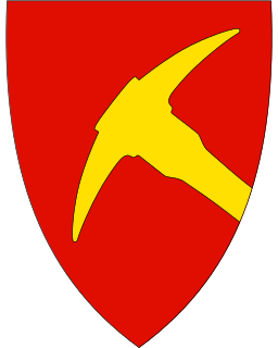
Folldal is a municipality in Innlandet county, Norway. It is part of the traditional region of Østerdalen. It is bordered on the north by Oppdal and Tynset municipalities, in the east by Alvdal municipality, in the south by Stor-Elvdal, Sør-Fron and Sel municipalities, and in the west by Dovre municipality. The administrative centre of the municipality is the village of Folldal. Mining at the Folldal mines was the main industry for Folldal's residents from the 18th century until the last mine related operation in 1993. The new municipality of Folldal was separated from Alvdal in 1914.

Dovre is a municipality in Innlandet county, Norway. It is part of the traditional region of Gudbrandsdalen. The administrative centre of the municipality is the village of Dovre. The municipality is bordered on the north by Oppdal municipality, on the east by Folldal, on the south by Sel and Vågå, and on the northwest by Lesja. The highest peak is Snøhetta at a height of 2,286 metres (7,500 ft). The municipality of Dovre was created when it was separated from the municipality of Lesja in 1861. The area "upper Folldal" was transferred from Dovre to Alvdal in 1884.

Lesja is a municipality in Innlandet county, Norway. It is part of the traditional region of Gudbrandsdal. The administrative centre of the municipality is the village of Lesja.
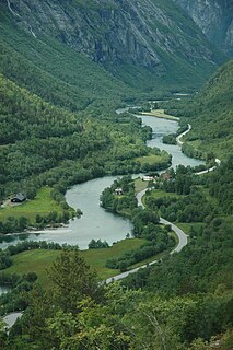
The Rauma is a river that runs through Romsdalen, a valley in Møre og Romsdal and Innlandet counties in Norway. It runs for 68 kilometres (42 mi) from Lesjaskogsvatnet, a lake in the municipality of Lesja, to the town of Åndalsnes in the municipality of Rauma. The river was once famous for its salmon-fishing, but since an infection with Gyrodactylus salaris only 5 to 10% of the original stock survives. The salmon runs up to the Slettafossen, a 16-metre (52 ft) high combination of waterfalls and rapids more than 42 kilometres (26 mi) upriver from the estuary.

Romsdal is a traditional district in the Norwegian county Møre og Romsdal, located between Nordmøre and Sunnmøre. The district of Romsdal comprises Aukra, Fræna, Midsund, Molde, Nesset, Rauma, Sandøy, and Vestnes. It is named after the valley of Romsdalen, which covers part of Rauma.

Gudbrandsdalen is a valley and traditional district in the Norwegian county of Innlandet. The valley is oriented in a north-westerly direction from Lillehammer and the lake of Mjøsa, extending 230 kilometers (140 mi) toward Romsdalen. The river of Gudbrandsdalslågen (Lågen) flows through the valley, starting from Lesjaskogsvatnet and ending at Mjøsa. The Otta river flowing through Otta valley is a major tributary to Lågen. The valleys of the tributary rivers such as Otta and Gausa (Gausdal) are usually regarded as part of Gudbrandsdalen. The total area of the valley is calculated from the areas of the related municipalities. Gudbrandsdalen is the main valley in a web of smaller valleys. On the western side there are long adjacent valleys: Ottadalen stretches 100 kilometers (62 mi) from Otta village, Gausdal some 50 kilometers (31 mi) from Lillehammer and Heidal some 40 kilometers (25 mi) from Sjoa. Gudbrandsdalen runs between the major mountain ranges of Norway including Jotunheimen and Dovrefjell-Rondane.

Lesjaverk is a village in Lesja municipality in the upper Gudbrandsdal valley of Innlandet county, Norway. It lies approximately 25 miles north of Dombås on the Rauma Line. European route E136 goes from Ålesund up through the Romsdal valley and passes through Lesjaverk to end at Dombås. Located in a high mountain pass at 633 meters elevation, it is situated between Svarthøi, Storhøi and Merratind mountains in the Dovrefjell range to the north and Digervarden mountain to the south.
Lora is a female given name and family name in the Spanish language of French origin.

Kvikne is a former municipality in Hedmark, Norway and a mountain village between Østerdalen and Trøndelag. The river Orkla begins in Kvikne. Further south the river Tunna descends to meet the Glomma.
Lesjaskog village in Lesja municipality in Innlandet county, Norway lies by the lake Lesjaskogsvatnet.

Bjorli is a village in Lesja municipality in Innlandet, Norway. It lies on the Rauma river near the western municipality border.

Tubilla del Agua is a village and municipality located in the province of Burgos, Castile and León, Spain. According to the 2004 census (INE), the municipality has a population of 209 inhabitants. The climate is relatively cool in the summer and cold in the winter.

Reinheimen National Park is a national park in Norway that was established in 2006. The park consists of a 1,969-square-kilometre (760 sq mi) continuous protected mountain area. It is located in Møre og Romsdal and Innlandet counties in Western Norway. The park includes parts of the municipalities of Lesja, Skjåk, Vågå, Lom, Fjord, and Rauma. The park consists of much of the Tafjordfjella mountain range as well as the reindeer habitat in the northern part of the Ottadalen valley.
Digervarden is a mountain in the municipality of Lesja in Innlandet, in southern Norway.
Gråhø is a mountain in the municipality of Lesja in Oppland, in southern Norway.
Storhøa is a mountain on the border between the municipalities of Rauma in Møre og Romsdal and Lesja and Skjåk in Oppland, in southern Norway. It is 1,921 meters high an lies in the center of Reinheimen National Park.

Storstyggesvånåtinden is a mountain in the municipality of Lesja in Oppland, Norway. The summit is the highest point in Lesja.

Verma is a village in Rauma Municipality in Møre og Romsdal county, Norway. It is located along the European route E136 highway deep in the Romsdalen valley. The village lies along the Rauma Line, where the Kylling Bridge crosses the Rauma River. The village is named after the local river Verma which empties into the main river Rauma.

Llíber is a village in the province of Alicante and autonomous community of Valencia, Spain. The municipality covers an area of 21.9 square kilometres (8.5 sq mi).

Lesja Church is a cruciform church built in 1749 in the municipality of Lesja in Innlandet county, Norway. It was consecrated with the name Bethel kirke 'Bethel Church'. The church stands on a small hillside surrounded by woods in a valley.
