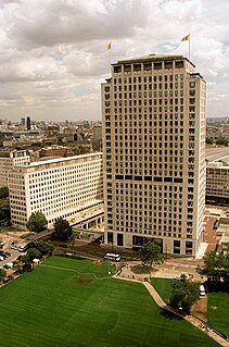
The Shell Centre, in London, is one of the two central offices of oil major Shell. It is located on Belvedere Road in the London Borough of Lambeth. It is a prominent feature on the South Bank of the River Thames near County Hall, and now forms the backdrop to the London Eye.

Fenchurch Street is a street in London linking Aldgate at its eastern end with Lombard Street and Gracechurch Street in the west. It is a well-known thoroughfare in the City of London financial district and is the site of a large number of corporate offices and headquarters.

Leadenhall Street is a road in London that is about 0.3 miles (500 m) long and links Cornhill and Bishopsgate in the west to St. Botolph Street and Aldgate in the east. It is situated in the City of London, which is the historic nucleus of modern London as well its primary financial district.

The Queen's Lawn is a green lawned area situated at the centre of Imperial College London's South Kensington campus, next to the Queen's Tower and immediately to the north of Imperial College Road. It provides an open space of 1,600 sq metres.
Bedlay Castle is a former defensive castle, dating from the late 16th and 17th centuries. It is located between Chryston and Moodiesburn in North Lanarkshire, Scotland. The castle is just off the A80 road, around 8 miles to the north-east of Glasgow, at NS692700.

Windsor House is an office building in Victoria Street, City of Westminster, London, England. The complex, built in 1973, consists of an eighteen-storey tower, a two-storey block and residential accommodation above an underground car park and basement. The purple granite and glass facade of the main structure stands 70 m (230 ft). Butler Place houses Lloyds TSB at ground level.

Saffron Square is a town square and high-rise building in Croydon, United Kingdom. The purple and red Saffron Tower is currently the tallest building in Croydon.

Altitude 25 is an apartment building on Fairfield Road in the London Borough of Croydon, London. It is Croydon's second tallest building after Saffron Square Tower. The development was intended to regenerate a brownfield site near to East Croydon station. The building was completed in 2009, and has 26 floors of apartments up to floor 25, hence the name Altitude 25, a roof height of 82.00 and a structural height of 94 m (307 ft). It is part of the Croydon Vision 2020 regeneration project for a new generation of buildings in the town.

Portland Street is a street which runs from Piccadilly at its junction with Newton Street southwards to Oxford Street at its junction with Chepstow Street in Manchester, England. The major buildings of Portland Street include the largest former warehouse in the city centre, Watts Warehouse, the former Bank of England Building and other former warehouses on the corners of Princess Street.
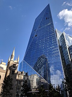
The Scalpel is a commercial skyscraper in London, United Kingdom. It is located on Lime Street in the City of London financial area. Originally a nickname but subsequently designated as its official name, the term "Scalpel" was coined by the Financial Times due to the building's distinctive angular design and followed a trend of nicknaming new buildings based upon their shape, such as the nearby Leadenhall Building, also known as "The Cheesegrater". Completed in 2018, The Scalpel is 190 m (620 ft) tall, with 38 storeys. It was designed by Kohn Pedersen Fox.
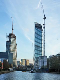
Principal Tower is a 50-storey residential tower under construction in Worship Street, Shoreditch, London. Its completion is expected in March 2019.
The Lexicon Tower is a 36-storey 115m tall residential building in City Road, London, on the west side of the City Road Basin, part of the Regent's Canal. The closest underground station is Angel.
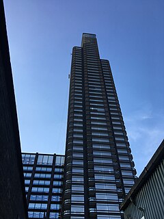
Maine Tower is a 41-storey residential building that will form part of the Harbour Central development in Canary Wharf, London, England.
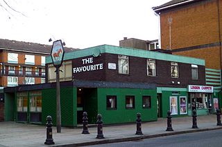
The Favourite was a pub at 27 St Anns Road, Holland Park, London W11, that closed in 2011. A pub had existed on the site since at least 1879. The building was demolished and replaced by a six-storey block of studio flats around 2012.

250 City Road is a residential-led scheme under construction in the borough of Islington, London, designed by Foster + Partners and developed by Berkeley. It was given planning permission in 2014 by the then London Mayor Boris Johnson after being rejected by Islington Council.

Bowater House was a 17-floor office block at 68 Knightsbridge in London SW1, completed in 1958. The building occupied a site between Knightsbridge and South Carriage Road, at the southern edge of Hyde Park. It was demolished in 2006 and redeveloped by Candy & Candy to create One Hyde Park.
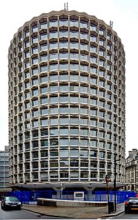
One Kemble Street and Civil Aviation Authority House, originally known jointly as Space House, is an architecturally notable building off Kingsway in the London Borough of Camden. It is a grade II listed building with Historic England. Like nearby Centre Point, it was built for the developer Harry Hyams as part of the 1960s commercial property boom and kept empty for several years after completion.
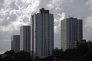
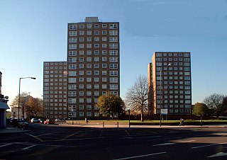
The Chalcots Estate is a council housing estate on Adelaide Road and Fellows Road in Swiss Cottage in the London Borough of Camden. It was designed by Dennis Lennon and Partners.
The Ledbury Estate is a large estate of social housing, in Peckham in the London Borough of Southwark. It is within the Old Kent Road Opportunity Area. The four high rise, H-shaped tower blocks were constructed in the mid-1960s using pre-fabricated concrete panels.
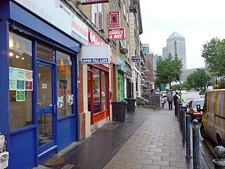
West India Dock Road is a road in Limehouse and is in London's East End. It connected Commercial Road with the entrance to the West India Docks.