
Lou Neff Point is a promontory with a gazebo in Austin, Texas, United States.
Lou Neff Point is a promontory with a gazebo in Austin, Texas, United States.
The point offers views of downtown Austin from where Barton Creek enters Lady Bird Lake. In 1975, the Texas Society of Landscape Architects selected Lou Neff Point as the "best example of Texas Public Architecture". [1]
The Austin Group-designed gazebo was installed in 1993. [2]
Lou Neff Point was widened and restored by The Trail Foundation with funding provided by the Michael and Susan Dell Foundation, the Stillwater Foundation, friends of Nancy Kohler, and members of The Trail Foundation. The work was completed during April–June 2006. [3]
The point is named after Lou Neff, a member of the Town Lake Beautification Committee who worked with Lady Bird Johnson. Neff was a former president of the Austin Junior League and a member of the Natural Science Center Guild. In 1971 the Austin American Statesman included her among their Outstanding Women in Austin. Three years later Neff died at the age of 44. [4]

Austin is the capital city of the U.S. state of Texas, as well as the seat and largest city of Travis County, with portions extending into Hays and Williamson counties. Incorporated on December 27, 1839, it is the 11th-most populous city in the United States, the fourth-most-populous city in Texas, the second-most-populous state capital city, one of two state capitals with a population of over one million people, after Phoenix, Arizona, and the most populous state capital that is not also the most populous city in its state. It has been one of the fastest growing large cities in the United States since 2010. Downtown Austin and Downtown San Antonio are approximately 80 miles (129 km) apart, and both fall along the Interstate 35 corridor. Some observers believe that the two regions may some day form a new "metroplex" similar to Dallas and Fort Worth. Austin is the southernmost state capital in the contiguous United States and is considered a "Beta −" global city as categorized by the Globalization and World Cities Research Network.

Duncan is a city and county seat of Stephens County, Oklahoma, United States. The population was 22,310 at the 2020 census. Its main claim to fame is as the birthplace of the Halliburton Corporation. Erle P. Halliburton established the New Method Oil Well Cementing Company in 1919. Halliburton maintains seven different complexes in Duncan plus an employee recreational park, but the corporate offices relocated first to Dallas and later to Houston.
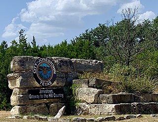
Jonestown is a city in Travis County, Texas, United States on the north shore of Lake Travis. The population was 2,365 at the 2020 census.

Lady Bird Lake is a river-like reservoir on the Colorado River in Austin, Texas, United States. The City of Austin created the reservoir in 1960 as a cooling pond for a new city power plant. The lake, which has a surface area of 416 acres (168 ha), is now used primarily for recreation and flood control. The reservoir is named in honor of former First Lady of the United States Lady Bird Johnson.

Claudia Alta "Lady Bird" Johnson was First Lady of the United States from 1963 to 1969 as the wife of President Lyndon B. Johnson. She previously served as Second Lady from 1961 to 1963 when her husband was vice president.
The Texas Highland Lakes is a chain of fresh water reservoirs in Central Texas formed by dams on the lower Colorado River. The Texas Colorado River winds southeast from West Texas to Matagorda Bay and the Gulf of Mexico.

Longhorn Dam is a dam crossing the Colorado River in Austin, Texas, United States, where it creates Lady Bird Lake. Completed in 1960, the dam was built by the City of Austin as the last in a chain of Colorado River dams in central Texas begun during the Great Depression. The name refers to its location on a ford used for longhorn cattle drives as a part of the Chisholm Trail in the late 19th century.

Mount Bonnell, also known as Covert Park, is a prominent point alongside the Lake Austin portion of the Colorado River in Austin, Texas. It has been a popular tourist destination since the 1850s. The mount provides a vista for viewing the city of Austin, Lake Austin, and the surrounding hills. It was designated a Recorded Texas Historic Landmark in 1969, bearing Marker number 6473, and was listed on the National Register of Historic Places in 2015.

Zilker is a neighborhood in south central Austin, Texas. It extends south of Lady Bird Lake, approximately bounded by the Union Pacific Railway to the southeast/south, Barton Skyway to the south, Rabb Road and Azie Morton Road to the west and Lady Bird Lake to the north.
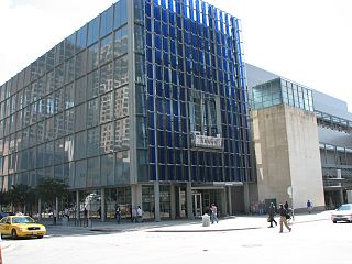
The Neal Kocurek Memorial Austin Convention Center is a multi-purpose convention center located in Austin, Texas. The building is the home of the Texas Rollergirls, and was also home to the Austin Toros basketball team, until their move to the Cedar Park Center in nearby Cedar Park in 2010. The facility is also the primary "home base" for the internationally renowned South by Southwest technology, music and film conference/festival, held annually in March.
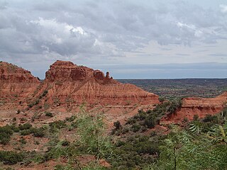
Caprock Canyons State Park and Trailway is a Texas state park located along the eastern edge of the Llano Estacado in Briscoe County, Texas, United States, approximately 100 miles (160 km) southeast of Amarillo. The state park opened in 1982 and is 15,314 acres (6,197 ha) in size, making it the third-largest state park in Texas.

The Lady Bird Johnson Wildflower Center at The University of Texas at Austin is the state botanical garden and arboretum of Texas. The center features more than 900 species of native Texas plants in both garden and natural settings and is home to a breadth of educational programs and events. The center is 284 acres and located 10 miles southwest of downtown Austin, Texas just inside the edge of the distinctive Texas hill country. It straddles both Edwards Plateau and Texas Blackland Prairies ecosystems.

The Austin–Round Rock-Georgetown Metropolitan Statistical Area is a five-county metropolitan area in the U.S. state of Texas, as defined by the Office of Management and Budget. The metropolitan area is situated in Central Texas on the western edge of the American South and on the eastern edge of the American Southwest, and borders Greater San Antonio to the south.

The Lamar Boulevard Bridge is a historic arch bridge carrying Texas State Highway Loop 343 over Lady Bird Lake in downtown Austin, Texas, United States. The bridge features six open-spandrel concrete arches spanning 659 feet (201 m) and carries tens of thousands of vehicles daily across the lake. Completed in 1942, the Lamar Boulevard Bridge was the second permanent bridge to cross the Colorado River, and one of the last Art Deco-style open-spandrel concrete arch bridges built in Texas. The bridge was named an Austin Landmark in 1993 and added to the National Register of Historic Places in 1994.
Auditorium Shores is an urban park located in downtown Austin, Texas, within the larger Town Lake Park. Its name refers to its location between the former Palmer Auditorium and the shores of Lady Bird Lake. The park is known as the site of major music performances at South by Southwest and Fun Fun Fun Fest, as well as a number of other events.
East Riverside-Oltorf is a neighborhood in Austin, Texas, located southeast of the city's urban core. The East Riverside, Parker Lane, and Pleasant Valley neighborhoods together form the East Riverside-Oltorf Combined Neighborhood Planning Area. The region is bounded on the north by Lake Lady Bird, to the east by Grove Boulevard and the Montopolis neighborhood, Texas State Highway 71 to the south, and Interstate 35 and South River City to the west.

Waters Park, Texas was a village located eight miles north of downtown Austin, Texas defined by the boundaries of Farm Road 1325, MoPac, and the Southern Pacific Railroad. It is now part of the City of Austin.

The James D. Pfluger Pedestrian and Bicycle Bridge is a shared use bridge for pedestrians and cyclists spanning Lady Bird Lake in downtown Austin, Texas. Opened in 2001, the bridge connects the north and south sides of the Ann and Roy Butler Hike-and-Bike Trail and features an unusual "double curve" design. The bridge runs parallel to the Lamar Boulevard Bridge, which carries road traffic across the lake roughly 200 feet (61 m) to the west.

The Town Lake Gazebo is a historic gazebo on the south shore of Lady Bird Lake in Austin, Texas, beside Auditorium Shores. Built in 1969 to beautify the south shore of Lady Bird Lake, the gazebo was paid for by the National Association of Women in Construction and features eclectic architecture. The structure was listed on the National Register of Historic Places in 2020.

The Boardwalk at Lady Bird Lake is a boardwalk along Lady Bird Lake in Austin, Texas, United States.
Coordinates: 30°16′2″N97°45′42″W / 30.26722°N 97.76167°W
| | This Texas-related article is a stub. You can help Wikipedia by expanding it. |