Louisiana Highway 560

Last updated

Louisiana 560 (2008).svg

Louisiana Highway 560
Route information
Maintained by Louisiana DOTD
Existed 1955 renumbering–present
Location
Parishes Jefferson
Highway system
  • Louisiana Highway System
Louisiana 559 (2008).svg LA 559 LA 561 Louisiana 561 (2008).svg

Louisiana Highway 560 (LA 560) is a collection of two current and two former state-maintained streets in Marrero and Crown Point, Jefferson Parish. All four routes were established with the 1955 Louisiana Highway renumbering.

Contents

Current routes

Louisiana Highway 560-2

Louisiana 560-2 (2008).svg

Louisiana Highway 560-2
Location Marrero
Length0.17 mi [1] (0.27 km)
Existed1955–present

From the south, LA 560-2 begins at an intersection with LA 18 (4th Street to the east/Barataria Boulevard to the south). It continues northward along Barataria Boulevard to a terminus at LA 541 (River Road).

The entire highway is in Marrero, Jefferson Parish.

mi [1] kmDestinationsNotes
0.000.00Louisiana 18 (2008).svg LA 18 (Barataria Boulevard, 4th Street)Southern terminus
0.170.27Louisiana 541 (2008).svg LA 541 (River Road)Northern terminus
1.000 mi = 1.609 km; 1.000 km = 0.621 mi

Louisiana Highway 560-4

Louisiana 560-4 (2008).svg

Louisiana Highway 560-4
Location Crown Point
Length0.85 mi [1] (1.37 km)
Existed1955–present

From the southwest, LA 560-4 begins at a dead-end east of the LA 45/LA 3134 (Leo Kerner/Lafitte Parkway, formerly Lafitte-Larose Highway) bridge over Bayou Barataria at Crown Point (near Jean Lafitte). It heads northeast on Sharpe Road along the north bank of the bayou before turning northwest to a terminus at LA 45 (Barataria Boulevard).

LA 560-4 was known as State Route 1306 in the pre-1955 Louisiana highway system.

The entire highway is in Crown Point, Jefferson Parish.

mi [1] kmDestinationsNotes
0.000.00Dead end east of Louisiana 45 (2008).svgLouisiana 3134 (2008).svg LA 45 / LA 3134 (Leo Kerner/Lafitte Parkway)Southwestern terminus
0.851.37Louisiana 45 (2008).svg LA 45 (Barataria Boulevard)Northeastern terminus
1.000 mi = 1.609 km; 1.000 km = 0.621 mi

Former routes

Louisiana Highway 560-1

Louisiana 560-1.svg

Louisiana Highway 560-1
Location Marrero
Length0.17 mi (0.27 km)
Existed1955–2010

From the south, LA 560-1 began at a dead-end on the north side of the New Orleans and Gulf Coast Railroad tracks. It continued northward on Distillery Lane along the border between Marrero and Harvey to a terminus at LA 541 (River Road).

LA 560-1 originally began at an intersection LA 18 (4th Street). In 2001, it was truncated north of the railroad tracks to allow for remote control operation of locomotives servicing the Kinder Morgan plant. The route became a dead-end, accessing only gates of the industrial plant on both sides of the road. It was deleted altogether in 2010.

The entire highway was in Marrero, Jefferson Parish.

mikmDestinationsNotes
0.000.00Dead end north of New Orleans and Gulf Coast Railroad tracksSouthern terminus
0.170.27Louisiana 541 (2008).svg LA 541 (River Road)Northern terminus
1.000 mi = 1.609 km; 1.000 km = 0.621 mi

Louisiana Highway 560-3

Louisiana 560-3.svg

Louisiana Highway 560-3
Location Marrero
Length0.71 mi (1.14 km)
Existed1955–2010

From the southwest, LA 560-3 began at an intersection with LA 45 (Barataria Boulevard) just south of the latter's northern terminus at LA 18. It continued eastward along 7th Street before turning northward along Avenue B to a terminus at LA 18 (4th Street). The route was deleted in 2010.

The entire highway was in Marrero, Jefferson Parish.

mikmDestinationsNotes
0.000.00Louisiana 45 (2008).svg LA 45 (Barataria Boulevard)Southwestern terminus
0.711.14Louisiana 18 (2008).svg LA 18 (4th Street)Northeastern terminus
1.000 mi = 1.609 km; 1.000 km = 0.621 mi

Related Research Articles

U.S. Route 90 Business (New Orleans, Louisiana) highway in New Orleans, Louisiana

U.S. Highway 90 Business is a business route of U.S. Highway 90 located in and near New Orleans, Louisiana. It runs 14.33 miles (23.06 km) in a general east–west direction from a point on US 90 between Avondale and Westwego to the junction of Interstate 10 (I-10) and US 90 in the New Orleans Central Business District.

U.S. Route 90 in Louisiana highway in Louisiana

U.S. Highway 90 (US 90), one of the major east–west U.S. Highways in the Southern United States, runs through southern Louisiana for 297.6 miles (478.9 km), serving Lake Charles, Lafayette, New Iberia, Morgan City, and New Orleans. Much of it west of Lafayette and east of New Orleans has been supplanted by Interstate 10 (I-10) for all but local traffic, but the section between Lafayette and New Orleans runs a good deal south of I-10.

Louisiana Highway 18 highway in Louisiana

Louisiana Highway 18 is a state highway that serves Ascension, St. James, St. John the Baptist, St. Charles, and Jefferson Parishes. Called the Great River Road, it runs from west to east, parallel to the west bank of the Mississippi River, running from Donaldsonville to Gretna. It spans a total of 79.7 miles (128.3 km). In the more rural parts of LA 18's span, it is commonly referred to as River Road, but it becomes 4th Street once it enters Westwego.

Louisiana Highway 3 highway in Louisiana

Louisiana Highway 3 (LA 3) is a state highway located in Bossier Parish, Louisiana. It runs 35.71 miles (57.47 km) in a north–south direction from the junction of Interstate 20 (I-20), U.S. Highway 71 (US 71), and LA 72 in Bossier City to the Arkansas state line north of Plain Dealing.

Louisiana Highway 45 highway in Louisiana

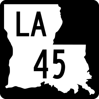
Louisiana Highway 45 (LA 45) is a state highway located in Jefferson Parish, Louisiana. It runs 22.08 miles (35.53 km) in a north–south direction from a dead end at Bayou Barataria in Lafitte to a junction with LA 18 in Marrero.

Louisiana Highway 20 highway in Louisiana

Louisiana Highway 20 is a state highway that serves Terrebonne Parish, Lafourche Parish, and St. James Parish. It spans a total of 36.6 miles (58.9 km) as a two lane, undivided road.

Louisiana Highway 611 highway in Louisiana

Louisiana Highway 611 is a collection of three current and ten former state-maintained streets in Jefferson, Metairie, and New Orleans. All thirteen routes were established with the 1955 Louisiana Highway renumbering.

Louisiana Highway 574 highway in Louisiana

Louisiana Highway 574 is a collection of eight current and four former state-maintained streets in Grand Isle, located in lower Jefferson Parish. All twelve routes were established with the 1955 Louisiana Highway renumbering.

Louisiana Highway 49 highway in Louisiana

Louisiana Highway 49 (LA 49) is a state highway located in Jefferson Parish, Louisiana. It runs 3.93 miles (6.32 km) in a north–south direction along Williams Boulevard from U.S. Highway 61 (US 61) to an intersection with Joe Yenni Boulevard and 44th Street in Kenner.

Louisiana Highway 48 highway in Louisiana

Louisiana Highway 48 is a state highway in Louisiana that serves St. Charles and Jefferson Parishes. It runs from west to east, parallel to the east bank of the Mississippi River, from Norco to Jefferson. It spans a total of 20.9 miles (33.6 km). Throughout its run, LA 48 is known as Apple Street, River Road, 3rd Street, Reverend Richard Wilson Drive, and Jefferson Highway.

Louisiana Highway 57 highway in Louisiana

Louisiana Highway 57 is a state highway that serves Terrebonne Parish. It runs 25.1 miles (40.4 km) in a south to north direction along Bayou Sale Road and Grand Caillou Road, connecting Cocodrie and Houma.

Louisiana Highway 3046 is a state highway in Louisiana that serves Jefferson Parish. It spans 1.0 mile (1.6 km) in a south to north direction. It is known locally as Causeway Boulevard.

Louisiana Highway 3134 is a state highway in Louisiana that serves Jefferson Parish. It spans 7.2 miles (11.6 km) in a north-south direction along Leo Kerner/Lafitte Parkway between Jean Lafitte and Estelle and acts as a four-lane bypass to the older Barataria Boulevard.

Louisiana Highway 613 was a collection of four state-maintained streets in Metairie and New Orleans established with the 1955 Louisiana Highway renumbering. All four routes have since been deleted from the state highway system.

References

  1. 1 2 3 4 Microsoft; Nokia (November 11, 2012). "Map of LA 560" (Map). Bing Maps . Microsoft. Retrieved November 11, 2012.

Route map:

KML file (edithelp)
    KML is from Wikidata